https://ftp.nhc.noaa.gov/atcf/btk/
ATL: KARL - Post Tropical - Discussion
Moderator: S2k Moderators
ATL: KARL - Post Tropical - Discussion
AL, 93, 2022101106, , BEST, 0, 190N, 940W, 25, 1008, DB, 34, NEQ, 0, 0, 0, 0, 1010, 90, 60, 0, 0, L, 0, , 0, 0, INVEST, S, 0, , 0, 0, 0, 0, genesis-num, 034, SPAWNINVEST, al772022 to al932022,
https://ftp.nhc.noaa.gov/atcf/btk/
0 likes
Re: ATL: INVEST 93L - Discussion
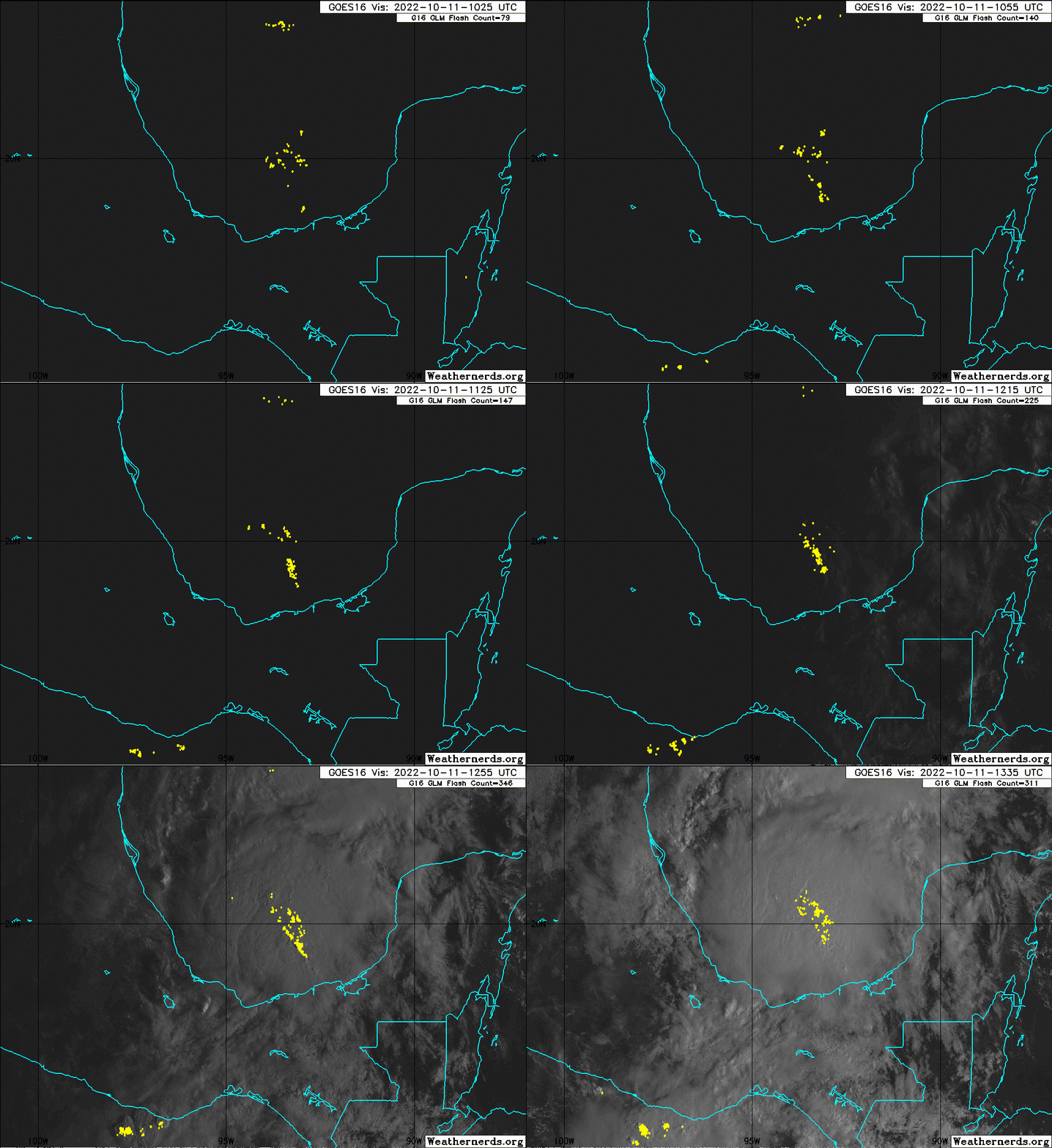
Towers expanding out last few hours.
Recon tasked to fly in later today.
Recon tasked to fly in later today.
0 likes
Re: ATL: INVEST 93L - Discussion
700MB vort had backed off a little since yesterday but seems to be coming back strong now.
Obviously driven by the sustained heavy convection.
Convection is driven by strong convergence of high CAPE air from the mid GoM onto the shore of the IoT.
Last look indicates CAPE values are increasing.
Obviously driven by the sustained heavy convection.
Convection is driven by strong convergence of high CAPE air from the mid GoM onto the shore of the IoT.
Last look indicates CAPE values are increasing.
0 likes
Re: ATL: INVEST 93L - Discussion
This is under an ARWB which is forecast to improve over the next couple days.
The PV streamers from the Rossby Wave are well away, along the Gulf Shore.
The block that keeps this from moving into the body of the GoM is a stationary ULL that will anchor over Lake Superior.
Two factors that may cause this to break out are:
1) ULL is not as strong as forecast or doesn't remain stationary and moves east.
2) 93L becomes a lot stronger and can push back on the Rossby Wave. There is a lot of CAPE convergence in the GoM along the stationary front. This is a possibility.
2 likes
- weeniepatrol
- Category 5

- Posts: 1343
- Joined: Sat Aug 22, 2020 5:30 pm
- Location: WA State
Re: ATL: INVEST 93L - Discussion
For the North Atlantic...Caribbean Sea and the Gulf of Mexico:
Southwest Gulf of Mexico:
A broad area of low pressure over the Bay of Campeche is producing a
large area of showers and thunderstorms. Surface pressures are
falling in the region, and radar from Mexico indicates the system is
becoming better organized. Environmental conditions are expected to
be conducive for further development, and a tropical depression
could form within the next day or two while the system moves slowly
northwestward over the southwestern Gulf of Mexico. After that
time, increasing upper-level winds are likely to hinder additional
development while it meanders in the southwestern Gulf of Mexico.
Regardless of formation, heavy rainfall is expected over portions of
southern Mexico during the next couple of days. An Air Force
Reserve reconnaissance aircraft is scheduled to investigate the
disturbance this afternoon, if necessary.
* Formation chance through 48 hours...medium...60 percent.
* Formation chance through 5 days...medium...60 percent.

0 likes
- weeniepatrol
- Category 5

- Posts: 1343
- Joined: Sat Aug 22, 2020 5:30 pm
- Location: WA State
Re: ATL: INVEST 93L - Discussion
IR sat analysis just came in.
Very strong, closed off wind field just above the boundary layer.
I would be very surprised if Recon is cancelled for today.
Very strong, closed off wind field just above the boundary layer.
I would be very surprised if Recon is cancelled for today.
0 likes
- weeniepatrol
- Category 5

- Posts: 1343
- Joined: Sat Aug 22, 2020 5:30 pm
- Location: WA State
Re: ATL: INVEST 93L - Discussion
weeniepatrol wrote:Surface pressures are
falling in the region


1 likes
- weeniepatrol
- Category 5

- Posts: 1343
- Joined: Sat Aug 22, 2020 5:30 pm
- Location: WA State
Re: ATL: INVEST 93L - Discussion
Good outflow into the mid latitude westerlies, but that jet is cutting it close


1 likes
Re: ATL: INVEST 93L - Discussion
This is going fast.
Outflow is already pushing the Rossby Wave back to 93L's NW.
Very distinct radial fingers in the cirrus.
Outflow is already pushing the Rossby Wave back to 93L's NW.
Very distinct radial fingers in the cirrus.
0 likes
Re: ATL: INVEST 93L - Discussion
None of the models like 93L, but since it’ll be stuck in the BoC for a few days, maybe it could become something moderately noteworthy as long as it can avoid the meat grinder flow just to its north.
1 likes
Irene '11 Sandy '12 Hermine '16 5/15/2018 Derecho Fay '20 Isaias '20 Elsa '21 Henri '21 Ida '21
I am only a meteorology enthusiast who knows a decent amount about tropical cyclones. Look to the professional mets, the NHC, or your local weather office for the best information.
I am only a meteorology enthusiast who knows a decent amount about tropical cyclones. Look to the professional mets, the NHC, or your local weather office for the best information.
- weeniepatrol
- Category 5

- Posts: 1343
- Joined: Sat Aug 22, 2020 5:30 pm
- Location: WA State
Re: ATL: INVEST 93L - Discussion
aspen wrote:None of the models like 93L, but since it’ll be stuck in the BoC for a few days, maybe it could become something moderately noteworthy as long as it can avoid the meat grinder flow just to its north.
Yep, currently the flow is enhancing outflow with strong upper divergence, but the difference between this currently favorable interaction and complete decapitation is probably close to a double digit mile difference in latitude.
0 likes
-
Tailgater33
- Tropical Depression

- Posts: 94
- Joined: Thu Jun 02, 2022 9:15 am
Re: ATL: INVEST 93L - Discussion
BOC, for newbs, stands for Birthing Of Cyclones. It does spin em up quick.
Anyone have the Mexican radar mentioned in the last TWO discussion?
Anyone have the Mexican radar mentioned in the last TWO discussion?
2 likes
- StormChaser75
- Tropical Storm

- Posts: 101
- Age: 24
- Joined: Sat Feb 06, 2016 4:23 pm
- Location: Corpus Christi TX
- Contact:
Re: ATL: INVEST 93L - Discussion
Tailgater33 wrote:BOC, for newbs, stands for Birthing Of Cyclones. It does spin em up quick.
Anyone have the Mexican radar mentioned in the last TWO discussion?
Link: https://smn.conagua.gob.mx/en/observand ... or-radares
2 likes
- wxman57
- Moderator-Pro Met

- Posts: 23175
- Age: 68
- Joined: Sat Jun 21, 2003 8:06 pm
- Location: Houston, TX (southwest)
Re: ATL: INVEST 93L - Discussion
Nearest radar is 200 miles SE, so it's looking at 20,000-25,000 feet above the surface. Jet to the north will be digging south by Thursday, pushing whatever is in the BoC south and into Mexico. There is always a natural vortex that sets up after a front moves into the Gulf. Air rushes south from Texas, down the east coast of Mexico and spins in the BoC. Tropical wave that was Julia helping convection.
2 likes
-
Sciencerocks
- Category 5

- Posts: 10186
- Age: 40
- Joined: Thu Jul 06, 2017 1:51 am
Re: ATL: INVEST 93L - Discussion
CIMSS showing, on 200mb vort, the ARWB improving as expected.
Shear decreasing over a good portion of the GoM.
Shear decreasing over a good portion of the GoM.
0 likes
- ElectricStorm
- Category 5

- Posts: 5148
- Age: 25
- Joined: Tue Aug 13, 2019 11:23 pm
- Location: Norman, OK
Re: ATL: INVEST 93L - Discussion
Looking pretty good, doesn't have model support but I wouldn't be surprised if this becomes a TD/TS
0 likes
B.S Meteorology, University of Oklahoma '25
Please refer to the NHC, NWS, or SPC for official information.
Please refer to the NHC, NWS, or SPC for official information.
Who is online
Users browsing this forum: No registered users and 7 guests


