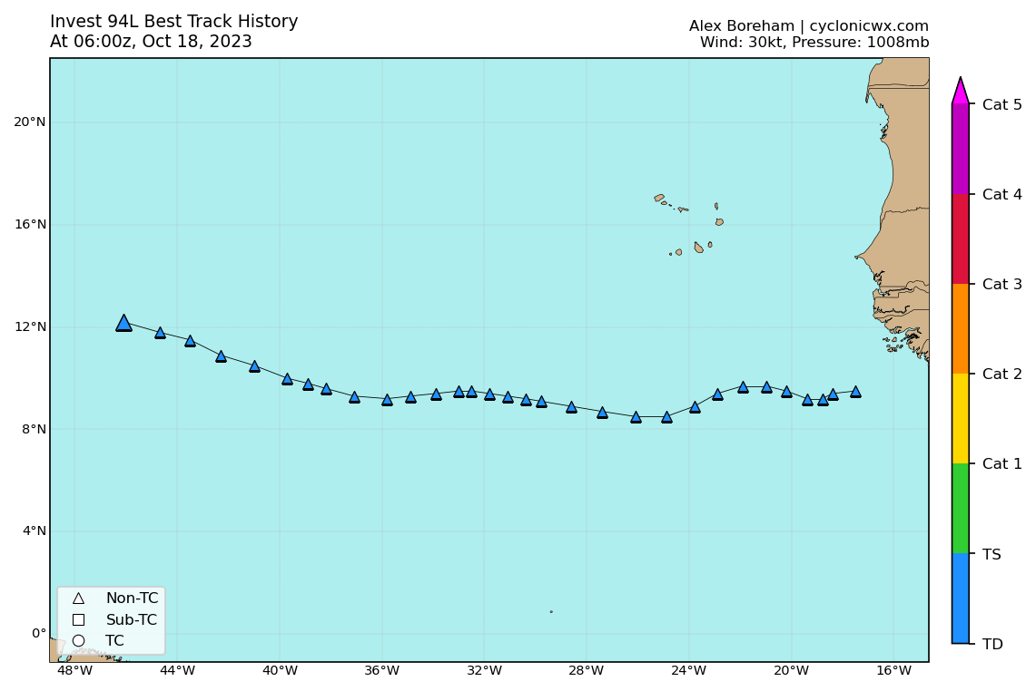
AL, 94, 2023101800, , BEST, 0, 118N, 447W, 30, 1008, LO

Moderator: S2k Moderators


cycloneye wrote:Pressure down to 1008 mbs.AL, 94, 2023101800, , BEST, 0, 118N, 447W, 30, 1008, LO
https://i.imgur.com/ApTyrCm.png
abajan wrote:cycloneye wrote:Pressure down to 1008 mbs.AL, 94, 2023101800, , BEST, 0, 118N, 447W, 30, 1008, LO
https://i.imgur.com/ApTyrCm.png
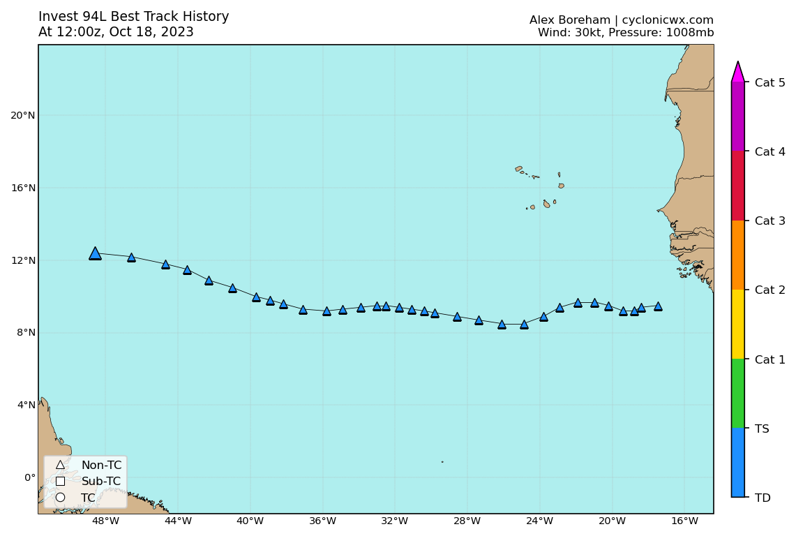
Yes, and there's a slight bend in the track back towards the west too.


Ianswfl wrote:abajan wrote:cycloneye wrote:Pressure down to 1008 mbs.AL, 94, 2023101800, , BEST, 0, 118N, 447W, 30, 1008, LO
https://i.imgur.com/ApTyrCm.png
Yes, and there's a slight bend in the track back towards the west too.
All interesting to watch down the road. 12z euro has it weak and bending back due west just north of Haiti with a strong high. Trof coming in at the end of teh run but who knows if that stalls or not over FL. GFS shows stronger ridging on the 18z run. But totally out to lunch on 94l. Pattern later in Oct favors warmer temps, stronger ridging in the southeast though. Something to watch.


ScottNAtlanta wrote:Maybe it's just me, but this is looking just about as good as it ever has. For the first time I am seeing westerly inflow of the south side. I think this will develop within the nest day or two. I have also noticed the intensity models are on the upswing again. The models all seem to initialize this a bit too far north


Sciencerocks wrote:https://imagizer.imageshack.com/img922/1686/jv2X4Y.gif
I am floored that this isn't being upgraded at 5pm. That is a well defined LLC and already producing tropical storm force winds.

floridasun wrote:Sciencerocks wrote:https://imagizer.imageshack.com/img922/1686/jv2X4Y.gif
I am floored that this isn't being upgraded at 5pm. That is a well defined LLC and already producing tropical storm force winds.
Not 5pm nhc say iikely watch later today


Users browsing this forum: No registered users and 75 guests


