ATL: INVEST 95L - Discussion

Moderator: S2k Moderators

Message
Author
User avatar
abajan
S2K Supporter
S2K Supporter
Posts: 4175
Joined: Sun Sep 07, 2003 5:10 am
Location: Barbados

Re: ATL: INVEST 95L - Discussion

#141 Postby abajan » Sun Jul 23, 2023 10:44 am

Hang on... Its structural appearance is recovering (somewhat).
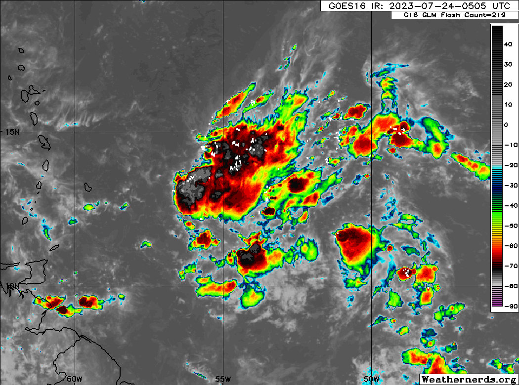
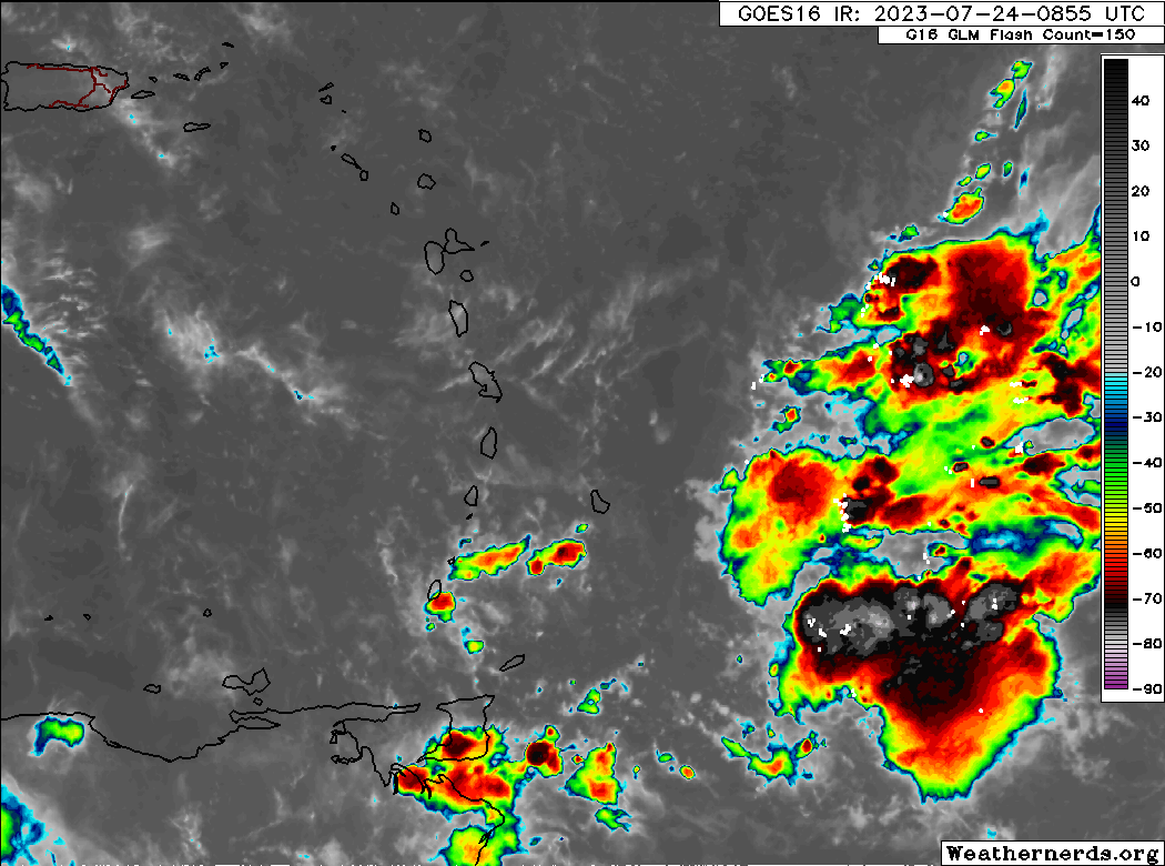
I don't think the fat lady's about to sing quite yet.
Is this the magical 50W effect we've seen so often with other systems?

Image
0 likes   

User avatar
chaser1
S2K Supporter
S2K Supporter
Posts: 4731
Age: 63
Joined: Sat Oct 15, 2005 5:59 pm
Location: Longwood, Fl

Re: ATL: INVEST 95L - Discussion

#142 Postby chaser1 » Sun Jul 23, 2023 11:30 am

GCANE wrote:Looks like the shear ahead of the wave is confined to the 300 to 400mb level and is associated with quite a bit of moisture.
So, its a mixed bag, meaning it will wash out the SAL ahead of the wave and add moisture in the mid to upper level of the troposphere.


The outcome from that narrative would suggest that 95L will not be beheaded; Rather, it's demise will occur from being impaled instead. The environment may further moisten but this young disturbance will be even more vertically challenged then it has been up to now. I do suspect that this vigorous wave may well spell some very gusty conditions and minor wind damage especially at higher elevation to southern portions of the Windwards. Perhaps there's adequate vorticity after a weeklong scrape with S. America to give it another go west of 75W but that will have to wait.
2 likes   
Personal Forecast Disclaimer:
The posts in this forum are NOT official forecast and should not be used as such. They are just the opinion of the poster and may or may not be backed by sound meteorological data. They are NOT endorsed by any professional institution or storm2k.org. For official information, please refer to the NHC and NWS products.


User avatar
GCANE
S2K Supporter
S2K Supporter
Posts: 10787
Joined: Mon Oct 22, 2007 8:03 am

Re: ATL: INVEST 95L - Discussion

#143 Postby GCANE » Sun Jul 23, 2023 12:16 pm

Looking at Visible Satellite, CoC is at approx 11N 47W.
Well defined cumulus feeder band developing south of that.
Its picking up Amazon moisture, the usual effect when a system gets close to 50W.

https://www.tropicaltidbits.com/sat/sat ... roduct=vis


Wider view on Water Vapor showing UL Divergence picking up.
Main component of the shear jet well south and west of the CoC at this point.
Its also high enough to not pinch off the feeder band.
In fact, it may create convection in the feeder band in the next 24 hrs.
That would be a sure sign that 95L is entraining high TPW air.

https://www.tropicaltidbits.com/sat/sat ... uct=wv_mid
0 likes   

User avatar
cycloneye
Admin
Admin
Posts: 139498
Age: 67
Joined: Thu Oct 10, 2002 10:54 am
Location: San Juan, Puerto Rico

Re: ATL: INVEST 95L - Discussion

#144 Postby cycloneye » Sun Jul 23, 2023 12:40 pm

2 PM TWO:

Central Tropical Atlantic (AL95):
Satellite images show that there has been little change in the
organization of the small area of low pressure located about 850
miles east of the Windward Islands. Although environmental
conditions are forecast to be only marginally conducive for some
gradual development, this system could still become a tropical
depression during the next few days while it moves westward across
the tropical Atlantic and eastern Caribbean Sea. Interests in the
Lesser Antilles should monitor the progress of this system.
* Formation chance through 48 hours...low...30 percent.
* Formation chance through 7 days...medium...40 percent.
0 likes   
Visit the Caribbean-Central America Weather Thread where you can find at first post web cams,radars
and observations from Caribbean basin members Click Here

User avatar
Iceresistance
Category 5
Category 5
Posts: 8929
Age: 20
Joined: Sat Oct 10, 2020 9:45 am
Location: Tecumseh, OK/Norman, OK

Re: ATL: INVEST 95L - Discussion

#145 Postby Iceresistance » Sun Jul 23, 2023 12:46 pm

4 likes   
Bill 2015 & Beta 2020

Winter 2020-2021 :cold:

All observations are in Tecumseh, OK unless otherwise noted.

Winter posts are focused mainly for Oklahoma & Texas.

Take any of my forecasts with a grain of salt, refer to the NWS, SPC, and NHC for official information

Never say Never with weather! Because ANYTHING is possible!

tolakram
Admin
Admin
Posts: 19172
Age: 60
Joined: Sun Aug 27, 2006 8:23 pm
Location: Florence, KY (name is Mark)

Re: ATL: INVEST 95L - Discussion

#146 Postby tolakram » Sun Jul 23, 2023 1:55 pm

0 likes   
M a r k
- - - - -
Join us in chat: Storm2K Chatroom Invite. Android and IOS apps also available.

The posts in this forum are NOT official forecasts and should not be used as such. Posts are NOT endorsed by any professional institution or STORM2K.org. For official information and forecasts, please refer to NHC and NWS products.

User avatar
Woofde
Category 1
Category 1
Posts: 289
Joined: Tue Jul 06, 2021 11:33 am

Re: ATL: INVEST 95L - Discussion

#147 Postby Woofde » Sun Jul 23, 2023 2:46 pm

Dry air pretty much destroyed it. It's still July though, it makes sense.
2 likes   

User avatar
Nimbus
Category 5
Category 5
Posts: 4929
Joined: Mon Jul 19, 2004 10:54 am

Re: ATL: INVEST 95L - Discussion

#148 Postby Nimbus » Sun Jul 23, 2023 3:33 pm

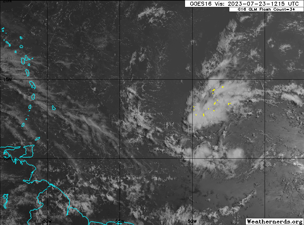
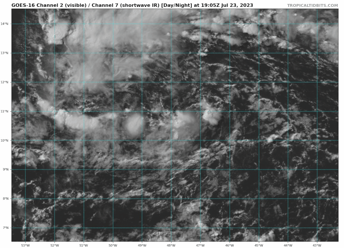
GCANE wrote:Looking at Visible Satellite, CoC is at approx 11N 47W.
Well defined cumulus feeder band developing south of that.
Its picking up Amazon moisture, the usual effect when a system gets close to 50W.

https://www.tropicaltidbits.com/sat/sat ... roduct=vis


Wider view on Water Vapor showing UL Divergence picking up.
Main component of the shear jet well south and west of the CoC at this point.
Its also high enough to not pinch off the feeder band.
In fact, it may create convection in the feeder band in the next 24 hrs.
That would be a sure sign that 95L is entraining high TPW air.

https://www.tropicaltidbits.com/sat/sat ... uct=wv_mid


Great synopsis!
Staying south of the SAL with some convection near the center, was very close to an open wave.
That far south it may continue feeding despite the shear.
1 likes   

User avatar
Blown Away
S2K Supporter
S2K Supporter
Posts: 9870
Joined: Wed May 26, 2004 6:17 am

Re: ATL: INVEST 95L - Discussion

#149 Postby Blown Away » Sun Jul 23, 2023 4:41 pm

Image
95L looking a little better today @11N/47W…
2 likes   
Hurricane Eye Experience: David 79, Irene 99, Frances 04, Jeanne 04, Wilma 05... EYE COMING MY WAY IN 2024…
Hurricane Brush Experience: Andrew 92, Erin 95, Floyd 99, Matthew 16, Irma 17, Ian 22, Nicole 22…

User avatar
GCANE
S2K Supporter
S2K Supporter
Posts: 10787
Joined: Mon Oct 22, 2007 8:03 am

Re: ATL: INVEST 95L - Discussion

#150 Postby GCANE » Sun Jul 23, 2023 6:27 pm

Leading-edge convection seems to be pushing the shear jet out of the way.
High-helicity hot towers near the CoC returns.
0 likes   

User avatar
abajan
S2K Supporter
S2K Supporter
Posts: 4175
Joined: Sun Sep 07, 2003 5:10 am
Location: Barbados

Re: ATL: INVEST 95L - Discussion

#151 Postby abajan » Sun Jul 23, 2023 6:31 pm

Tropical Weather Outlook
NWS National Hurricane Center Miami FL
800 PM EDT Sun Jul 23 2023

For the North Atlantic...Caribbean Sea and the Gulf of Mexico:

Active Systems:
The National Hurricane Center is issuing advisories on Tropical
Storm Don, located over the central Atlantic.

1. Central Tropical Atlantic (AL95):
An area of low pressure associated with a tropical wave continues to
produce disorganized showers and thunderstorms about 700 miles east
of the Windward Islands. Some slow development of this system is
possible during the next couple of days while it moves westward
across the tropical Atlantic and eastern Caribbean Sea.
Environmental conditions are expected to become less conducive for
development by the middle of the week. Interests in the Lesser
Antilles should monitor the progress of this system.
* Formation chance through 48 hours...low...30 percent.
* Formation chance through 7 days...low...30 percent.

Forecaster Cangialosi
0 likes   

User avatar
GCANE
S2K Supporter
S2K Supporter
Posts: 10787
Joined: Mon Oct 22, 2007 8:03 am

Re: ATL: INVEST 95L - Discussion

#152 Postby GCANE » Sun Jul 23, 2023 7:31 pm

I suspect the models are not factoring in the anomalous rise in SSTs.
Could be a game changer.

 https://twitter.com/HurricaneManWx/status/1683232133622423552


1 likes   

User avatar
cycloneye
Admin
Admin
Posts: 139498
Age: 67
Joined: Thu Oct 10, 2002 10:54 am
Location: San Juan, Puerto Rico

Re: ATL: INVEST 95L - Discussion

#153 Postby cycloneye » Sun Jul 23, 2023 7:46 pm

AL, 95, 2023072400, , BEST, 0, 109N, 484W, 25, 1012, LO
0 likes   
Visit the Caribbean-Central America Weather Thread where you can find at first post web cams,radars
and observations from Caribbean basin members Click Here

User avatar
Teban54
Category 5
Category 5
Posts: 1980
Joined: Sat May 19, 2018 1:19 pm

Re: ATL: INVEST 95L - Discussion

#154 Postby Teban54 » Sun Jul 23, 2023 8:54 pm

Image
0 likes   

User avatar
abajan
S2K Supporter
S2K Supporter
Posts: 4175
Joined: Sun Sep 07, 2003 5:10 am
Location: Barbados

Re: ATL: INVEST 95L - Discussion

#155 Postby abajan » Mon Jul 24, 2023 3:27 am

Formation chances continue to diminish and the Interests in the Lesser Antilles should monitor the progress of this system sentence has been removed from the text. However, there's still lots of heavy rainfall in store for some of the Windward Islands (or so it appears).

Tropical Weather Outlook
NWS National Hurricane Center Miami FL
200 AM EDT Mon Jul 24 2023

For the North Atlantic...Caribbean Sea and the Gulf of Mexico:

Active Systems:
The National Hurricane Center is issuing advisories on Tropical
Storm Don, located over the north-central Atlantic.

1. East of the Windward Islands (AL95):
A weak area of low pressure associated with a tropical wave
continues to produce disorganized showers and thunderstorms about
650 miles east of the Windward Islands. While this system has not
become any better organized recently, some slow development remains
possible during the next couple of days while it moves westward
across the tropical Atlantic and eastern Caribbean Sea.
Environmental conditions are expected to become unfavorable for
development by the middle of the week. Locally heavy rainfall is
possible across the Windward Islands early this week from this
system.
* Formation chance through 48 hours...low...20 percent.
* Formation chance through 7 days...low...20 percent.

Forecaster Blake

Image
0 likes   

User avatar
Jr0d
S2K Supporter
S2K Supporter
Posts: 1177
Joined: Tue Aug 27, 2019 10:52 am
Location: Cayo Hueso

Re: ATL: INVEST 95L - Discussion

#156 Postby Jr0d » Mon Jul 24, 2023 4:47 am

Not looking horrible. Disorganized but vigorous.

Hopefully this stays below Cuba as it crosses the Caribbean because I don't want to see a vigorous wave find those upper 80s++ temperatures around South Florida
0 likes   

User avatar
abajan
S2K Supporter
S2K Supporter
Posts: 4175
Joined: Sun Sep 07, 2003 5:10 am
Location: Barbados

Re: ATL: INVEST 95L - Discussion

#157 Postby abajan » Mon Jul 24, 2023 7:02 am

No change in formation chances:

Tropical Weather Outlook
NWS National Hurricane Center Miami FL
800 AM EDT Mon Jul 24 2023

For the North Atlantic...Caribbean Sea and the Gulf of Mexico:

Active Systems:
The National Hurricane Center is issuing advisories on Tropical
Storm Don, located over the north-central Atlantic.

1. East of the Windward Islands (AL95):
A broad area of low pressure associated with a tropical wave is
located several hundred miles east of the Windward Islands. While
this system has not become significantly better organized since
yesterday, some slow development remains possible during the next
couple of days while it moves westward across the tropical Atlantic
and into the eastern Caribbean Sea. Regardless of development,
locally heavy rains and strong gusty winds are possible across
portions of the Lesser Antilles during the next day or two.
Environmental conditions are expected to become unfavorable for
development of this system by the middle of the week.
* Formation chance through 48 hours...low...20 percent.
* Formation chance through 7 days...low...20 percent.

Forecaster Pasch

Excerpt from the 1205 UTC Tropical Weather Discussion:

A 1012 mb low pressure system, designated as Invest 95L, is
located near 11N50W or about 560 nm east of the Windward Islands.
Latest satellite imagery shows numerous moderate to strong
convection increasing quite rapidly ahead of the low from 09N
to 17N between 51W-57W.
Scattered moderate to isolated strong
convection is over the low and extends to northwest of the low
to 13N and between 48W-51W. Fresh to strong easterly winds are
in the N quadrant of the low. Seas over these waters are 5-8 ft.
While this system has not become any better organized recently,
some slow development remains possible during the next couple of
days while it moves westward across the tropical Atlantic and
eastern Caribbean Sea. Environmental conditions are expected to
become unfavorable for development by the middle of the week.
Locally heavy rainfall is possible across the Windward Islands
early this week from this system.

Image
1 likes   

User avatar
abajan
S2K Supporter
S2K Supporter
Posts: 4175
Joined: Sun Sep 07, 2003 5:10 am
Location: Barbados

Re: ATL: INVEST 95L - Discussion

#158 Postby abajan » Mon Jul 24, 2023 7:37 am

0 likes   

User avatar
cycloneye
Admin
Admin
Posts: 139498
Age: 67
Joined: Thu Oct 10, 2002 10:54 am
Location: San Juan, Puerto Rico

Re: ATL: INVEST 95L - Discussion

#159 Postby cycloneye » Mon Jul 24, 2023 8:29 am

AL, 95, 2023072412, , BEST, 0, 115N, 530W, 25, 1012, LO
1 likes   
Visit the Caribbean-Central America Weather Thread where you can find at first post web cams,radars
and observations from Caribbean basin members Click Here

User avatar
GCANE
S2K Supporter
S2K Supporter
Posts: 10787
Joined: Mon Oct 22, 2007 8:03 am

Re: ATL: INVEST 95L - Discussion

#160 Postby GCANE » Mon Jul 24, 2023 8:48 am

Convection may be outrunning the LLC
1 likes   


Return to “2023”

Who is online

Users browsing this forum: No registered users and 7 guests