
ATL: RINA - Remnants - Discussion
Moderator: S2k Moderators
-
cycloneye

- Admin

- Posts: 149720
- Age: 69
- Joined: Thu Oct 10, 2002 10:54 am
- Location: San Juan, Puerto Rico
Re: ATL: INVEST 91L - Discussion
0 likes
Visit the Caribbean-Central America Weather Thread where you can find at first post web cams,radars
and observations from Caribbean basin members Click Here
and observations from Caribbean basin members Click Here

Re: ATL: INVEST 91L - Discussion
Feel like everyone is getting hurricane tracking fatigue with these OTS cape verde systems.
10 likes
Igor 2010, Sandy 2012, Fay 2014, Gonzalo 2014, Joaquin 2015, Nicole 2016, Humberto 2019, Imelda 2025
I am only a tropical weather enthusiast. My predictions are not official and may or may not be backed by sound meteorological data. For official information, please refer to the NHC and NWS products.
I am only a tropical weather enthusiast. My predictions are not official and may or may not be backed by sound meteorological data. For official information, please refer to the NHC and NWS products.
-
cycloneye
- Admin
- Posts: 149720
- Age: 69
- Joined: Thu Oct 10, 2002 10:54 am
- Location: San Juan, Puerto Rico
Re: ATL: INVEST 91L - Discussion
60% / 90%
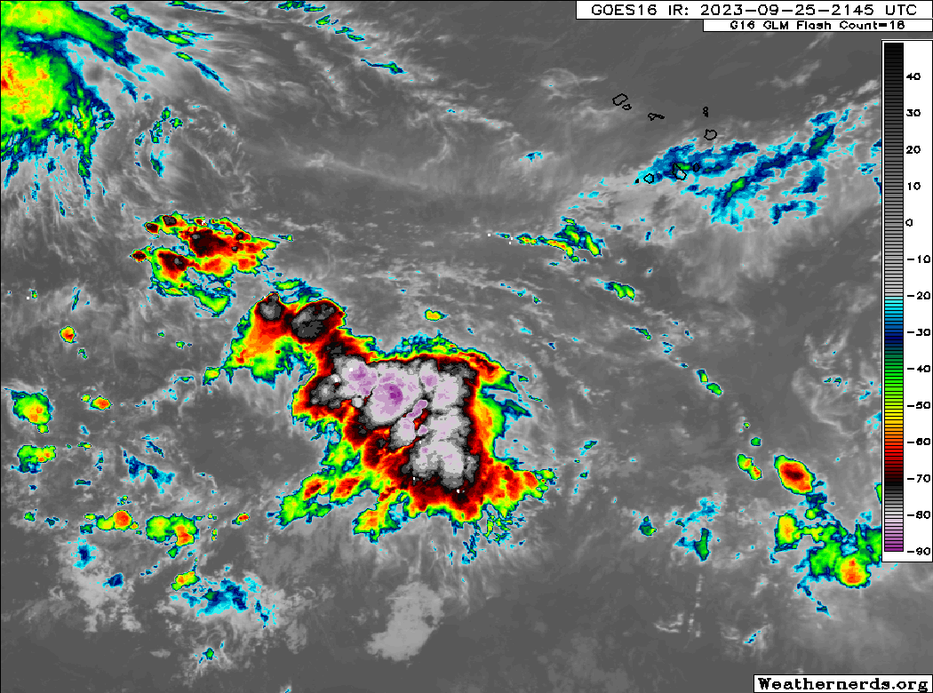
Eastern Tropical Atlantic (AL91):
Showers and thunderstorms have increased in association with a
tropical wave located several hundred miles west-southwest of the
Cabo Verde Islands. Environmental conditions are forecast to be
conducive for additional development, and a tropical depression is
expected to form in 2-3 days as the system moves west-northwestward
across the central tropical Atlantic.
* Formation chance through 48 hours...medium...60 percent.
* Formation chance through 7 days...high...90 percent.
2 likes
Visit the Caribbean-Central America Weather Thread where you can find at first post web cams,radars
and observations from Caribbean basin members Click Here
and observations from Caribbean basin members Click Here
-
Hurricane2022

- Category 5

- Posts: 2092
- Joined: Tue Aug 23, 2022 11:38 pm
- Location: Araçatuba, Brazil
Re: ATL: INVEST 91L - Discussion
Kazmit wrote:Feel like everyone is getting tropical storm tracking fatigue with these OTS cape verde systems.
1 likes
Sorry for the bad English sometimes...!
For reliable and detailed information for any meteorological phenomenon, please consult the National Hurricane Center, Joint Typhoon Warning Center , or your local Meteo Center.
--------
ECCE OMNIA NOVA FACIAM (Ap 21,5).
For reliable and detailed information for any meteorological phenomenon, please consult the National Hurricane Center, Joint Typhoon Warning Center , or your local Meteo Center.
--------
ECCE OMNIA NOVA FACIAM (Ap 21,5).
-
Sciencerocks
- Category 5
- Posts: 10193
- Age: 40
- Joined: Thu Jul 06, 2017 1:51 am
Re: ATL: INVEST 91L - Discussion
Kazmit wrote:Feel like everyone is getting hurricane tracking fatigue with these OTS cape verde systems.
Yep, it is boring and a pain at times and we don't get nearly the data with them either. More so if it is a sheared piece of trash! I have a archives and have to take the loops to maintain that either way and it is a lot of work...So yeah.
2 likes


Re: ATL: INVEST 91L - Discussion
It appears NHC'c Best Track site has been down for several hours. The last auto-update to the maps at CyclonicWx was over 12 hours ago (12z).
0 likes
Re: ATL: INVEST 91L - Discussion
AL91's really kicking up a storm, though (no pun intended).
3 likes
-
cycloneye
- Admin
- Posts: 149720
- Age: 69
- Joined: Thu Oct 10, 2002 10:54 am
- Location: San Juan, Puerto Rico
Re: ATL: INVEST 91L - Discussion
91L INVEST 230926 0000 10.5N 34.1W ATL 25 1010
0 likes
Visit the Caribbean-Central America Weather Thread where you can find at first post web cams,radars
and observations from Caribbean basin members Click Here
and observations from Caribbean basin members Click Here
-
cycloneye
- Admin
- Posts: 149720
- Age: 69
- Joined: Thu Oct 10, 2002 10:54 am
- Location: San Juan, Puerto Rico
Re: ATL: INVEST 91L - Discussion
2 AM:
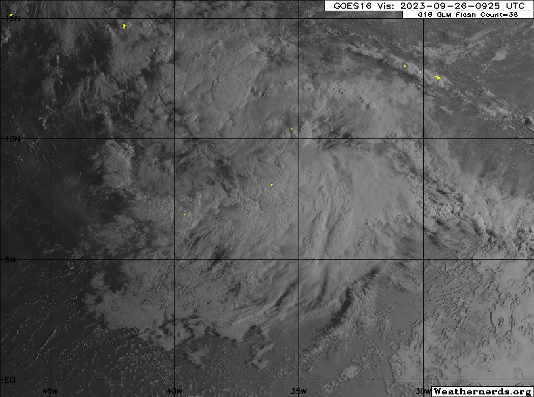
Eastern Tropical Atlantic (AL91):
Showers and thunderstorms associated with a tropical wave located
several hundred miles west-southwest of the Cabo Verde Islands
have shown little change in organization over the past several
hours. Environmental conditions are forecast to be conducive for
development, and a tropical depression is expected to form in 2
to 3 days as the system moves west-northwestward across the central
tropical Atlantic.
* Formation chance through 48 hours...medium...60 percent.
* Formation chance through 7 days...high...90 percent.
0 likes
Visit the Caribbean-Central America Weather Thread where you can find at first post web cams,radars
and observations from Caribbean basin members Click Here
and observations from Caribbean basin members Click Here
-
cycloneye
- Admin
- Posts: 149720
- Age: 69
- Joined: Thu Oct 10, 2002 10:54 am
- Location: San Juan, Puerto Rico
Re: ATL: INVEST 91L - Discussion
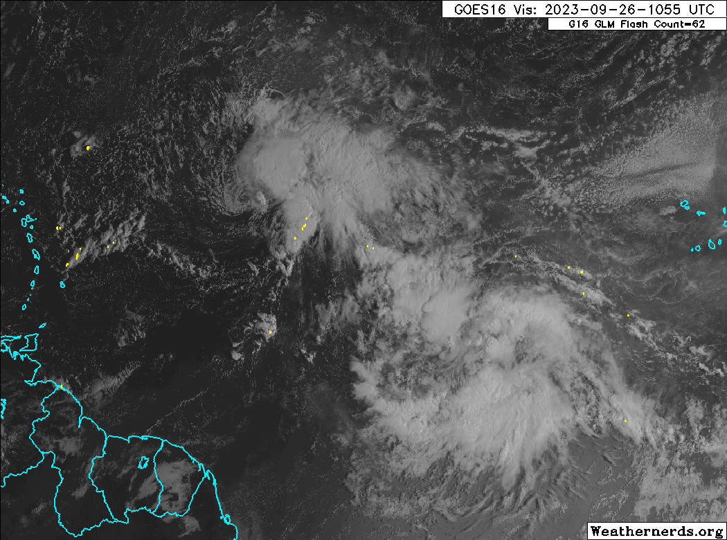
8 AM:
Central Tropical Atlantic (AL91):
Showers and thunderstorms are showing signs of organization in
association with a broad area of low pressure located several
hundred miles west-southwest of the Cabo Verde Islands.
Environmental conditions are forecast to be conducive for
development, and a tropical depression is expected to form in the
next couple of days while the system moves west-northwestward across
the central tropical Atlantic.
* Formation chance through 48 hours...high...70 percent.
* Formation chance through 7 days...high...90 percent.
1 likes
Visit the Caribbean-Central America Weather Thread where you can find at first post web cams,radars
and observations from Caribbean basin members Click Here
and observations from Caribbean basin members Click Here
-
cycloneye
- Admin
- Posts: 149720
- Age: 69
- Joined: Thu Oct 10, 2002 10:54 am
- Location: San Juan, Puerto Rico
Re: ATL: INVEST 91L - Discussion
2 likes
Visit the Caribbean-Central America Weather Thread where you can find at first post web cams,radars
and observations from Caribbean basin members Click Here
and observations from Caribbean basin members Click Here
-
cycloneye
- Admin
- Posts: 149720
- Age: 69
- Joined: Thu Oct 10, 2002 10:54 am
- Location: San Juan, Puerto Rico
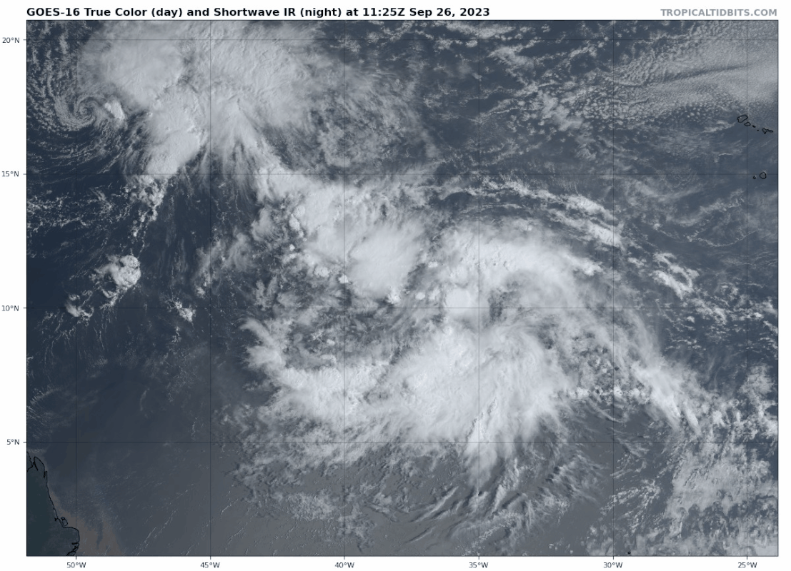
Re: ATL: INVEST 91L - Discussion
12z Best Track:
91L INVEST 230926 1200 10.7N 37.1W ATL 25 1009
0 likes
Visit the Caribbean-Central America Weather Thread where you can find at first post web cams,radars
and observations from Caribbean basin members Click Here
and observations from Caribbean basin members Click Here
-
cycloneye
- Admin
- Posts: 149720
- Age: 69
- Joined: Thu Oct 10, 2002 10:54 am
- Location: San Juan, Puerto Rico
Re: ATL: INVEST 91L - Discussion
abajan wrote:It appears NHC'c Best Track site has been down for several hours. The last auto-update to the maps at CyclonicWx was over 12 hours ago (12z).
The site is working again.
https://ftp.nhc.noaa.gov/atcf/btk/

1 likes
Visit the Caribbean-Central America Weather Thread where you can find at first post web cams,radars
and observations from Caribbean basin members Click Here
and observations from Caribbean basin members Click Here
-
Sciencerocks
- Category 5
- Posts: 10193
- Age: 40
- Joined: Thu Jul 06, 2017 1:51 am

-
Iceresistance

- Category 5
- Posts: 9607
- Age: 22
- Joined: Sat Oct 10, 2020 9:45 am
- Location: Tecumseh, OK/Norman, OK
Re: ATL: INVEST 91L - Discussion
3 likes
Bill 2015 & Beta 2020
Winter 2020-2021
All observations are in Tecumseh, OK unless otherwise noted.
Winter posts are focused mainly for Oklahoma & Texas.
Take any of my forecasts with a grain of salt, refer to the NWS, SPC, and NHC for official information
Never say Never with weather! Because ANYTHING is possible!
Winter 2020-2021
All observations are in Tecumseh, OK unless otherwise noted.
Winter posts are focused mainly for Oklahoma & Texas.
Take any of my forecasts with a grain of salt, refer to the NWS, SPC, and NHC for official information
Never say Never with weather! Because ANYTHING is possible!
Re: ATL: INVEST 91L - Discussion
Hurricane2022 wrote:Kazmit wrote:Feel like everyone is getting tropical storm tracking fatigue with these OTS cape verde systems.
Maybe I'm just not as "into" tracking all the storms as some, but the only ones I really care about are the ones that might affect me personally. I mean, I do like to watch them and track them, watch them evolve and grow, but in the end, once I am certain it's an OTS storm, my interest is gone.
3 likes
Cleo - 1964, Betsy - 1965, David - 1979, Andrew - 1992, Charlie (Francis, Ivan, Jeanne) - 2004, Irma - 2017, Ian - 2022, Milton - 2024

Re: ATL: INVEST 91L - Discussion
Taking shape:
2 likes
TC naming lists: retirements and intensity
Most aggressive Advisory #1's in North Atlantic (cr. kevin for starting the list)
Most aggressive Advisory #1's in North Atlantic (cr. kevin for starting the list)
-
ScottNAtlanta

- Category 5
- Posts: 2535
- Joined: Sat May 25, 2013 3:11 pm
- Location: Atlanta, GA
Re: ATL: INVEST 91L - Discussion
I'm not 100% sure this is OTS. It is awfully far south and Philippe is pretty weak so it doesn't look like it is going OTS either (though it will probably open up to a wave)
3 likes
The posts in this forum are NOT official forecast and should not be used as such. They are just the opinion of the poster and may or may not be backed by sound meteorological data. They are NOT endorsed by any professional institution or storm2k.org. For official information, please refer to the NHC and NWS products.
Who is online
Users browsing this forum: No registered users and 49 guests