chris_fit wrote:Eyeballing 18z EPS... More South at 100+hrs

Moderator: S2k Moderators


chris_fit wrote:Eyeballing 18z EPS... More South at 100+hrs
Ianswfl wrote:
18z operational euro is a lot weaker than 12z.


SFLcane wrote:https://i.postimg.cc/ZK9QyC11/IMG-1381.png

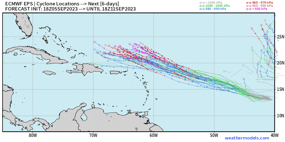
BobHarlem wrote:chris_fit wrote:Eyeballing 18z EPS... More South at 100+hrs
https://i.imgur.com/j3IeY09.png
AubreyStorm wrote:BobHarlem wrote:chris_fit wrote:Eyeballing 18z EPS... More South at 100+hrs
https://i.imgur.com/j3IeY09.png
I don’t like due west near over Puerto Rico


mantis83 wrote:a safe recurve is looking more and more likely as we get closer in time.....
Users browsing this forum: No registered users and 13 guests