ATL: LEE - Post-Tropical - Discussion
Moderator: S2k Moderators
-
wxman57

- Moderator-Pro Met

- Posts: 22482
- Age: 66
- Joined: Sat Jun 21, 2003 8:06 pm
- Location: Houston, TX (southwest)
Re: ATL: LEE - Hurricane - Discussion
Careful with that latest NHC track. It illustrates the issue with 24 hr points during a gradual turn. You cannot just connect those points with a straight line. Landfall will probably be a little east of the Maine border, but not nearly as far east as the straight line indicates. Regardless, there will be no core remaining at landfall. Models are indicating only 35-40 kts as it reaches New Brunswick. Coastal New England will be raked by tropical storm force wind with strong gusts. With the wet ground and leaves still on the trees, there will be widespread power outages as trees/branches fall on power lines. Rainfall in eastern MA may only be an inch or two, though. Maybe 2-5 inches in SE Maine. That's a lot for up there.
10 likes
-
WalterWhite

- Category 1

- Posts: 311
- Joined: Fri Mar 17, 2023 5:53 pm
-
tolakram
- Admin

- Posts: 19165
- Age: 60
- Joined: Sun Aug 27, 2006 8:23 pm
- Location: Florence, KY (name is Mark)
Re: ATL: LEE - Hurricane - Discussion
HurricaneBelle wrote:galaxy401 wrote:Hurricane Watch has been issued for Maine.
Lee is going to be the Maine event.
How many years were you waiting to say that?
7 likes
M a r k
- - - - -
Join us in chat: Storm2K Chatroom Invite. Android and IOS apps also available.
The posts in this forum are NOT official forecasts and should not be used as such. Posts are NOT endorsed by any professional institution or STORM2K.org. For official information and forecasts, please refer to NHC and NWS products.
-
Hurricane2022

- Category 4

- Posts: 921
- Joined: Tue Aug 23, 2022 11:38 pm
- Location: Araçatuba, Brazil
Re: ATL: LEE - Hurricane - Discussion
tolakram wrote:HurricaneBelle wrote:galaxy401 wrote:Hurricane Watch has been issued for Maine.
Lee is going to be the Maine event.
How many years were you waiting to say that?
~ 54 years
8 likes
Sorry for the bad English sometimes...!
For reliable and detailed information for any meteorological phenomenon, please consult the National Hurricane Center, Joint Typhoon Warning Center , or your local Meteo Center.
--------
Una cvm Christo, pro Christo, et in Christo. Sit nomen Domini benedictvm.
For reliable and detailed information for any meteorological phenomenon, please consult the National Hurricane Center, Joint Typhoon Warning Center , or your local Meteo Center.
--------
Una cvm Christo, pro Christo, et in Christo. Sit nomen Domini benedictvm.
-
PavelGaborik10
- Category 1
- Posts: 403
- Joined: Tue Sep 04, 2018 3:23 pm
Re: ATL: LEE - Hurricane - Discussion
Lee looks like something you'd expect to see in November, not the first half of September.
0 likes
-
Hybridstorm_November2001

- S2K Supporter

- Posts: 2802
- Joined: Sat Aug 21, 2004 2:50 pm
- Location: SW New Brunswick, Canada
- Contact:
Re: ATL: LEE - Hurricane - Discussion
tolakram wrote:HurricaneBelle wrote:galaxy401 wrote:Hurricane Watch has been issued for Maine.
Lee is going to be the Maine event.
How many years were you waiting to say that?
Speaking of which I find the last part rather interesting. BTW They are referencing Tropical Storm Gerda (downgraded from a cat one upon recent reanalysis) from 1969 a storm whose surge and waves did a great deal of damage to the structures mentioned -
The current official NHC track suggests that the noon Saturday
high tide may feature the greatest surge.
Since the track has moved further west and peak surge could line
up with the noon Saturday high tide, the scope and severity of
storm surge impacts could be significant.
This means flooding issues in Machias, Eastport, Lubec, along
the Deer Isle Causeway, Stonington, and other causeways crossing
tidal-impacted waterways. Heavy rainfall will acerbate the
potential for coastal infrastructure impacts. Key in mind that a
tropical storm of this magnitude has no analogy since at least
1969 or earlier for Downeast.
source - https://forecast.weather.gov/product.php?site=CAR&issuedby=CAR&product=AFD&format=CI&version=1&glossary=1&highlight=off
1 likes
-
Hybridstorm_November2001
- S2K Supporter
- Posts: 2802
- Joined: Sat Aug 21, 2004 2:50 pm
- Location: SW New Brunswick, Canada
- Contact:
Re: ATL: LEE - Hurricane - Discussion
It is awful of me I know, but looking at the recent consensus model southeastward trend I am hoping for a track south of the Gulf of Maine into/near Western Nova Scotia. Such a track would likely keep the worst winds and storm surge away from those of us located around Passamaquoddy Bay due to the general eastside wind rule.
1 likes
-
Sciencerocks
- Category 5

- Posts: 7286
- Age: 38
- Joined: Thu Jul 06, 2017 1:51 am
-
RevanTheJedi96
- Tropical Storm

- Posts: 106
- Joined: Wed Sep 01, 2021 10:40 am
Re: ATL: LEE - Hurricane - Discussion
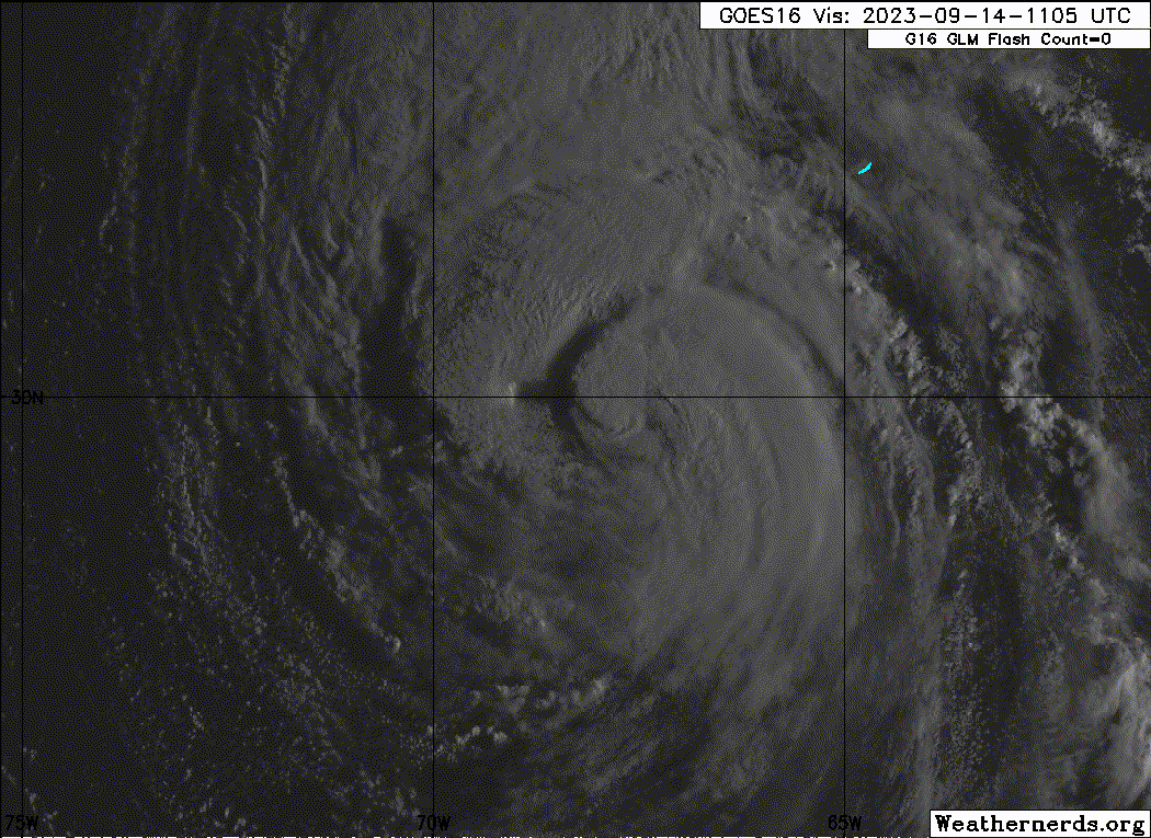
Lee looks horrible on IR. Hopefully, its impacts this weekend will be minimal to New England and Atlantic Canada.
1 likes
-
Hurricane Mike
- Category 2

- Posts: 562
- Joined: Tue Apr 10, 2018 7:44 am
Re: ATL: LEE - Hurricane - Discussion
I'm surprised how strong the winds on recon are given the disorganized satellite appearance.
0 likes
-
Sciencerocks
- Category 5
- Posts: 7286
- Age: 38
- Joined: Thu Jul 06, 2017 1:51 am

Re: ATL: LEE - Hurricane - Discussion
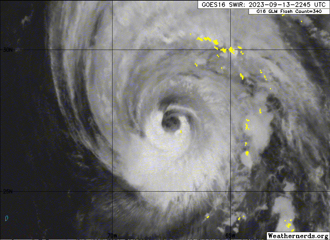
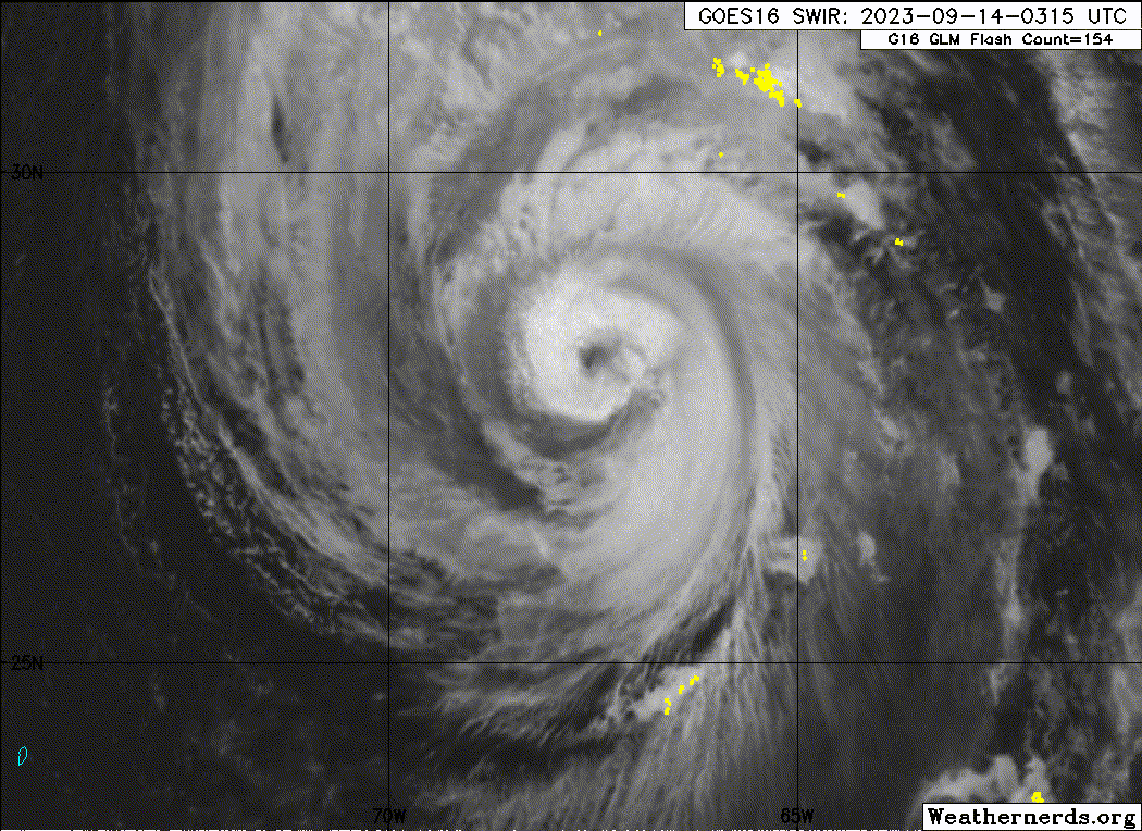
Lee is already taking on a subtropical like structure with the strongest winds a good 70-80 miles from its CoC.
Not much left of a tight gradient core around its eye.

Not much left of a tight gradient core around its eye.
2 likes
Re: ATL: LEE - Hurricane - Discussion
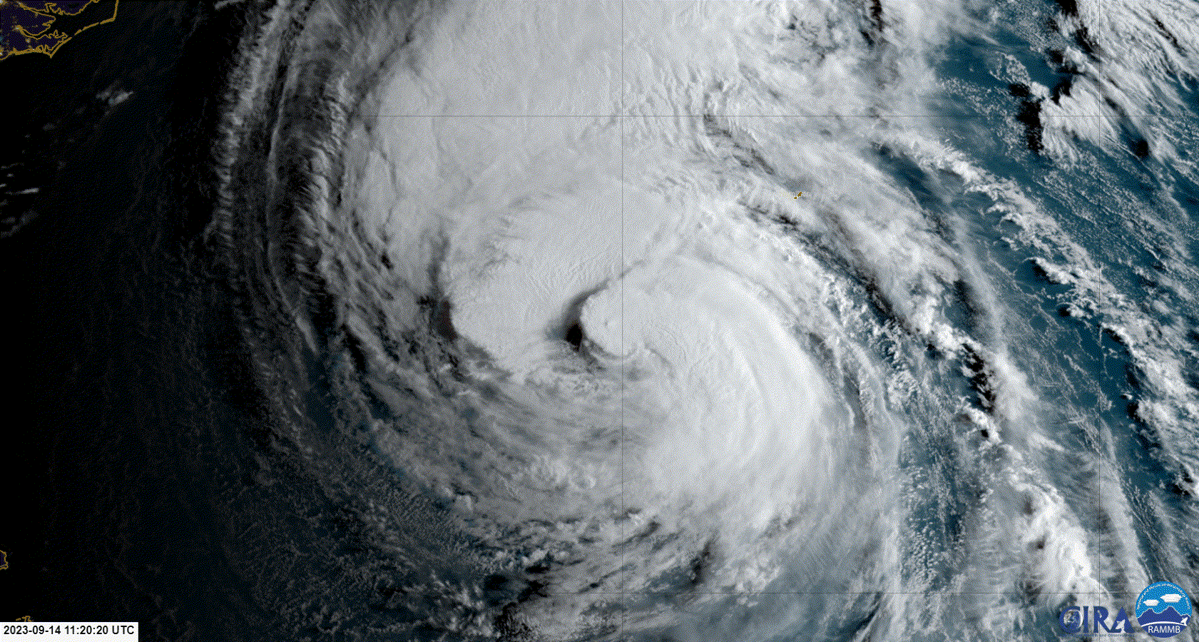
Lee this morning. There is convection over the centre but the south west part of the storm has been weakened.
0 likes

-
Sciencerocks
- Category 5
- Posts: 7286
- Age: 38
- Joined: Thu Jul 06, 2017 1:51 am
Re: ATL: LEE - Hurricane - Discussion
Huge mofo wind field on the eastern side. Bermuda better be ready.
0 likes
Personal Forecast Disclaimer:
The posts in this forum are NOT official forecast and should not be used as such. They are just the opinion of the poster and may or may not be backed by sound meteorological data. For official information, please refer to the NHC and NWS products.
The posts in this forum are NOT official forecast and should not be used as such. They are just the opinion of the poster and may or may not be backed by sound meteorological data. For official information, please refer to the NHC and NWS products.
-
wxman57
- Moderator-Pro Met
- Posts: 22482
- Age: 66
- Joined: Sat Jun 21, 2003 8:06 pm
- Location: Houston, TX (southwest)
Re: ATL: LEE - Hurricane - Discussion
WalterWhite wrote:The FL winds of 107 kt support Lee being at 95 kt.
No, they don't. Cannot use standard FL-SFC wind conversion in this case. The "standard" FL to SFC reduction formula is only valid in the specific case of eyewall squalls, but each storm is different. Measured winds were much lower. Current recon is finding peak wind about 70 kts in NE quadrant. Could be a 75 kt max there somewhere. Cat 1. Lee is now moving out of 27C water into cooler water from Franklin/Idalia upwelling.
1 likes
-
wxman57
- Moderator-Pro Met
- Posts: 22482
- Age: 66
- Joined: Sat Jun 21, 2003 8:06 pm
- Location: Houston, TX (southwest)
Re: ATL: LEE - Hurricane - Discussion
It appears that with the ingestion of last evening's G-IV dropsonde data into the models, they've come into better agreement on a track to western Nova Scotia Saturday evening. Still will see TS wind all along the NE U.S. coast Saturday, though.
2 likes
-
Sciencerocks
- Category 5
- Posts: 7286
- Age: 38
- Joined: Thu Jul 06, 2017 1:51 am
-
MEANINGLESS_NUMBERS
- Tropical Depression

- Posts: 58
- Joined: Mon Nov 02, 2020 1:43 pm
Who is online
Users browsing this forum: No registered users and 60 guests