https://ftp.nhc.noaa.gov/atcf/btk/bep932023.dat
EPAC: JOVA - Post-Tropical - Discussion
Moderator: S2k Moderators
EPAC: JOVA - Post-Tropical - Discussion
EP, 93, 2023090300, , BEST, 0, 122N, 961W, 20, 1010, DB, 34, NEQ, 0, 0, 0, 0, 1012, 120, 60, 0, 0, E, 0, , 0, 0, INVEST, S, 0, , 0, 0, 0, 0, genesis-num, 018, SPAWNINVEST, ep792023 to ep932023,
https://ftp.nhc.noaa.gov/atcf/btk/bep932023.dat
0 likes
- cycloneye
- Admin

- Posts: 139080
- Age: 67
- Joined: Thu Oct 10, 2002 10:54 am
- Location: San Juan, Puerto Rico
Re: EPAC: INVEST 93E - Discussion
Tropical Weather Outlook
NWS National Hurricane Center Miami FL
500 AM PDT Sun Sep 3 2023
For the eastern North Pacific...east of 140 degrees west longitude:
1. Central East Pacific (EP93):
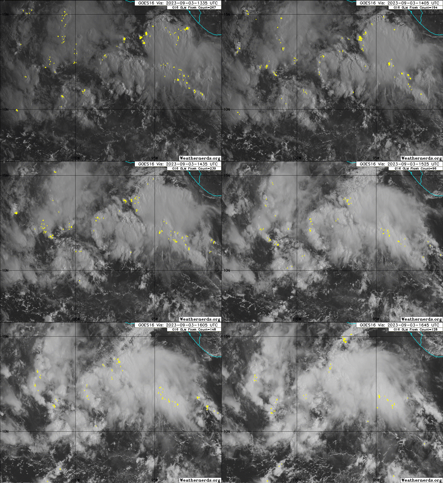
A tropical wave located southwest of the Gulf of Tehuantepec is
producing disorganized showers and thunderstorms. Environmental
conditions are forecast to be conducive for development of this
system, and a tropical depression is expected to form within the
next few days. The system is forecast to move westward to
west-northwestward, passing well south of mainland Mexico.
* Formation chance through 48 hours...medium...40 percent.
* Formation chance through 7 days...high...90 percent.
Forecaster D. Zelinsky
0 likes
Visit the Caribbean-Central America Weather Thread where you can find at first post web cams,radars
and observations from Caribbean basin members Click Here
and observations from Caribbean basin members Click Here
-
Sciencerocks
- Category 5

- Posts: 7286
- Age: 38
- Joined: Thu Jul 06, 2017 1:51 am
- cycloneye
- Admin

- Posts: 139080
- Age: 67
- Joined: Thu Oct 10, 2002 10:54 am
- Location: San Juan, Puerto Rico
Re: EPAC: INVEST 93E - Discussion
Central East Pacific (EP93):
Showers and thunderstorms associated with a tropical wave located
south of the southern coast of Mexico are beginning to show slight
indications of organization. Environmental conditions are forecast
to be conducive for further development of this system, and a
tropical depression is expected to form in the next two to three
days. The system is forecast to move westward to west-northwestward,
passing well south of mainland Mexico.
* Formation chance through 48 hours...medium...50 percent.
* Formation chance through 7 days...high...90 percent.
0 likes
Visit the Caribbean-Central America Weather Thread where you can find at first post web cams,radars
and observations from Caribbean basin members Click Here
and observations from Caribbean basin members Click Here
- ElectricStorm
- Category 5

- Posts: 4541
- Age: 23
- Joined: Tue Aug 13, 2019 11:23 pm
- Location: Skiatook, OK / Norman, OK
Re: EPAC: INVEST 93E - Discussion
This could have a good chance to become the next major
0 likes
I am in no way a professional. Take what I say with a grain of salt as I could be totally wrong. Please refer to the NHC, NWS, or SPC for official information.
Boomer Sooner!
Boomer Sooner!
- cycloneye
- Admin

- Posts: 139080
- Age: 67
- Joined: Thu Oct 10, 2002 10:54 am
- Location: San Juan, Puerto Rico
Re: EPAC: INVEST 93E - Discussion
Central East Pacific (EP93):
A broad area of low pressure associated with a tropical wave is
producing shower and thunderstorm activity with some signs of
organization a few hundred miles south of the southern coast of
Mexico. Environmental conditions are expected to be conducive for
further development of this system, and a tropical depression is
expected to form during the next couple of days or so while the
system moves westward to west-northwestward at 10 to 15 mph, passing
well south of mainland Mexico.
* Formation chance through 48 hours...medium...60 percent.
* Formation chance through 7 days...high...90 percent.
0 likes
Visit the Caribbean-Central America Weather Thread where you can find at first post web cams,radars
and observations from Caribbean basin members Click Here
and observations from Caribbean basin members Click Here
- Kingarabian
- S2K Supporter

- Posts: 15434
- Joined: Sat Aug 08, 2009 3:06 am
- Location: Honolulu, Hawaii
Re: EPAC: INVEST 93E - Discussion
Intensity models seem to really like this.
0 likes
RIP Kobe Bryant
- Yellow Evan
- Professional-Met

- Posts: 15952
- Age: 25
- Joined: Fri Jul 15, 2011 12:48 pm
- Location: Henderson, Nevada/Honolulu, HI
- Contact:
Re: EPAC: INVEST 93E - Discussion
Starting to see convective organization, although mostly MLC induced. Probably 24 hours away from TCG.
How fast TCG occurs determines ceiling but the ULAC pattern is pretty good
How fast TCG occurs determines ceiling but the ULAC pattern is pretty good
1 likes
- cycloneye
- Admin

- Posts: 139080
- Age: 67
- Joined: Thu Oct 10, 2002 10:54 am
- Location: San Juan, Puerto Rico
Re: EPAC: INVEST 93E - Discussion
Central East Pacific (EP93):
Shower and thunderstorm activity associated with a tropical wave
located a few hundred miles south of the southwestern coast of
Mexico continues to show signs of organization. Although the
low-level circulation of the system appears to be elongated for the
moment, further development is expected and a tropical depression
is very likely to form during the next day or two. The system is
forecast to move westward to west-northwestward at 10 to 15 mph,
passing well south of mainland Mexico.
* Formation chance through 48 hours...high...90 percent.
* Formation chance through 7 days...high...near 100 percent.
0 likes
Visit the Caribbean-Central America Weather Thread where you can find at first post web cams,radars
and observations from Caribbean basin members Click Here
and observations from Caribbean basin members Click Here
- Extratropical94
- Professional-Met

- Posts: 3535
- Age: 29
- Joined: Wed Oct 20, 2010 6:36 am
- Location: Hamburg, Germany
- Contact:
Re: EPAC: INVEST 93E - Discussion
EP, 11, 2023090418, , BEST, 0, 124N, 1038W, 30, 1007, LO, 34, NEQ, 0, 0, 0, 0, 1010, 150, 50, 0, 0, E, 0, , 0, 0, ELEVEN, M, 0, , 0, 0, 0, 0, genesis-num, 018, TRANSITIONED, epB32023 to ep112023,
0 likes
54° 11' 59'' N, 9° 9' 20'' E
Boomer Sooner!
Go Broncos! Go Cards! Go Niners!
- Daniel
Boomer Sooner!
Go Broncos! Go Cards! Go Niners!
- Daniel
Re: EPAC: INVEST 93E - Discussion
First forecast peak is at 100 kt. That’s awfully aggressive. I have my doubts it’ll get any stronger than a high-end 2 or a low-end 3.
0 likes
Irene '11 Sandy '12 Hermine '16 5/15/2018 Derecho Fay '20 Isaias '20 Elsa '21 Henri '21 Ida '21
I am only a meteorology enthusiast who knows a decent amount about tropical cyclones. Look to the professional mets, the NHC, or your local weather office for the best information.
I am only a meteorology enthusiast who knows a decent amount about tropical cyclones. Look to the professional mets, the NHC, or your local weather office for the best information.
- cycloneye
- Admin

- Posts: 139080
- Age: 67
- Joined: Thu Oct 10, 2002 10:54 am
- Location: San Juan, Puerto Rico
Re: EPAC: ELEVEN-E - Tropical Depression - Discussion
Tropical Depression Eleven-E Discussion Number 1
NWS National Hurricane Center Miami FL EP112023
400 PM CDT Mon Sep 04 2023
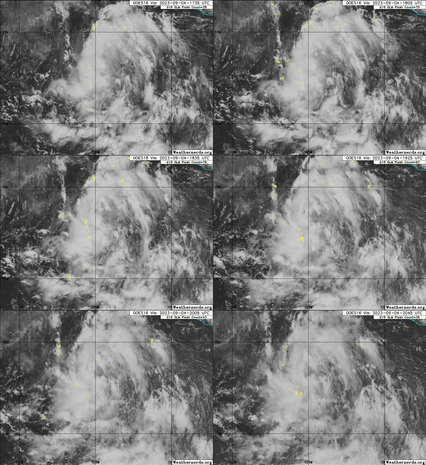
Recent visible satellite imagery indicates that the disturbance
located south of the southwestern coast of Mexico (93E) has
developed a well-defined circulation. In addition, a prominent band
of deep convection has formed around its western half. The latest
Dvorak classification Data-T from TAFB is a 2.0, which corresponds
to 30 kt. Based on the available data, the system has been
classified as Tropical Depression Eleven.
The depression is moving westward, with an estimated forward speed
of 10 kt. While all models agree that the cyclone will head
generally west-northwestward for the next 5 or more days, moving
well south and west of Mexico, there is substantial disagreement on
its forward speed. The main source of this uncertainty appears to be
differences in the strength of the primary steering mechanism
influencing the depression, a deep ridge centered over northern
Mexico and the southwestern U.S. that extends over the eastern
Pacific. The stronger the ridge, the faster the cyclone will move.
The uncertainty in the track forecast is much higher than normal by
the end of the forecast, with even the consensus models relatively
far apart. At day 5, the gap between HCCA and TVCN is more than 150
n mi. As a course of least regret, the NHC forecast doesn't favor
any one model or consensus aid, generally staying between the simple
and corrected consensus tracks.
The environment looks very conducive for strengthening, possibly
significantly so. SHIPS-derived shear is forecast to be near or
below 10 kt through day 5, with plenty of moisture and warm SSTs
available as well. It will likely take a day or so for the
depression to get sufficiently organized to take advantage of this
environment, so only slow strengthening is forecast for the first 24
h. Looking beyond that, the SHIPS-RII and DTOPS rapid
intensification (RI) probabilities for 65kt/72 h are both above 60
percent. The NHC forecast explicitly shows RI starting at 36 h and
continuing through 72 h. While there is spread at just how strong
the cyclone will get, most models suggest its peak will come between
72 and 96 h, so a peak intensity higher than what the NHC forecast
shows is definitely possible. Beginning at 96 h, the cyclone should
begin to quickly spin down as it moves over cooler waters.
FORECAST POSITIONS AND MAX WINDS
INIT 04/2100Z 12.5N 104.2W 30 KT 35 MPH
12H 05/0600Z 12.8N 105.3W 35 KT 40 MPH
24H 05/1800Z 13.3N 106.7W 40 KT 45 MPH
36H 06/0600Z 13.9N 108.2W 50 KT 60 MPH
48H 06/1800Z 14.6N 110.2W 60 KT 70 MPH
60H 07/0600Z 15.5N 112.5W 80 KT 90 MPH
72H 07/1800Z 16.5N 114.8W 95 KT 110 MPH
96H 08/1800Z 19.0N 119.5W 100 KT 115 MPH
120H 09/1800Z 21.5N 124.5W 75 KT 85 MPH
$$
Forecaster D. Zelinsky
0 likes
Visit the Caribbean-Central America Weather Thread where you can find at first post web cams,radars
and observations from Caribbean basin members Click Here
and observations from Caribbean basin members Click Here
-
Sciencerocks
- Category 5

- Posts: 7286
- Age: 38
- Joined: Thu Jul 06, 2017 1:51 am
- Kingarabian
- S2K Supporter

- Posts: 15434
- Joined: Sat Aug 08, 2009 3:06 am
- Location: Honolulu, Hawaii
Re: EPAC: ELEVEN-E - Tropical Depression - Discussion
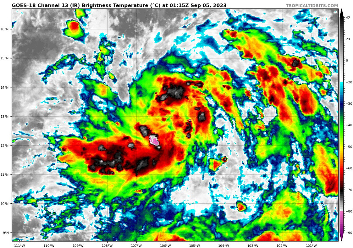
Outflow boundaries for days but its overall structure looks solid.
0 likes
RIP Kobe Bryant
- Kingarabian
- S2K Supporter

- Posts: 15434
- Joined: Sat Aug 08, 2009 3:06 am
- Location: Honolulu, Hawaii
- cycloneye
- Admin

- Posts: 139080
- Age: 67
- Joined: Thu Oct 10, 2002 10:54 am
- Location: San Juan, Puerto Rico
Re: EPAC: ELEVEN-E - Tropical Depression - Discussion
Still TD.
EP, 11, 2023090500, , BEST, 0, 126N, 1051W, 30, 1006, TD
0 likes
Visit the Caribbean-Central America Weather Thread where you can find at first post web cams,radars
and observations from Caribbean basin members Click Here
and observations from Caribbean basin members Click Here
- Yellow Evan
- Professional-Met

- Posts: 15952
- Age: 25
- Joined: Fri Jul 15, 2011 12:48 pm
- Location: Henderson, Nevada/Honolulu, HI
- Contact:
Re: EPAC: ELEVEN-E - Tropical Depression - Discussion
Give some time for Dvorak to catch up.
0 likes
- Yellow Evan
- Professional-Met

- Posts: 15952
- Age: 25
- Joined: Fri Jul 15, 2011 12:48 pm
- Location: Henderson, Nevada/Honolulu, HI
- Contact:
Re: EPAC: ELEVEN-E - Tropical Depression - Discussion

GFS is a little less optimistic shear wise but this is a prolonged period of favorable conditions. The sort that prompts an explicit Category 4 forecast.
1 likes
-
Sciencerocks
- Category 5

- Posts: 7286
- Age: 38
- Joined: Thu Jul 06, 2017 1:51 am
- Yellow Evan
- Professional-Met

- Posts: 15952
- Age: 25
- Joined: Fri Jul 15, 2011 12:48 pm
- Location: Henderson, Nevada/Honolulu, HI
- Contact:
Who is online
Users browsing this forum: No registered users and 85 guests


