https://ftp.nhc.noaa.gov/atcf/btk/bep952023.dat
EPAC: KENNETH - Post-Tropical - Discussion
Moderator: S2k Moderators
EPAC: KENNETH - Post-Tropical - Discussion
EP, 95, 2023091712, , BEST, 0, 100N, 1095W, 20, 1009, DB, 34, NEQ, 0, 0, 0, 0, 1011, 150, 60, 0, 0, E, 0, , 0, 0, INVEST, S, 0, , 0, 0, 0, 0, genesis-num, 021, SPAWNINVEST, ep732023 to ep952023,
https://ftp.nhc.noaa.gov/atcf/btk/bep952023.dat
0 likes
- cycloneye
- Admin

- Posts: 149843
- Age: 69
- Joined: Thu Oct 10, 2002 10:54 am
- Location: San Juan, Puerto Rico
Re: EPAC: INVEST 95E
Central East Pacific:
Showers and thunderstorms associated with a broad area of low
pressure located well south of the southern tip of the Baja
California peninsula continue to show signs of becoming better
organized. This system is currently elongated, but environmental
conditions are expected to allow for additional development during
the next few days. A tropical depression is expected to form by the
middle of the week while the system moves west-northwestward over
the central and western portions of the basin.
* Formation chance through 48 hours...medium...40 percent.
* Formation chance through 7 days...high...80 percent
0 likes
Visit the Caribbean-Central America Weather Thread where you can find at first post web cams,radars
and observations from Caribbean basin members Click Here
and observations from Caribbean basin members Click Here
-
Sciencerocks
- Category 5

- Posts: 10194
- Age: 40
- Joined: Thu Jul 06, 2017 1:51 am
- Yellow Evan
- Professional-Met

- Posts: 16257
- Age: 27
- Joined: Fri Jul 15, 2011 12:48 pm
- Location: Henderson, Nevada/Honolulu, HI
- Contact:
Re: EPAC: INVEST 95E

Dark horse intensification candidate (setup reminds me a little of Herman) but the window under 10 knots of shear is fairly short and it is super sensitive to shear at its size.
0 likes
-
Sciencerocks
- Category 5

- Posts: 10194
- Age: 40
- Joined: Thu Jul 06, 2017 1:51 am
Re: EPAC: INVEST 95E
Tropical Weather Outlook
NWS National Hurricane Center Miami FL
1100 AM PDT Mon Sep 18 2023
For the eastern North Pacific...east of 140 degrees west longitude:
Central East Pacific (EP95):
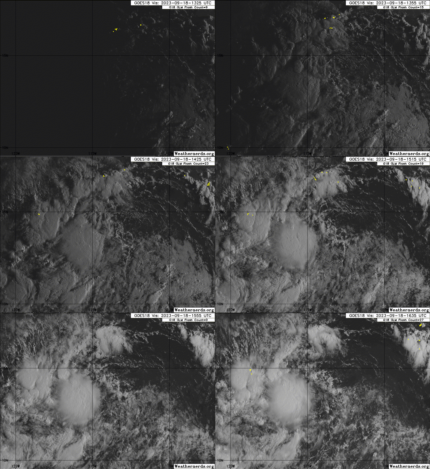
Satellite imagery indicates a broad area of low pressure located
well south-southwest of the southern tip of the Baja California
peninsula is gradually becoming better defined. The system continues
to produce disorganized shower and thunderstorm activity, and
environmental conditions are expected to remain conducive for
further development through midweek. A tropical depression is likely
to form during the next couple of days while the system moves
generally west-northwestward over the central and western portions
of the basin.
* Formation chance through 48 hours...high...70 percent.
* Formation chance through 7 days...high...90 percent.
$$
Forecaster A. Reinhart/B. Reinhart
0 likes
- Yellow Evan
- Professional-Met

- Posts: 16257
- Age: 27
- Joined: Fri Jul 15, 2011 12:48 pm
- Location: Henderson, Nevada/Honolulu, HI
- Contact:
-
Sciencerocks
- Category 5

- Posts: 10194
- Age: 40
- Joined: Thu Jul 06, 2017 1:51 am
- cycloneye
- Admin

- Posts: 149843
- Age: 69
- Joined: Thu Oct 10, 2002 10:54 am
- Location: San Juan, Puerto Rico
Re: EPAC: INVEST 95E
Tropical Weather Outlook
NWS National Hurricane Center Miami FL
500 PM PDT Mon Sep 18 2023
For the eastern North Pacific...east of 140 degrees west longitude:
1. Central East Pacific (EP95):
A low pressure system located well southwest of the southern tip of
the Baja California peninsula has become better defined today. The
associated shower and thunderstorm activity has decreased slightly
during the past several hours but is also showing signs of becoming
more organized. Further development is expected and a tropical
depression is likely to form during the next day or so. This system
is forecast to move slowly west-northwestward for the next 24 hours,
and then turn northward by late Wednesday over the western portion
of the basin.
* Formation chance through 48 hours...high...80 percent.
* Formation chance through 7 days...high...90 percent.
Forecaster D. Zelinsky
0 likes
Visit the Caribbean-Central America Weather Thread where you can find at first post web cams,radars
and observations from Caribbean basin members Click Here
and observations from Caribbean basin members Click Here
- Yellow Evan
- Professional-Met

- Posts: 16257
- Age: 27
- Joined: Fri Jul 15, 2011 12:48 pm
- Location: Henderson, Nevada/Honolulu, HI
- Contact:
Re: EPAC: INVEST 95E
EP, 13, 2023091912, , BEST, 0, 149N, 1184W, 30, 1006, TD, 34, NEQ, 0, 0, 0, 0, 1010, 180, 90, 0, 0, E, 0, , 0, 0, THIRTEEN, S, 0, , 0, 0, 0, 0, genesis-num, 021, TRANSITIONED, epB52023 to ep132023,
0 likes
- cycloneye
- Admin

- Posts: 149843
- Age: 69
- Joined: Thu Oct 10, 2002 10:54 am
- Location: San Juan, Puerto Rico
Re: EPAC: THIRTEEN-E - Tropical Depression - Discussion
Tropical Depression Thirteen-E Discussion Number 1
NWS National Hurricane Center Miami FL EP132023
800 AM PDT Tue Sep 19 2023
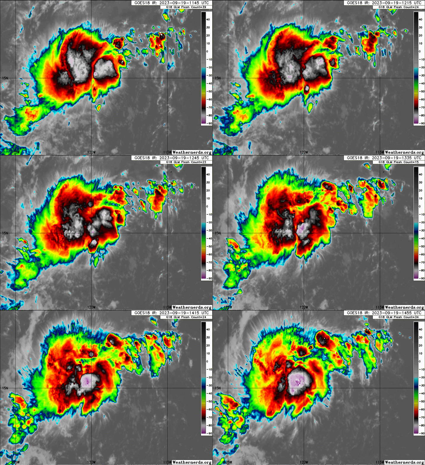
Persistent showers and thunderstorms have become better organized in
association with the area of low pressure located several hundred
miles southwest of the southern tip of Baja California. A 19/0535
UTC ASCAT-C pass showed a well-defined circulation. The invest is
upgraded to a 30-kt tropical depression. This intensity is in
agreement with the ASCAT pass and a satellite intensity estimate of
30 kt from TAFB.
The current motion estimate is 295/11. A west-northwestward motion
is expected during the next 36 h as the cyclone is steered by the
trade wind flow. After that time, a potent mid- to upper-level
trough approaching from the northwest is expected to cause
Thirteen-E to turn to the northwest and north-northwest. The track
forecast is in best agreement with the consensus aid TVCE. After the
cyclone loses its convection and becomes a remnant low, a bend back
to the west-northwest is likely in 4 to 5 days.
Warm ocean temperatures, light northeasterly to easterly vertical
wind shear, and a moist low to mid-level troposphere currently
surround the tropical cyclone. The system has perhaps 36 hours to
strengthen while it remains over these relatively favorable
environmental conditions. The cyclone is forecast to cross the 26C
isotherm in about 48 h. The aforementioned approaching mid- to
upper-level trough will induce strong southwesterly vertical wind
shear on the cyclone beginning by 60 h. After that time, much drier
air along with further decreasing ocean temperatures and increasing
wind shear will lead to the cyclone losing its convection and
becoming a remnant low in about 4 days.
FORECAST POSITIONS AND MAX WINDS
INIT 19/1500Z 15.0N 119.0W 30 KT 35 MPH
12H 20/0000Z 15.2N 120.7W 35 KT 40 MPH
24H 20/1200Z 15.5N 122.5W 35 KT 40 MPH
36H 21/0000Z 16.0N 123.9W 40 KT 45 MPH
48H 21/1200Z 16.7N 125.2W 35 KT 40 MPH
60H 22/0000Z 17.9N 126.2W 30 KT 35 MPH
72H 22/1200Z 19.8N 127.0W 30 KT 35 MPH
96H 23/1200Z 22.5N 127.6W 25 KT 30 MPH...POST-TROP/REMNT LOW
120H 24/1200Z 24.0N 129.5W 20 KT 25 MPH...POST-TROP/REMNT LOW
$$
Forecaster Hagen/Reinhart
0 likes
Visit the Caribbean-Central America Weather Thread where you can find at first post web cams,radars
and observations from Caribbean basin members Click Here
and observations from Caribbean basin members Click Here
-
Sciencerocks
- Category 5

- Posts: 10194
- Age: 40
- Joined: Thu Jul 06, 2017 1:51 am
-
MarioProtVI
- Category 5

- Posts: 1039
- Age: 24
- Joined: Sun Sep 29, 2019 7:33 pm
- Location: New Jersey
Re: EPAC: THIRTEEN-E - Tropical Depression - Discussion
Looks like the Kenneth streak is finally broken.
0 likes
- cycloneye
- Admin

- Posts: 149843
- Age: 69
- Joined: Thu Oct 10, 2002 10:54 am
- Location: San Juan, Puerto Rico
Re: EPAC: THIRTEEN-E - Tropical Depression - Discussion
Hello Kenneth.
EP, 13, 2023091918, , BEST, 0, 150N, 1205W, 40, 1004, TS
0 likes
Visit the Caribbean-Central America Weather Thread where you can find at first post web cams,radars
and observations from Caribbean basin members Click Here
and observations from Caribbean basin members Click Here
-
Sciencerocks
- Category 5

- Posts: 10194
- Age: 40
- Joined: Thu Jul 06, 2017 1:51 am
- cycloneye
- Admin

- Posts: 149843
- Age: 69
- Joined: Thu Oct 10, 2002 10:54 am
- Location: San Juan, Puerto Rico
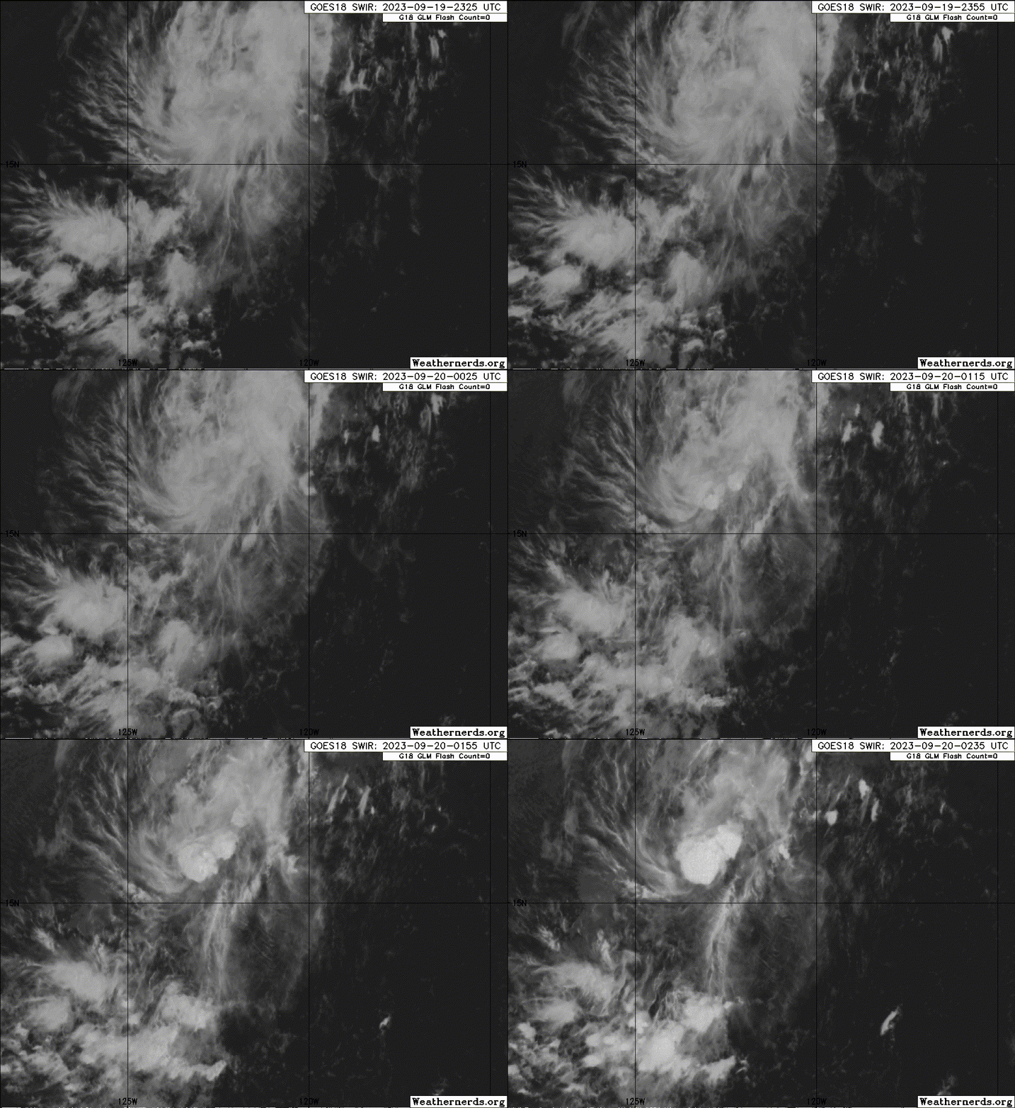
Re: EPAC: THIRTEEN-E - Tropical Depression - Discussion
0 likes
Visit the Caribbean-Central America Weather Thread where you can find at first post web cams,radars
and observations from Caribbean basin members Click Here
and observations from Caribbean basin members Click Here
- cycloneye
- Admin

- Posts: 149843
- Age: 69
- Joined: Thu Oct 10, 2002 10:54 am
- Location: San Juan, Puerto Rico
Re: EPAC: KENNETH - Tropical Storm - Discussion
Tropical Storm Kenneth Discussion Number 2
NWS National Hurricane Center Miami FL EP132023
200 PM PDT Tue Sep 19 2023
SSMIS and GMI microwave overpasses from this morning around 13Z
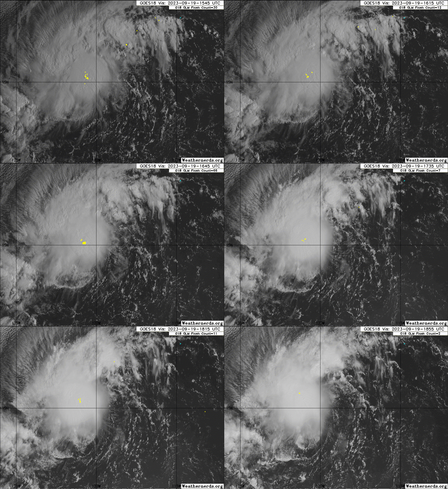
indicated that the cyclone was still quite disorganized. However,
the satellite presentation has improved since that time. The earlier
northeasterly to easterly shear appears to be abating. A 1714 UTC
ASCAT-B pass confirms that the low-level center is underneath the
central cold convective canopy and also shows tropical-storm-force
winds up to 40 kt in the NW quadrant. Based on the ASCAT pass, the
depression is upgraded to Tropical Storm Kenneth with 40-kt winds.
Based on fixes over the past 6 hours, the center appears to have
reformed a bit to the west. The estimated motion is 280/14. A
west-northwestward motion is expected through Wednesday night as
the cyclone is steered by the trade wind flow. After that time, a
potent mid- to upper-level trough approaching from the northwest is
expected to cause Kenneth to turn to the northwest or
north-northwest. The track forecast was adjusted a bit faster and
to the left of the previous NHC prediction, mainly due to the
recent center reformation, which caused some of the simple
consensus models to be farther west this cycle.
The intensity forecast has been adjusted upward based on the higher
initial intensity. Warm ocean temperatures, light northeasterly to
easterly vertical wind shear, and a moist low to mid-level
troposphere currently surround the tropical cyclone. The system has
perhaps 36 hours to strengthen while it remains in these relatively
favorable environmental conditions. The cyclone is forecast to cross
the 26C SST isotherm in about 48 h. The aforementioned approaching
mid- to upper-level trough will induce strong southwesterly vertical
wind shear on the cyclone beginning by 60 h. After that time, much
drier air along with further decreasing ocean temperatures and
increasing wind shear will lead to the cyclone losing its convection
and becoming a remnant low in about 3 to 4 days. Global models show
the system opening up into a trough by Day 5. Given the hostile
conditions the cyclone will be moving into, the NHC forecast follows
suit and calls for dissipation by Day 5.
FORECAST POSITIONS AND MAX WINDS
INIT 19/2100Z 15.1N 121.0W 40 KT 45 MPH
12H 20/0600Z 15.4N 122.4W 45 KT 50 MPH
24H 20/1800Z 15.9N 124.1W 50 KT 60 MPH
36H 21/0600Z 16.4N 125.6W 50 KT 60 MPH
48H 21/1800Z 17.4N 126.6W 45 KT 50 MPH
60H 22/0600Z 19.0N 127.3W 35 KT 40 MPH
72H 22/1800Z 20.4N 127.8W 30 KT 35 MPH
96H 23/1800Z 22.3N 128.7W 25 KT 30 MPH...POST-TROP/REMNT LOW
120H 24/1800Z...DISSIPATED
$$
Forecaster Hagen/Pasch
0 likes
Visit the Caribbean-Central America Weather Thread where you can find at first post web cams,radars
and observations from Caribbean basin members Click Here
and observations from Caribbean basin members Click Here
-
Sciencerocks
- Category 5

- Posts: 10194
- Age: 40
- Joined: Thu Jul 06, 2017 1:51 am
- cycloneye
- Admin

- Posts: 149843
- Age: 69
- Joined: Thu Oct 10, 2002 10:54 am
- Location: San Juan, Puerto Rico
Re: EPAC: KENNETH - Tropical Storm - Discussion
Tropical Storm Kenneth Discussion Number 3
NWS National Hurricane Center Miami FL EP132023
800 PM PDT Tue Sep 19 2023
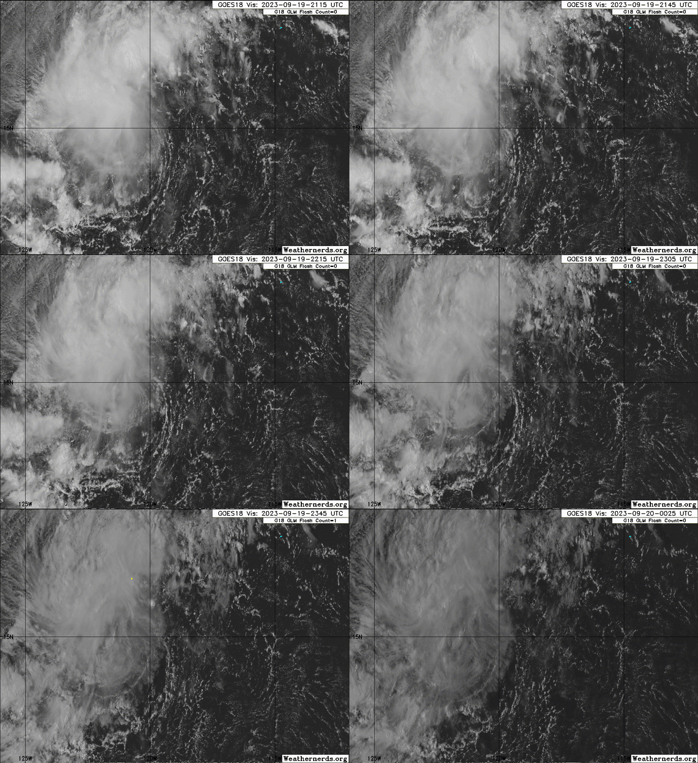
Kenneth is a poorly organized tropical cyclone. The large
convective canopy from earlier this afternoon has mostly
collapsed, with only a couple new convective cells forming well to
the northwest of the center. The initial intensity remains 40 kt
based on the earlier ASCAT data, although satellite intensity
estimates are no higher than about 35 kt.
Microwave data suggests that Kenneth's center has jogged--or
re-formed--a bit to the southwest of the previous fixes. The
long-term motion is gradually slowing down and is now westward, or
270/11 kt. A mid-level high centered over west-central Mexico and a
deep-layer trough extending southwest of California are expected to
steer Kenneth generally toward the northwest through the end of the
week. The NHC track forecast is changed little from the previous
prediction, and lies to the right of the TVCE multi-model consensus,
although not as far to the right as the latest GFS, ECMWF, and HCCA
solutions.
Moderate easterly shear is affecting the storm, but SHIPS
diagnostics suggest the shear should decrease and be relatively
light during the next 36 hours. The NHC forecast shows some modest
strengthening during this period, and is at the upper end of the
guidance envelope to maintain continuity with the previous forecast.
By 48 hours, Kenneth is expected to reach cooler waters, and
deep-layer shear is forecast to increase out of the southwest.
Weakening is therefore expected, and GFS- and ECMWF-based simulated
satellite images indicate that Kenneth could lose organized deep
convection and degenerate into a remnant low by day 3. The remnant
low is forecast to dissipate by day 5.
FORECAST POSITIONS AND MAX WINDS
INIT 20/0300Z 14.6N 121.6W 40 KT 45 MPH
12H 20/1200Z 15.1N 123.0W 45 KT 50 MPH
24H 21/0000Z 15.8N 124.6W 50 KT 60 MPH
36H 21/1200Z 16.6N 125.9W 45 KT 50 MPH
48H 22/0000Z 17.7N 126.8W 40 KT 45 MPH
60H 22/1200Z 19.2N 127.2W 35 KT 40 MPH
72H 23/0000Z 20.4N 127.6W 30 KT 35 MPH...POST-TROP/REMNT LOW
96H 24/0000Z 21.4N 128.8W 20 KT 25 MPH...POST-TROP/REMNT LOW
120H 25/0000Z...DISSIPATED
$$
Forecaster Berg
0 likes
Visit the Caribbean-Central America Weather Thread where you can find at first post web cams,radars
and observations from Caribbean basin members Click Here
and observations from Caribbean basin members Click Here
-
Sciencerocks
- Category 5

- Posts: 10194
- Age: 40
- Joined: Thu Jul 06, 2017 1:51 am
Who is online
Users browsing this forum: No registered users and 38 guests

