Tropical Depression Fourteen-E Discussion Number 5
NWS National Hurricane Center Miami FL EP142023
1100 AM HST Sun Sep 24 2023
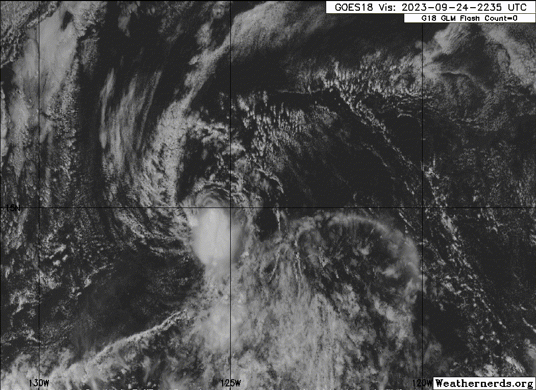
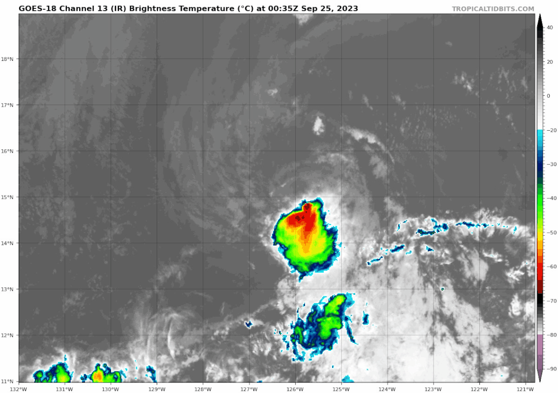
Moderate (15-20 kt) deep-layer shear and an enveloping dry and
stable low- to mid-level atmosphere have taken their toll
on the depression. The cyclone has lacked organized deep
convection since last night and primarily consists of a swirl of
low cloud elements, with deep convection well south of the surface
center associated with the inter-tropical convergence zone. The
initial intensity remains 30 kt based on a Dvorak CI number of 2.0
from TAFB. Despite warm waters ahead of the depression's track, the
negative environmental contributions mentioned above should cause
the depression to weaken further while impeding deep convective
redevelopment. Subsequently, the cyclone is expected to degenerate
to a remnant low later tonight and open into a trough in 4 days, or
less.
The exposed surface circulation's initial motion is estimated to be
westward or 270/13 kt. The forecast track philosophy is unchanged.
Mid-tropospheric high pressure extending from the Baja California
peninsula to the western tropical East Pacific should steer the
cyclone on a generally westward track through Monday. A turn
toward the west-southwest is expected on Tuesday within the
low-level tradewind steering flow through dissipation. The official
forecast is an update of the previous one and is based on the
various consensus aids.
FORECAST POSITIONS AND MAX WINDS
INIT 24/2100Z 15.2N 125.5W 30 KT 35 MPH
12H 25/0600Z 15.3N 127.5W 30 KT 35 MPH...POST-TROP/REMNT LOW
24H 25/1800Z 15.1N 130.0W 25 KT 30 MPH...POST-TROP/REMNT LOW
36H 26/0600Z 14.7N 132.4W 25 KT 30 MPH...POST-TROP/REMNT LOW
48H 26/1800Z 13.8N 135.8W 25 KT 30 MPH...POST-TROP/REMNT LOW
60H 27/0600Z 12.7N 139.2W 20 KT 25 MPH...POST-TROP/REMNT LOW
72H 27/1800Z 11.5N 142.6W 20 KT 25 MPH...POST-TROP/REMNT LOW
96H 28/1800Z...DISSIPATED
$$
Forecaster Roberts
NWS National Hurricane Center Miami FL EP142023
1100 AM HST Sun Sep 24 2023
Moderate (15-20 kt) deep-layer shear and an enveloping dry and
stable low- to mid-level atmosphere have taken their toll
on the depression. The cyclone has lacked organized deep
convection since last night and primarily consists of a swirl of
low cloud elements, with deep convection well south of the surface
center associated with the inter-tropical convergence zone. The
initial intensity remains 30 kt based on a Dvorak CI number of 2.0
from TAFB. Despite warm waters ahead of the depression's track, the
negative environmental contributions mentioned above should cause
the depression to weaken further while impeding deep convective
redevelopment. Subsequently, the cyclone is expected to degenerate
to a remnant low later tonight and open into a trough in 4 days, or
less.
The exposed surface circulation's initial motion is estimated to be
westward or 270/13 kt. The forecast track philosophy is unchanged.
Mid-tropospheric high pressure extending from the Baja California
peninsula to the western tropical East Pacific should steer the
cyclone on a generally westward track through Monday. A turn
toward the west-southwest is expected on Tuesday within the
low-level tradewind steering flow through dissipation. The official
forecast is an update of the previous one and is based on the
various consensus aids.
FORECAST POSITIONS AND MAX WINDS
INIT 24/2100Z 15.2N 125.5W 30 KT 35 MPH
12H 25/0600Z 15.3N 127.5W 30 KT 35 MPH...POST-TROP/REMNT LOW
24H 25/1800Z 15.1N 130.0W 25 KT 30 MPH...POST-TROP/REMNT LOW
36H 26/0600Z 14.7N 132.4W 25 KT 30 MPH...POST-TROP/REMNT LOW
48H 26/1800Z 13.8N 135.8W 25 KT 30 MPH...POST-TROP/REMNT LOW
60H 27/0600Z 12.7N 139.2W 20 KT 25 MPH...POST-TROP/REMNT LOW
72H 27/1800Z 11.5N 142.6W 20 KT 25 MPH...POST-TROP/REMNT LOW
96H 28/1800Z...DISSIPATED
$$
Forecaster Roberts