EPAC: PILAR - Post-Tropical - Discussion
Moderator: S2k Moderators
-
Sciencerocks
- Category 5

- Posts: 7286
- Age: 38
- Joined: Thu Jul 06, 2017 1:51 am

-
cycloneye

- Admin

- Posts: 139083
- Age: 67
- Joined: Thu Oct 10, 2002 10:54 am
- Location: San Juan, Puerto Rico
Re: EPAC: PILAR - Tropical Storm - Discussion
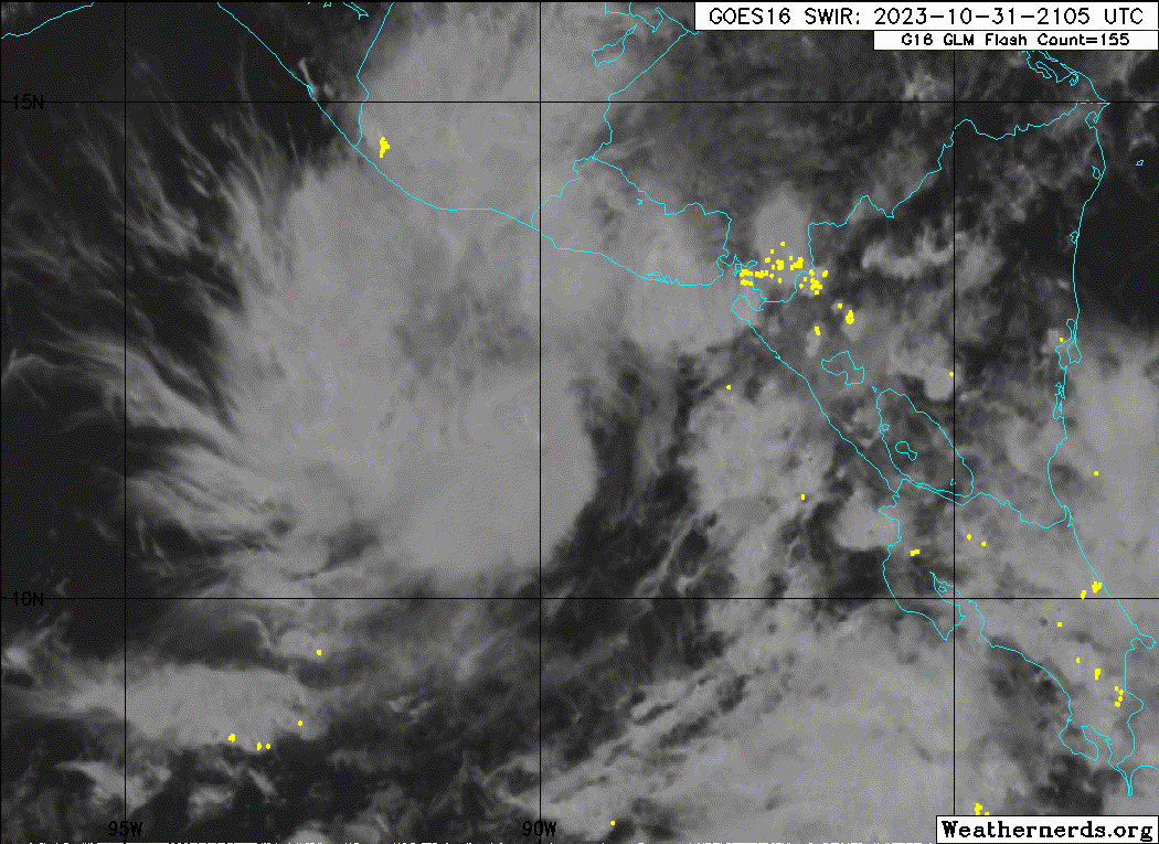
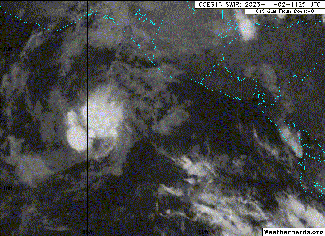
Tropical Storm Pilar Discussion Number 14
NWS National Hurricane Center Miami FL EP192023
1000 PM CDT Tue Oct 31 2023
After the previous advisory, a significant convective burst formed
mainly to the west of the center of Pilar that is now waning.
While the most recent GPM microwave pass missed the center of
the storm, it did catch a prominent curved band on the 37-GHz
channel extending to the northwest away from the center. Subjective
Dvorak estimates were T3.0/45 kt from TAFB and T3.5/55 kt from SAB.
Taking a blend of these estimates, the initial intensity is set at
50 kt this advisory. This value also assumes a bit of undersampling
from the ASCAT-B/C passes that had peak wind retrievals of 45 kt
outside of the convection earlier today. While the wind-radii were
adjusted a bit based on that scatterometer data, the 34-kt winds
remain just offshore of El Salvador.
Pilar has nudged a bit closer to the coast of El Salvador, with the
estimated motion a drift to the north at 360/2 kt. The upper-level
trough that had weakened the ridging over Mexico is lifting out, and
in response, mid-level ridging is becoming re-established over
Mexico. In addition, a significant gale-force gap wind event is
currently ongoing to the west of Pilar in the Gulf of Tehuantepec. A
combination of these low and mid-level steering influences is
expected to start moving Pilar to the west and then west-southwest
beginning tomorrow and continuing through the end of this week. The
track guidance remains in fairly good agreement on this solution,
though was a bit further north early on given the initial position,
and further south towards the end of the forecast. The NHC track has
been adjusted accordingly, and still lies in between the reliable
TVCE and HCCA consensus aids.
Pilar could be near its peak intensity as it continues to battle
moderate vertical wind shear out of the east. While this shear is
forecast to decrease in the next 24-48 hours, this is expected to be
offset by ocean upwelling, which is likely occurring near the slow
moving storm currently, in addition to the strong gap-wind flow
further west also putting a dent in the sea-surface temperatures
along Pilar's forecast track. This effect is most accurately
captured by the atmospheric-ocean coupled hurricane regional
guidance, which are all notably lower than the consensus aids as
they show Pilar traversing SSTs below 26 C over the next few days.
The aforementioned gap winds may also import dry mid-latitude air
near the circulation of Pilar as it begins to lose latitude. The
most recent GFS and ECMWF runs also show a weaker system than before
after the next 36-48 hours, so a bit more weakening is shown in the
latest NHC forecast. This forecast splits the difference between the
higher IVCN and HCCA consensus aids, and the lower hurricane
regional model guidance.
Key Messages:
1. Heavy rains from Pilar will produce flash and urban flooding,
along with mudslides in areas of higher terrain of the Pacific coast
of Central America from southern El Salvador, across southern
Honduras, western Nicaragua into northern Costa Rica through
Wednesday.
2. Tropical storm conditions are possible along portions of the
Pacific coast of El Salvador, Honduras, and Nicaragua, where a
Tropical Storm Watch remains in effect.
3. Swells generated by Pilar will continue to affect the Pacific
coast of Central America during the next few days. These swells are
likely to cause life-threatening surf and rip current conditions.
FORECAST POSITIONS AND MAX WINDS
INIT 01/0300Z 11.9N 89.4W 50 KT 60 MPH
12H 01/1200Z 11.9N 89.5W 50 KT 60 MPH
24H 02/0000Z 11.7N 91.0W 50 KT 60 MPH
36H 02/1200Z 11.3N 93.2W 45 KT 50 MPH
48H 03/0000Z 10.6N 96.0W 40 KT 45 MPH
60H 03/1200Z 9.8N 98.9W 40 KT 45 MPH
72H 04/0000Z 9.4N 101.4W 40 KT 45 MPH
96H 05/0000Z 9.0N 106.0W 40 KT 45 MPH
120H 06/0000Z 10.0N 110.0W 40 KT 45 MPH
$$
Forecaster Papin
0 likes
Visit the Caribbean-Central America Weather Thread where you can find at first post web cams,radars
and observations from Caribbean basin members Click Here
and observations from Caribbean basin members Click Here
-
cycloneye
- Admin
- Posts: 139083
- Age: 67
- Joined: Thu Oct 10, 2002 10:54 am
- Location: San Juan, Puerto Rico
Re: EPAC: PILAR - Tropical Storm - Discussion
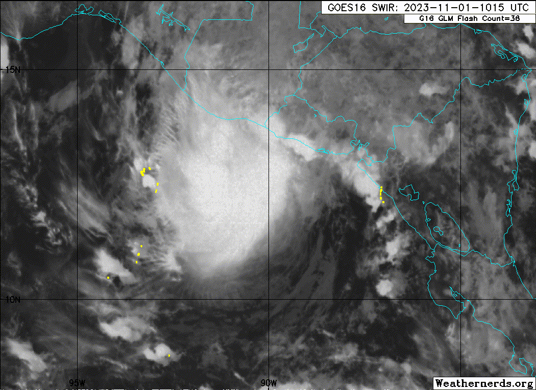
Tropical Storm Pilar Discussion Number 15
NWS National Hurricane Center Miami FL EP192023
400 AM CDT Wed Nov 01 2023
Deep convection associated with Pilar has increased over the western
portion of the circulation this morning. Despite some continued
east-southeasterly shear over the cyclone, the cold dense overcast
has begun to expand eastward, and proxy-visible and shortwave
infrared satellite images suggest the center is no longer exposed.
The latest objective intensity estimates seem too low based on
recent satellite trends and yesterday's scatterometer data. A blend
of subjective Dvorak current intensity estimates from SAB and TAFB
support holding the initial intensity at 50 kt.
Satellite images and recent fixes suggest Pilar is now moving
northwestward (325/3 kt). A more westward motion is expected later
today, followed by an acceleration to the west-southwest through
Friday as a mid-level ridge builds over central Mexico. This motion
away from land should be reinforced by the low-level northerly flow
well downstream of a strong Gulf of Tehuantepec gap wind event. The
only notable change to the NHC track forecast is a faster forward
speed during the first few days of the forecast, which is supported
by the latest TVCE and HCCA consensus aids.
While the satellite structure of Pilar has improved during the
diurnal maximum period, the storm will continue to be impacted by
moderate shear during the next couple of days. Also, the regional
hurricane models show that the slow-moving cyclone has upwelled some
cooler waters, and Pilar is forecast to move over this cool wake
during the next day or two. In addition, model-simulated satellite
imagery indicates the storm's convection could be disrupted while it
encounters the drier low-level flow downstream of the ongoing gap
wind event. Not surprisingly, most of the intensity guidance shows
some gradual weakening during the next couple of days, and the
official NHC forecast follows suit. Later in the period, there is a
large spread in the intensity guidance, as the statistical-dynamical
aids show strengthening while the global and regional hurricane
models are much weaker. Similar to the previous prediction, this
forecast stays near the simple consensus (IVCN) and shows little
intensity change from days 3-5.
Key Messages:
1. Heavy rains from Pilar will produce flash and urban flooding,
along with mudslides in areas of higher terrain of the Pacific coast
of Central America from southern El Salvador, across southern
Honduras, western Nicaragua into northern Costa Rica through today.
2. Tropical storm conditions are possible along portions of the
Pacific coast of El Salvador, Honduras, and Nicaragua, where a
Tropical Storm Watch remains in effect.
3. Swells generated by Pilar will continue to affect the Pacific
coast of Central America during the next couple of days. These
swells are likely to cause life-threatening surf and rip current
conditions.
FORECAST POSITIONS AND MAX WINDS
INIT 01/0900Z 12.3N 89.9W 50 KT 60 MPH
12H 01/1800Z 12.1N 90.6W 50 KT 60 MPH
24H 02/0600Z 11.7N 92.5W 45 KT 50 MPH
36H 02/1800Z 11.0N 95.2W 45 KT 50 MPH
48H 03/0600Z 10.2N 98.1W 40 KT 45 MPH
60H 03/1800Z 9.6N 101.0W 40 KT 45 MPH
72H 04/0600Z 9.2N 103.5W 40 KT 45 MPH
96H 05/0600Z 9.5N 108.5W 40 KT 45 MPH
120H 06/0600Z 10.0N 111.5W 35 KT 40 MPH
$$
Forecaster Reinhart
0 likes
Visit the Caribbean-Central America Weather Thread where you can find at first post web cams,radars
and observations from Caribbean basin members Click Here
and observations from Caribbean basin members Click Here
-
Sciencerocks
- Category 5
- Posts: 7286
- Age: 38
- Joined: Thu Jul 06, 2017 1:51 am
-
cycloneye
- Admin
- Posts: 139083
- Age: 67
- Joined: Thu Oct 10, 2002 10:54 am
- Location: San Juan, Puerto Rico
Re: EPAC: PILAR - Tropical Storm - Discussion
Tropical Storm Pilar Discussion Number 16
NWS National Hurricane Center Miami FL EP192023
1000 AM CDT Wed Nov 01 2023
Deep convection has continued to burst over the western portion of
Pilar's circulation this morning. However, the cloud tops have been
warming during the past couple of hours, and recent visible imagery
still indicates that the low-level circulation is located near the
eastern edge of the convection. The initial intensity is again held
at 50 kt, which is a blend of the latest subjective Dvorak T- and
CI-numbers from TAFB and SAB.
Recent satellite fixes show that Pilar is now moving westward or
270 degrees at 6 kt. A much faster westward to west-southwestward
motion is expected during the next few days as a narrow mid-level
ridge builds across southern Mexico. The dynamical model guidance
continues to trend toward a faster solution, and the NHC track
forecast has again been sped up from the previous advisory. The
new forecast track lies between the previous interpolated forecast
and the latest HCCA and TVCE consensus aids.
The moderate shear that has been plaguing Pilar is expected to
continue for another day or so. Although the shear may decrease
somewhat after that time, the storm is likely to encounter a drier
and more stable airmass from an ongoing Gulf of Tehuantepec gap wind
event. In addition, Pilar is expected to pass over an area of
slightly cooler upwelled waters to the south and southwest of the
Gulf of Tehuantepec. As a result of these unfavorable conditions,
most of the dynamical model guidance shows gradual weakening
during the next few days, and the NHC intensity forecast follows
suit. It should be noted that simulated satellite imagery from the
GFS suggests that Pilar could struggle to maintain organized deep
convection by the weekend. The NHC forecast maintains Pilar as a
tropical cyclone for the entire 5-day period, but it is possible
that the system degenerates into a remnant low or trough before the
end of the period. There is still a fair amount of uncertainty in
the longer range status and intensity of the system.
Key Messages:
1. Additional heavy rainfall from Pilar will produce flash and urban
flooding, along with mudslides in areas of higher terrain of the
Pacific coast of Central America from southern El Salvador, across
southern Honduras, western Nicaragua into northern Costa Rica
through today.
2. Tropical storm conditions are possible along portions of the
Pacific coast of El Salvador where a Tropical Storm Watch remains
in effect.
3. Swells generated by Pilar will continue to affect the Pacific
coast of Central America during the next day or two. These
swells are likely to cause life-threatening surf and rip current
conditions.
FORECAST POSITIONS AND MAX WINDS
INIT 01/1500Z 12.5N 90.5W 50 KT 60 MPH
12H 02/0000Z 12.2N 91.8W 45 KT 50 MPH
24H 02/1200Z 11.6N 94.2W 45 KT 50 MPH
36H 03/0000Z 10.6N 97.3W 45 KT 50 MPH
48H 03/1200Z 9.9N 100.4W 40 KT 45 MPH
60H 04/0000Z 9.4N 103.3W 40 KT 45 MPH
72H 04/1200Z 9.3N 105.8W 35 KT 40 MPH
96H 05/1200Z 9.6N 110.2W 35 KT 40 MPH
120H 06/1200Z 10.4N 113.7W 30 KT 35 MPH
$$
Forecaster Brown
0 likes
Visit the Caribbean-Central America Weather Thread where you can find at first post web cams,radars
and observations from Caribbean basin members Click Here
and observations from Caribbean basin members Click Here
-
Sciencerocks
- Category 5
- Posts: 7286
- Age: 38
- Joined: Thu Jul 06, 2017 1:51 am
-
cycloneye
- Admin
- Posts: 139083
- Age: 67
- Joined: Thu Oct 10, 2002 10:54 am
- Location: San Juan, Puerto Rico
Re: EPAC: PILAR - Tropical Storm - Discussion
Tropical Storm Pilar Discussion Number 17
NWS National Hurricane Center Miami FL EP192023
400 PM CDT Wed Nov 01 2023
Convection over and near Pilar's low-level circulation continues to
flare periodically. A recent burst of convection has obscured the
center on visible satellite imagery. Satellite intensity estimates
have trended downward this cycle, with 45 kt from TAFB and SAB
and a range of 33-49 kt from various objective estimates. The
initial intensity has been lowered to 45 kt based on these values.
Pilar is accelerating westward with an estimated motion of 270/9
kt. This general motion with an increase in forward speed is
forecast for the next few days as the storm is steered along the
south side of a mid-level ridge. The model guidance has
accelerated again from the previous advisory. The latest forecast
track is a blend of the prior prediction and the latest simple and
corrected consensus aids.
Moderate deep-layer vertical wind shear is expected to persist for
at least another 24 hours. While the shear decreases beyond a day,
Pilar will likely encounter a drier, more stable airmass associated
with a Gulf of Tehuantepec gap wind event. These environmental
conditions, along with cooler, upwelled ocean waters should result
in a gradual weaken trend as indicated by the majority of the
dynamical intensity guidance. The official intensity forecast
reflects this scenario and is closest to the simple model consensus.
There remains the possibility that Pilar could weaken sooner and
become a post-tropical cyclone or open into a trough. However, the
official forecast conservatively maintains a 5-day forecast for now.
Key Messages:
1. Additional heavy rainfall from Pilar will produce flash and urban
flooding, along with mudslides in areas of higher terrain of the
Pacific coast of Central America from southern El Salvador, across
southern Honduras, western Nicaragua into northern Costa Rica
through today.
2. Swells generated by Pilar will continue to affect the Pacific
coast of Central America during the next day or two. These
swells are likely to cause life-threatening surf and rip current
conditions.
FORECAST POSITIONS AND MAX WINDS
INIT 01/2100Z 12.4N 91.7W 45 KT 50 MPH
12H 02/0600Z 12.0N 93.4W 45 KT 50 MPH
24H 02/1800Z 11.1N 96.2W 40 KT 45 MPH
36H 03/0600Z 10.2N 99.4W 40 KT 45 MPH
48H 03/1800Z 9.5N 102.4W 35 KT 40 MPH
60H 04/0600Z 9.3N 105.1W 35 KT 40 MPH
72H 04/1800Z 9.4N 107.8W 35 KT 40 MPH
96H 05/1800Z 10.0N 111.7W 30 KT 35 MPH
120H 06/1800Z 10.9N 115.0W 30 KT 35 MPH
$$
Forecaster Bucci
0 likes
Visit the Caribbean-Central America Weather Thread where you can find at first post web cams,radars
and observations from Caribbean basin members Click Here
and observations from Caribbean basin members Click Here
-
Sciencerocks
- Category 5
- Posts: 7286
- Age: 38
- Joined: Thu Jul 06, 2017 1:51 am
-
cycloneye
- Admin
- Posts: 139083
- Age: 67
- Joined: Thu Oct 10, 2002 10:54 am
- Location: San Juan, Puerto Rico
Re: EPAC: PILAR - Tropical Storm - Discussion
Tropical Storm Pilar Discussion Number 18
NWS National Hurricane Center Miami FL EP192023
1000 PM CDT Wed Nov 01 2023
Deep convection near the center of Pilar has diminished
significantly this evening. Cloud tops associated with the cyclone
are now generally warmer than -50 deg C. This degradation in the
cloud structure could be at least partially be caused by the
system's passage over upwelled ocean waters near the coast. Another
factor could be some disruption due to the influence of a nearby
Tehuantepec gap wind event. Given the decrease in convection, it is
assumed that some weakening has occurred and the current intensity
is set at 40 kt for this advisory. This is close to the mean of
final T-numbers and CI numbers from TAFB and SAB.
Center fixes indicate that the westward track is continuing with a
motion estimate of 270/10 kt. A prominent mid-level subtropical
ridge is expected to remain north of Pilar, and strengthen further,
during the next few days. This should force a westward to
west-southwestward motion with some increase in forward speed. The
official track forecast is again a little faster than the previous
one and is a blend of the simple and corrected dynamical model
consensus predictions.
The gap wind event and easterly vertical wind shear could cause
some additional weakening during the next day or so. Later in the
forecast period, moderate shear and marginal thermodynamic
conditions are likely to inhibit strengthening. The NHC forecast
shows very slow weakening through the period. However, there is a
possibility that the system will degenerate into a remnant low or a
trough within the next 5 days.
Key Messages:
1. The combination of previous heavy rainfall and any additional
rainfall from Pilar may produce flash and urban flooding, along with
mudslides in areas of higher terrain of the Pacific coast from El
Salvador into southern Guatemala overnight.
2. Swells generated by Pilar and strong winds near the Gulf of
Tehuantepec are expected to continue affecting the Pacific coast of
Central America during the next day or two. These swells are
likely to cause life-threatening surf and rip current conditions.
FORECAST POSITIONS AND MAX WINDS
INIT 02/0300Z 12.4N 92.6W 40 KT 45 MPH
12H 02/1200Z 11.7N 94.8W 40 KT 45 MPH
24H 03/0000Z 10.8N 97.8W 40 KT 45 MPH
36H 03/1200Z 9.9N 101.0W 35 KT 40 MPH
48H 04/0000Z 9.4N 104.1W 35 KT 40 MPH
60H 04/1200Z 9.5N 106.8W 35 KT 40 MPH
72H 05/0000Z 9.7N 109.2W 35 KT 40 MPH
96H 06/0000Z 10.5N 113.1W 30 KT 35 MPH
120H 07/0000Z 11.3N 116.0W 30 KT 35 MPH
$$
Forecaster Pasch
0 likes
Visit the Caribbean-Central America Weather Thread where you can find at first post web cams,radars
and observations from Caribbean basin members Click Here
and observations from Caribbean basin members Click Here
-
cycloneye
- Admin
- Posts: 139083
- Age: 67
- Joined: Thu Oct 10, 2002 10:54 am
- Location: San Juan, Puerto Rico
Re: EPAC: PILAR - Tropical Storm - Discussion
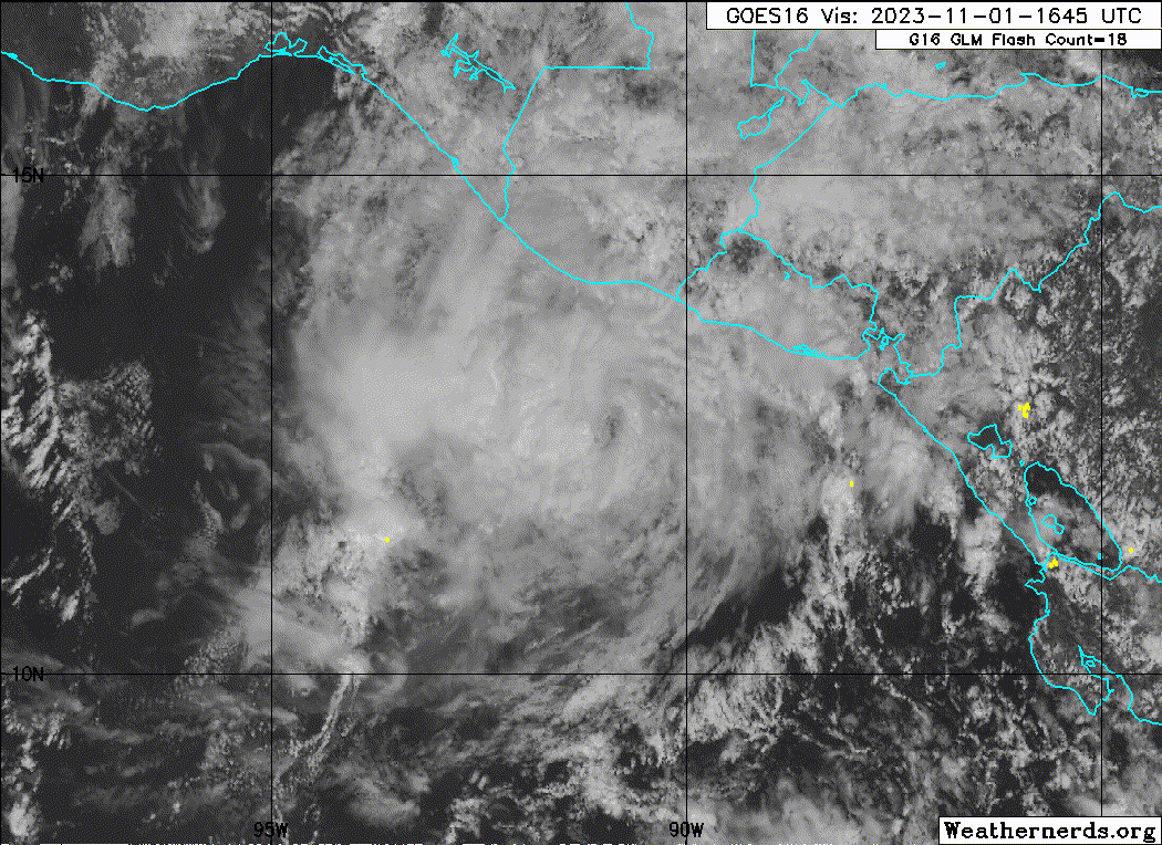
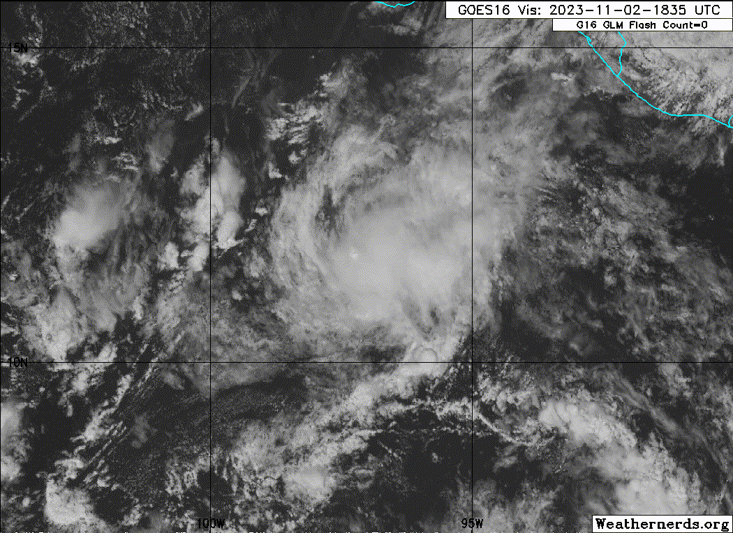
Tropical Storm Pilar Discussion Number 19
NWS National Hurricane Center Miami FL EP192023
400 AM CDT Thu Nov 02 2023
After a lull in convective activity last night, a small area of deep
convection has developed and persisted with Pilar early this
morning. The center of the compact storm is located underneath a
small cold dense overcast, and the latest satellite intensity
estimates have risen as a result of this improved convective
structure. The initial intensity is set at 45 kt for this advisory,
in best agreement with a T3.0/45 kt subjective Dvorak classification
from TAFB and a 45-kt SATCON estimate.
Pilar is accelerating westward away from land (265 degrees/12 kt).
As a mid-level ridge continues building to the north and northwest
of Pilar, the storm is expected to move faster to the west-southwest
during the next couple of days. Over the weekend, a shortwave trough
is forecast to move across the Baja California peninsula and weaken
the steering ridge. As a result, Pilar should slow down and turn
toward the west and west-northwest early next week. In general,
there is good agreement among the models on the future track of
Pilar, with more of the differences in the along-track direction.
Once again, the official NHC forecast is slightly faster than the
previous prediction based on the latest TVCE and HCCA aids.
Pilar is near a strong band of low-level northerly winds associated
with an ongoing Tehuantepec gap wind event. The gap wind flow could
introduce some drier air into Pilar's circulation and/or briefly
disrupt its convective organization. Otherwise, the storm is
forecast to move over warm waters in a generally weak to moderate
shear environment through this weekend. There is more spread noted
in the intensity guidance at 48-72 h. Some of the regional hurricane
models (HWRF, HAFS-A) show strengthening during this period, while
the global models and other regional guidance (HMON, HAFS-B) show
little change or some weakening. Given the higher initial intensity
and guidance trends this cycle, the updated NHC forecast is slightly
stronger than the previous one through the first few days of the
period. But overall, little change in strength is forecast during
the next few days. As Pilar gains latitude at days 4-5, it should
encounter stronger southwesterly shear and weaken more.
FORECAST POSITIONS AND MAX WINDS
INIT 02/0900Z 12.3N 94.1W 45 KT 50 MPH
12H 02/1800Z 11.5N 96.3W 45 KT 50 MPH
24H 03/0600Z 10.6N 99.5W 40 KT 45 MPH
36H 03/1800Z 10.0N 102.7W 40 KT 45 MPH
48H 04/0600Z 9.9N 105.7W 40 KT 45 MPH
60H 04/1800Z 10.0N 108.2W 40 KT 45 MPH
72H 05/0600Z 10.3N 110.3W 40 KT 45 MPH
96H 06/0600Z 11.3N 113.9W 35 KT 40 MPH
120H 07/0600Z 12.5N 117.0W 30 KT 35 MPH
$$
Forecaster Reinhart
0 likes
Visit the Caribbean-Central America Weather Thread where you can find at first post web cams,radars
and observations from Caribbean basin members Click Here
and observations from Caribbean basin members Click Here
-
cycloneye
- Admin
- Posts: 139083
- Age: 67
- Joined: Thu Oct 10, 2002 10:54 am
- Location: San Juan, Puerto Rico
Re: EPAC: PILAR - Tropical Storm - Discussion
Tropical Storm Pilar Discussion Number 20
NWS National Hurricane Center Miami FL EP192023
1000 AM CDT Thu Nov 02 2023
Pilar continues to have a burst of convection near the low-level
center this morning. There have been a few microwave passes this
morning, which depict the overall pulsing nature of the convective
structure of Pilar. The satellite intensity estimates have decreased
slightly this cycle. Given the nature of the pulsing convective
pattern, the initial intensity leans toward the Dvorak CI-numbers,
which were 3.0 and 2.5 from TAFB and SAB, respectively. This
supports keeping the initial intensity steady at 45 kt, but this
could be a little generous.
Pilar continues to accelerate westward this morning at an estimated
motion of 260/13 kt. A strengthening mid-level ridge is building to
the north and northeast of Pilar, which will steer the system
west-southwestward the next few days. A shortwave trough is forecast
to move in from the northwest and weaken the mid-level ridge late
this weekend. This will result in Pilar slowing down and turning
west to west-northwest early next week. The model guidance is
in fairly good agreement with this scenario, with the main
difference among the models being along-track with the forward
speed of Pilar. The NHC forecast is slightly faster than the
previous, and lies between the simple and corrected consensus aids.
The near term intensity forecast is a little tricky given the
pulsing convective nature of Pilar and the interaction with strong
low-level northerly winds associated with an ongoing Gulf of
Tehuantepec gap wind event. The gap wind flow could introduce some
drier air into Pilar's circulation, which may briefly disrupt its
convective organization. Later this weekend, the system is forecast
to move over warm sea surface temperatures with weak to moderate
vertical wind shear. There is some spread in the intensity guidance
between 36-72h with some of the hurricane regional models showing
strengthening, while some of the global models show little change in
intensity. Given the favorable parameters and the guidance trends,
the NHC intensity forecast is slightly higher than the previous at
these time ranges, but still below the HWRF, HAFS-A and HCCA
corrected consensus. Towards the end of the forecast period, Pilar
will encounter a less favorable environment with increasing
southwesterly shear and drier air. Given the small size of Pilar,
intensity fluctuations are possible throughout the forecast period.
FORECAST POSITIONS AND MAX WINDS
INIT 02/1500Z 11.9N 95.2W 45 KT 50 MPH
12H 03/0000Z 11.2N 97.7W 45 KT 50 MPH
24H 03/1200Z 10.5N 100.9W 40 KT 45 MPH
36H 04/0000Z 10.1N 104.0W 40 KT 45 MPH
48H 04/1200Z 10.2N 106.8W 45 KT 50 MPH
60H 05/0000Z 10.5N 109.2W 45 KT 50 MPH
72H 05/1200Z 10.9N 111.3W 45 KT 50 MPH
96H 06/1200Z 11.9N 114.5W 40 KT 45 MPH
120H 07/1200Z 13.1N 117.3W 35 KT 40 MPH
$$
Forecaster Kelly
0 likes
Visit the Caribbean-Central America Weather Thread where you can find at first post web cams,radars
and observations from Caribbean basin members Click Here
and observations from Caribbean basin members Click Here
-
Sciencerocks
- Category 5
- Posts: 7286
- Age: 38
- Joined: Thu Jul 06, 2017 1:51 am
-
cycloneye
- Admin
- Posts: 139083
- Age: 67
- Joined: Thu Oct 10, 2002 10:54 am
- Location: San Juan, Puerto Rico
Re: EPAC: PILAR - Tropical Storm - Discussion
Tropical Storm Pilar Discussion Number 21
NWS National Hurricane Center Miami FL EP192023
400 PM CDT Thu Nov 02 2023
Pilar has not changed much during the past several hours. The storm
continues to produce a ragged area of deep convection that lacks
banding features with dry and stable air, associated with the
ongoing Gulf of Tehuantepec gap wind event, intruding into the
circulation. Despite this steady state appearance, a recent ASCAT-C
pass showed peak winds between 45 and 50 kt, and therefore, the
initial intensity is nudged back up to 50 kt. This value is above
the latest Dvorak classifications. Pilar is quite compact with its
tropical-storm-force winds estimated to only extend up to 60 n mi
from the center and its overall deep cloud field only extending a
little more than 100 n mi across.
The environmental conditions around Pilar during the next few days
are marginal. Although SSTs are warm, the vertical wind shear is
expected to be moderate and dry air in the vicinity of the cyclone
could continue to intrude into the circulation. The net result will
likely be fluctuations in strength through the weekend. By early
next week, however, Pilar is expected to move into a region of
stronger shear, and that should result in a weakening trend. The
NHC intensity forecast is higher than the previous one, mostly based
on the initial intensity, and lies near the middle of the guidance
envelope.
The storm is moving just south of due west at 14 kt. A continued
swift west-southwestward to westward motion is expected during the
next day or two while the system remains steered by a low- to
mid-level ridge to its northwest. After that time, a slow down and
a westward to west-northwestward motion is predicted as the ridge
breaks down and the weakening system moves in the low- to mid-level
flow. The track models are in relatively good agreement, and little
change was made to the previous NHC track forecast.
FORECAST POSITIONS AND MAX WINDS
INIT 02/2100Z 11.6N 96.9W 50 KT 60 MPH
12H 03/0600Z 10.9N 99.4W 50 KT 60 MPH
24H 03/1800Z 10.4N 102.6W 50 KT 60 MPH
36H 04/0600Z 10.3N 105.5W 50 KT 60 MPH
48H 04/1800Z 10.5N 108.1W 50 KT 60 MPH
60H 05/0600Z 10.7N 110.5W 50 KT 60 MPH
72H 05/1800Z 11.2N 112.3W 50 KT 60 MPH
96H 06/1800Z 12.3N 114.9W 45 KT 50 MPH
120H 07/1800Z 13.6N 117.4W 35 KT 40 MPH
$$
Forecaster Cangialosi
0 likes
Visit the Caribbean-Central America Weather Thread where you can find at first post web cams,radars
and observations from Caribbean basin members Click Here
and observations from Caribbean basin members Click Here
-
Sciencerocks
- Category 5
- Posts: 7286
- Age: 38
- Joined: Thu Jul 06, 2017 1:51 am
-
cycloneye
- Admin
- Posts: 139083
- Age: 67
- Joined: Thu Oct 10, 2002 10:54 am
- Location: San Juan, Puerto Rico
Re: EPAC: PILAR - Tropical Storm - Discussion
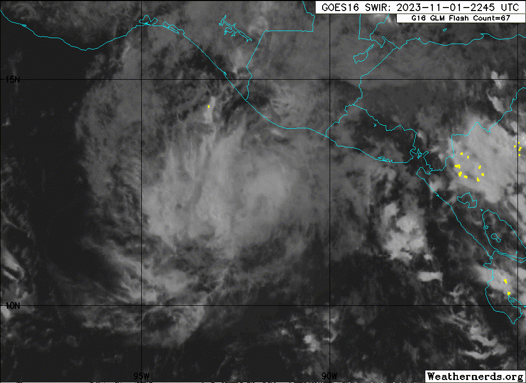
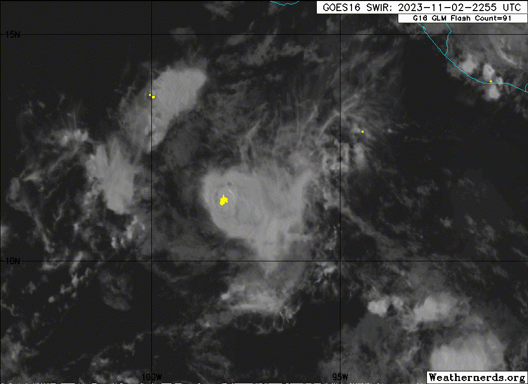
Tropical Storm Pilar Discussion Number 22
NWS National Hurricane Center Miami FL EP192023
1000 PM CDT Thu Nov 02 2023
On regular geostationary satellite imagery, Pilar's structure is not
that impressive, with pulsing deep convection near the center and a
continued lack of banding features. However, an earlier AMSR-2
microwave pass at 2003 UTC and a more recent 2231 UTC GPM pass show
the cyclone's low-level structure is more formidable, with a cyan
ring evident on the 37-GHz channel. However, the 89-GHz channel
shows the deeper convection is displaced northeast of the center,
possibly a result of moderate westerly vertical wind shear due to
the brisk Gulf of Tehuantepec gap-wind flow Pilar is embedded in.
While subjective Dvorak estimates remains on the lower side, at
T3.0/45 kt from TAFB, and T2.5/35 kt form SAB, the initial intensity
will remain 50 kt this advisory, out of respect for the earlier
scatterometer data. The maximum winds on Pilar's north side are
likely a result of Pilar's cyclonic vortex superimposed on the
larger gap-wind flow in the area.
This same flow appears to have caused Pilar to accelerate today, and
its estimated motion is currently rapid to the west-southwest at
250/19 kt. A continued west-southwestward motion with a gradual
slowdown is expected for the next day or so as the small cyclone is
steered by the low-level gap winds in addition to a mid-level ridge
draped along to its northwest. Farther upstream, an upper-level
trough is forecast to dig into the Baja California Peninsula, which
will ultimately erode the ridging at the same time Pilar leaves the
influence of the gap wind flow, allowing for a turn westward and
west-northwestward by the end of the forecast. The track aids this
evening have shifted faster and a bit farther south, influenced some
by the initial position assisted by the microwave data. The NHC
track forecast is a blend of the prior interpolated track with the
consensus aids.
As earlier stated, the environmental conditions do not appear all
that favorable for Pilar, as the gap winds the storm is embedded in
also contribute to moderate westerly vertical wind shear. The shear
direction is important, because that could result in Pilar importing
dry air upstream as seen in the GOES-18 water vapor imagery. In
addition, the cyclone is quite small, potentially making it more
susceptible than usual to less favorable environmental conditions.
Thus, the NHC intensity forecast continues to slow little change in
intensity or very gradual weakening, despite the storm moving over
warmer sea-surface temperatures. The latest NHC intensity forecast
favors a blend of the HAFS-A/B hurricane-dynamical guidance and IVCN
consensus aid. By early next week, even stronger vertical wind shear
will lead to a faster rate of weakening, and it's possible Pilar
could become a remnant low or dissipate by the end of the forecast
period.
FORECAST POSITIONS AND MAX WINDS
INIT 03/0300Z 10.7N 99.2W 50 KT 60 MPH
12H 03/1200Z 10.0N 101.8W 50 KT 60 MPH
24H 04/0000Z 9.7N 105.0W 45 KT 50 MPH
36H 04/1200Z 9.6N 108.0W 45 KT 50 MPH
48H 05/0000Z 9.8N 110.6W 45 KT 50 MPH
60H 05/1200Z 10.1N 112.7W 45 KT 50 MPH
72H 06/0000Z 10.8N 114.5W 40 KT 45 MPH
96H 07/0000Z 11.8N 116.7W 35 KT 40 MPH
120H 08/0000Z 13.6N 118.8W 30 KT 35 MPH
$$
Forecaster Papin
0 likes
Visit the Caribbean-Central America Weather Thread where you can find at first post web cams,radars
and observations from Caribbean basin members Click Here
and observations from Caribbean basin members Click Here
-
cycloneye
- Admin
- Posts: 139083
- Age: 67
- Joined: Thu Oct 10, 2002 10:54 am
- Location: San Juan, Puerto Rico
Re: EPAC: PILAR - Tropical Storm - Discussion
Tropical Storm Pilar Discussion Number 23
NWS National Hurricane Center Miami FL EP192023
400 AM CDT Fri Nov 03 2023
Deep convection over the center of Pilar has collapsed this morning.
The low-level circulation of the compact storm is exposed, and only
small areas of convective activity are noted well away from the
center. These changes are likely the result of some dry air
intrusions and westerly shear over the small cyclone. Given its
lackluster satellite presentation, and its increased distance from
the enhanced background flow associated with a gap wind event, it is
assumed that some weakening has occurred overnight. Thus, the
initial intensity is lowered to 45 kt.
Pilar is moving quickly west-southwestward (255/19 kt), steered by a
combination of the low-level northeasterly gap wind flow and the
flow associated with a mid-level ridge to the north and northwest of
the storm. A weakness is expected to develop in this ridge during
the next couple of days as a mid-level trough/cut-off low moves
toward the Baja California peninsula. This weakness in the ridge
should cause Pilar to gradually slow down and turn toward the west
and west-northwest through early next week. The track guidance is in
reasonably good agreement on this scenario. The latest NHC track
forecast generally remains between the HCCA and TVCE consensus aids,
and this prediction is very similar to the previous one.
The westerly shear and bouts of dry air entrainment are likely to
continue over the next couple of days. The latest GFS and ECMWF
simulated satellite imagery does show convection returning with
Pilar later this morning, but it also suggests that its convective
structure may continue fluctuating in the coming days. Since Pilar
is a small storm, it will be more susceptible to disruptions from
the marginal environmental conditions. Although Pilar will remain
over very warm waters, the intensity guidance generally shows little
change in strength through the weekend, and the NHC forecast follows
suit. As Pilar gains latitude at days 3-5, the cyclone is expected
to weaken as it encounters stronger southwesterly shear. In fact,
this forecast shows Pilar degenerating to a 30-kt remnant low by the
end of the period.
FORECAST POSITIONS AND MAX WINDS
INIT 03/0900Z 10.4N 101.4W 45 KT 50 MPH
12H 03/1800Z 10.0N 103.7W 45 KT 50 MPH
24H 04/0600Z 9.7N 106.7W 45 KT 50 MPH
36H 04/1800Z 9.8N 109.5W 45 KT 50 MPH
48H 05/0600Z 10.1N 111.8W 45 KT 50 MPH
60H 05/1800Z 10.5N 113.8W 45 KT 50 MPH
72H 06/0600Z 11.3N 115.1W 40 KT 45 MPH
96H 07/0600Z 13.0N 117.5W 35 KT 40 MPH
120H 08/0600Z 14.5N 120.0W 30 KT 35 MPH...POST-TROP/REMNT LOW
$$
Forecaster Reinhart
0 likes
Visit the Caribbean-Central America Weather Thread where you can find at first post web cams,radars
and observations from Caribbean basin members Click Here
and observations from Caribbean basin members Click Here
-
cycloneye
- Admin
- Posts: 139083
- Age: 67
- Joined: Thu Oct 10, 2002 10:54 am
- Location: San Juan, Puerto Rico
Re: EPAC: PILAR - Tropical Storm - Discussion
Tropical Storm Pilar Discussion Number 24
NWS National Hurricane Center Miami FL EP192023
1000 AM CDT Fri Nov 03 2023
Deep convection has re-developed over Pilar this morning. Multiple
microwave images depict that the low-level center is poorly
organized. This disruption in organization is likely due to
westerly shear. The pulsing nature of the convective structure of
Pilar continues to impact satellite intensity estimates, with those
estimates slightly decreased for this cycle. The initial intensity
leans toward the Dvorak CI-numbers, which was a 3.0 from TAFB. With
convection bursting once again and the Dvorak CI values, this
supports keeping the initial intensity steady at 45 kt.
Pilar is moving swiftly west-southwestward (255/18 kt), steered by a
mid-level ridge to the north and northwest of the system. A
mid-level trough is forecast to approach the Baja California
peninsula this weekend, which will cause the ridge to weaken, and
Pilar should gradually slow down and turn to the west and
west-northwest through early next week. The track guidance remains
in fairly good agreement, with the main difference being the forward
speed of Pilar. The NHC forecast is slightly faster than the
previous, and lies between the simple and corrected consensus aids.
The convective structure of Pilar continues to fluctuate, with a
pulsing convective burst from time-to-time. Given the small size of
Pilar, intensity fluctuations are possible throughout the forecast
period as the system will be more susceptible within varying
environmental conditions. The intensity forecast shows very little
change in the intensity through the weekend. In about 3 days, as
Pilar moves northwestward, the system is expected to encounter
strong southwesterly shear and will weaken. Global models are in
fairly good agreement that Pilar will become a remnant low by the
end of the period.
FORECAST POSITIONS AND MAX WINDS
INIT 03/1500Z 10.2N 103.0W 45 KT 50 MPH
12H 04/0000Z 9.9N 105.4W 45 KT 50 MPH
24H 04/1200Z 9.8N 108.6W 45 KT 50 MPH
36H 05/0000Z 10.0N 111.0W 45 KT 50 MPH
48H 05/1200Z 10.4N 113.4W 45 KT 50 MPH
60H 06/0000Z 11.1N 115.0W 45 KT 50 MPH
72H 06/1200Z 11.8N 116.2W 40 KT 45 MPH
96H 07/1200Z 13.5N 118.5W 35 KT 40 MPH
120H 08/1200Z 14.9N 121.2W 25 KT 30 MPH...POST-TROP/REMNT LOW
$$
Forecaster Kelly
0 likes
Visit the Caribbean-Central America Weather Thread where you can find at first post web cams,radars
and observations from Caribbean basin members Click Here
and observations from Caribbean basin members Click Here
Who is online
Users browsing this forum: No registered users and 92 guests