EPAC: PILAR - Post-Tropical - Discussion
Moderator: S2k Moderators
-
Sciencerocks
- Category 5

- Posts: 7286
- Age: 38
- Joined: Thu Jul 06, 2017 1:51 am
-
cycloneye

- Admin

- Posts: 139083
- Age: 67
- Joined: Thu Oct 10, 2002 10:54 am
- Location: San Juan, Puerto Rico
Re: EPAC: PILAR - Tropical Storm - Discussion
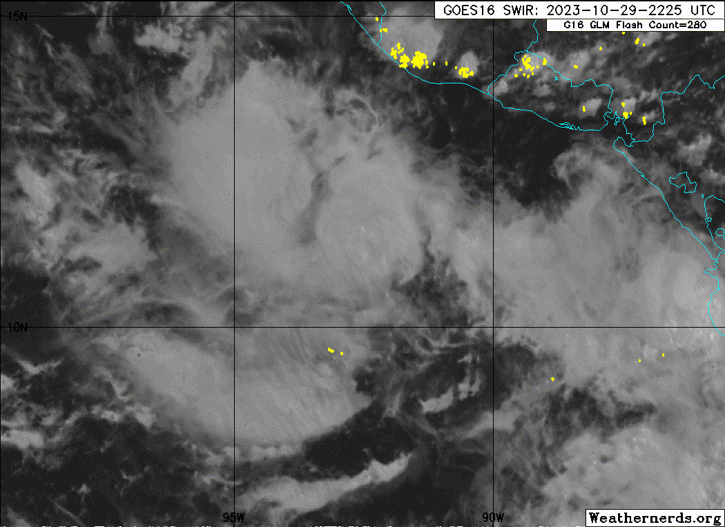
BULLETIN
Tropical Storm Pilar Advisory Number 6
NWS National Hurricane Center Miami FL EP192023
1000 PM CDT Sun Oct 29 2023
...DEPRESSION INTENSIFIES INTO TROPICAL STORM PILAR...
...HEAVY RAINFALL AND FLASH FLOODING EXPECTED IN CENTRAL AMERICA
THIS WEEK AS PILAR MOVES CLOSER TO LAND...
SUMMARY OF 1000 PM CDT...0300 UTC...INFORMATION
-----------------------------------------------
LOCATION...11.0N 92.0W
ABOUT 265 MI...425 KM SW OF SAN SALVADOR EL SALVADOR
ABOUT 395 MI...630 KM W OF MANAGUA NICARAGUA
MAXIMUM SUSTAINED WINDS...40 MPH...65 KM/H
PRESENT MOVEMENT...ENE OR 60 DEGREES AT 5 MPH...7 KM/H
MINIMUM CENTRAL PRESSURE...1003 MB...29.62 INCHES
WATCHES AND WARNINGS
--------------------
CHANGES WITH THIS ADVISORY:
The government of Honduras has issued a Tropical Storm Watch for
the entire Pacific coast of Honduras including the Gulf of
Fonseca.
The government of Nicaragua has issued a Tropical Storm Watch from
the Honduras and Nicaragua border southward to Puerto Sandino.
SUMMARY OF WATCHES AND WARNINGS IN EFFECT:
A Tropical Storm Watch is in effect for...
* Entire coast of El Salvador
* Pacific coast of Honduras including the Gulf of Fonseca
* Honduras/Nicaragua border southward to Puerto Sandino.
A Tropical Storm Watch means that tropical storm conditions are
possible within the watch area, generally within 48 hours.
Interests in along the Pacific coasts of Guatemala and Nicaragua
should monitor the progress of this system.
For storm information specific to your area, please monitor
products issued by your national meteorological service.
DISCUSSION AND OUTLOOK
----------------------
At 1000 PM CDT (0300 UTC), the center of Tropical Storm Pilar was
located near latitude 11.0 North, longitude 92.0 West. Pilar is
moving toward the east-northeast near 5 mph (7 km/h) and a continued
east-northeastward motion is anticipated for the next couple of
days. On the forecast track, Pilar could be near the coast
of El Salvador on Tuesday night or early Wednesday, though the core
of the system is forecast to stay offshore.
Maximum sustained winds have increased to near 40 mph (65 km/h)
with higher gusts. Additional strengthening is forecast over the
next couple of days, and Pilar could be near hurricane strength by
Tuesday.
Tropical-storm-force winds extend outward up to 35 miles (55 km)
from the center.
The estimated minimum central pressure is 1003 mb (29.62 inches).
HAZARDS AFFECTING LAND
----------------------
Key messages for Pilar can be found in the Tropical Cyclone
Discussion under AWIPS header MIATCDEP4 and WMO header WTPZ44 KNHC
and on the web at hurricanes.gov/text/MIATCDEP4.shtml
RAINFALL: Tropical Storm Pilar is expected to produce storm total
rainfall of 5 to 10 inches, with local amounts to 15 inches, in and
around much of the Pacific coast of Central America, including the
country of El Salvador, through Wednesday. This rainfall will
produce flash and urban flooding, along with mudslides in areas of
higher terrain.
SURF: Swells generated by Pilar are expected to reach portions of
the Pacific coast of Central America on Monday. These swells are
likely to cause life-threatening surf and rip current conditions.
Please consult products from your local weather office.
WIND: Tropical storm conditions could begin in the Tropical
Storm Watch area early on Tuesday.
NEXT ADVISORY
-------------
Next intermediate advisory at 100 AM CDT.
Next complete advisory at 400 AM CDT.
$$
Forecaster Papin
Tropical Storm Pilar Discussion Number 6
NWS National Hurricane Center Miami FL EP192023
1000 PM CDT Sun Oct 29 2023
A small but concentrated convective burst has been persisting near
the estimated center of the tropical cyclone tonight. After the
prior advisory, we received a fortuitous GPM microwave pass valid
at 2252 UTC that suggested the low-level circulation may have
tightened up some but was located just south of the deepest
convection. Subjective Dvorak intensity estimates were up to T2.5/35
kt form TAFB and T2.0/30 kt from SAB. The objective estimates from
ADT, SATCON, and D-PRINT/MINT are all between 34-36 kt, and thus the
latest advisory is set at 35 kt this advisory, upgrading TD19-E to
Tropical Storm Pilar.
A more pronounced east-northeastward motion appears to be starting,
estimated at 060/4 kt. A continued motion to the east-northwest is
anticipated over the next 24-48 hours as Pilar's primary steering
influences are an equatorial ridge south of the storm providing
deep-layer westerlies in addition to a mid- to upper-level cutoff
low over the northwestern Caribbean that is interrupting the more
typical ridging that would be present to the north over Mexico. The
guidance is in general agreement on this scenario, but how far east
the tropical storm gets in the next 48 h remains uncertain, with the
latest HWRF and HAFS-B runs far enough east to affect the Gulf of
Fonseca with tropical storm conditions. For this reason, the
tropical storm watch has been extended eastward to portions of the
Pacific coast of Honduras and Nicaragua this advisory. On Tuesday,
Pilar is expected to stall and move very slowly as low to mid-level
ridging attempts to build back in to the north of the tropical
cyclone and a strong cold front induces a significant gap wind flow
event in the Gulf of Tehuantepec. By the middle of this week, the
enhanced low-level flow associated with the ridge and gap winds are
forecast to push Pilar away from Central America to the
west-southwest as a weakening tropical storm. As discussed
previously, the confidence of when or how sharp this turn away from
Central America will be is low given the inconsistent model guidance
over the past day. The NHC track this cycle is just a bit closer to
the coast and a touch east of the prior track, but is roughly in
between the TVCE and HCCA consensus aids.
A small core may be starting to take shape given the earlier
microwave imagery, and the persistent area of convection that Pilar
has been maintaining over the last 3-6 hours near the estimated
center. Most of the guidance maintains this small core structure
with intensification while the storm remains embedded in moderate
(15-20 kt) easterly vertical wind shear but is over warm 28-29 C
sea-surface temperatures in a moist mid-level air environment. The
latest NHC intensity forecast still takes Pilar to near hurricane
intensity in 36 h, on the higher end of the intensity guidance but
not far off the hurricane-regional guidance solutions. Afterwards,
it seems likely a combination of the dry mid-latitude gap-wind flow
in addition to possible cool upwelling of the shallow warm waters
due to slow motion near the coast of Central America could begin a
weakening trend. If the latest HWRF and HAFS-B runs end up being
correct, land interaction could also result in weakening. The
intensity forecast beyond 48 h is a little lower than the prior
advisory, as it is looking more likely that a combination of
moderate shear and additional dry stable air could prevent the storm
from re-intensifying even after it begins to move back over warmer
ocean waters away from its own cold wake.
Key Messages:
1. Heavy rains from the tropical depression will produce flash and
urban flooding, along with mudslides in areas of higher terrain
along the Pacific coast of Central America, including El Salvador,
through Wednesday.
2. Tropical storm conditions are possible by early Tuesday into
Wednesday along portions of the Pacific coast of El Salvador,
Honduras, and Nicaragua where a Tropical Storm Watch is now in
effect. Interests elsewhere along the Pacific coast of Guatemala,
and Nicaragua should monitor the progress of this system as
additional watches or warnings could be needed tomorrow.
3. Swells generated by the depression will begin to affect portions
of the Pacific coast of Central America, including El Salvador,
beginning on Monday. These swells are likely to cause
life-threatening surf and rip current conditions.
FORECAST POSITIONS AND MAX WINDS
INIT 30/0300Z 11.0N 92.0W 35 KT 40 MPH
12H 30/1200Z 11.2N 91.3W 45 KT 50 MPH
24H 31/0000Z 11.6N 90.2W 55 KT 65 MPH
36H 31/1200Z 12.0N 89.4W 60 KT 70 MPH
48H 01/0000Z 12.3N 88.9W 55 KT 65 MPH
60H 01/1200Z 12.0N 88.9W 45 KT 50 MPH
72H 02/0000Z 11.2N 89.7W 35 KT 40 MPH
96H 03/0000Z 9.9N 93.0W 35 KT 40 MPH
120H 04/0000Z 9.0N 97.5W 35 KT 40 MPH
$$
Forecaster Papin
0 likes
Visit the Caribbean-Central America Weather Thread where you can find at first post web cams,radars
and observations from Caribbean basin members Click Here
and observations from Caribbean basin members Click Here
-
lilbump3000

- Category 4

- Posts: 918
- Age: 36
- Joined: Sat Sep 20, 2003 10:09 am
- Location: New Orleans, Louisiana
- Contact:
-
cycloneye
- Admin
- Posts: 139083
- Age: 67
- Joined: Thu Oct 10, 2002 10:54 am
- Location: San Juan, Puerto Rico
Re: EPAC: PILAR - Tropical Storm - Discussion
Tropical Storm Pilar Discussion Number 7
NWS National Hurricane Center Miami FL EP192023
400 AM CDT Mon Oct 30 2023
There has been little change with Pilar overnight. The storm is
still producing a concentrated area of deep convection, but
microwave data suggest that the low-level center is located near the
southeastern edge of the thunderstorms. The latest satellite
intensity estimates range from 35 to 45 kt, but an ASCAT pass from a
few hours ago showed maximum reliable winds closer to 30 kt. Based
on a blend of all of these data, the initial intensity is held at 35
kt.
Pilar is moving slowly to the east-northeast, and that motion should
continue for the next couple of days. Nearly all of the models
stall Pilar near the coast of Central America on Tuesday and Tuesday
night, but at this point the reliable models keep the core of the
storm offshore. On Wednesday, Pilar will likely turn southwestward
away from land as a mid-level ridge builds to the north of the
system. The cyclone will likely accelerate westward after that in
part due to an anticipated Gulf of Tehuantepec gap wind event. Only
small changes were made to the previous NHC track forecast and this
one lies fairly close to the consensus aids.
The storm will have an opportunity to strengthen during the next day
or so as it remains over warm SSTs and in relatively favorable
atmospheric conditions. Pilar is expected to be near hurricane
strength when it is close to the coast of Central America.
However, beyond that time, the slow motion of the system could
cause ocean upwelling and the Gulf of Tehuantepec gap wind event
will likely result in an increase in shear and intrusions of dry
and stable air. Therefore, a weakening trend is forecast beginning
late Tuesday or early Wednesday. The NHC intensity forecast lies
at the high end of the guidance in the short term, but falls closer
to the middle of the guidance envelope from 72-120 hours.
Key Messages:
1. Heavy rains from Pilar will produce flash and urban flooding,
along with mudslides in areas of higher terrain of the Pacific coast
of Central America from El Salvador southward to Costa Rica through
Wednesday.
2. Tropical storm conditions are possible beginning early Tuesday
along portions of the Pacific coast of El Salvador, Honduras, and
Nicaragua, where a Tropical Storm Watch remains in effect.
Interests elsewhere along the Pacific coast of Guatemala,
and Nicaragua should monitor the progress of this system as
additional watches or warnings could be needed later today.
3. Swells generated by Pilar will begin to affect portions
of the Pacific coast of Central America later today. These swells
are likely to cause life-threatening surf and rip current
conditions.
FORECAST POSITIONS AND MAX WINDS
INIT 30/0900Z 11.0N 91.8W 35 KT 40 MPH
12H 30/1800Z 11.1N 91.2W 45 KT 50 MPH
24H 31/0600Z 11.6N 90.1W 55 KT 65 MPH
36H 31/1800Z 12.0N 89.5W 60 KT 70 MPH
48H 01/0600Z 12.0N 89.2W 50 KT 60 MPH
60H 01/1800Z 11.7N 89.7W 40 KT 45 MPH
72H 02/0600Z 11.1N 91.2W 35 KT 40 MPH
96H 03/0600Z 9.8N 95.3W 35 KT 40 MPH
120H 04/0600Z 9.3N 100.8W 35 KT 40 MPH
$$
Forecaster Cangialosi
0 likes
Visit the Caribbean-Central America Weather Thread where you can find at first post web cams,radars
and observations from Caribbean basin members Click Here
and observations from Caribbean basin members Click Here
-
Sciencerocks
- Category 5
- Posts: 7286
- Age: 38
- Joined: Thu Jul 06, 2017 1:51 am

-
REDHurricane

- Tropical Storm

- Posts: 206
- Age: 26
- Joined: Sun Jul 03, 2022 2:36 pm
- Location: Northeast Pacific Ocean
Re: EPAC: PILAR - Tropical Storm - Discussion
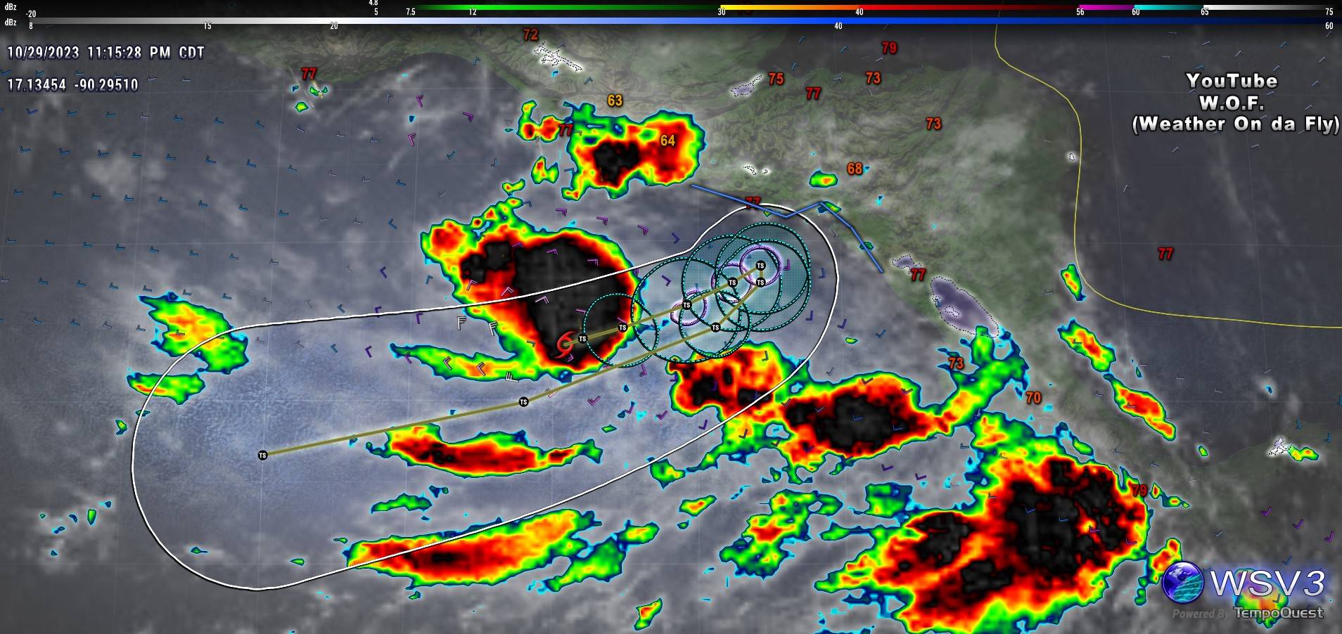
Sciencerocks wrote:https://imagizer.imageshack.com/img923/813/x58AIe.gif
This one isn't going to RI too, right?!?
0 likes
-
cycloneye
- Admin
- Posts: 139083
- Age: 67
- Joined: Thu Oct 10, 2002 10:54 am
- Location: San Juan, Puerto Rico
Re: EPAC: PILAR - Tropical Storm - Discussion
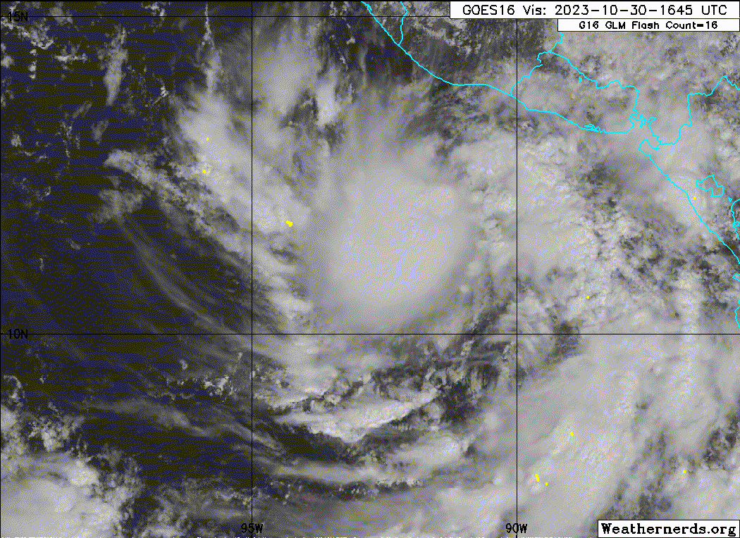
Tropical Storm Pilar Discussion Number 8
NWS National Hurricane Center Miami FL EP192023
1000 AM CDT Mon Oct 30 2023
Pilar appears to have intensified this morning. Satellite imagery
indicate that very deep convection is located to the northwest of
the center, with more organization in low-level banding features
noted in recent microwave passes. The initial wind speed is set to
45 kt, which matches the recent TAFB satellite classification and is
close to the UW-CIMSS satellite consensus value. An Air Force
Reserve Hurricane Hunter aircraft is scheduled to be in the system
this afternoon for a more precise look at the storm.
The storm continues moving slowly to the east-northeast, and most
models continue this motion for the next day or so. Thereafter,
nearly all of the models stall Pilar near the coast of Central
America by Tuesday night, though they still keep the core of the
storm offshore. On Wednesday, Pilar will likely turn west-
southwestward away from land as a mid-level ridge builds to the
north of the system, and most of the guidance shows the storm moving
very close to or just north of its track on approach to Central
America. Only small changes were made to the previous NHC
forecast, generally near or a bit north of the last track
prediction.
Pilar has a day or two to intensify in moderate shear conditions
within a very warm and moist environment. Most of the guidance
respond to this forcing by showing Pilar near hurricane strength,
and the official forecast continues the same peak as the last
advisory. In 36 to 48 hours, an increase in southeasterly shear
could cause Pilar to level off in intensity and eventually weaken,
along with any dry air intrusions from a gap wind event or
storm-induced upwelling. The long-range intensity guidance is a bit
higher than the last cycle, so the official forecast is adjusted
upward at that time frame.
Key Messages:
1. Heavy rains from Pilar will produce flash and urban flooding,
along with mudslides in areas of higher terrain, near the Pacific
coast of Central America from El Salvador southward to Costa Rica
through Wednesday.
2. Tropical storm conditions are possible beginning early Tuesday
along portions of the Pacific coast of El Salvador, Honduras, and
Nicaragua, where a Tropical Storm Watch remains in effect. Interests
elsewhere along the Pacific coast of Guatemala, and Nicaragua should
monitor the progress of this system as additional watches or
warnings could be needed later today.
3. Swells generated by Pilar will continue to affect the Pacific
coast of Central America during the next few days. These swells are
likely to cause life-threatening surf and rip current conditions.
FORECAST POSITIONS AND MAX WINDS
INIT 30/1500Z 11.1N 91.2W 45 KT 50 MPH
12H 31/0000Z 11.3N 90.3W 50 KT 60 MPH
24H 31/1200Z 11.5N 89.4W 55 KT 65 MPH
36H 01/0000Z 12.0N 89.0W 60 KT 70 MPH
48H 01/1200Z 12.1N 89.1W 60 KT 70 MPH
60H 02/0000Z 11.7N 90.0W 50 KT 60 MPH
72H 02/1200Z 11.2N 92.0W 45 KT 50 MPH
96H 03/1200Z 10.0N 97.0W 40 KT 45 MPH
120H 04/1200Z 9.3N 103.0W 40 KT 45 MPH
$$
Forecaster Blake
0 likes
Visit the Caribbean-Central America Weather Thread where you can find at first post web cams,radars
and observations from Caribbean basin members Click Here
and observations from Caribbean basin members Click Here

Re: EPAC: PILAR - Tropical Storm - Discussion
A blend of ADT/AiDT/DPRINT/DMINT/MW Sounding/SATCON results in an intensity of 45.2 kt, pretty much the same as NHC has. Here ADT is the outlier with an intensity of 51 kt.
Pilar is in conductive environment with just 11 kt of shear. Over the last 24 hours changes of RI have increased, but are still relatively low. They used to be near-0, but are now 6% for AI-RI (30kt/24hrs) and 7% for SHIPS consensus (30kt/24hrs). 25kt/24hrs intensification is more realistic but still not extremely likely with a chance of 26% for AI-RI and 12% for SHIPS consensus. Such intenfication would bring Pilar to hurricane strength (65 kt) in 24 hours with likely another 24 hrs until its closest approach to CA. A MH upon closest approach (which would require 55kt/48hrs) is also deemed unlikely with a 2.5% chance based on AI-RI and 6.5% from SHIPS consensus. Note, however, that Pilar has improved considerably since 12z when all these RI calculations were made. So I'd at least wait until the next RI data cycle before making any conclusions.
Pilar is in conductive environment with just 11 kt of shear. Over the last 24 hours changes of RI have increased, but are still relatively low. They used to be near-0, but are now 6% for AI-RI (30kt/24hrs) and 7% for SHIPS consensus (30kt/24hrs). 25kt/24hrs intensification is more realistic but still not extremely likely with a chance of 26% for AI-RI and 12% for SHIPS consensus. Such intenfication would bring Pilar to hurricane strength (65 kt) in 24 hours with likely another 24 hrs until its closest approach to CA. A MH upon closest approach (which would require 55kt/48hrs) is also deemed unlikely with a 2.5% chance based on AI-RI and 6.5% from SHIPS consensus. Note, however, that Pilar has improved considerably since 12z when all these RI calculations were made. So I'd at least wait until the next RI data cycle before making any conclusions.
0 likes
-
Hurricane2022

- Category 4
- Posts: 921
- Joined: Tue Aug 23, 2022 11:38 pm
- Location: Araçatuba, Brazil
Re: EPAC: PILAR - Tropical Storm - Discussion
0 likes
Sorry for the bad English sometimes...!
For reliable and detailed information for any meteorological phenomenon, please consult the National Hurricane Center, Joint Typhoon Warning Center , or your local Meteo Center.
--------
Una cvm Christo, pro Christo, et in Christo. Sit nomen Domini benedictvm.
For reliable and detailed information for any meteorological phenomenon, please consult the National Hurricane Center, Joint Typhoon Warning Center , or your local Meteo Center.
--------
Una cvm Christo, pro Christo, et in Christo. Sit nomen Domini benedictvm.
-
cycloneye
- Admin
- Posts: 139083
- Age: 67
- Joined: Thu Oct 10, 2002 10:54 am
- Location: San Juan, Puerto Rico
Re: EPAC: PILAR - Tropical Storm - Discussion
0 likes
Visit the Caribbean-Central America Weather Thread where you can find at first post web cams,radars
and observations from Caribbean basin members Click Here
and observations from Caribbean basin members Click Here
-
Sciencerocks
- Category 5
- Posts: 7286
- Age: 38
- Joined: Thu Jul 06, 2017 1:51 am
-
cycloneye
- Admin
- Posts: 139083
- Age: 67
- Joined: Thu Oct 10, 2002 10:54 am
- Location: San Juan, Puerto Rico
Re: EPAC: PILAR - Tropical Storm - Discussion
Tropical Storm Pilar Discussion Number 9
NWS National Hurricane Center Miami FL EP192023
400 PM CDT Mon Oct 30 2023
Pilar seems to have held somewhat steady this afternoon. 1-minute
geostationary satellite visible imagery shows the low-level
circulation beginning to be exposed just east of the deep convection
as the central deep overcast gradually clears. Recent microwave
imagery revealed a decent curved band wrapping around the western
and northern portions of the core. Subjective and objective
satellite intensity estimates range from 39-51 kt and the initial
intensity is held at 45 kt, closest to the SAB T3.0/45 kt value.
The storm continues to move slowly east-northeastward. Models
generally agree on this motion, which should continue for the next
day or so. By Tuesday evening, Pilar is forecast to stall near the
coast of El Salvador with the core of the storm offshore. By
Wednesday the storm is expected to turn west-southwestward, away
from the coastline, in the flow of a building ridge over the western
Caribbean and Central America. The latest NHC track forecast is
shifted slightly north of the previous prediction, largely due to
the northward shift in the initial position.
Moderate east-southeasterly shear appears to be affecting Pilar.
However, most of the model guidance indicates that the storm should
steadily strengthen for the next day or so over the warm waters and
in a moist airmass. After 36 h, the deep-layer shear should
increase which will likely induce a weakening trend. By days 3-5,
the shear is expected to abate somewhat. Once again, the long-range
official intensity forecast has been increased slightly and is close
to the various consensus aids.
Key Messages:
1. Heavy rains from Pilar will produce flash and urban flooding,
along with mudslides in areas of higher terrain, near the Pacific
coast of Central America from El Salvador southward to Costa Rica
through Wednesday.
2. Tropical storm conditions are possible beginning early Tuesday
along portions of the Pacific coast of El Salvador, Honduras, and
Nicaragua, where a Tropical Storm Watch remains in effect. Interests
elsewhere along the Pacific coast of Guatemala, and Nicaragua should
monitor the progress of this system as additional watches or
warnings could be needed later tonight.
3. Swells generated by Pilar will continue to affect the Pacific
coast of Central America during the next few days. These swells are
likely to cause life-threatening surf and rip current conditions.
FORECAST POSITIONS AND MAX WINDS
INIT 30/2100Z 11.4N 91.2W 45 KT 50 MPH
12H 31/0600Z 11.6N 90.2W 50 KT 60 MPH
24H 31/1800Z 11.9N 89.5W 55 KT 65 MPH
36H 01/0600Z 12.3N 89.4W 60 KT 70 MPH
48H 01/1800Z 12.2N 89.9W 55 KT 65 MPH
60H 02/0600Z 11.8N 91.3W 50 KT 60 MPH
72H 02/1800Z 11.2N 93.7W 45 KT 50 MPH
96H 03/1800Z 10.1N 98.8W 45 KT 50 MPH
120H 04/1800Z 9.9N 104.3W 45 KT 50 MPH
$$
Forecaster Bucci
0 likes
Visit the Caribbean-Central America Weather Thread where you can find at first post web cams,radars
and observations from Caribbean basin members Click Here
and observations from Caribbean basin members Click Here
-
Kingarabian

- S2K Supporter

- Posts: 15434
- Joined: Sat Aug 08, 2009 3:06 am
- Location: Honolulu, Hawaii
Re: EPAC: PILAR - Tropical Storm - Discussion
Had that look to it where it looked like it was going to RI. But easterly shear has kicked in.
0 likes
RIP Kobe Bryant
-
cycloneye
- Admin
- Posts: 139083
- Age: 67
- Joined: Thu Oct 10, 2002 10:54 am
- Location: San Juan, Puerto Rico
Re: EPAC: PILAR - Tropical Storm - Discussion
Tropical Storm Pilar Discussion Number 10
NWS National Hurricane Center Miami FL EP192023
1000 PM CDT Mon Oct 30 2023
Pilar has not strengthened this evening. In fact, the system looks
less organized on satellite images with the center becoming exposed
on the southern side of a ragged-looking area of deep convection.
There are some poorly-defined banding features over the western
portion of the circulation, and the upper-level outflow does not
appear to be very pronounced. Subjective Dvorak T-numbers from
TAFB and SAB are 3.0 which corresponds to 45 kt, and objective
satellite intensity estimates from UW-CIMSS have decreased a bit
from earlier today. The intensity estimate is held at 45 kt for
this advisory.
The initial motion estimate is slowly east-northeastward, or 070/4
kt, which is about the same as in the previous advisory. There is
currently a weakness in the ridge to the northeast of Pilar which is
apparently inducing the east-northeastward motion. This movement is
expected to continue a little while longer, bringing the center of
the cyclone closer to the coast on Tuesday. Over the next few days,
a mid-level ridge is forecast to build to the northeast and north of
the system. This steering evolution should cause Pilar to make a
sharp turn and move west-southwestward away from the coast beginning
Wednesday. A continued west-southwestward to westward track is
likely for the rest of the forecast period. The official track
forecast is close to the model consensus, and does not bring the
center of Pilar closer to the coast than previously forecast.
Although moderate vertical wind shear is likely to continue
affecting Pilar, a moist and unstable air mass along with warm ocean
waters should allow some strengthening during the next day or so.
Later in the forecast period, easterly shear could inhibit
strengthening. The official intensity forecast is a blend of the
simple and corrected model consensus predictions.
Key Messages:
1. Heavy rains from Pilar will produce flash and urban flooding,
along with mudslides in areas of higher terrain of the Pacific coast
of Central America from El Salvador southward to Costa Rica through
Wednesday.
2. Tropical storm conditions are possible beginning early Tuesday
along portions of the Pacific coast of El Salvador, Honduras, and
Nicaragua, where a Tropical Storm Watch remains in effect. Interests
elsewhere along the Pacific coast of Guatemala, and Nicaragua should
monitor the progress of this system as additional watches or
warnings could be needed tomorrow.
3. Swells generated by Pilar will continue to affect the Pacific
coast of Central America during the next few days. These swells are
likely to cause life-threatening surf and rip current conditions.
FORECAST POSITIONS AND MAX WINDS
INIT 31/0300Z 11.3N 90.9W 45 KT 50 MPH
12H 31/1200Z 11.4N 90.3W 50 KT 60 MPH
24H 01/0000Z 11.7N 89.7W 55 KT 65 MPH
36H 01/1200Z 11.9N 90.1W 60 KT 70 MPH
48H 02/0000Z 11.6N 91.1W 55 KT 65 MPH
60H 02/1200Z 11.1N 92.9W 50 KT 60 MPH
72H 03/0000Z 10.5N 95.3W 45 KT 50 MPH
96H 04/0000Z 9.3N 100.4W 45 KT 50 MPH
120H 05/0000Z 9.3N 105.0W 45 KT 50 MPH
$$
Forecaster Pasch
0 likes
Visit the Caribbean-Central America Weather Thread where you can find at first post web cams,radars
and observations from Caribbean basin members Click Here
and observations from Caribbean basin members Click Here
-
cycloneye
- Admin
- Posts: 139083
- Age: 67
- Joined: Thu Oct 10, 2002 10:54 am
- Location: San Juan, Puerto Rico
Re: EPAC: PILAR - Tropical Storm - Discussion
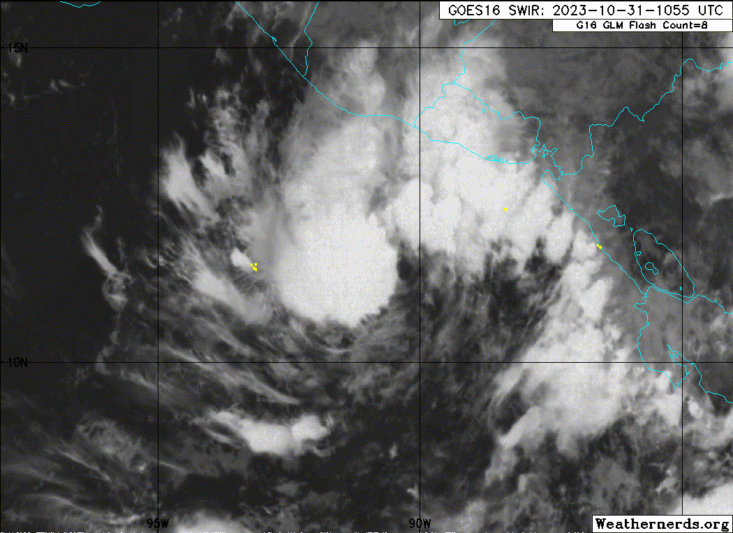
Tropical Storm Pilar Discussion Number 11
NWS National Hurricane Center Miami FL EP192023
400 AM CDT Tue Oct 31 2023
While deep convection has increased with Pilar overnight, the
center of the storm remains mostly exposed on the southeastern
side of a burst of deep convection. It seems like moderate shear
is preventing the system from strengthening, with basically no
thunderstorm activity southeast of the center. The initial wind
speed remains 45 kt based on a blend of the available intensity
estimates.
Pilar continues to creep east-northeastward, or 075/3 kt, a little
slower than the previous advisory. The steering flow is expected to
collapse later today, with most of the guidance stalling Pilar just
east of 90W, then accelerating the storm west-southwestward as a
mid-level ridge builds by Thursday. Generally, the model guidance
stays a touch farther offshore than the last cycle, and the official
forecast follows the trend. Little change was made at long range,
with the previous forecast coming in very close to the model
consensus. It is possible that later today the Tropical Storm Watch
could be discontinued for portions of Central America, but there
remains a significant heavy rain and flash flooding threat.
The storm still has a chance to intensify over the next day or so
within moderate wind shear conditions but in a moist and unstable
air mass along with warm ocean waters. It seems like the chances of
Pilar becoming a hurricane have decreased, and the peak NHC wind
speed forecast is dropped 5 kt from the previous one, slightly above
the model consensus. It remains to be seen how Pilar maintains
itself in a challenging environment after 60 hours, with dry air
intrusions from a gap wind event and easterly wind shear. The
intensity forecast is maintained at 45 kt at long range, blending
reliable guidance showing tropical depression to hurricane strength,
and the uncertainty is high at long range.
Key Messages:
1. Heavy rains from Pilar will produce flash and urban flooding,
along with mudslides in areas of higher terrain of the Pacific coast
of Central America from El Salvador southward to Costa Rica through
Wednesday.
2. Tropical storm conditions are possible beginning later today
along portions of the Pacific coast of El Salvador, Honduras, and
Nicaragua, where a Tropical Storm Watch remains in effect.
3. Swells generated by Pilar will continue to affect the Pacific
coast of Central America during the next few days. These swells are
likely to cause life-threatening surf and rip current conditions.
FORECAST POSITIONS AND MAX WINDS
INIT 31/0900Z 11.4N 90.4W 45 KT 50 MPH
12H 31/1800Z 11.6N 89.9W 50 KT 60 MPH
24H 01/0600Z 11.8N 89.9W 55 KT 65 MPH
36H 01/1800Z 11.7N 90.6W 55 KT 65 MPH
48H 02/0600Z 11.3N 92.1W 50 KT 60 MPH
60H 02/1800Z 10.7N 94.3W 45 KT 50 MPH
72H 03/0600Z 10.1N 97.0W 45 KT 50 MPH
96H 04/0600Z 9.2N 102.5W 45 KT 50 MPH
120H 05/0600Z 9.5N 108.0W 45 KT 50 MPH
$$
Forecaster Blake
0 likes
Visit the Caribbean-Central America Weather Thread where you can find at first post web cams,radars
and observations from Caribbean basin members Click Here
and observations from Caribbean basin members Click Here
-
Sciencerocks
- Category 5
- Posts: 7286
- Age: 38
- Joined: Thu Jul 06, 2017 1:51 am
-
cycloneye
- Admin
- Posts: 139083
- Age: 67
- Joined: Thu Oct 10, 2002 10:54 am
- Location: San Juan, Puerto Rico
Re: EPAC: PILAR - Tropical Storm - Discussion
Tropical Storm Pilar Discussion Number 12
NWS National Hurricane Center Miami FL EP192023
1000 AM CDT Tue Oct 31 2023
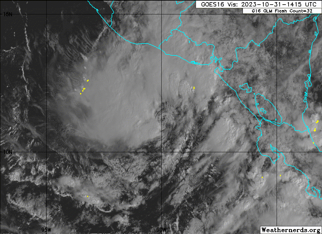
Pilar's structure has changed little since last night. GOES-16
one-minute visible satellite imagery shows that the center is
exposed to the southeast of the main convective mass, with some
banding noted over the far northeastern portion of the circulation.
Subjective Dvorak satellite estimates from both TAFB and SAB were
T3.0 or 45 kt at 1200 UTC, and the initial intensity remains at
that value for this advisory.
Pilar is still moving slowly eastward or 090/3 kt. The storm is
forecast to stall later today as the steering current over the far
eastern Pacific collapse. On Wednesday, a narrow mid-level
ridge is forecast to build to the north and northeast of Pilar
which should cause the storm to begin moving west-southwestward. A
west-southwestward to westward motion is then expected into the
weekend as the ridge builds westward to the north of the storm. The
latest NHC track forecast is similar to the previous advisory and
is a blend of the the ECMWF, GFS, and the latest consensus aids.
The Tropical Storm Watch for portions of Central America remains in
effect, but given the latest model trends it could be discontinued
later today or this evening. Although the threat of tropical-storm-
force winds appears to be diminishing, the risk of heavy rain and
flash flooding is expected to continue over portions of Central
America during the next couple of days.
Some slight strengthening is possible during the next day or so
as the storm is located within moderate vertical wind shear and
over warm sea surface temperatures. However, the latest NHC
forecast calls for a little less intensification during this time
than before. As Pilar moves westward the shear could relax, but
intrusions of dry air from a gap wind event are likely to hold the
intensity in check. Very late in the period, the intensity guidance
suggests that environmental conditions could become a little more
conducive to support some strengthening during the weekend, and the
NHC wind speed forecast has been adjusted accordingly.
Key Messages:
1. Heavy rains from Pilar will produce flash and urban flooding,
along with mudslides in areas of higher terrain of the Pacific coast
of Central America from southern El Salvador, across southern
Honduras, western Nicaragua into northern Costa Rica through
Wednesday.
2. Tropical storm conditions are possible along portions of the
Pacific coast of El Salvador, Honduras, and Nicaragua, where a
Tropical Storm Watch remains in effect.
3. Swells generated by Pilar will continue to affect the Pacific
coast of Central America during the next few days. These swells are
likely to cause life-threatening surf and rip current conditions.
FORECAST POSITIONS AND MAX WINDS
INIT 31/1500Z 11.2N 89.9W 45 KT 50 MPH
12H 01/0000Z 11.5N 89.8W 50 KT 60 MPH
24H 01/1200Z 11.7N 90.2W 50 KT 60 MPH
36H 02/0000Z 11.5N 91.4W 50 KT 60 MPH
48H 02/1200Z 11.1N 93.4W 45 KT 50 MPH
60H 03/0000Z 10.5N 95.8W 45 KT 50 MPH
72H 03/1200Z 9.9N 98.5W 45 KT 50 MPH
96H 04/1200Z 9.4N 103.8W 45 KT 50 MPH
120H 05/1200Z 9.8N 108.7W 50 KT 60 MPH
$$
Forecaster Brown
NWS National Hurricane Center Miami FL EP192023
1000 AM CDT Tue Oct 31 2023
Pilar's structure has changed little since last night. GOES-16
one-minute visible satellite imagery shows that the center is
exposed to the southeast of the main convective mass, with some
banding noted over the far northeastern portion of the circulation.
Subjective Dvorak satellite estimates from both TAFB and SAB were
T3.0 or 45 kt at 1200 UTC, and the initial intensity remains at
that value for this advisory.
Pilar is still moving slowly eastward or 090/3 kt. The storm is
forecast to stall later today as the steering current over the far
eastern Pacific collapse. On Wednesday, a narrow mid-level
ridge is forecast to build to the north and northeast of Pilar
which should cause the storm to begin moving west-southwestward. A
west-southwestward to westward motion is then expected into the
weekend as the ridge builds westward to the north of the storm. The
latest NHC track forecast is similar to the previous advisory and
is a blend of the the ECMWF, GFS, and the latest consensus aids.
The Tropical Storm Watch for portions of Central America remains in
effect, but given the latest model trends it could be discontinued
later today or this evening. Although the threat of tropical-storm-
force winds appears to be diminishing, the risk of heavy rain and
flash flooding is expected to continue over portions of Central
America during the next couple of days.
Some slight strengthening is possible during the next day or so
as the storm is located within moderate vertical wind shear and
over warm sea surface temperatures. However, the latest NHC
forecast calls for a little less intensification during this time
than before. As Pilar moves westward the shear could relax, but
intrusions of dry air from a gap wind event are likely to hold the
intensity in check. Very late in the period, the intensity guidance
suggests that environmental conditions could become a little more
conducive to support some strengthening during the weekend, and the
NHC wind speed forecast has been adjusted accordingly.
Key Messages:
1. Heavy rains from Pilar will produce flash and urban flooding,
along with mudslides in areas of higher terrain of the Pacific coast
of Central America from southern El Salvador, across southern
Honduras, western Nicaragua into northern Costa Rica through
Wednesday.
2. Tropical storm conditions are possible along portions of the
Pacific coast of El Salvador, Honduras, and Nicaragua, where a
Tropical Storm Watch remains in effect.
3. Swells generated by Pilar will continue to affect the Pacific
coast of Central America during the next few days. These swells are
likely to cause life-threatening surf and rip current conditions.
FORECAST POSITIONS AND MAX WINDS
INIT 31/1500Z 11.2N 89.9W 45 KT 50 MPH
12H 01/0000Z 11.5N 89.8W 50 KT 60 MPH
24H 01/1200Z 11.7N 90.2W 50 KT 60 MPH
36H 02/0000Z 11.5N 91.4W 50 KT 60 MPH
48H 02/1200Z 11.1N 93.4W 45 KT 50 MPH
60H 03/0000Z 10.5N 95.8W 45 KT 50 MPH
72H 03/1200Z 9.9N 98.5W 45 KT 50 MPH
96H 04/1200Z 9.4N 103.8W 45 KT 50 MPH
120H 05/1200Z 9.8N 108.7W 50 KT 60 MPH
$$
Forecaster Brown
0 likes
Visit the Caribbean-Central America Weather Thread where you can find at first post web cams,radars
and observations from Caribbean basin members Click Here
and observations from Caribbean basin members Click Here
-
Sciencerocks
- Category 5
- Posts: 7286
- Age: 38
- Joined: Thu Jul 06, 2017 1:51 am
-
Sciencerocks
- Category 5
- Posts: 7286
- Age: 38
- Joined: Thu Jul 06, 2017 1:51 am
-
cycloneye
- Admin
- Posts: 139083
- Age: 67
- Joined: Thu Oct 10, 2002 10:54 am
- Location: San Juan, Puerto Rico
Re: EPAC: PILAR - Tropical Storm - Discussion
Tropical Storm Pilar Discussion Number 13
NWS National Hurricane Center Miami FL EP192023
400 PM CDT Tue Oct 31 2023
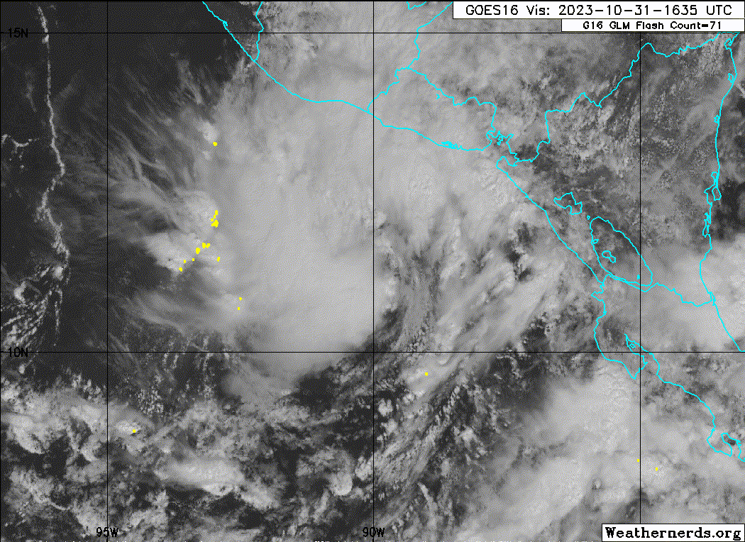
Satellite imagery shows that Pilar's center remains exposed on the
southeast side of the main convective plume. Earlier AMSR2 and
SSMI/S microwave imagery depicts some partial banding features
within the northern semi-circle. Scatterometer ASCAT-B and -C passes
this afternoon shows satellite derived winds are around 40 to 45
knots. These values are in good agreement with the latest Dvorak
satellite intensity estimates from both TAFB and SAB, T/3.0 or 45
knots. Therefore, given the combination of data this the
initial intensity remains at 45 kt for this advisory.
Pilar is moving slowly east-northeastward or 060/3 kt. The storm is
forecast to move very little tonight as the steering currents over
the far eastern Pacific collapse. A mid-level ridge is then forecast
to build to the north and northeast of Pilar, which should cause the
storm to begin moving west-southwestward. As the mid-level ridge
continues to build westward, Pilar will be steered on a
west-southwestward to westward motion along the southern side of the
ridge. The latest NHC track forecast is similar to the previous
advisory and lies near the latest consensus aids. The threat of
tropical-storm-force winds should begin to diminish as Pilar starts
moving westward, but the risk of heavy rain and flash-flooding is
expected to continue over portions of Central America over the next
couple of days.
Some slight strengthening is possible during the next day or so as
the storm is located over warm sea surface temperatures and moderate
vertical wind shear. In about 2 to 3 days vertical wind shear is
forecast to weaken, but dry air from a gap wind event from the Gulf
of Tehuantepec may limit intensification. Towards the end of the
period, the environmental conditions may become a little more
conducive and the official forecast depicts strengthening once
again. The NHC intensity forecast lies near the corrected HCCA
consensus aids.
Key Messages:
1. Heavy rains from Pilar will produce flash and urban flooding,
along with mudslides in areas of higher terrain of the Pacific coast
of Central America from southern El Salvador, across southern
Honduras, western Nicaragua into northern Costa Rica through
Wednesday.
2. Tropical storm conditions are possible along portions of the
Pacific coast of El Salvador, Honduras, and Nicaragua, where a
Tropical Storm Watch remains in effect.
3. Swells generated by Pilar will continue to affect the Pacific
coast of Central America during the next few days. These swells are
likely to cause life-threatening surf and rip current conditions.
FORECAST POSITIONS AND MAX WINDS
INIT 31/2100Z 11.4N 89.5W 45 KT 50 MPH
12H 01/0600Z 11.5N 89.7W 50 KT 60 MPH
24H 01/1800Z 11.5N 90.5W 50 KT 60 MPH
36H 02/0600Z 11.2N 92.2W 50 KT 60 MPH
48H 02/1800Z 10.7N 94.5W 45 KT 50 MPH
60H 03/0600Z 10.1N 97.2W 45 KT 50 MPH
72H 03/1800Z 9.6N 100.0W 45 KT 50 MPH
96H 04/1800Z 9.5N 105.3W 45 KT 50 MPH
120H 05/1800Z 10.1N 109.3W 50 KT 60 MPH
$$
Forecaster Kelly
NWS National Hurricane Center Miami FL EP192023
400 PM CDT Tue Oct 31 2023
Satellite imagery shows that Pilar's center remains exposed on the
southeast side of the main convective plume. Earlier AMSR2 and
SSMI/S microwave imagery depicts some partial banding features
within the northern semi-circle. Scatterometer ASCAT-B and -C passes
this afternoon shows satellite derived winds are around 40 to 45
knots. These values are in good agreement with the latest Dvorak
satellite intensity estimates from both TAFB and SAB, T/3.0 or 45
knots. Therefore, given the combination of data this the
initial intensity remains at 45 kt for this advisory.
Pilar is moving slowly east-northeastward or 060/3 kt. The storm is
forecast to move very little tonight as the steering currents over
the far eastern Pacific collapse. A mid-level ridge is then forecast
to build to the north and northeast of Pilar, which should cause the
storm to begin moving west-southwestward. As the mid-level ridge
continues to build westward, Pilar will be steered on a
west-southwestward to westward motion along the southern side of the
ridge. The latest NHC track forecast is similar to the previous
advisory and lies near the latest consensus aids. The threat of
tropical-storm-force winds should begin to diminish as Pilar starts
moving westward, but the risk of heavy rain and flash-flooding is
expected to continue over portions of Central America over the next
couple of days.
Some slight strengthening is possible during the next day or so as
the storm is located over warm sea surface temperatures and moderate
vertical wind shear. In about 2 to 3 days vertical wind shear is
forecast to weaken, but dry air from a gap wind event from the Gulf
of Tehuantepec may limit intensification. Towards the end of the
period, the environmental conditions may become a little more
conducive and the official forecast depicts strengthening once
again. The NHC intensity forecast lies near the corrected HCCA
consensus aids.
Key Messages:
1. Heavy rains from Pilar will produce flash and urban flooding,
along with mudslides in areas of higher terrain of the Pacific coast
of Central America from southern El Salvador, across southern
Honduras, western Nicaragua into northern Costa Rica through
Wednesday.
2. Tropical storm conditions are possible along portions of the
Pacific coast of El Salvador, Honduras, and Nicaragua, where a
Tropical Storm Watch remains in effect.
3. Swells generated by Pilar will continue to affect the Pacific
coast of Central America during the next few days. These swells are
likely to cause life-threatening surf and rip current conditions.
FORECAST POSITIONS AND MAX WINDS
INIT 31/2100Z 11.4N 89.5W 45 KT 50 MPH
12H 01/0600Z 11.5N 89.7W 50 KT 60 MPH
24H 01/1800Z 11.5N 90.5W 50 KT 60 MPH
36H 02/0600Z 11.2N 92.2W 50 KT 60 MPH
48H 02/1800Z 10.7N 94.5W 45 KT 50 MPH
60H 03/0600Z 10.1N 97.2W 45 KT 50 MPH
72H 03/1800Z 9.6N 100.0W 45 KT 50 MPH
96H 04/1800Z 9.5N 105.3W 45 KT 50 MPH
120H 05/1800Z 10.1N 109.3W 50 KT 60 MPH
$$
Forecaster Kelly
0 likes
Visit the Caribbean-Central America Weather Thread where you can find at first post web cams,radars
and observations from Caribbean basin members Click Here
and observations from Caribbean basin members Click Here
Who is online
Users browsing this forum: No registered users and 87 guests