
https://twitter.com/MichaelRLowry/status/1719189327937221004
Moderator: S2k Moderators


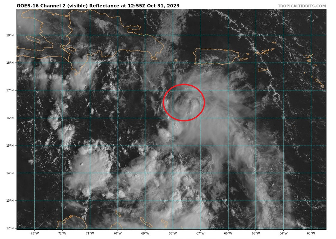

REDHurricane wrote:All of the 06z global and hurricane models (global models in particular) are initializing the center of this system too far to the south and west; I wouldn't take the upcoming model run or two for gospel until we have better data/more defined LLC so the models can at the very least figure out where the actual thing is that they're supposed to be forecasting.
SFLcane wrote:REDHurricane wrote:All of the 06z global and hurricane models (global models in particular) are initializing the center of this system too far to the south and west; I wouldn't take the upcoming model run or two for gospel until we have better data/more defined LLC so the models can at the very least figure out where the actual thing is that they're supposed to be forecasting.
Is there an actual center?
cycloneye wrote:SFLcane wrote:REDHurricane wrote:All of the 06z global and hurricane models (global models in particular) are initializing the center of this system too far to the south and west; I wouldn't take the upcoming model run or two for gospel until we have better data/more defined LLC so the models can at the very least figure out where the actual thing is that they're supposed to be forecasting.
Is there an actual center?
An ASCAT is need to see if there is one.

Landy wrote:Highly doubt there is anything at the surface for the time being. Low level winds look predominantly south / southeasterly. Buoy in the area corroborates this.


blp wrote:The system has switched to build up the mid level today versus yesterday being more at the lower levels. Though it looks worse on satellite the structure is improving overall.
500MB
https://i.ibb.co/CbCxgdR/ezgif-2-fb0b657cef.gif
850MB
https://i.ibb.co/PYyj6Tv/ezgif-2-b6d07d0255.gif
Users browsing this forum: No registered users and 21 guests


