Source - https://col.st/CkOWi
Moderator: S2k Moderators


Hurricane2022 wrote:Wow


cycloneye wrote:105kt.TROPICAL CYCLONE TECHNICAL BULLETIN: AUSTRALIA - EASTERN REGION
Issued by AUSTRALIAN BUREAU OF METEOROLOGY TROPICAL CYCLONE WARNING CENTRE
at: 0118 UTC 08/12/2023
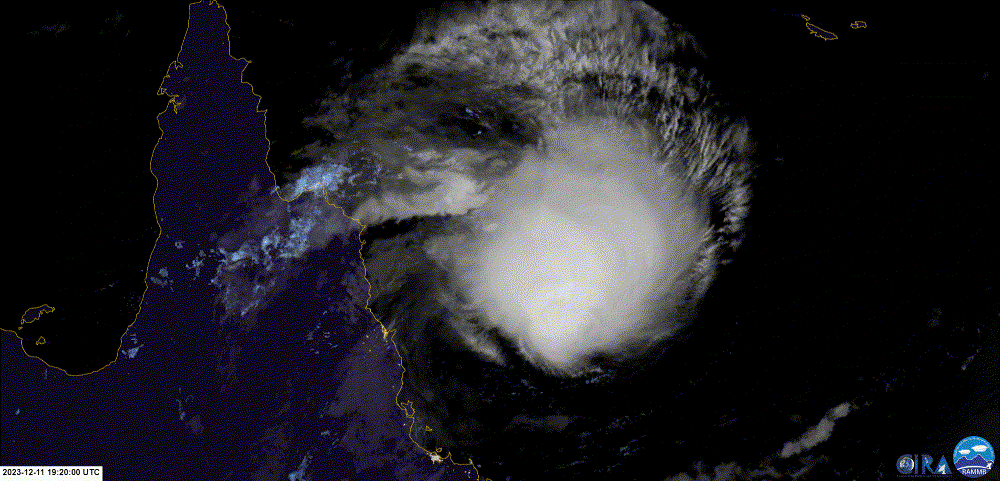
Name: Severe Tropical Cyclone Jasper
Identifier: 02U
Data At: 0000 UTC
Latitude: 14.2S
Longitude: 156.6E
Location Accuracy: within 15nm (30 km)
Movement Towards: south (190 deg)
Speed of Movement: 6 knots (10 km/h)
Maximum 10-Minute Wind: 105 knots (195 km/h)
Maximum 3-Second Wind Gust: 145 knots (270 km/h)
Central Pressure: 940 hPa
Radius of 34-knot winds NE quadrant: 110 nm (205 km)
Radius of 34-knot winds SE quadrant: 140 nm (260 km)
Radius of 34-knot winds SW quadrant: 140 nm (260 km)
Radius of 34-knot winds NW quadrant: 90 nm (165 km)
Radius of 48-knot winds NE quadrant: 70 nm (130 km)
Radius of 48-knot winds SE quadrant: 80 nm (150 km)
Radius of 48-knot winds SW quadrant: 90 nm (165 km)
Radius of 48-knot winds NW quadrant: 70 nm (130 km)
Radius of 64-knot winds: 50 nm ( km)
Radius of Maximum Winds: 20 nm (35 km)
Dvorak Intensity Code: T6.0/6.0/D1.5/24HRS STT:S0.0/06HRS
Pressure of outermost isobar: 1006 hPa
Radius of outermost closed isobar: 200 nm (370 km)
FORECAST DATA
Date/Time : Location : Loc. Accuracy: Max Wind : Central Pressure
(UTC) : degrees : nm (km): knots(km/h): hPa
+06: 08/0600: 14.7S 156.5E: 030 (055): 105 (195): 939
+12: 08/1200: 15.0S 156.4E: 045 (080): 105 (195): 938
+18: 08/1800: 15.3S 156.2E: 055 (100): 100 (185): 944
+24: 09/0000: 15.5S 155.8E: 065 (120): 090 (165): 955
+36: 09/1200: 15.7S 155.3E: 085 (155): 075 (140): 969
+48: 10/0000: 16.1S 154.3E: 105 (200): 065 (120): 978
+60: 10/1200: 16.3S 153.1E: 125 (230): 060 (110): 982
+72: 11/0000: 16.6S 151.9E: 125 (235): 055 (100): 986
+96: 12/0000: 16.0S 150.3E: 135 (250): 055 (100): 985
+120: 13/0000: 15.9S 148.2E: 185 (340): 065 (120): 978
REMARKS:
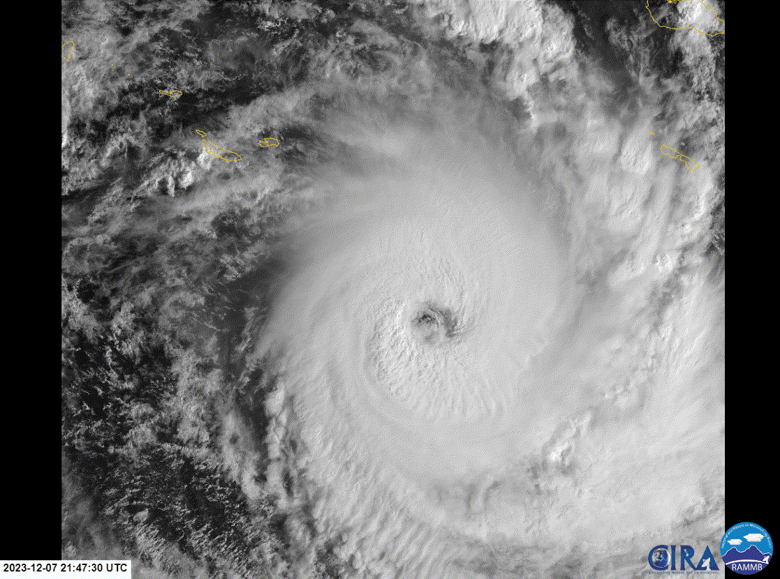
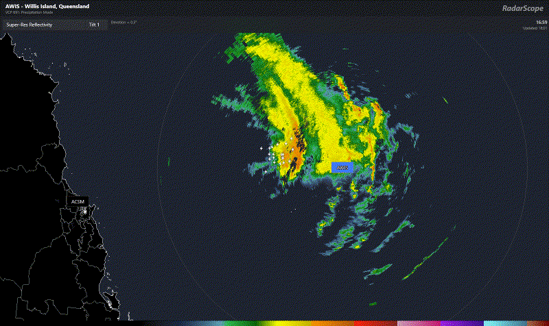
Severe Tropical Cyclone Jasper (02U) has undergone a period of rapid
intensification overnight.
Current position is based on animated EIR/VIS satellite imagery, with a clear
eye discernible. Motion is towards the south.
Dvorak: Recent DTs have been in the 6.0 to 6.5 range (WMG/OW eye with
surrounding temp ranging from B to W). Eye is somewhat ragged and elongated.
MET is 6.0 based on a 24 hour D+ trend, Pattern-T is also 6.0. Final T and CI
=6.0 based on DT. Current objective aids: ADT 127 kn, AiDT 121 kn, DPRINT 114
kn, DMINT 108 kn (at 1926 UTC), SATCON 119 kn (1926 UTC), all 1-min.
Intensity 105kn based primarily upon Dvorak analysis supported by objective
aids.
Structure is consistent with a 1914 UTC SAR pass.
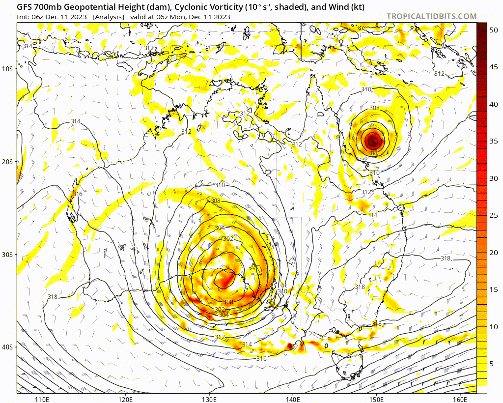
The environment remains very favourable: SSTs >28C; located in the vicinity of
an upper anticyclone, in a low to moderate shear environment; and an upper
trough to the south enhancing upper poleward outflow. CIMMS winds indicate
excellent outflow channels in southern quadrants.
The system has been tracking south under the steering of a mid-level ridge to
the east and southeast. This influence and track is likely to continue today. A
stronger steering ridge extending from Australia is likely to cradle the system
over the weekend, giving the track more of a westward component towards the
Queensland coast.
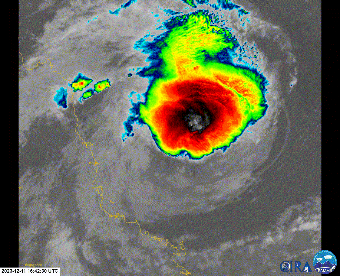
Further intensification is possible today. A category 5 system cannot be ruled
out.
Overnight and into the weekend, increasing wind shear and potential dry air
entrainment should lead to a period of weakening. Some models indicate there
might be an intensification phase with easing of this wind shear as Jasper
approaches the north Queensland coast next week.
The majority of the guidance has Jasper crossing the coast somewhere between
Cooktown and Townsville on a westerly track as a tropical cyclone mid next
week. Some recent guidance is favouring the scenario where Jasper crosses the
Queensland coast around Cairns or Port Douglas.
There is a chance that the system may move across Cape York Peninsula and into
the Gulf of Carpentaria towards next weekend, however there is uncertainty over
whether it would retain a suitable enough structure to redevelop. Another
potential outcome (though only a very low chance) is a slow moving system that
remains over the Coral Sea beyond the next seven days.
https://i.imgur.com/sqlz1id.png
The majority of the guidance has Jasper crossing the coast somewhere between Cooktown and Townsville on a westerly track as a tropical cyclone mid next week. Some recent guidance is favouring the scenario where Jasper crosses the Queensland coast around Cairns.

Users browsing this forum: No registered users and 80 guests