ATL: MILTON - Post-Tropical - Discussion

Moderator: S2k Moderators

Message
Author
Pasmorade
Tropical Storm
Tropical Storm
Posts: 141
Joined: Mon Jul 01, 2024 7:44 am
Location: Florida

Re: ATL: MILTON - Hurricane - Discussion Update: Cat 3=120 mph

#1221 Postby Pasmorade » Mon Oct 07, 2024 6:46 am

aspen wrote:
kevin wrote:Unflagged 134 SFMR was found during this pass. Not sure whether NHC is still gonna put much stock into SFMR but either way that's an incredible measurement.

Could be due to shoaling. If so, I suspect we might see some of the highest SFMR measurements ever recorded if Milton’s incredible ERI phase continues and it doesn’t succumb to random mid-level shear like Delta.

What’s frightening is that Milton is 20-30mb deeper than the newest HWRF/HAFS model runs, and the latter still get it to <920 mbar. We might be looking at our first sub-900 system since Wilma if this continues.

So for once, the HAFS and HWRF models are underestimating Milton. God no... :eek:
5 likes   

User avatar
kevin
Category 5
Category 5
Posts: 2587
Age: 26
Joined: Wed Aug 28, 2019 4:35 am

Re: ATL: MILTON - Hurricane - Discussion

#1222 Postby kevin » Mon Oct 07, 2024 6:48 am

Another convective burst in the NW eyewall. That was the only part of the eyewall that showed some weakness. That should seal off any chance that this backs down for now.
3 likes   

User avatar
weeniepatrol
Category 5
Category 5
Posts: 1276
Joined: Sat Aug 22, 2020 5:30 pm
Location: WA State

Re: ATL: MILTON - Hurricane - Discussion

#1223 Postby weeniepatrol » Mon Oct 07, 2024 6:49 am

FORECAST VALID 08/0600Z 21.8N 89.3W
MAX WIND 135 KT...GUSTS 165 KT.
8 likes   

User avatar
HurricaneAndre2008
Category 1
Category 1
Posts: 335
Age: 27
Joined: Wed Jul 31, 2019 9:51 pm
Contact:

Re: ATL: MILTON - Hurricane - Discussion

#1224 Postby HurricaneAndre2008 » Mon Oct 07, 2024 6:49 am

BULLETIN
Hurricane Milton Special Advisory Number 9
NWS National Hurricane Center Miami FL AL142024
700 AM CDT Mon Oct 07 2024

...AIR FORCE AND NOAA HURRICANE HUNTERS SHOW MILTON RAPIDLY
STRENGTHENING...
...NEW WATCHES AND WARNINGS ISSUED FOR PORTIONS OF MEXICO...


SUMMARY OF 700 AM CDT...1200 UTC...INFORMATION
----------------------------------------------
LOCATION...21.8N 92.2W
ABOUT 165 MI...265 KM WNW OF PROGRESO MEXICO
ABOUT 745 MI...1195 KM WSW OF TAMPA FLORIDA
MAXIMUM SUSTAINED WINDS...125 MPH...205 KM/H
PRESENT MOVEMENT...ESE OR 115 DEGREES AT 8 MPH...13 KM/H
MINIMUM CENTRAL PRESSURE...945 MB...27.91 INCHES
8 likes   
Cindy(2005), Katrina(2005), Rita(2005), Erin(2007), Isaac(2012)

User avatar
REDHurricane
Category 1
Category 1
Posts: 396
Age: 27
Joined: Sun Jul 03, 2022 2:36 pm
Location: Northeast Pacific Ocean

Re: ATL: MILTON - Hurricane - Discussion

#1225 Postby REDHurricane » Mon Oct 07, 2024 6:51 am

So what realistically could prevent Milton from continuing to intensify at or near this rate over the next 6-12 hours? Shear seems to be a non-issue since the storm is moving in the same direction as the shear vector, an EWRC is possible but the latest hurricane models aren't showing it, unless it goes way south of forecasted then there won't be any land interaction, etc., so it feels like it's all up to random/unpredictable dynamics at this point.
Last edited by REDHurricane on Mon Oct 07, 2024 6:54 am, edited 1 time in total.
5 likes   

User avatar
Hypercane_Kyle
Category 5
Category 5
Posts: 3353
Joined: Sat Mar 07, 2015 7:58 pm
Location: Cape Canaveral, FL

Re: ATL: MILTON - Hurricane - Discussion

#1226 Postby Hypercane_Kyle » Mon Oct 07, 2024 6:53 am

New forecast peak of 155mph, slight adjustment to the track south in the short-term but landfall location the same.
2 likes   
My posts are my own personal opinion, defer to the National Hurricane Center (NHC) and other NOAA products for decision making during hurricane season.

TampaWxLurker
Tropical Storm
Tropical Storm
Posts: 100
Joined: Thu Aug 01, 2024 8:20 am

Re: ATL: MILTON - Hurricane - Discussion

#1227 Postby TampaWxLurker » Mon Oct 07, 2024 6:54 am

Heading was at 110° at the last intermediate advisory. Now heading at 115°, slightly more south of ESE.
5 likes   

Keldeo1997
Category 2
Category 2
Posts: 637
Joined: Fri Oct 11, 2019 11:35 pm

Re: ATL: MILTON - Hurricane - Discussion

#1228 Postby Keldeo1997 » Mon Oct 07, 2024 6:54 am

Recon VDM reporting Hail in the NW EW
5 likes   

User avatar
weeniepatrol
Category 5
Category 5
Posts: 1276
Joined: Sat Aug 22, 2020 5:30 pm
Location: WA State

Re: ATL: MILTON - Hurricane - Discussion

#1229 Postby weeniepatrol » Mon Oct 07, 2024 6:54 am

Recent data from both NOAA and Air Force Hurricane Hunter aircraft
indicate that Milton continues to rapidly strengthen. The Air
Force aircraft very recently reported a peak flight-level wind of
120 kt, and dropsonde data show that the pressure has fallen to
around 945 mb, which is down about 9 mb from a previous dropsonde
report from the NOAA aircraft about an hour ago.
This special
advisory is being issued to increase the initial intensity to
110 kt, and to increase the short term intensity forecast that now
shows a peak wind speed of 135 kt in 24 hours.
5 likes   

User avatar
NDG
S2K Supporter
S2K Supporter
Posts: 15446
Joined: Sun Jul 09, 2006 10:14 pm
Location: Orlando, FL

Re: ATL: MILTON - Hurricane - Discussion

#1230 Postby NDG » Mon Oct 07, 2024 6:54 am

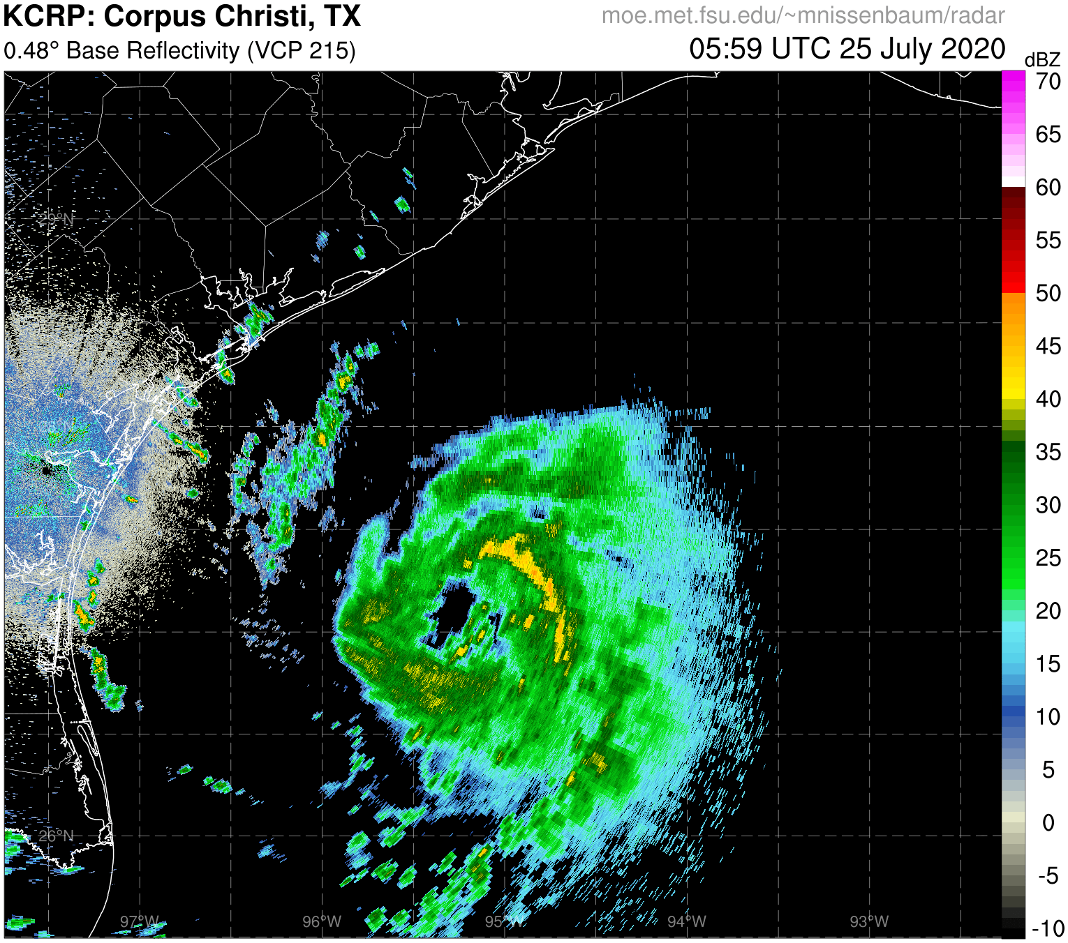
Saved radar loop.

Image
4 likes   

User avatar
FLpanhandle91
Category 5
Category 5
Posts: 1033
Age: 34
Joined: Mon Sep 13, 2010 3:50 pm
Location: Fort Walton Beach, FL

Re: ATL: MILTON - Hurricane - Discussion

#1231 Postby FLpanhandle91 » Mon Oct 07, 2024 6:55 am

REDHurricane wrote:So what realistically could prevent Milton from continuing to intensify at or near this rate over the next 6-12 hours? Shear seems to be a non-issue since the storm is moving in the same direction as the shear vector, an EWRC is possible even though the latest hurricane models aren't showing it, unless it goes way south of forecasted then there won't be any land interaction, etc., so it feels like it's all up to random/unpredictable dynamics at this point.


Unless he does something similar to Helene and pulls in some dry air off the Yucatan, but that air mass is much more moist now than when Helene passed.
3 likes   

User avatar
kevin
Category 5
Category 5
Posts: 2587
Age: 26
Joined: Wed Aug 28, 2019 4:35 am

Re: ATL: MILTON - Hurricane - Discussion

#1232 Postby kevin » Mon Oct 07, 2024 6:56 am

REDHurricane wrote:So what realistically could prevent Milton from continuing to intensify at or near this rate over the next 6-12 hours? Shear seems to be a non-issue since the storm is moving in the same direction as the shear vector, an EWRC is possible but the latest hurricane models aren't showing it, unless it goes way south of forecasted then there won't be any land interaction, etc., so it feels like it's all up to random/unpredictable dynamics at this point.


The only thing that can stop it is indeed some random mid-level shear or other unpredicted dynamics. With 9 mb per hour this Milton's theoretical ceiling over the next few hours if it doesn't back down.

13z (now) = 945 mb
14z = 936 mb
15z (next advisory) = 927 mb
16z = 918 mb
17z = 909 mb
18z = 900 mb
Last edited by kevin on Mon Oct 07, 2024 6:56 am, edited 1 time in total.
3 likes   

User avatar
Hypercane_Kyle
Category 5
Category 5
Posts: 3353
Joined: Sat Mar 07, 2015 7:58 pm
Location: Cape Canaveral, FL

Re: ATL: MILTON - Hurricane - Discussion

#1233 Postby Hypercane_Kyle » Mon Oct 07, 2024 6:56 am

Most of the models are showing Milton peaking in 48 hours. Even if it clips/makes a brief landfall the coast of the Yucatan, we still be looking at Milton being an extremely violent hurricane on approach to Florida.
0 likes   
My posts are my own personal opinion, defer to the National Hurricane Center (NHC) and other NOAA products for decision making during hurricane season.

User avatar
Travorum
Category 1
Category 1
Posts: 406
Joined: Tue Sep 05, 2023 9:36 am
Location: Dunedin, FL

Re: ATL: MILTON - Hurricane - Discussion

#1234 Postby Travorum » Mon Oct 07, 2024 6:57 am

weeniepatrol wrote:
Recent data from both NOAA and Air Force Hurricane Hunter aircraft
indicate that Milton continues to rapidly strengthen. The Air
Force aircraft very recently reported a peak flight-level wind of
120 kt, and dropsonde data show that the pressure has fallen to
around 945 mb, which is down about 9 mb from a previous dropsonde
report from the NOAA aircraft about an hour ago.
This special
advisory is being issued to increase the initial intensity to
110 kt, and to increase the short term intensity forecast that now
shows a peak wind speed of 135 kt in 24 hours.


:double: 9mb/hr deepening, pinhole eye, and hail in the eyewall. Welcome back Wilma. I'm off to fill up sandbags...
12 likes   

LandoWill
Tropical Storm
Tropical Storm
Posts: 154
Joined: Sun Sep 25, 2022 10:25 pm

Re: ATL: MILTON - Hurricane - Discussion

#1235 Postby LandoWill » Mon Oct 07, 2024 6:57 am

Not sure what to make of the adjustment north at 5am? Just waking up, are the 6am models suggesting any changes at 11am back south or north of the track?
0 likes   

xironman
S2K Supporter
S2K Supporter
Posts: 2522
Joined: Sun Jun 10, 2007 4:53 pm
Location: NoVA

Re: ATL: MILTON - Hurricane - Discussion

#1236 Postby xironman » Mon Oct 07, 2024 6:58 am

REDHurricane wrote:So what realistically could prevent Milton from continuing to intensify at or near this rate over the next 6-12 hours? Shear seems to be a non-issue since the storm is moving in the same direction as the shear vector, an EWRC is possible but the latest hurricane models aren't showing it, unless it goes way south of forecasted then there won't be any land interaction, etc., so it feels like it's all up to random/unpredictable dynamics at this point.


EWRC is very unlikely, normally there would be a double maxima in the recon data.
1 likes   

User avatar
dizzyfish
S2K Supporter
S2K Supporter
Posts: 1519
Joined: Fri Sep 16, 2005 7:56 am
Location: New Port Richey, FL

Re: ATL: MILTON - Hurricane - Discussion

#1237 Postby dizzyfish » Mon Oct 07, 2024 6:58 am

Watching local weather (Tampa) this morning and I'm seeing a large blob ahead of Milton. Not the stuff near the west coast associated with the rain today but the blob nearest Milton.
What is that? Will it be absorbed into Milton making him larger?
1 likes   

Keldeo1997
Category 2
Category 2
Posts: 637
Joined: Fri Oct 11, 2019 11:35 pm

Re: ATL: MILTON - Hurricane - Discussion

#1238 Postby Keldeo1997 » Mon Oct 07, 2024 7:00 am

VDM now down to 10nm eye. We are going full pinhole folks.
9 likes   

User avatar
kevin
Category 5
Category 5
Posts: 2587
Age: 26
Joined: Wed Aug 28, 2019 4:35 am

Re: ATL: MILTON - Hurricane - Discussion

#1239 Postby kevin » Mon Oct 07, 2024 7:02 am

The eye is partially covered again due to the deep convection in the CDO.
3 likes   

User avatar
FLpanhandle91
Category 5
Category 5
Posts: 1033
Age: 34
Joined: Mon Sep 13, 2010 3:50 pm
Location: Fort Walton Beach, FL

Re: ATL: MILTON - Hurricane - Discussion

#1240 Postby FLpanhandle91 » Mon Oct 07, 2024 7:02 am

Latent heating becoming evident on IR around these massive updrafts.
3 likes   


Return to “2024”

Who is online

Users browsing this forum: No registered users and 6 guests