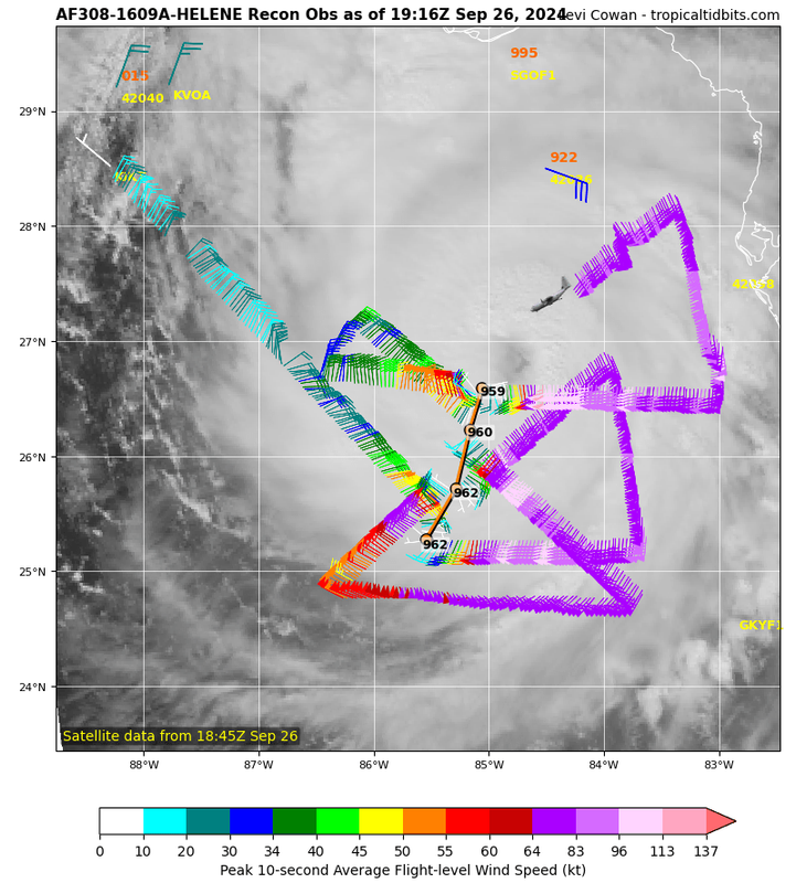
Pipelines182 wrote:PavelGaborik10 wrote:Pipelines182 wrote:
Steinhatchee is NOT forecasted to get 20+ storm surge, please don't spread false information, their forecast is 10-15. The areas with the highest surge potential (20+) are in the swamp, there's no civilization there.
10'-15' is still a very big deal though!
...current forecast for the Steinhatchee region is 15-20+ foot storm surge.
Steinhatchee is near the suwannee which is 10-15, and they aren't even on the coast, they're on the river, and that river isn't angled correctly to drive maximum surge with a storm landfalling in this direction. In no way shape or form is their forecast for 20+.
Below is the official statement from this morning. It clearly states 16-20ft. Might go up before landfall. You are close to earning a vacation from here.
STORM SURGE WARNING
NWS TALLAHASSEE FL
1109 AM EDT THU SEP 26 2024
FLZ128-262315-
/O.CON.KTAE.SS.W.1009.000000T0000Z-000000T0000Z/
1109 AM EDT THU SEP 26 2024
Coastal Taylor-
...HURRICANE WARNING REMAINS IN EFFECT...
...STORM SURGE WARNING REMAINS IN EFFECT...
* LOCATIONS AFFECTED
- Keaton Beach
- Steinhatchee
* WIND
- LATEST LOCAL FORECAST: Equivalent Cat 2 Hurricane force wind
- Peak Wind Forecast: 90-110 mph with gusts to 125 mph
- Window for Tropical Storm force winds: until early Friday
morning
- Window for Hurricane force winds: early this evening until
early Friday morning
- THREAT TO LIFE AND PROPERTY THAT INCLUDES TYPICAL FORECAST
UNCERTAINTY IN TRACK, SIZE AND INTENSITY: Potential for wind
greater than 110 mph
- The wind threat has increased from the previous assessment.
- PLAN: Plan for extreme wind of equivalent CAT 3 hurricane
force or higher.
- PREPARE: Last minute efforts should solely focus on
protecting life. The area remains subject to catastrophic
wind damage.
- ACT: Now is the time to shelter from life-threatening wind.
Be ready to move to the safest place inside your shelter if
necessary.
- POTENTIAL IMPACTS: Unfolding
- Potential impacts from the main wind event are unfolding.
* STORM SURGE
- LATEST LOCAL FORECAST: Life-threatening and historic storm
surge possible
- Peak Storm Surge Inundation: The potential for 16-20 feet
above ground somewhere within surge prone areas
- Window of concern: through Friday morning
- THREAT TO LIFE AND PROPERTY THAT INCLUDES TYPICAL FORECAST
UNCERTAINTY IN TRACK, SIZE AND INTENSITY: Potential for storm
surge flooding greater than 9 feet above ground
- The storm surge threat has remained nearly steady from the
previous assessment.
- PLAN: Shelter against extreme life-threatening storm surge
flooding greater than 9 feet above ground.
- PREPARE: All ordered evacuations should be complete.
Evacuees should be in shelters well away from storm surge
flooding.
- ACT: Remain sheltered in a safe location. Do not venture
outside. Move to upper floors to escape rising water if
necessary.
- POTENTIAL IMPACTS: Unfolding
- Potential impacts from the main surge event are unfolding.
* FLOODING RAIN
- LATEST LOCAL FORECAST: Flood Watch is in effect
- Peak Rainfall Amounts: Additional 2-4 inches, with locally
higher amounts
- THREAT TO LIFE AND PROPERTY THAT INCLUDES TYPICAL FORECAST
UNCERTAINTY IN TRACK, SIZE AND INTENSITY: Potential for extreme
flooding rain
- The flooding rain threat has remained nearly steady from
the previous assessment.
- PLAN: Emergency plans should include the potential for
extreme flooding from heavy rain. Evacuations and rescues
are likely.
- PREPARE: Urgently consider protective actions from extreme
and widespread rainfall flooding.
- ACT: Heed any flood watches and warnings. Failure to take
action will likely result in serious injury or loss of life.
- POTENTIAL IMPACTS: Devastating to Catastrophic
- Extreme rainfall flooding may prompt numerous evacuations
and rescues.
- Rivers and tributaries may overwhelmingly overflow their
banks in many places with deep moving water. Small streams,
creeks, and ditches may become raging rivers. Flood control
systems and barriers may become stressed.
- Flood waters can enter numerous structures within multiple
communities, some structures becoming uninhabitable or
washed away. Numerous places where flood waters may cover
escape routes. Streets and parking lots become rivers of
raging water with underpasses submerged. Driving conditions
become very dangerous. Numerous road and bridge closures
with some weakened or washed out.
* TORNADO
- LATEST LOCAL FORECAST: Tornado Watch is in effect
- Situation is favorable for tornadoes
- THREAT TO LIFE AND PROPERTY THAT INCLUDES TYPICAL FORECAST
UNCERTAINTY IN TRACK, SIZE AND INTENSITY: Potential for several
tornadoes
- The tornado threat has remained nearly steady from the
previous assessment.
- PLAN: Emergency plans should continue to include the
potential for several tornadoes.
- PREPARE: Stay within your shelter keeping informed of the
latest tornado situation.
- ACT: Move quickly to the safest place within your shelter
if a tornado warning is issued.
- POTENTIAL IMPACTS: Significant
- The occurrence of scattered tornadoes can hinder the
execution of emergency plans during tropical events.
- Several places may experience tornado damage with a few
spots of considerable damage, power loss, and
communications failures.
- Locations could realize roofs torn off frame houses, mobile
homes demolished, boxcars overturned, large trees snapped
or uprooted, vehicles tumbled, and small boats tossed
about. Dangerous projectiles can add to the toll.
* FOR MORE INFORMATION:
- Local Weather Conditions and Forecasts: NWS Tallahassee
- https://www.weather.gov/tallahassee
- Information from the Florida Division of Emergency Management
- https://www.floridadisaster.org
- Information from Taylor County Emergency Management
- http://www.taylorcountyem.com


