A Tropical Storm Watch has been issued for the east coast of Florida
from the Palm Beach/Martin County Line northward to the
Flagler/Volusia County Line.
from the Palm Beach/Martin County Line northward to the
Flagler/Volusia County Line.
Moderator: S2k Moderators


 Hurricanes: Andrew 1992 - Irene 1999 - Frances 2004 - Jeanne 2004 - Katrina 2005 - Wilma 2005 - Matthew 2016 - Irma 2017 - Ian 2022 - Nicole 2022 - Milton 2024
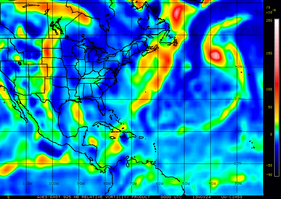
 Zonacane wrote:GCANE wrote:ScottNAtlanta wrote:Looking at where the vorticity is located, It is a bit east of where the 8am fix is located
https://tropic.ssec.wisc.edu/real-time/atlantic/winds/wg8vor5.GIF
https://tropic.ssec.wisc.edu/real-time/atlantic/winds/wg8vor.GIF
Its elongated in the same direction of a wave.
Land interaction is keeping it from closing off.
Morning GCANE, quick question, do you have any idea how the southern end of the wave axis has clung on for the past few days, given that the two halves of the wave were physically separated?

skillz305 wrote:I am officially in a tropical storm watch here in Vero Beach, FL
 Hurricanes: Andrew 1992 - Irene 1999 - Frances 2004 - Jeanne 2004 - Katrina 2005 - Wilma 2005 - Matthew 2016 - Irma 2017 - Ian 2022 - Nicole 2022 - Milton 2024
GCANE wrote:The GOM front is really enhancing mid-level and upper-level outflow.
https://weather.cod.edu/satrad/?parms=r ... =undefined


Weathertracker96 wrote:GCANE wrote:The GOM front is really enhancing mid-level and upper-level outflow.
https://weather.cod.edu/satrad/?parms=r ... =undefined
Is the front still moving as forecast? I know you mentioned this morning about some storms possibly eroding the front. Thanks for all your posts/analysis.


GCANE wrote:Hmm.
Keeping an eye on the tail of the front in the GOM that just popped up on the 200mb vort product from CIMSS.
Lots of curve balls here.
https://tropic.ssec.wisc.edu/real-time/ ... oom=&time=
Users browsing this forum: No registered users and 53 guests


