
caneman wrote:BobHarlem wrote:boca wrote:
Does that mean this will come much closer to Florida than what is forecast?
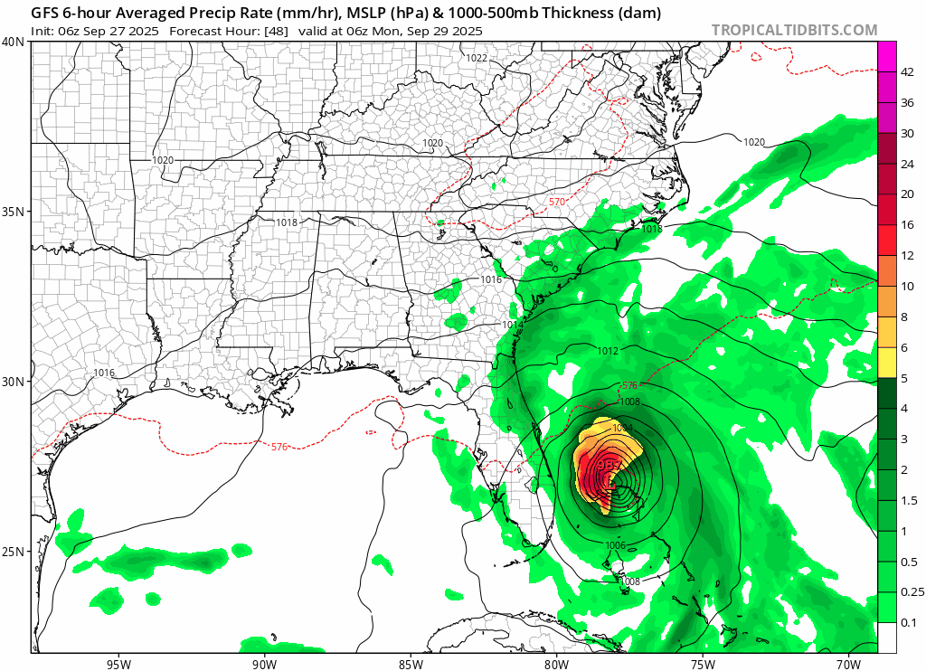
No. It does not. FWIW that side is very dry so Florida likely won't notice much as it passes by.
https://i.imgur.com/mNe2DuY.png
Not ok to make such a bold claim. They are under a ts watch and if they go under a ts warning then they can in fact experience ts conditions not to mention possible flooding for low lying areas. Rule of thumb is to wait til it passes your latitude before letting guard down
Looking at the gulf side it isn't really bold at all. Coastal areas will get the impacts, rest of the state won't really. Usual caveats apply, but that's what it shows.


 Hurricanes: