I'm becoming more concerned about this thing making landfall as far east as Cameron Parish and then grazing through south Louisiana tomorrow. It has clearly shifted more east and it looks looks almost ENE on Lake Charles radar loop: http://radar.weather.gov/radar.php?prod ... h&loop=yes
I don't know what to think! Oh and the "eye" has completely cleared out per LCH radar.
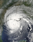
Tropical Depression HUMBERTO Discussion & Images
Moderator: S2k Moderators
-
PTrackerLA

- Category 5

- Posts: 5281
- Age: 42
- Joined: Thu Oct 10, 2002 8:40 pm
- Location: Lafayette, LA
-
Downdraft

- S2K Supporter

- Posts: 906
- Joined: Wed Oct 09, 2002 8:45 pm
- Location: Sanford, Florida
- Contact:
Re: T.S.HUMBERTO (GOM): Discussion & Images:7 PM CDT page 36
You can kiss any thoughts of intensification good-bye. Dry air intrusion is eating the western side of the system for lunch. As for the question is that an eye on radar, not by the classic concept of a true tropical system eye. It is the closed loop LLC of the system. You usually don't see a real eye till a cyclone reaches CAT II although strong CAT I's have produced a similar feature.
0 likes
-
Stormcenter
- S2K Supporter
- Posts: 6689
- Joined: Wed Sep 03, 2003 11:27 am
- Location: Houston, TX
Re: T.S.HUMBERTO (GOM): Discussion & Images:7 PM CDT page 36
As of now I 'm looking at a TX/LA. border possible landfall.
http://www.ssd.noaa.gov/goes/flt/t1/loop-avn.html
http://www.ssd.noaa.gov/goes/flt/t1/loop-avn.html
0 likes
-
windstorm99

- S2K Supporter
- Posts: 1578
- Age: 48
- Joined: Sat May 26, 2007 8:10 am
- Location: Miami, Florida
- Contact:

-
Derek Ortt
I've seen true eyes in tropical storms. They tend to start forming at 50KT, though they do not show up on sat imagery until about 75-80KT
This is what i would call a poorly defined eye. It looks like an eyewall has formed, but it is very open and barely meets the 50 percent threshold, and the eye has not yet cleared out completely
This is what i would call a poorly defined eye. It looks like an eyewall has formed, but it is very open and barely meets the 50 percent threshold, and the eye has not yet cleared out completely
0 likes
-
Weatherfreak14

- Category 5
- Posts: 1381
- Joined: Sat Sep 24, 2005 3:40 pm
- Location: Beaufort, SC
- Contact:
Re: T.S.HUMBERTO (GOM): Discussion & Images:7 PM CDT page 36
IMO it looks actually rather good on radar, no matter how it looks though this is not good for saturated areas in TX and LA, i wish this whould of made landfall in AL or MS where they need it.
0 likes

Re: T.S.HUMBERTO (GOM): Discussion & Images:7 PM CDT page 36
Derek, is there any chance this thing just hugs the coast and keeps east?
0 likes
-
Downdraft
- S2K Supporter
- Posts: 906
- Joined: Wed Oct 09, 2002 8:45 pm
- Location: Sanford, Florida
- Contact:
Re:
RL3AO wrote:A hurricane watch is starting to seem more and more necessary for NE TX/SW LA.
Based on what??? There is no data that supports a hurricane watch in anything I'm seeing here. What are you basing that on?
0 likes
Re: Re:
Downdraft wrote:RL3AO wrote:A hurricane watch is starting to seem more and more necessary for NE TX/SW LA.
Based on what??? There is no data that supports a hurricane watch in anything I'm seeing here. What are you basing that on?
If it goes further east that expected, than it will have more time over water.
I guess it doesn't matter though.
0 likes
-
PTrackerLA
- Category 5
- Posts: 5281
- Age: 42
- Joined: Thu Oct 10, 2002 8:40 pm
- Location: Lafayette, LA
Re: T.S.HUMBERTO (GOM): Discussion & Images:7 PM CDT page 36
Weatherfreak14 wrote:IMO it looks actually rather good on radar, no matter how it looks though this is not good for saturated areas in TX and LA, i wish this whould of made landfall in AL or MS where they need it.
Well LA hasn't been nearly as wet as Texas. In fact, even with the rain we received today, we're officially .57" below normal for the year in Lafayette. We can handle it, just not 10 inches
0 likes
Re: T.S.HUMBERTO (GOM): Discussion & Images:7 PM CDT page 36
We here on the Tx/La border do not need more rain, but I must say that it is a bit more comfortable to be in the cross-hairs of Humberto than the feeling we experienced looking down the barrel at Rita! 
http://www.wunderground.com/weatherstat ... =KTXBRIDG4
http://www.wunderground.com/weatherstat ... =KTXBRIDG4
0 likes
-
Tampa Bay Hurricane

- Category 5
- Posts: 5597
- Age: 38
- Joined: Fri Jul 22, 2005 7:54 pm
- Location: St. Petersburg, FL
Re: T.S.HUMBERTO (GOM): Discussion & Images:7 PM CDT page 36
Judging by an WSW-ENE orientation of the front
axis, a ENE movement is possible.
axis, a ENE movement is possible.
0 likes
-
wxman57

- Moderator-Pro Met

- Posts: 23172
- Age: 68
- Joined: Sat Jun 21, 2003 8:06 pm
- Location: Houston, TX (southwest)
Re: T.S.HUMBERTO (GOM): Discussion & Images:7 PM CDT page 36
I think predicting a LA landfall is quite a bit of a stretch. More like eastern Bolivar Peninsula (just east of Galveston Bay) early tomorrow morning. No significant change in strength prior to landfall, except maybe a little weaker with the dry air entrainment.
0 likes
-
PTrackerLA
- Category 5
- Posts: 5281
- Age: 42
- Joined: Thu Oct 10, 2002 8:40 pm
- Location: Lafayette, LA
Re: T.S.HUMBERTO (GOM): Discussion & Images:7 PM CDT page 36
Looks like on the latest radar frames the center has pulled up north a little. Hard to tell exactly as it has become a little more ragged in appearance.
0 likes
-
Ed Mahmoud
Re: T.S.HUMBERTO (GOM): Discussion & Images:7 PM CDT page 36
Kludge wrote:wxman57 wrote:Doesn't look like much for Houston as far as I can see, either. I notice the eastward shift and dry air intrusion. Humberto and I will be passing each other as I drive to work tomorrow morning at 5:30 on I-45. Probably just some light rain from I-45 west. Would have been interesting to see at least 20-30 mph wind blowing through the trees.
The rules of this forum will not allow me to "question" the forecasts of a pro met. But looking back on your calls from yesterday, versus what this turned into by mid day today is.... interesting.
So I'll just say that...uh...it turned out that your forecast for Houston was... ummm... genius.Nice job!
Well, maybe Joe Bastardi's prediction yesterday morning of sustained TS winds in Texas might also be wrong, if the center can hang a little further East.
Although after moving NE, looks like maybe a wobble closer to due North. Tricky, because on HGX radar something sort of weird looking happening near the center.
0 likes
-
Weatherfreak14
- Category 5
- Posts: 1381
- Joined: Sat Sep 24, 2005 3:40 pm
- Location: Beaufort, SC
- Contact:
Re: T.S.HUMBERTO (GOM): Discussion & Images:7 PM CDT page 36
Is it just me or has it really taken a wooble to the north or NNW on GRX radar.
Last edited by Weatherfreak14 on Wed Sep 12, 2007 8:53 pm, edited 1 time in total.
0 likes
-
Sean in New Orleans
- Category 5
- Posts: 1794
- Joined: Thu Aug 28, 2003 7:26 pm
- Location: New Orleans, LA 30.0N 90.0W
- Contact:
It's not very impressive, at all. Just a little tropical storm, but, it needs to do some jogging N. if it is going to hit Texas (which it may be doing), but, either way, all of the weather is going to be to the East, so no matter where the center really falls, it's obvious 90% of all weather associated with the system will be in Louisiana....which is fine. This isn't going to hurt anybody or anything, IMO.
0 likes


Re: T.S.HUMBERTO (GOM): Discussion & Images:7 PM CDT page 36
Interesting how convection can be building on the western side on infrared, but the rain shield being eroded on the western side. I dont exactly understand.
0 likes
-
Weatherfreak14
- Category 5
- Posts: 1381
- Joined: Sat Sep 24, 2005 3:40 pm
- Location: Beaufort, SC
- Contact:
Re: T.S.HUMBERTO (GOM): Discussion & Images:7 PM CDT page 36
BigA wrote:Interesting how convection can be building on the western side on infrared, but the rain shield being eroded on the western side. I dont exactly understand.
The storm must be fickled...
0 likes
Who is online
Users browsing this forum: No registered users and 36 guests