And if anything tries to form at the surface, it will be pushed northward.
Moderator: S2k Moderators


dixiebreeze wrote:Sort of surprised there's not even a Tropical Disturbance STatement issued yet. Guess the NHC is not impressed.
dixiebreeze wrote:Sort of surprised there's not even a Tropical Disturbance STatement issued yet. Guess the NHC is not impressed.
HURAKAN wrote:dixiebreeze wrote:Sort of surprised there's not even a Tropical Disturbance STatement issued yet. Guess the NHC is not impressed.
Why surprised? There's not even a LLC associated with the convection. It should just die out as the day progresses.


eyesurvivor wrote:On radar I see what I think to be a slight counter clockwise spin in one area. However, this is probably caused by areas of clouds dying out and then reforming in areas slightly to the left. That's my spin on the matter.


Comanche wrote:from Jeff Lindner this morning-
Tropics:
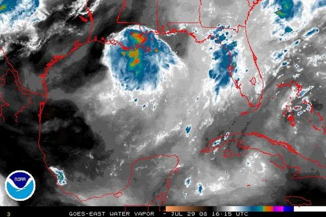
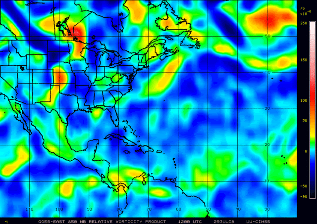
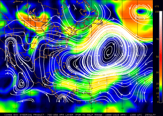
MCS that moved off the NE Gulf coast Sunday has spawned a mid level low pressure system in the Gulf of Mexico about 180 miles S of New Orleans, LA. IR satellite images reveal a well defined circulation. Surface pressures have fallen slightly in the past 24 hours. Radar out of New Orleans shows heavy thunderstorms north of the mid level center moving NW while it appears that the center itself is either stationary or drifting WNW.
While it takes time for mid level system to work their way to the surface…it has happened before and in fact this is how Hurricane Alicia formed in 1983. There is no model support for this system…however it bears watching. Dolly and Humberto both have showed how quickly systems can spin up in the Gulf.


RL3AO wrote:Not even mentioned in new TWO.
RL3AO wrote:Not even mentioned in new TWO.
Users browsing this forum: pepecool20 and 78 guests