
Ed doesn't look bad, best its looked over the past few hours IMO then it has been since it developed. In may ways its good it did lift a little more to the WNW then was expected.
Interesting that this is yet another storm that has generally ended up landfalling on the eastern side of the guidence in the Gulf, they seem to happen so often...
ATL: Tropical Depression Edouard
Moderator: S2k Moderators
-
carolina_73

- Tropical Storm

- Posts: 148
- Joined: Wed Jul 23, 2008 1:30 am
Re: ATL: Tropical Storm Edouard - Gulf of Mexico
Looks like Ed's time has about ran out to get to cane status. Landfall very soon.
Last edited by carolina_73 on Tue Aug 05, 2008 4:50 am, edited 1 time in total.
0 likes
-
HarlequinBoy

- Category 5

- Posts: 1400
- Age: 35
- Joined: Wed Nov 29, 2006 1:57 am
- Location: Memphis
-
Stratosphere747
- Category 5
- Posts: 3772
- Joined: Thu Sep 11, 2003 8:34 pm
- Location: Surfside Beach/Freeport Tx
- Contact:
Re: ATL: Tropical Storm Edouard - Gulf of Mexico
AREA FORECAST DISCUSSION
NATIONAL WEATHER SERVICE HOUSTON/GALVESTON TX
335 AM CDT TUE AUG 5 2008
THE OBVIOUS FORECAST ISSUE WILL BE TS EDOUARD. KLCH 88D CURRENTLY
SHOWS EDOUARD MAKING A MORE NW TRACK WITH LANDFALL LATER THIS
MORNING PROBABLY BETWEEN SABINE PASS AND HIGH ISLAND. EDOUARD
COULD STILL STRENGTHEN BEFORE MAKING LANDFALL BUT WILL LIKELY BE
A STRONG TROPICAL STORM.
EDOUARD IS EXPECTED TO TRACK THROUGH SE TX TODAY WITH HEAVY
RAINFALL. POPS WERE INCREASED ACROSS MOST OF THE AREA WITH LESS
RAINFALL CHANCES FOR JACKSON AND MATAGORDA COUNTIES. A BROAD AREA
OF 3 TO 5 INCHES OF RAINFALL STILL LOOKS GOOD WITH SOME POSSIBLY
HIGHER AMOUNTS DEPENDING ON THE FORWARD SPEED OF EDOUARD. A
SLOWER FORWARD SPEED WOULD ALLOW FOR MORE RAINFALL. MORE DETAILS
ON THE LOCAL IMPACTS OF EDOUARD CAN BE FOUND IN OUR LOCAL
HURRICANE STATEMENT (SATHLSHGX). THE HLS WILL ALSO OUTLINE ANY
CHANGES TO THE WATCHES/WARNINGS.
0 likes
-
Evac3
- Tropical Depression

- Posts: 60
- Joined: Sun Sep 23, 2007 1:59 pm
- Location: Orange County, Southeast Texas
Lights Out
Lights went out for a few minutes. Good timing too... just as I was walking down the stairs.
0 likes
-
wxman57

- Moderator-Pro Met

- Posts: 23172
- Age: 68
- Joined: Sat Jun 21, 2003 8:06 pm
- Location: Houston, TX (southwest)
Re: ATL: Tropical Storm Edouard - Gulf of Mexico
deltadog03 wrote:wxman57 wrote:deltadog03 wrote:I am still suprised that there were never any hurricane warnings issued...I understand there is not a huge difference, in a 70 mph TS and a 80 mph Cane, but its the principal. Not to mention, once again, we have a strengthening system upon landfall in texas. If this does come in as a verified cane, I think the NHC just will have been caught with there pants down.
The argument Jack Bevin (NHC forecaster) keeps making that there's virtually no difference between a strong TS and a hurricane seems to me to be a good one FOR putting out a hurricane warning. I think they have decided they don't want to make it a hurricane at landfall for some reason and they're sticking to it.
Ya, I dunno...lol Its the same argument you have about the TD in the gom vs ATL. I just can't understand why they never put some up. I just think I am suprised a bit thats all.
The only thing I can think of is that they thought it would cause more harm than good to put out a warning due to the short notice. I'm sure they've been on the phone regularly with emergency management officials all along the upper TX coast and SW LA. They must have decided that a warning would prompt more action than was necessary with this borderline storm, perhaps putting more people in harm's way on the road.
0 likes
-
carolina_73
- Tropical Storm
- Posts: 148
- Joined: Wed Jul 23, 2008 1:30 am
Re: ATL: Tropical Storm Edouard - Gulf of Mexico
This could of been one bad dealy if the shear and dry air had not kept Ed in check. We could of been looking at a cat 2 or 3 about to make landfall right now.
0 likes
-
Stratosphere747
- Category 5
- Posts: 3772
- Joined: Thu Sep 11, 2003 8:34 pm
- Location: Surfside Beach/Freeport Tx
- Contact:
Re: ATL: Tropical Storm Edouard - Gulf of Mexico
AREA FORECAST DISCUSSION
NATIONAL WEATHER SERVICE LAKE CHARLES LA
450 AM CDT TUE AUG 5 2008
.DISCUSSION...EDOUARD MAKING ITS WAY ACROSS THE NORTHWEST GULF AS
A STRONG TROPICAL STORM. SOME STRENGTHENING STILL POSSIBLE BEFORE
LANDFALL NOW EXPECTED IN THE HIGH ISLAND/SEA RIM STATE PARK AREA.
THUS FAR HAVE HAD A MAX GUST HERE AT THE LCH AIRPORT OF 49 MPH. 54
MPH NOTED AT CALCASIEU PASS. OVERALL GRIDS/ZONES HAVE CHANGED
LITTLE WITH THE EXCEPTION OF FLASH FLOOD WATCH ISSUED FOR PORTIONS
OF SOUTHWEST LOUISIANA AND SOUTHEAST TEXAS
0 likes
-
raindrops68

- Tropical Low

- Posts: 36
- Joined: Tue Aug 01, 2006 3:28 pm
- Location: Lake Conroe
-
JonathanBelles
- Professional-Met

- Posts: 11430
- Age: 35
- Joined: Sat Dec 24, 2005 9:00 pm
- Location: School: Florida State University (Tallahassee, FL) Home: St. Petersburg, Florida
- Contact:
-
paintplaye
- Category 1

- Posts: 380
- Joined: Sun Jul 20, 2008 11:25 pm
Re: ATL: Tropical Storm Edouard - Gulf of Mexico
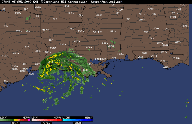
It looks like a more west movement (well at least all the storms have expanded to the west.)
0 likes

Re: ATL: Tropical Storm Edouard - Gulf of Mexico
Houston to start feeling the effects in the next two hours... Which is when I'll be waking up again. The storm sure tightened overnight - we haven't seen anything from Ed yet, but that should change shortly.
0 likes


-
Smurfwicked
- Tropical Storm
- Posts: 164
- Age: 41
- Joined: Mon Sep 03, 2007 7:47 pm
- Location: SETX
Re:
mpic wrote:Anybody have any guesses as to how long that west wind/rain band will last?
If thats the same one that came thru here in north beaumont a little while ago, and I think it is. It should last about 25 minutes.
0 likes

Re: Re:
Smurfwicked wrote:mpic wrote:Anybody have any guesses as to how long that west wind/rain band will last?
If thats the same one that came thru here in north beaumont a little while ago, and I think it is. It should last about 25 minutes.
Thanks...would rather have a lot of rain in a short period of tie than prolonged. Also gives me an indication of when it will get here.
0 likes
-
paintplaye
- Category 1
- Posts: 380
- Joined: Sun Jul 20, 2008 11:25 pm
Re: ATL: Tropical Storm Edouard - Gulf of Mexico
Defiantly a west movement. Houston might get more than they bargained for.
0 likes

Who is online
Users browsing this forum: No registered users and 44 guests