ATL: Tropical Depression Fay

Moderator: S2k Moderators

Message
Author
User avatar
Blown Away
S2K Supporter
S2K Supporter
Posts: 10147
Joined: Wed May 26, 2004 6:17 am

Re:

#881 Postby Blown Away » Tue Aug 12, 2008 6:50 am

Meso wrote:Image

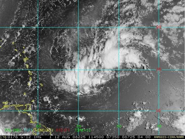
Not too long before it moves out of the area of shear and into an area of slightly more moist air too.


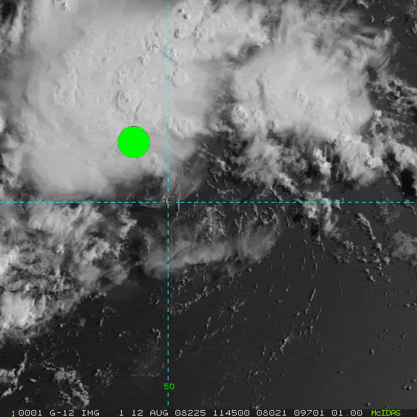
Nice graphic, good point.
0 likes   

User avatar
cycloneye
Admin
Admin
Posts: 145366
Age: 68
Joined: Thu Oct 10, 2002 10:54 am
Location: San Juan, Puerto Rico

Re: ATL: Invest 92L - Central Atlantic

#882 Postby cycloneye » Tue Aug 12, 2008 6:52 am

57,how does the average person know by looking at sat pics if a circulation is at the surface or at mid levels?
0 likes   

Derek Ortt

#883 Postby Derek Ortt » Tue Aug 12, 2008 6:53 am

not going to be in AF recon range it appears today
0 likes   

User avatar
Aquawind
Category 5
Category 5
Posts: 6714
Age: 62
Joined: Mon Jun 16, 2003 10:41 pm
Location: Salisbury, NC
Contact:

Re:

#884 Postby Aquawind » Tue Aug 12, 2008 6:56 am

Derek Ortt wrote:not going to be in AF recon range it appears today


Dang..so close. What if the NHC begs them? lol hands n knees kinda stuff..
0 likes   

User avatar
HURAKAN
Professional-Met
Professional-Met
Posts: 46086
Age: 38
Joined: Thu May 20, 2004 4:34 pm
Location: Key West, FL
Contact:

#885 Postby HURAKAN » Tue Aug 12, 2008 6:58 am

Image
0 likes   

User avatar
cycloneye
Admin
Admin
Posts: 145366
Age: 68
Joined: Thu Oct 10, 2002 10:54 am
Location: San Juan, Puerto Rico

Re: ATL: Invest 92L - Central Atlantic

#886 Postby cycloneye » Tue Aug 12, 2008 7:00 am

Maybe pojo can answer this.Are there any planes in Barbados as in the past some missions haved departed from there?
0 likes   

User avatar
HURAKAN
Professional-Met
Professional-Met
Posts: 46086
Age: 38
Joined: Thu May 20, 2004 4:34 pm
Location: Key West, FL
Contact:

Re: ATL: Invest 92L - Central Atlantic

#887 Postby HURAKAN » Tue Aug 12, 2008 7:10 am

Ready. Scroll down

.

.

.

.

.

.

.


.

.

.

.

.

.

.

.

.

.

.

Image

TPC thinking.
0 likes   

User avatar
hurricanefloyd5
Category 5
Category 5
Posts: 1659
Age: 44
Joined: Sun May 02, 2004 10:53 am
Location: Spartanburg
Contact:

Re: ATL: Invest 92L - Central Atlantic

#888 Postby hurricanefloyd5 » Tue Aug 12, 2008 7:11 am

I think if the GFDL model model holds up and this system forms then I think that central and north florida "COULD" be under the gun and IF this happens model pans out!!!!!!!!!!!
0 likes   

User avatar
Extremeweatherguy
Category 5
Category 5
Posts: 11095
Joined: Mon Oct 10, 2005 8:13 pm
Location: Florida

Re: ATL: Invest 92L - Central Atlantic

#889 Postby Extremeweatherguy » Tue Aug 12, 2008 7:14 am

The system is starting to look pretty good this morning. If convection continues, then I think a LLC will build down to the surface later today and we could be looking at a depression within 24-48 hours.

The posts in this forum are NOT official forecast and should not be used as such. They are just the opinion of the poster and may or may not be backed by sound meteorological data. They are NOT endorsed by any professional institution or storm2k.org. For official information, please refer to the NHC and NWS products.
0 likes   

MWatkins
S2K Supporter
S2K Supporter
Posts: 2574
Joined: Sat Oct 12, 2002 7:51 pm
Location: SE Florida
Contact:

Re: ATL: Invest 92L - Central Atlantic

#890 Postby MWatkins » Tue Aug 12, 2008 7:16 am

Waiting to see if that convection to the SW of the apparent (at least) mid level center will either die down or develop into a band. Hard to consolidate a circulation when there is competition for upward motion. Plus...upward motion in a semi-linear appearance argues against having a well-defined circulation.

Going to be interesting to watch today...but I agree with Ortt here. Too far away for recon, that mission will get bumped to tomorrow.

MW
0 likes   

User avatar
bvigal
S2K Supporter
S2K Supporter
Posts: 2276
Joined: Sun Jul 24, 2005 8:49 am
Location: British Virgin Islands
Contact:

Re: ATL: Invest 92L - Central Atlantic

#891 Postby bvigal » Tue Aug 12, 2008 7:16 am

Well, I must admit to being totally confused now! We have a red circle from NHC. We have "too weak" for dvorak. We have different surface maps from different branches of NOAA. I think even the experts could honestly say "we really don't know what this will do".

http://www.nhc.noaa.gov/tafb_latest/WATL_latest.gif - (6z) moving almost due west, toward Guadeloupe, 1008 to 1007mb in 6hrs. Model guidance 6z puts motion at 325 degrees true! Look at that surface map arrow - NO WAY it's EVEN CLOSE to 325degrees.

Here's the most interesting thing I found this morning. Between this low and the islands, still a big wad of dry air, shown on precipitable water through 6z. Maybe it's this, not shear, that's hampering what would otherwise be expected development?
Image
0 likes   

User avatar
boca
Category 5
Category 5
Posts: 6367
Age: 60
Joined: Mon Dec 15, 2003 8:49 am
Location: Boca Raton,FL

Re: ATL: Invest 92L - Central Atlantic

#892 Postby boca » Tue Aug 12, 2008 7:19 am

Mike do you think 92L will be a possible threat to Florida next week?
0 likes   

User avatar
hurricanefloyd5
Category 5
Category 5
Posts: 1659
Age: 44
Joined: Sun May 02, 2004 10:53 am
Location: Spartanburg
Contact:

Re: ATL: Invest 92L - Central Atlantic

#893 Postby hurricanefloyd5 » Tue Aug 12, 2008 7:20 am

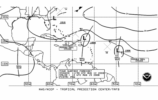
boca wrote:Mike do you think 92L will be a possible threat to Florida next week?

I can help you with that!!!!!!! IMHO I think that it could threaten florida!!!!!!!!!!
0 likes   

HURRICANELONNY
Category 5
Category 5
Posts: 1383
Joined: Wed May 07, 2003 6:48 am
Location: HOLLYWOOD.FL

Re: ATL: Invest 92L - Central Atlantic

#894 Postby HURRICANELONNY » Tue Aug 12, 2008 7:20 am

I don't even look at models when there is an invest. Especially when the is no LLC. Just a broad low. Until a center is located and the shear relaxes. I see not a heck of alot with 92L. You can see the shear on most sat. loops. From the South. Were just getting in to the favorable area of the MJO. Lots more invest coming. :eek:
0 likes   

User avatar
Meso
Category 5
Category 5
Posts: 1609
Age: 38
Joined: Mon Aug 09, 2004 12:14 pm
Location: South Africa
Contact:

#895 Postby Meso » Tue Aug 12, 2008 7:21 am

bvigal, you're right about the dry air.But it's been a combination of both dry air and shear during the past 12 hours or so, as the system was heads into an area of some 30kt shear, which didn't look like it was going to last too long, one was able to see the cloud tops being ripped on the visible loops. Dry air has been a problem with this storm for a while and I have a feeling it will do a lot better once it passed the heaviest area of dry air, and into the lower shear.
0 likes   

Derek Ortt

#896 Postby Derek Ortt » Tue Aug 12, 2008 7:24 am

http://cimss.ssec.wisc.edu/tropic/real- ... 8conv.html

very little low level convergence this morning
0 likes   

User avatar
storms in NC
S2K Supporter
S2K Supporter
Posts: 2338
Joined: Thu Jul 28, 2005 2:58 pm
Location: Wallace,NC 40 miles NE of Wilm
Contact:

Re: ATL: Invest 92L - Central Atlantic

#897 Postby storms in NC » Tue Aug 12, 2008 7:25 am

hurricanefloyd5 wrote:I think if the GFDL model model holds up and this system forms then I think that central and north florida "COULD" be under the gun and IF this happens model pans out!!!!!!!!!!!


Could be but it will change a few times run after run of the models JMO would be a turn on out to sea.
0 likes   

User avatar
caribepr
Category 5
Category 5
Posts: 1794
Joined: Fri Sep 05, 2003 10:43 pm
Location: Culebra, PR 18.33 65.33

Re: ATL: Invest 92L - Central Atlantic

#898 Postby caribepr » Tue Aug 12, 2008 7:25 am

I'd say confusion could be the word of the morning, bvigal! But I do like the models, whether I trust them or not! 8-)
0 likes   

User avatar
HURAKAN
Professional-Met
Professional-Met
Posts: 46086
Age: 38
Joined: Thu May 20, 2004 4:34 pm
Location: Key West, FL
Contact:

#899 Postby HURAKAN » Tue Aug 12, 2008 7:27 am

Loop: http://rammb.cira.colostate.edu/product ... 031815.GIF

Image

Based on the loop above, a circulation, likely ML, is located near the dot.
0 likes   

User avatar
deltadog03
Professional-Met
Professional-Met
Posts: 3580
Joined: Tue Jul 05, 2005 6:16 pm
Location: Macon, GA

#900 Postby deltadog03 » Tue Aug 12, 2008 7:27 am

I agree, no need for recon today.. Just dosn't look like anything is SFC right now, plus too far for the airplanes.
0 likes   


Return to “2008”

Who is online

Users browsing this forum: No registered users and 5 guests