Enzo Aquarius wrote:jlauderdal wrote: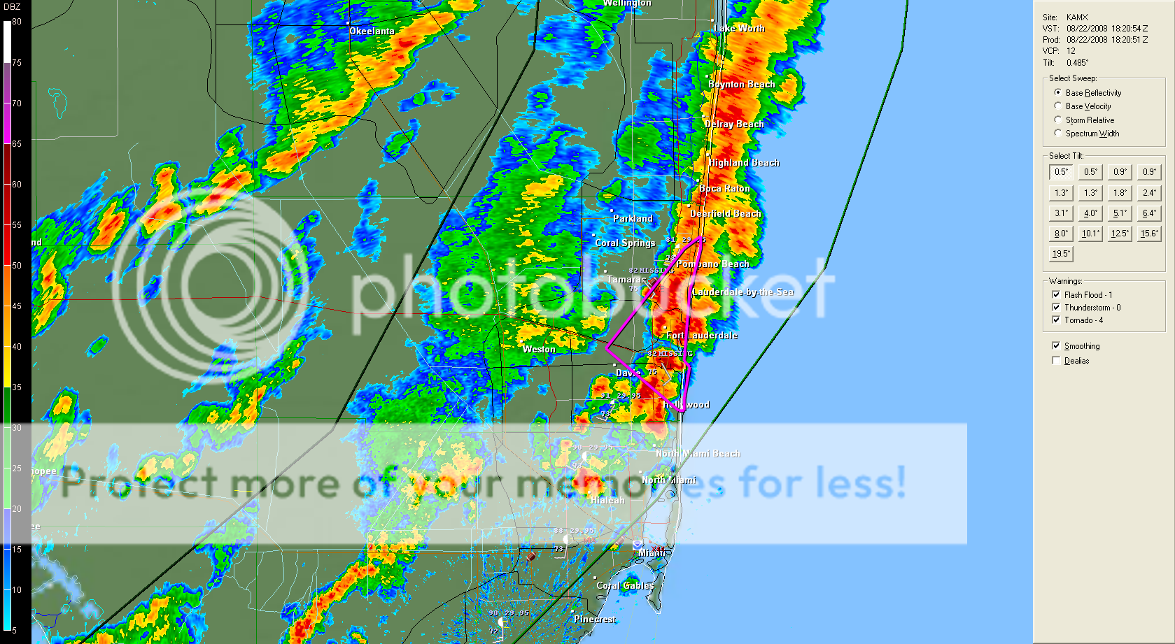
HE NATL WEATHER SVC IN MIAMI HAS ISSUED A
* TORNADO WARNING FOR.
EAST CNTL BROWARD COUNTY IN SO. FL.
* UNTIL 245 PM EDT
* AT 220 PM EDT.NATL WEATHER SVC DOPPLER RADAR INDICATED A
SEVERE THUNDERSTORM CAPABLE OF PRODUCING A TORNADO NEAR PORT
EVERGLADES.MOVING NE AT 22 MPH.
* THE TORNADO WILL BE NEAR.
PORT EVERGLADES.
LAUDERDALE BY THE SEA.
& SURROUNDING COMMUNITIES.
Now that shows you that Fay is really affecting ALL of Florida.
thats for sure,
235 PM EDT FRI AUG 22 2008
.A TORNADO WARNING REMAINS IN EFFECT UNTIL 245 PM EDT FOR EAST
CNTL BROWARD COUNTY.
AT 235 PM EDT.WEATHER SVC DOPPLER RADAR CONTINUED TO INDICATE A
SEVERE THUNDERSTORM CAPABLE OF PRODUCING A TORNADO. THIS STORM WAS
LOCATED NEAR FORT LAUDERDALE BEACH.MOVING NE AT 19 MPH.
THE BROAD ROTATION WITH THIS STORM IS ABOUT TO MOVE OFF THE COAST
JUST NE OF INTERSTATE 595.
SOUTH FL TORNADOES MAY AT TIMES BE SMALL & NARROW BUT THEY ARE
STILL DANGEROUS. THEY CAN EASILY FLIP A VEHICLE OR TRAILER OR CAUSE
LARGE TREES TO FALL. TAKE COVER INSIDE A STURDY BUILDING IMMEDIATELY.


