ATL GUSTAV: Tropical Depression - Discussion

Moderator: S2k Moderators

Message
Author
AlabamaDave
Tropical Storm
Tropical Storm
Posts: 169
Joined: Wed Aug 11, 2004 6:44 pm

Re: Re:

#7501 Postby AlabamaDave » Sat Aug 30, 2008 8:54 pm

wxman57 wrote:
Just Joshing You wrote:What are the pro-mets thinking in regards to the 11 pm advisory? Will it be kept on track or shifted east/west?


20-30 mile east shift. Midway between LFT-BTR.


That would mean a really nasty smack for Louisiana's two largest metro areas.
0 likes   

tolakram
Admin
Admin
Posts: 20036
Age: 62
Joined: Sun Aug 27, 2006 8:23 pm
Location: Florence, KY (name is Mark)

Re: Cat. 4 Hurricane Gustav in Gulf of Mexico

#7502 Postby tolakram » Sat Aug 30, 2008 8:54 pm

Hurricane Jason wrote:ftp://ftp.tpc.ncep.noaa.gov/surge/Latest/g23_key.gif


Wow, thanks, that was a cool graphical animation.
0 likes   

User avatar
Portastorm
Storm2k Moderator
Storm2k Moderator
Posts: 9914
Age: 63
Joined: Fri Jul 11, 2003 9:16 am
Location: Round Rock, TX
Contact:

Re: Cat. 4 Hurricane Gustav in Gulf of Mexico

#7503 Postby Portastorm » Sat Aug 30, 2008 8:54 pm

mawolf3 wrote:Please dont throw eggs at me but anyone know what JB is saying?? Just curious.


What? Are you insane?! :lol: Just kidding ... mawolf3. JB is saying sub 920mb storm at some point prior to landfall and landfall at 91.5 or 92 west.
0 likes   

RL3AO
Moderator-Pro Met
Moderator-Pro Met
Posts: 16308
Joined: Thu Jun 14, 2007 10:03 pm
Location: NC

Re: Cat. 4 Hurricane Gustav in Gulf of Mexico

#7504 Postby RL3AO » Sat Aug 30, 2008 8:55 pm

Just Joshing You wrote:
mawolf3 wrote:Please dont throw eggs at me but anyone know what JB is saying?? Just curious.


I'd trust J.B more than a lot of the pro-mets right now, as they were all forecasting against such a substantial increase, even NHC. He said it is likely for Gus to make a run at Cat. 5 and by golly it did.


NHC has been mentioning possible RI for days now.

"HOWEVER...IT WOULD BE NO SURPRISE IF RAPID
INTENSIFICATION OCCURRED AND GUSTAV BECAME A CATEGORY 4 OR 5
HURRICANE BY 72 HR."

That was Thursday night.
0 likes   

AlabamaDave
Tropical Storm
Tropical Storm
Posts: 169
Joined: Wed Aug 11, 2004 6:44 pm

Re: Cat. 4 Hurricane Gustav in Gulf of Mexico

#7505 Postby AlabamaDave » Sat Aug 30, 2008 8:55 pm

Just Joshing You wrote:
mawolf3 wrote:Please dont throw eggs at me but anyone know what JB is saying?? Just curious.


I'd trust J.B more than a lot of the pro-mets right now, as they were all forecasting against such a substantial increase, even NHC. He said it is likely for Gus to make a run at Cat. 5 and by golly it did.


Well, when you forecast every hurricane to achieve Category 5 status, eventually you will get one right. :roll:
0 likes   

User avatar
ConvergenceZone
Category 5
Category 5
Posts: 5201
Joined: Fri Jul 29, 2005 1:40 am
Location: Northern California

Re:

#7506 Postby ConvergenceZone » Sat Aug 30, 2008 8:56 pm

Dean4Storms wrote:He really took more of a hit crossing Cuber than I thought he would moving as fast as he is moving.


I agree. It doesn't look NEAR as good as it did prior to landfall in Cuba. The convection mass around the eye has diminished quite a bit in size. The intensity of convection has really diminished and the eye is all but gone, except on radar.

http://www.ssd.noaa.gov/goes/flt/t1/avn-l.jpg

With that said, It will be an interesting update in about an hour, but don't be suprised if you see a high cat 2 hurricane. This looks about like it did when it was a cat 2 cane....They mentioned on the weather channel that it weakened over land I think it's pretty obvious, even to a monkey, that it's weakened, the question is, how much? ...I'm guessing, Low Cat 3, but it may only be a high cat 2
0 likes   

User avatar
Just Joshing You
Category 2
Category 2
Posts: 512
Joined: Sat Nov 03, 2007 10:29 am
Location: Nova Scotia

Re: Cat. 4 Hurricane Gustav in Gulf of Mexico

#7507 Postby Just Joshing You » Sat Aug 30, 2008 8:56 pm

RL3AO wrote:
Just Joshing You wrote:
mawolf3 wrote:Please dont throw eggs at me but anyone know what JB is saying?? Just curious.


I'd trust J.B more than a lot of the pro-mets right now, as they were all forecasting against such a substantial increase, even NHC. He said it is likely for Gus to make a run at Cat. 5 and by golly it did.


NHC has been mentioning possible RI for days now.

"HOWEVER...IT WOULD BE NO SURPRISE IF RAPID
INTENSIFICATION OCCURRED AND GUSTAV BECAME A CATEGORY 4 OR 5
HURRICANE BY 72 HR."

That was Thursday night.


They said that the rapid intensification that had transpired was far greater than they anticipated, sorry.
0 likes   

User avatar
vacanechaser
Category 5
Category 5
Posts: 1461
Joined: Wed Dec 03, 2003 9:34 pm
Location: Portsmouth, Va
Contact:

Re: Cat. 4 Hurricane Gustav emerging Western Cuba

#7508 Postby vacanechaser » Sat Aug 30, 2008 8:57 pm

soonertwister wrote:
Ptarmigan wrote:
wxman57 wrote:
Jesse, it's actually a fact. Lance Wood of the Houston-Galveston NWS has done a 10 year study of forecasts in the Gulf to help estimate forecast confidence. He found that in the Gulf, 74% of the time the hurricane tracks right of the forecast.


I remember that with Katrina, Rita, and even Edouard. Even though 74% is substantial, there are the 26% that go left of the forecast and you never know.


I think that the NHC has gotten very much better on track forecasting in the last few years. They do struggle sometimes with intensity and timing, but most of their track forecasts are pretty reliable 48 hours out.


i agree 100%... still, the fact is, they always seem to miss to the left... fact is fact... and it does not matter if it is 20 miles or 100 miles.. it is still to the right of their projected landfall... even though they get better with it, they still have missed... 20 miles or 30 miles, which ever it could be, could make a big difference to the conditions of any given area... they will be better the closer it gets of course... but i am thinking it will fade east... we will see


Jesse V. Bass III
http://www.vastormphoto.com
Hurricane Intercept Research Team
0 likes   

User avatar
HURAKAN
Professional-Met
Professional-Met
Posts: 46086
Age: 38
Joined: Thu May 20, 2004 4:34 pm
Location: Key West, FL
Contact:

#7509 Postby HURAKAN » Sat Aug 30, 2008 8:57 pm

Just Joshing You, that's nothing new. I have nothing against JB but he usually thinks that every storm will be a Cat 5 or very close and will affect the US.

Of course, after being wrong several times, he once get one right.
0 likes   

CrazyC83
Professional-Met
Professional-Met
Posts: 34092
Joined: Tue Mar 07, 2006 11:57 pm
Location: Deep South, for the first time!

Re: Cat. 4 Hurricane Gustav in Gulf of Mexico

#7510 Postby CrazyC83 » Sat Aug 30, 2008 8:57 pm

This seems to be the most similar storm from my view (I disagree on the intensity though - it was probably much stronger in the Gulf - this was 1856 after all):

Image
0 likes   

tolakram
Admin
Admin
Posts: 20036
Age: 62
Joined: Sun Aug 27, 2006 8:23 pm
Location: Florence, KY (name is Mark)

Re: Cat. 4 Hurricane Gustav emerging Western Cuba

#7511 Postby tolakram » Sat Aug 30, 2008 8:58 pm

wxman57 wrote:
vacanechaser wrote:
well i will say this, when the hurricane center misses, they miss left.... meaning that the storms usually fade east or to the right of their forecast track... so, in my opinion, new orleans is in a bad way for now...


Jesse V. Bass III
http://www.vastormphoto.com
Hurricane Intercept Research Team


Jesse, it's actually a fact. Lance Wood of the Houston-Galveston NWS has done a 10 year study of forecasts in the Gulf to help estimate forecast confidence. He found that in the Gulf, 74% of the time the hurricane tracks right of the forecast.


We've been seeing Gustav right of the track all day. We had the so called 'wobble' wars a while back and I pointed out that rather than wobble it was continually running east. Individually each error is small but won't they start to add up? Every time it misses to the right of the forecast point the angle of approach to LA becomes a little steeper.

Some actual meteorology would help me out here. :)
0 likes   

User avatar
Just Joshing You
Category 2
Category 2
Posts: 512
Joined: Sat Nov 03, 2007 10:29 am
Location: Nova Scotia

Re:

#7512 Postby Just Joshing You » Sat Aug 30, 2008 8:58 pm

HURAKAN wrote:Just Joshing You, that's nothing new. I have nothing against JB but he usually thinks that every storm will be a Cat 5 or very close and will affect the US.

Of course, after being wrong several times, he once get one right.


I'm not the only one that "defended" him. Even Air Force Met did... AFM made quite the alarming post earlier.
0 likes   

User avatar
MGC
S2K Supporter
S2K Supporter
Posts: 5907
Joined: Sun Mar 23, 2003 9:05 pm
Location: Pass Christian MS, or what is left.

Re: Cat. 4 Hurricane Gustav in Gulf of Mexico

#7513 Postby MGC » Sat Aug 30, 2008 8:58 pm

Here is an excellent article concerning the surge of Hurricane Betsy in SE Louisiana. Since Gustav will be approaching the Louisiana coast from a near identical angle and intensity this could be what will transpire.....MGC

http://docs.lib.noaa.gov/rescue/mwr/096/mwr-096-02-0118.pdf
0 likes   

User avatar
mawolf3
Tropical Low
Tropical Low
Posts: 31
Joined: Sat Jul 09, 2005 11:36 pm
Location: Tampa, FL

Re: Cat. 4 Hurricane Gustav in Gulf of Mexico

#7514 Postby mawolf3 » Sat Aug 30, 2008 9:02 pm

Yes it does appear Gustav is dead on track. Really hasnt wavered at all.
0 likes   

User avatar
Portastorm
Storm2k Moderator
Storm2k Moderator
Posts: 9914
Age: 63
Joined: Fri Jul 11, 2003 9:16 am
Location: Round Rock, TX
Contact:

Re: Cat. 4 Hurricane Gustav in Gulf of Mexico

#7515 Postby Portastorm » Sat Aug 30, 2008 9:02 pm

Gustav continues on its (overall) northwest track. Here is a good loop and you can also see the ULL cutting off in the WGOM. The high over the Great Lakes looks stout but doesn't seem to be building south, either.

http://www.atmos.washington.edu/~ovens/loops/wxloop.cgi?wv_east_enhanced+12+-update+3600
0 likes   

AlabamaDave
Tropical Storm
Tropical Storm
Posts: 169
Joined: Wed Aug 11, 2004 6:44 pm

Re: Cat. 4 Hurricane Gustav in Gulf of Mexico

#7516 Postby AlabamaDave » Sat Aug 30, 2008 9:03 pm

MGC wrote:Here is an excellent article concerning the surge of Hurricane Betsy in SE Louisiana. Since Gustav will be approaching the Louisiana coast from a near identical angle and intensity this could be what will transpire.....MGC

http://docs.lib.noaa.gov/rescue/mwr/096/mwr-096-02-0118.pdf


It's amazing how close in intensity and track Gustav is projected to mimic Betsy. Betsy flooded many of the same sections of N.O. as Katrina: 9th Ward, St. Bernard, etc.
0 likes   

User avatar
vacanechaser
Category 5
Category 5
Posts: 1461
Joined: Wed Dec 03, 2003 9:34 pm
Location: Portsmouth, Va
Contact:

Re: Cat. 4 Hurricane Gustav emerging Western Cuba

#7517 Postby vacanechaser » Sat Aug 30, 2008 9:04 pm

tolakram wrote:
wxman57 wrote:
vacanechaser wrote:
well i will say this, when the hurricane center misses, they miss left.... meaning that the storms usually fade east or to the right of their forecast track... so, in my opinion, new orleans is in a bad way for now...


Jesse V. Bass III
http://www.vastormphoto.com
Hurricane Intercept Research Team


Jesse, it's actually a fact. Lance Wood of the Houston-Galveston NWS has done a 10 year study of forecasts in the Gulf to help estimate forecast confidence. He found that in the Gulf, 74% of the time the hurricane tracks right of the forecast.


We've been seeing Gustav right of the track all day. We had the so called 'wobble' wars a while back and I pointed out that rather than wobble it was continually running east. Individually each error is small but won't they start to add up? Every time it misses to the right of the forecast point the angle of approach to LA becomes a little steeper.

Some actual meteorology would help me out here. :)


its not so much the wobble wars or wobbles adding up... it will wobble back the other way and make up for it possibly... its just the fact that before landfall, they seem to make a right turn of sorts, going to the right of the forecast track.. to me, this will be no different... this will put the rfq right over n.o. .. that is if it does not shift furth before landfall..

we are not talking about a shift east early either.. we are talking about almost lst minute.. hour or 2 or so before landfall is what i am getting at... so we will see


Jesse V. Bass III
http://www.vastormphoto.com
Hurricane Intercept Research Team
0 likes   

HurricaneRobert
Category 3
Category 3
Posts: 812
Joined: Fri May 18, 2007 9:31 pm

Re: Cat. 4 Hurricane Gustav in Gulf of Mexico

#7518 Postby HurricaneRobert » Sat Aug 30, 2008 9:06 pm

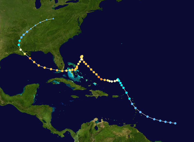
Hanna's model runs remind me a lot of Betsy's track:

Image
0 likes   

6SpeedTA95
Category 5
Category 5
Posts: 1206
Joined: Wed Oct 19, 2005 3:25 pm
Location: Oklahoma
Contact:

#7519 Postby 6SpeedTA95 » Sat Aug 30, 2008 9:07 pm

Guys here's a map of the oil infrastructure and katrina's footprint, ignore katrina and just look at the infrastructure, if this thing turns westerly as it approaches the shorline or skirts the coast a hundred miles or more it would be devastating to the nation and send prices through the roof.

http://tonto.eia.doe.gov/oog/special/im ... _large.gif
0 likes   

User avatar
mawolf3
Tropical Low
Tropical Low
Posts: 31
Joined: Sat Jul 09, 2005 11:36 pm
Location: Tampa, FL

Re: Cat. 4 Hurricane Gustav in Gulf of Mexico

#7520 Postby mawolf3 » Sat Aug 30, 2008 9:08 pm

Well Hurricanes DO seem to respond to encountering land. Hardly ever just barrel on through without hesitation or left-right movement.
0 likes   


Return to “2008”

Who is online

Users browsing this forum: No registered users and 9 guests