
Selected rainfall totals for 24 hrs ending at 8am this morning:-
Ft Lauderdale Executive Airport 4.29"
Ft Lauderdale Airport 1.37" (24hr total for Mar 21)**new record**
Hollywood 3.37"
Pembroke Pines 1.09"
Pompano Beach 1.02"
Boynton Beach 0.74"
Ft Pierce 0.58"
Vero Beach 0.44"
Marathon Airport 0.43"
St Lucie County Airport 0.36"
Tamiami Airport 0.26"
West Palm Beach 0.10"
Miami Int'l Airport 0.05"
-justin-
Florida Weather
Moderator: S2k Moderators
Forum rules

The posts in this forum are NOT official forecast and should not be used as such. They are just the opinion of the poster and may or may not be backed by sound meteorological data. They are NOT endorsed by any professional institution or STORM2K.
-
Tampa Bay Hurricane

- Category 5

- Posts: 5597
- Age: 38
- Joined: Fri Jul 22, 2005 7:54 pm
- Location: St. Petersburg, FL
-
JonathanBelles
- Professional-Met

- Posts: 11430
- Age: 35
- Joined: Sat Dec 24, 2005 9:00 pm
- Location: School: Florida State University (Tallahassee, FL) Home: St. Petersburg, Florida
- Contact:
-
gatorcane

- S2K Supporter

- Posts: 23708
- Age: 48
- Joined: Sun Mar 13, 2005 3:54 pm
- Location: Boca Raton, FL
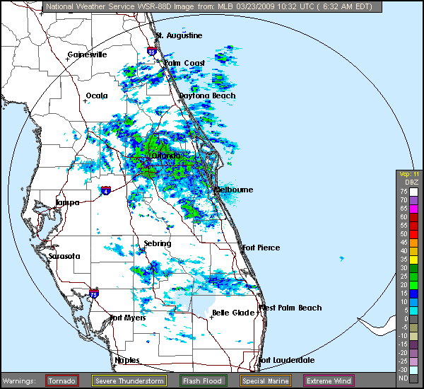
yep I see those smoke plumes and also the widely scattered showers moving briskly with a low-level east windflow. Right now they are holding together pretty well as they move through Central Polk County headed for Tampa Bay.
But -- its likely they will poof just before reaching the metro areas of Tampa unfortunately. The airmass is quite dry along the West Central Coast of FL. A shortwave enters the picture tomorrow though increasing rain chances according to NWS. I will stay conservative and only suggest a 20% chance for all of West Central FL.
But -- its likely they will poof just before reaching the metro areas of Tampa unfortunately. The airmass is quite dry along the West Central Coast of FL. A shortwave enters the picture tomorrow though increasing rain chances according to NWS. I will stay conservative and only suggest a 20% chance for all of West Central FL.
0 likes
-
JonathanBelles
- Professional-Met
- Posts: 11430
- Age: 35
- Joined: Sat Dec 24, 2005 9:00 pm
- Location: School: Florida State University (Tallahassee, FL) Home: St. Petersburg, Florida
- Contact:

-
Tampa Bay Hurricane
- Category 5
- Posts: 5597
- Age: 38
- Joined: Fri Jul 22, 2005 7:54 pm
- Location: St. Petersburg, FL
-
Tampa Bay Hurricane
- Category 5
- Posts: 5597
- Age: 38
- Joined: Fri Jul 22, 2005 7:54 pm
- Location: St. Petersburg, FL
-
Tampa Bay Hurricane
- Category 5
- Posts: 5597
- Age: 38
- Joined: Fri Jul 22, 2005 7:54 pm
- Location: St. Petersburg, FL
-
Tampa Bay Hurricane
- Category 5
- Posts: 5597
- Age: 38
- Joined: Fri Jul 22, 2005 7:54 pm
- Location: St. Petersburg, FL


-
Tampa Bay Hurricane
- Category 5
- Posts: 5597
- Age: 38
- Joined: Fri Jul 22, 2005 7:54 pm
- Location: St. Petersburg, FL
-
Tampa Bay Hurricane
- Category 5
- Posts: 5597
- Age: 38
- Joined: Fri Jul 22, 2005 7:54 pm
- Location: St. Petersburg, FL
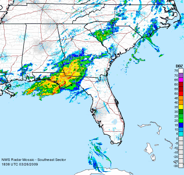
Re: Florida Weather Thread: SLGT risk D1-3 NFL
KBDI continues to show increased values over most of the state during the past few days...

U.S. Monitor Drought update for florida....we had a good week for rain in fort lauderdale...rest of the state didn't fare as well.
Heavy rain fell in southeastern Florida, mainly in and near some of the east coast cities, but largely bypassed the remainder of the parched peninsula. March 17-21 rainfall totaled 2.81 inches in Ft. Lauderdale, with nearby amounts locally ranging from 6 to 10 inches. However, Ft. Lauderdale recently completed its driest winter on record, with a December-February rainfall total of just 0.39 inch (5% of normal). Nevertheless, some severe drought (D2) was removed from the hardest-hit areas of southeastern Florida, replaced by abnormal dryness and moderate drought (D0 and D1).
Elsewhere, there was some modest expansion of severe drought (D2) deeper into interior southern Florida, including all of Lake Okeechobee. The level of Lake Okeechobee has been falling steadily since a few weeks after the August 2008 passage of Tropical Storm Fay, and the lake’s average surface elevation on March 24 stood at 12.32 feet (about 2 feet below the 1965-2007 average for the date).
0 likes

-
Tampa Bay Hurricane
- Category 5
- Posts: 5597
- Age: 38
- Joined: Fri Jul 22, 2005 7:54 pm
- Location: St. Petersburg, FL
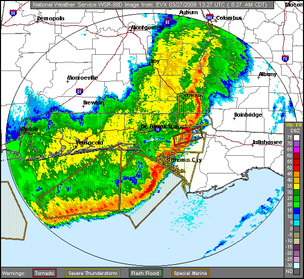
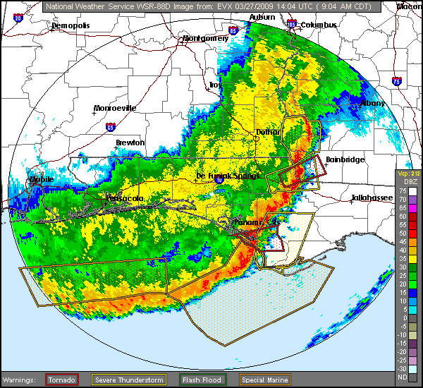
Tampa Bay Area- Risk of Severe Weather:
http://forecast.weather.gov/product.php ... glossary=1
DURING SATURDAY NIGHT THROUGH EARLY SUNDAY RAIN CHANCES WILL BE ON THE
INCREASE ACROSS THE FORECAST AREA AS THE AFOREMENTIONED COLD FRONT SWEEPS
SOUTHEAST THROUGH THE REGION. INCREASING MOISTURE/INSTABILITY ALONG AND
AHEAD OF THE FRONT COMBINED WITH INCREASING LARGE SCALE ASCENT FROM STRONG
JET DYNAMICS ALOFT WILL LIKELY SUPPORT A SQUALL LINE WITH SOME STRONG
TO SEVERE STORMS A POSSIBILITY AS INCREASING LOW/MID LEVEL WIND FIELDS
(45-50 KNOT LOW LEVEL JET) PROVIDES AMPLE DEEP LAYER SHEAR FOR STORM
ROTATION/SUPERCELLS WITH DAMAGING WINDS. ALTHOUGH MODEL SOUNDING WIND
PROFILES APPEAR FAIRLY UNIDIRECTIONAL CAN NOT RULE OUT THE RISK OF SPIN
UPS OR TORNADOES AS WELL AND WILL HIT ON ALL OF THIS IN THE HWO LATER
THIS MORNING. IN ADDITION TO THE SEVERE THREAT SOME BRIEF LOCALLY HEAVY
RAINFALL WILL ALSO BE POSSIBLE.
http://forecast.weather.gov/showsigwx.p ... er+Outlook
...THUNDERSTORM IMPACT...
A COLD FRONT IS FORECAST TO APPROACH AND MOVE THROUGH WEST CENTRAL
AND SOUTHWEST FLORIDA SATURDAY NIGHT AND SUNDAY. THE FRONT WILL BE
PRECEDED BY SCATTERED SHOWERS AND THUNDERSTORMS SATURDAY NIGHT AND
EARLY ON SUNDAY...THEN DRIER AIR WILL MOVE INTO THE REGION ON MONDAY
IN THE WAKE OF THE FRONT. SUFFICIENT MOISTURE AND INSTABILITY ALONG
AND AHEAD OF THE FRONT ALONG WITH INCREASING WINDS IN THE LOWER
AND MID LEVELS OF THE ATMOSPHERE MAY SUPPORT SOME STRONG TO SEVERE
STORMS WITH DAMAGING WINDS AND OR TORNADOES. IN ADDITION TO THE SEVERE
WEATHER THREAT BRIEF LOCALLY HEAVY RAIN AND OCCASIONAL LIGHTNING
STRIKES WILL WILL BE POSSIBLE. RESIDENTS AND VISITORS OF WEST CENTRAL
AND SOUTHWEST FLORIDA SHOULD REMAIN ALERT TO RAPIDLY CHANGING WEATHER
CONDITIONS SATURDAY NIGHT AND SUNDAY. IF THREATENING WEATHER APPROACHES
YOUR LOCATION MOVE INDOORS IMMEDIATELY
Winds could gust to near tropical storm force along the coast:
Today: Partly sunny, with a high near 80. Windy, with a south wind between 21 and 26 mph, with gusts as high as 37 mph.
Tonight: Mostly cloudy, with a low around 71. South wind between 11 and 14 mph, with gusts as high as 20 mph.
Saturday: Partly sunny, with a high near 82. Windy, with a south wind 15 to 18 mph increasing to between 23 and 26 mph. Winds could gust as high as 37 mph.
http://forecast.weather.gov/MapClick.ph ... &map.y=145
Last edited by Tampa Bay Hurricane on Fri Mar 27, 2009 9:13 am, edited 2 times in total.
0 likes
Return to “USA & Caribbean Weather”
Who is online
Users browsing this forum: No registered users and 40 guests