

Florida Weather
Moderator: S2k Moderators
Forum rules

The posts in this forum are NOT official forecast and should not be used as such. They are just the opinion of the poster and may or may not be backed by sound meteorological data. They are NOT endorsed by any professional institution or STORM2K.
-
Tampa Bay Hurricane

- Category 5

- Posts: 5597
- Age: 38
- Joined: Fri Jul 22, 2005 7:54 pm
- Location: St. Petersburg, FL
Still very windy- I just drove over the Gandy Bridge...about a half
hour ago
Winds look SW 25 with G 40+ easily, though there are numerous wunderstations
with wind gusts to 55 mph earlier in Tampa Bay. The highest wind was with
the squall early this morning that gust knocked down 2 large trees in my
neighborhood and littered the roads with many branches.
hour ago
Winds look SW 25 with G 40+ easily, though there are numerous wunderstations
with wind gusts to 55 mph earlier in Tampa Bay. The highest wind was with
the squall early this morning that gust knocked down 2 large trees in my
neighborhood and littered the roads with many branches.
0 likes
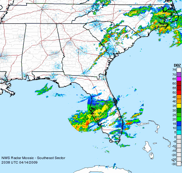
very cool blast this morning with the squall line. i live about 10 miles south of the tornado activity that took place in Pasco county, and near the southern end of the bow echo that produced that activity. we probably had a wind gust just of 50 to 55 mph with the line that took down some tree branches in the area although places just north of here had higher winds (60 mph in tarpon springs and 68 mph in odessa) so while i was in a pretty good wind zone, i was south of the highest winds. incidentally, the southern extent of the bow echo in pinellas county ran at about the state road 580 zone, or north of a line from Dunedin to Oldsmar. South of there, there doesn't appear to have been much wind. very cool overall, reminded me of a midwest derecho event (except on a less damaging scale in my neighborhood).
0 likes
Re: Florida Weather Thread:warming, have/have nots in rain conti
Front sputtered on approach. Only 1/20th of an inch in the bucket.
0 likes

Re: Florida Weather Thread:warming, have/have nots in rain conti
Pasco County tornado damage surveys.
http://www.srh.noaa.gov/images/tbw/pdf/ ... il2009.pdf
I am a few miles to the north and east of the Trinity tornado. We got lucky once again.
http://www.srh.noaa.gov/images/tbw/pdf/ ... il2009.pdf
I am a few miles to the north and east of the Trinity tornado. We got lucky once again.
0 likes
Re: Florida Weather Thread:warming, have/have nots in rain conti
Very warm day in south florida, though I am a bit suspect (to say the least!) of the reading coming out of Opa Locka at the 12pm update from NWS Miami
W PALM BEACH PTSUNNY 80
FT LAUDER-EXEC MOSUNNY 82
FT LAUDERDALE PTSUNNY 84
POMPANO BEACH PTSUNNY 81
PEMBROKE PINES SUNNY 84
OPA LOCKA MOSUNNY 102 HX 109
MIAMI PTSUNNY 86
WEST KENDALL MOSUNNY 88
HOMESTEAD MOSUNNY 85
W PALM BEACH PTSUNNY 80
FT LAUDER-EXEC MOSUNNY 82
FT LAUDERDALE PTSUNNY 84
POMPANO BEACH PTSUNNY 81
PEMBROKE PINES SUNNY 84
OPA LOCKA MOSUNNY 102 HX 109
MIAMI PTSUNNY 86
WEST KENDALL MOSUNNY 88
HOMESTEAD MOSUNNY 85
0 likes
Re: Florida Weather Thread:warming, have/have nots in rain conti
Yep, another really hot day for April in south florida...just shy of the records.
Miami hit 91 (record was 93) and Fort Lauderdale hit 92 (recrod was 93).
That makes 4 days at 90+ in Miami this month so far....3 of which were record highs. Also been 3 days with a high of 89 this month. Month is running about 2.5 deg above normal to date, and that includes the cool snap we had last week! Without that, the month would be more like 5 or 6 deg above normal to date.
0 likes
-
DESTRUCTION5

- Category 5
- Posts: 4430
- Age: 44
- Joined: Wed Sep 03, 2003 11:25 am
- Location: Stuart, FL
Re: Florida Weather Thread:warming, have/have nots in rain conti
jinftl wrote:Yep, another really hot day for April in south florida...just shy of the records.
Miami hit 91 (record was 93) and Fort Lauderdale hit 92 (recrod was 93).
That makes 4 days at 90+ in Miami this month so far....3 of which were record highs. Also been 3 days with a high of 89 this month. Month is running about 2.5 deg above normal to date, and that includes the cool snap we had last week! Without that, the month would be more like 5 or 6 deg above normal to date.
Im not sure what the winds were last night up here in MC but they had to be in the 40's easy...
0 likes
-
Tampa Bay Hurricane
- Category 5
- Posts: 5597
- Age: 38
- Joined: Fri Jul 22, 2005 7:54 pm
- Location: St. Petersburg, FL
Re: Florida Weather Thread:warming, have/have nots in rain conti
At my house:
Partly Cloudy, Windy, 68*F, Wind NE 20 G 30 mph
Partly Cloudy, Windy, 68*F, Wind NE 20 G 30 mph
0 likes
Re: Florida Weather Thread:warming, have/have nots in rain conti
That's it. Permanent warm now. GOM warming. April is one of the best months here. Warm sun, cool breezes in sunshine today.
0 likes
-
Tampa Bay Hurricane
- Category 5
- Posts: 5597
- Age: 38
- Joined: Fri Jul 22, 2005 7:54 pm
- Location: St. Petersburg, FL
Re: Florida Weather Thread:warming, have/have nots in rain conti
Water temps really coming up on the SW coast...26-28 deg C (78-82 deg F). Almost warm enough for Floridians to go in (personally I would say 84 deg is optimal for taking a comfy dip)!!!

Sanibel wrote:That's it. Permanent warm now. GOM warming. April is one of the best months here. Warm sun, cool breezes in sunshine today.
0 likes
-
gatorcane

- S2K Supporter

- Posts: 23708
- Age: 48
- Joined: Sun Mar 13, 2005 3:54 pm
- Location: Boca Raton, FL
Re: Florida Weather Thread:warming, have/have nots in rain conti
Here is another view of the SSTs. Jinftl you are absolutely right as SSTs are rising fairly quickly in the SE GOM off the SW Coast of FL.

0 likes
Re: Florida Weather Thread:warming, have/have nots in rain conti
DROUGHT INFORMATION STATEMENT
NATIONAL WEATHER SERVICE MIAMI FL
430 AM EDT FRI APR 17 2009
...EXTREME DROUGHT CONDITIONS OVER PORTIONS OF EVERGLADES...
...SEVERE DROUGHT CONDITIONS OVER REST OF SOUTH FLORIDA...
...FIRE DANGER REMAINS SEVERE TO EXTREME AREA WIDE...
SYNOPSIS...
A COUPLE OF COLD FRONTS HAVE MOVED THROUGH SOUTH FLORIDA DURING THE
PAST THREE WEEKS. HOWEVER THESE FRONTS WERE RELATIVELY DRY IN
NATURE, RESULTING IN LITTLE SIGNIFICANT RAINFALL ACROSS THE REGION.
MOST AREAS ONLY SAW A TRACE TO TENTH OF AN INCH OF RAIN DURING THIS
TIME, EXCEPT FOR PORTIONS OF METRO PALM BEACH AND METRO MIAMI-DADE
COUNTIES WHERE RAINFALL AMOUNTS RANGED FROM A QUARTER TO A HALF OF
AN INCH. ISOLATED AREAS OF CENTRAL METRO PALM BEACH COUNTY SAW
AMOUNTS OF UP TO AN INCH.
THE LACK OF SIGNIFICANT RAINFALL OVER SOUTH FLORIDA SINCE THE LAST
WEEK OF MARCH MEANS THAT MOST OF THE EVERGLADES OF SOUTH FLORIDA
HAVE BEEN PLACED IN AN EXTREME DROUGHT STATUS (D3), WITH THE REST OF
SOUTH FLORIDA IN A SEVERE DROUGHT STATUS (D2). AREAS OF PALM BEACH
AND BROWARD COUNTIES THAT RECEIVED PLENTY OF RAINFALL IN MID-MARCH
HAVE SINCE SEEN LITTLE IN THE WAY OF RAIN, THEREFORE THESE AREAS
HAVE BEEN INCLUDED WITH THE REST OF THE EASTERN METRO AREAS IN THE
SEVERE DROUGHT STATUS.
HYDROLOGIC IMPACTS...
WELLS ACROSS THE INTERIOR AND WEST COAST METRO AREAS OF SOUTH
FLORIDA WERE STARTING TO FALL INTO THE LOWEST 10 PERCENT OF NORMAL
LEVELS FOR THIS TIME OF YEAR. WELLS ACROSS THE EAST COAST METRO
AREAS HAVE STARTED TO FALL INTO THE 10 TO 30 PERCENT OF NORMAL
LEVELS FOR THIS TIME OF YEAR.
THE UNDERGROUND RESERVOIRS ALONG THE EAST AND WEST COAST METRO AREAS
WERE RUNNING AT 10 TO 30 PERCENT BELOW NORMAL LEVELS FOR THIS TIME
OF YEAR. THE LEVEL OF LAKE OKEECHOBEE WAS 11.69 FEET, WHICH IS ABOUT
2.3 FEET BELOW NORMAL FOR THIS TIME OF THE YEAR. FISHEATING CREEK
WAS AROUND 0.15 FEET WHICH WAS 3 PERCENT OF THE NORMAL LEVEL FOR THIS
TIME OF YEAR.
FIRE DANGER IMPACTS...
THE KEETCH-BYRAM DROUGHT INDEX (KBDI) HAS INCREASED SINCE LATE MARCH
DUE TO THE LACK OF RAINFALL OVER THE AREA. THE ENTIRE EAST COAST
METRO AREAS, AS WELL AS GLADES COUNTY, HAVE INCREASED TO THE 650 TO
700 RANGE, WHILE COLLIER AND HENDRY COUNTIES REMAINED IN THE 700 TO
750 RANGE. THIS KEEPS THE FIRE DANGER IN THE SEVERE RANGE FOR MOST
OF SOUTH FLORIDA, EXCEPT FOR GLADES AND HENDRY COUNTIES WHERE THEY
ARE IN THE EXTREME RANGE. KBDI VALUES OF 650 OR HIGHER ARE
INDICATIVE OF DESERT-LIKE DRYNESS.
OUTLOOK...
HIGH PRESSURE WILL CONTROL SOUTH FLORIDA`S WEATHER THIS WEEKEND,
BEFORE A COLD FRONT MOVES INTO SOUTH FLORIDA EARLY NEXT WEEK. THIS
WILL KEEP THE AREA DRY THIS WEEKEND, BEFORE ALLOWING FOR A SLIGHT
CHANCE OF SHOWERS AND THUNDERSTORMS EARLY NEXT WEEK.
THE CLIMATE PREDICTION CENTER`S PRECIPITATION OUTLOOK FOR THE NEXT
14 DAYS IS FOR AN INCREASED LIKELIHOOD OF BELOW NORMAL RAINFALL.
THIS IS FAIRLY TYPICAL FOR THE LATTER PART OF THE DRY SEASON WHICH
ENCOMPASSES THE MONTH OF APRIL. THE CLIMATE PREDICTION CENTER`S
LONGER TERM OUTLOOK FOR MAY THROUGH JUNE SHOWS AN EQUAL CHANCE OF
SEEING ABOVE OR BELOW NORMAL RAINFALL. IT SHOULD BE EMPHASIZED THAT
MOST OF MAY TYPICALLY FALLS IN THE SOUTH FLORIDA DRY SEASON, AND
THUS THE REGION IS PRONE TO EXTENDED DRY SPELLS. THESE EXTENDED DRY
SPELLS, COMBINED WITH RISING TEMPERATURES, MAY LEAD TO INCREASING
FIRE DANGER OVER THE NEXT SEVERAL WEEKS BEFORE THE RAINY SEASON GETS
UNDERWAY IN LATE MAY OR EARLY JUNE.
$$
BAXTER/MOLLEDA
http://www.srh.noaa.gov/productview.php?pil=DGTMFL
0 likes
-
Tampa Bay Hurricane
- Category 5
- Posts: 5597
- Age: 38
- Joined: Fri Jul 22, 2005 7:54 pm
- Location: St. Petersburg, FL
Nice thunderstorm complex in the Gulf
http://www.ssd.noaa.gov/goes/east/gmex/loop-rb.html
South Florida has a 50% chance of rain for Tuesday. With a
SW flow the SE coast of Florida might get some brief thunderstorms
Monday and Tuesday.
Areas North of Tampa Bay may see some thunderstorms tonight/tomorrow.
http://www.ssd.noaa.gov/goes/east/gmex/loop-rb.html
South Florida has a 50% chance of rain for Tuesday. With a
SW flow the SE coast of Florida might get some brief thunderstorms
Monday and Tuesday.
Areas North of Tampa Bay may see some thunderstorms tonight/tomorrow.
0 likes
-
Tampa Bay Hurricane
- Category 5
- Posts: 5597
- Age: 38
- Joined: Fri Jul 22, 2005 7:54 pm
- Location: St. Petersburg, FL
http://www.ssd.noaa.gov/goes/east/gmex/loop-rb.html
A lot of unstable energy is visible over Mexico's east
coast and surging into the Gulf towards the Florida
Panhandle. Analyzing the upper level conditions-click
upper level winds- there are upper level winds of
50-65 knots. While the air is still dry over Florida, these
strong upper level winds and extensive gulf moisture
canopy may support isolated stronger thunderstorms over the
next 48 hours over Florida. However, dry air could still limit
storm activity. We will see what happens.
The earlier cluster over the Northeast Gulf has
weakened slightly, but has sent out a strong
outflow boundary that is producing thicker clouds closer
to Florida's west coast. However, there is no rain yet with
these clouds.
We can only hope the very high moisture in the central gulf
really taps into the fast moving upper level winds and
explodes into an area of heavy rain. This HAS NOT happened,
and the chances for heavy rain are NOT high,
but we can hope for it given the current extreme drought in South
Florida.
The reason I am posting this analysis is because there is a **slight**
chance for a cluster of heavy rain and cold cloud tops to develop.
Hopefully these conditions can be useful.
0 likes
-
Tampa Bay Hurricane
- Category 5
- Posts: 5597
- Age: 38
- Joined: Fri Jul 22, 2005 7:54 pm
- Location: St. Petersburg, FL
-
Tampa Bay Hurricane
- Category 5
- Posts: 5597
- Age: 38
- Joined: Fri Jul 22, 2005 7:54 pm
- Location: St. Petersburg, FL
Dry Air really evaporating everything:
http://www.ssd.noaa.gov/goes/east/gmex/loop-rb.html
Cluster in the Gulf is not impressive anymore. For the 60% rain
chance to verify there would have to be a rain
complex develop and maintain itself. This is not likely.
I might be premature- but I am going to call this a BUST.
Nice complex in the BOC...now it just needs to head this way
(probably won't happen, or will dry out before getting very
far)
0 likes
Return to “USA & Caribbean Weather”
Who is online
Users browsing this forum: No registered users and 33 guests