

Florida Weather
Moderator: S2k Moderators
Forum rules

The posts in this forum are NOT official forecast and should not be used as such. They are just the opinion of the poster and may or may not be backed by sound meteorological data. They are NOT endorsed by any professional institution or STORM2K.

Re: Florida Weather Thread: Rainy season is here
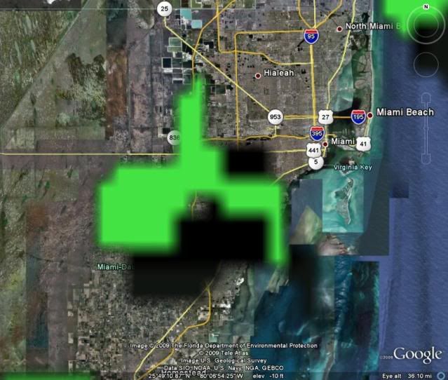
WOW! look at that radar.
http://radar.weather.gov/radar.php?rid= ... 11&loop=no
Wish I knew how to save the pic so you could see it here. Can't even get it to work with print screen.
weather.gov
National Weather Service
Watches, Warnings & Advisories
Local weather forecast by "City, St" or zip code
3 products issued by NWS for: Loxahatchee FL
--------------------------------------------------------------------------------
Special Weather Statement
SPECIAL WEATHER STATEMENT
NATIONAL WEATHER SERVICE MIAMI FL
437 PM EDT MON JUN 8 2009
FLZ067-068-070>073-075-168-082130-
MAINLAND MONROE FL-INLAND PALM BEACH COUNTY FL-
METRO PALM BEACH COUNTY FL-COASTAL PALM BEACH COUNTY FL-
INLAND COLLIER COUNTY FL-INLAND BROWARD COUNTY FL-
METRO BROWARD COUNTY FL-INLAND MIAMI-DADE FL-
437 PM EDT MON JUN 8 2009
...STRONG THUNDERSTORMS MOVING ACROSS CENTRAL PALM BEACH AND WESTERN
COLLIER COUNTIES...
AT 432 PM EDT...NATIONAL WEATHER SERVICE DOPPLER RADAR INDICATED
STRONG THUNDERSTORMS ALONG A LINE EXTENDING FROM 5 MILES NORTHWEST OF
NORTH PALM BEACH GENERAL AIRPORT TO 6 MILES SOUTHEAST OF HOLEY LAND
WILDLIFE MANAGEMENT AREA TO 4 MILES SOUTH OF DADE-COLLIER TRAINING
AIRPORT...MOVING EAST AT 15 MPH. THESE STORMS WILL MOVE INTO
NORTHWEST MIAMI DADE COUNTY SHORTLY.
THESE STORMS WILL AFFECT...
CALOOSA...
WEST BROWARD REC. AREA ON ALLIGATOR ALLEY...
FORTYMILE BEND...
JUPITER FARMS...
THE ACREAGE...
INTERSECTION ALLIGATOR ALLEY AND MIAMI CANAL...
AND SURROUNDING COMMUNITIES.
FREQUENT TO EXCESSIVE LIGHTNING...GUSTY WINDS TO 50 MPH...PEA-SIZED
HAIL...TORRENTIAL DOWNPOURS...OR A COMBINATION OF THESE ARE POSSIBLE.
LIGHTNING IS THE NUMBER ONE WEATHER RELATED KILLER IN FLORIDA. TREES
AND OPEN SHELTERS OFFER NO PROTECTION. WIND GUSTS OF UP TO 50 MPH CAN
DOWN SMALL TREE LIMBS AND BRANCHES...AND BLOW AROUND UNSECURED SMALL
OBJECTS. SEEK SHELTER IN A SAFE BUILDING UNTIL THE STORM PASSES.
RESIDENTS NEAR THE PATH OF THESE STORMS SHOULD REMAIN ON THE ALERT
FOR ADDITIONAL STATEMENTS AND POSSIBLE WARNINGS.
LAT...LON 2573 8059 2575 8104 2642 8080 2695 8039
2694 8008
TIME...MOT...LOC 2036Z 277DEG 12KT 2690 8027 2634 8067
2580 8088
$$
GR
--------------------------------------------------------------------------------
Short Term Forecast
SHORT TERM FORECAST
NATIONAL WEATHER SERVICE MIAMI FL
403 PM EDT MON JUN 8 2009
FLZ066-067-070-071-082115-
HENDRY-INLAND PALM BEACH-INLAND COLLIER-INLAND BROWARD-
403 PM EDT MON JUN 8 2009
.NOW...
THROUGH 5 PM...A LINE OF SHOWERS AND THUNDERSTORMS WILL EXTEND
FROM NORTH CENTRAL PALM BEACH TO SOUTHEAST HENDRY AND EASTERN
COLLIER COUNTIES. THIS LINE OF STORMS WILL PRODUCE WIND GUSTS UP
TO 40 MPH WITH SOME SMALL HAIL AND FREQUENT LIGHTNING. MOVEMENT
WILL BE TO THE EAST SOUTHEAST AT 15 MPH. HEAVY RAINS APPROACHING
2 INCHES PER HOUR CAN BE EXPECTED WITH THE STRONGER THUNDERSTORMS.
HEAVY RAINS WILL BE CAUSING URBAN FLOODING OF LOW LYING ROADS AND
POORLY DRAINED STREETS.
$$
--------------------------------------------------------------------------------
0 likes
Re: Florida Weather Thread: Rainy season is here


fortunately it's bark was alot worse than its bite!
0 likes
-
tropicana

- Category 5

- Posts: 8056
- Joined: Sat Sep 27, 2003 6:48 pm
- Location: Niagara Falls, Ontario, Canada
- Contact:
Re: Florida Weather Thread: Rainy season is here
Mon Jun 8 2009
CORAL SPRINGS, FLORIDA
Lightning struck and killed a 53 year old Pompano Beach man around 2pm today.
Witnesses report that a man using a weed-whacker in front of a condo complex in Coral Springs was struck by the bolt.
Apartment dwellers report that outside lit up red and blue.
The man literally had no teeth, everything was charred, blood was coming out of his mouth, his eyes were open, and the hat that he was wearing was literally in shreds.
Emergency officials say there's a lesson in all of this: always be aware of the weather situation around you and seek cover in a storm. Even if the storm is far away, a bolt of lightning can travel 10 miles from where it is raining.
-justin-
0 likes
-
dolebot_Broward_NW
- Category 2

- Posts: 529
- Joined: Fri Sep 10, 2004 6:38 am
Re: Florida Weather Thread: Rainy season is here
I was actually quite nearly hit by lighting less than 3 blocks from the place where that man died (He was at riverside and 40th I think, my friend lived at 85th and sample). I was at a friends doing the brakes on my firebird when an afternoon storm popped up. I was nearly done so I figured I could at least finish up, whatever I would just be wet. My friend was nice enough to bring out an umbrella and suffer along with me. Well as I went to put the last lugnut on the car a 2 inch spark came off my finger onto the brake rotor (actually I think the static travels from the ground up) - I felt this enormous static field, it felt like putting sweater right out of the dryer (thats the closest analogy I've come up with, it was as if the air itself was charged, and it likely was). We both bolted for his house and right when I got up I was blinded by a bolt hitting the sapling tree across the street. There was nothing left but shards of the tree. I still shiver when I think how close I came to dying there.
0 likes
Re: Florida Weather Thread: Rainy season is here
I suppose the weed trimmer was the lightning rod? Lightning comes out of nowhere sometimes down here.
0 likes
Re: Florida Weather Thread: Rainy season is here
Bright shining object of some duration to make comeback in south florida for the rest of the week....it will be blinding since our eyes aren't used to seeing it lately...esp not for hours on end! Check out the forecast for Thursday….sunny! Drier spell may not last too long though….
NWS Forecast for: Miami FL
Issued by: National Weather Service Miami - South Florida
Last Update: 12:48 pm EDT Jun 9, 2009
________________________________________
Wednesday: A 30 percent chance of showers and thunderstorms after 2pm. Partly cloudy, with a high near 88.
Wednesday Night: Partly cloudy, with a low around 77.
Thursday: Sunny, with a high near 88.
Thursday Night: A 20 percent chance of showers and thunderstorms. Partly cloudy, with a low around 78.
Friday: A 20 percent chance of showers and thunderstorms. Partly cloudy, with a high near 89.
Friday Night: A 20 percent chance of showers and thunderstorms. Partly cloudy, with a low around 78.
From NWS Miami Discussion:
BY WEDNESDAY THE MID TO UPPER LEVEL RIDGE IS FORECAST TO DOMINATE
ACROSS THE REGION WITH SUBSIDENCE INHIBITING CHANCES OF
CONVECTION...BUT WITH SOME LINGERING LOW LEVEL MOISTURE AND SEA
BREEZES EXPECTED LEFT A CHANCE OF SCATTERED SHOWERS AND
THUNDERSTORMS ACROSS THE PENINSULA. BY THURSDAY THE AFOREMENTIONED
RIDGE SHOULD BE WELL ENOUGH ESTABLISHED TO INHIBIT MOST
CONVECTION.
FOR THE EXTENDED...SUITE OF MODEL GUIDANCE INDICATES TROPICAL
MOISTURE COMING NORTHWARD ACROSS THE WESTERN CARIBBEAN AND
APPROACHING THE REGION PROBABLY SOMETIME OVER THE
WEEKEND...INCREASING CHANCES OF SHOWERS ACROSS THE REGION...BUT
STILL A LOT OF UNCERTAINTY FOR THE WEEKEND FORECAST.
0 likes
-
dolebot_Broward_NW
- Category 2
- Posts: 529
- Joined: Fri Sep 10, 2004 6:38 am
Re: Florida Weather Thread: Rainy season is here
Some pics - from today's stormy non-event (not a drop from SR84 on up to Sample). All the action was mainly south it seems.
http://www.flickr.com/photos/dolespics/
http://www.flickr.com/photos/dolespics/
0 likes
-
tropicana
- Category 5
- Posts: 8056
- Joined: Sat Sep 27, 2003 6:48 pm
- Location: Niagara Falls, Ontario, Canada
- Contact:
Re: Florida Weather Thread: Rainy season is here
dolebot_Broward_NW wrote:Some pics - from today's stormy non-event (not a drop from SR84 on up to Sample). All the action was mainly south it seems.
http://www.flickr.com/photos/dolespics/
great pics thanks for posting!
0 likes
Re: Florida Weather Thread: Rainy season is here
Wind from the north brought lower humidity and cooler air. Should warm back up quickly in June sun.
0 likes
-
Tampa Bay Hurricane

- Category 5
- Posts: 5597
- Age: 38
- Joined: Fri Jul 22, 2005 7:54 pm
- Location: St. Petersburg, FL
Re: Florida Weather Thread: Rainy season is here
http://forecast.weather.gov/MapClick.ph ... &map.y=143
Tampa, FL Knight Airport Heat Index: 110*F
Tampa, FL Knight Airport Heat Index: 110*F
0 likes
-
dolebot_Broward_NW
- Category 2
- Posts: 529
- Joined: Fri Sep 10, 2004 6:38 am
Re: Florida Weather Thread: Rainy season is here
Dry pattern under GOM High. Wind still from north.
0 likes
-
JonathanBelles
- Professional-Met

- Posts: 11430
- Age: 35
- Joined: Sat Dec 24, 2005 9:00 pm
- Location: School: Florida State University (Tallahassee, FL) Home: St. Petersburg, Florida
- Contact:
-
JonathanBelles
- Professional-Met
- Posts: 11430
- Age: 35
- Joined: Sat Dec 24, 2005 9:00 pm
- Location: School: Florida State University (Tallahassee, FL) Home: St. Petersburg, Florida
- Contact:
HWO from TBW:
...EXCESSIVE HEAT IMPACT...
GIVEN THE BELOW NORMAL COVERAGE OF THUNDERSTORMS TODAY...EXPECT
TEMPERATURES TO RISE QUICKLY INTO THE MID 90S BY MID AFTERNOON.
THE LOW LEVELS OF THE ATMOSPHERE WILL HAVE JUST ENOUGH HUMIDITY TO
PRODUCE HEAT INDICES INTO THE LOW 100S...MAINLY OVER SOUTHWEST
FLORIDA WHERE HUMIDITY WILL BE THE HIGHEST. DRINK PLENTY OF
WATER...BEFORE YOU GET THIRSTY. WEAR LIGHTWEIGHT AND LIGHT COLORED
CLOTHING. RESERVE STRENUOUS EXERCISE FOR EARLY MORNING OR EVENING
HOURS. STAY NEAR AIR CONDITIONED LOCATIONS IF POSSIBLE.
0 likes
Re: Florida Weather Thread: Rainy season is here
Porch thermometer at 93* yesterday instead of the usual 86*.
0 likes
Re: Florida Weather Thread: Rainy season is here
High pressure dominating. Return to dry season burp. Busted as far as rain.
0 likes
-
JonathanBelles
- Professional-Met
- Posts: 11430
- Age: 35
- Joined: Sat Dec 24, 2005 9:00 pm
- Location: School: Florida State University (Tallahassee, FL) Home: St. Petersburg, Florida
- Contact:
Return to “USA & Caribbean Weather”
Who is online
Users browsing this forum: No registered users and 72 guests