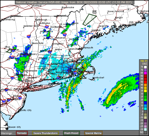
x-y-no wrote:wonder why they did that ... it's not like they're anywhere near the center ...
they could have possibly seen a hook echo on radar... that's a speculation that I have, but the only people that know are the NHC forecasters and the crew.
Moderator: S2k Moderators
x-y-no wrote:wonder why they did that ... it's not like they're anywhere near the center ...
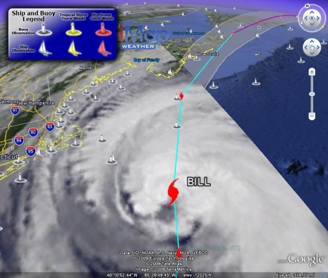
kat61 wrote:wow! so quiet out here! anyone know when the turn NNE is supposed to happen? Bill seems to
moving pretty quickly.


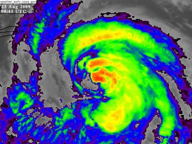
kat61 wrote:At 8pm there were still 85mph winds. NHC has little info on narrative. It's like Bill just disappeard.......or does it turnover to EC info?????newbie questions???
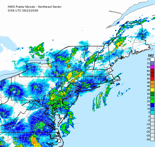
jinftl wrote:11pm advisory, forecast, discussion, maps, tables now available....this is a large system in size....NHC gives Halifax a 96% chance of at least sustained winds of 39 mph....easy to see why
HURRICANE FORCE WINDS EXTEND OUTWARD UP TO 85 MILES...140 KM...FROM
THE CENTER...AND TROPICAL STORM FORCE WINDS EXTEND OUTWARD UP TO 275
MILES...445 KM. NOAA BUOY 44008...LOCATED ABOUT 60 MILES...100
KM...SOUTHEAST OF NANTUCKET...RECENTLY REPORTED A SUSTAINED WIND OF
29 MPH...49 KM/HR...AND A WIND GUST OF 40 MPH...65 KM/HR.
Readings from Cisco Beach on Nantucket....wind gusts approaching ts force.kat61 wrote:At 8pm there were still 85mph winds. NHC has little info on narrative. It's like Bill just disappeard.......or does it turnover to EC info?????newbie questions???


kat61 wrote:I thought the cooler SST's would break him down more.

Users browsing this forum: Google [Bot] and 61 guests