

Gulf Of Panama
Moderator: S2k Moderators
Forum rules

The posts in this forum are NOT official forecasts and should not be used as such. They are just the opinion of the poster and may or may not be backed by sound meteorological data. They are NOT endorsed by any professional institution or STORM2K. For official information, please refer to products from the National Hurricane Center and National Weather Service.
-
tolakram
- Admin

- Posts: 20187
- Age: 62
- Joined: Sun Aug 27, 2006 8:23 pm
- Location: Florence, KY (name is Mark)
Re: Gulf Of Panama
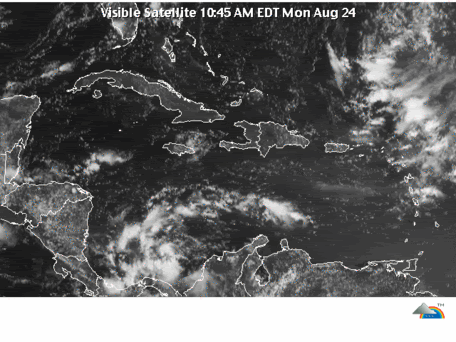
http://www.ssd.noaa.gov/goes/east/watl/flash-vis.html
Looks to me as if it will be in the Pacific soon, trucking west.
Looks to me as if it will be in the Pacific soon, trucking west.
0 likes
Re: Gulf Of Panama
1) Agreed, EPAC-bound.
2) Think it is an Atlantic entity that suddenly formed all the way over here west at Panama.
2) Think it is an Atlantic entity that suddenly formed all the way over here west at Panama.
0 likes

-
HURAKAN

- Professional-Met

- Posts: 46084
- Age: 39
- Joined: Thu May 20, 2004 4:34 pm
- Location: Key West, FL
- Contact:
505
AXNT20 KNHC 241737
TWDAT
TROPICAL WEATHER DISCUSSION
NWS TPC/NATIONAL HURRICANE CENTER MIAMI FL
205 PM EDT MON AUG 24 2009
A TROPICAL WAVE IS ALONG 74W S OF 20N MOVING W 15-20 KT. THIS
WAVE LIES IN A BROAD AREA OF DEEP LAYER MOISTURE THAT RANGES
FROM THE COAST OF VENEZUELA TO ERN PANAMA. LOW-LEVEL CYCLONIC
FLOW IS ALSO BROAD OVER THIS SAME AREA. DUE TO THE BROAD SURFACE
FLOW...CONFIDENCE IN THE EXACT LOCATION OF THE WAVE IS LOW AND
THE WAVE MAY BE FARTHER WEST. SCATTERED MODERATE CONVECTION IS
FROM 13N-15N BETWEEN 69W-72W. SCATTERED MODERATE/ISOLATED STRONG
CONVECTION IS FROM 9N-15N BETWEEN 76W-82W.
THE CARIBBEAN SEA...
ISOLATED SHOWERS/THUNDERSTORMS ARE N OF HONDURAS FROM 16N-18N
BETWEEN 82W-89W. THIS ACTIVITY MAY BE ENHANCED BY THE BROAD
CYCLONIC FLOW AROUND THE TROPICAL WAVE ALONG 74W. THE TROPICAL
WAVE IS ALSO ENHANCING SHOWERS/THUNDERSTORMS ACROSS THE SW AND S
CENTRAL CARIBBEAN...SEE ABOVE. THIS ACTIVITY IS ALSO ENHANCED BY
SURFACE CONVERGENCE NEAR THE E PACIFIC ITCZ AND A 1007 MB LOW
OVER PANAMA NEAR 8N78W. DRY AIR AND SUBSIDENCE ALOFT AROUND THE
UPPER LEVEL HIGH OVER CUBA NEAR 23N80W IS BRINGING GENERALLY
FAIR WEATHER ACROSS THE REMAINDER OF THE CENTRAL CARIBBEAN. A
FEW ISOLATED SHOWERS/POSSIBLE THUNDERSTORMS ARE ACROSS PUERTO
RICO AND THE LESSER ANTILLES DUE TO UPPER LEVEL DIFFLUENCE
BETWEEN AN UPPER LEVEL LOW IN THE ATLC NEAR 26N63W AND AN UPPER
LEVEL HIGH TO E NEAR 19N45W. EXPECT A TROPICAL WAVE CURRENTLY
ALONG 56W TO REACH THE NE CARIBBEAN LATER TONIGHT.
0 likes
-
HURAKAN
- Professional-Met
- Posts: 46084
- Age: 39
- Joined: Thu May 20, 2004 4:34 pm
- Location: Key West, FL
- Contact:
Re: Gulf Of Panama

No one is paying attention to this system but it appears to be quietly trying to do something
0 likes
-
srainhoutx

- S2K Supporter

- Posts: 6919
- Age: 68
- Joined: Sun Jan 14, 2007 11:34 am
- Location: Haywood County, NC
- Contact:
Re: Gulf Of Panama
This is the area that the NOGAPS wanted to bring toward the Yucatan a few days ago. 
0 likes


Re: Gulf Of Panama
The GFS is forecasting that it will bring some moderate to heavy rainfall to Central America, I hope it won't be too heavy but certainly we need that rain because this year we've had below average rainfall (Typical of an El Niño year).
0 likes

Re: Gulf Of Panama
Sanibel wrote:Whoa! Where did this suddenly come from?
This wave flared up pretty good as it was passing over Trinadad a couple of days ago and the Nam has been bringing it a little NW, sort of up the spine of Central America for 3 or 4 days now. looks like it has it a little more on the Caribbean side this run.
http://www.nco.ncep.noaa.gov/pmb/nwprod ... loop.shtml
0 likes
-
lrak

- S2K Supporter
- Posts: 1770
- Age: 59
- Joined: Thu Jun 21, 2007 2:48 pm
- Location: Corpus Christi, TX
Re: Gulf Of Panama
0 likes
Re: Gulf Of Panama
This is a cool lesson in Panamanian correolis being too weak to spin it up unless it heads north.
Even if it doesn't form it makes you wonder about SW Caribbean favorability in a northward track trough year.
Even if it doesn't form it makes you wonder about SW Caribbean favorability in a northward track trough year.
0 likes
-
Brent
- S2K Supporter
- Posts: 38779
- Age: 37
- Joined: Sun May 16, 2004 10:30 pm
- Location: Tulsa Oklahoma
- Contact:
Re: Gulf Of Panama
SPECIAL TROPICAL WEATHER OUTLOOK
NWS TPC/NATIONAL HURRICANE CENTER MIAMI FL
555 PM EDT MON AUG 24 2009
FOR THE NORTH ATLANTIC...CARIBBEAN SEA AND THE GULF OF MEXICO...
SPECIAL OUTLOOK ISSUED TO ADD DISCUSSION OF AREA IN THE SOUTHWESTERN
CARIBBEAN.
UPDATED...A BROAD AREA OF LOW PRESSURE LOCATED OVER THE SOUTHWESTERN
CARIBBEAN SEA IS PRODUCING SCATTERED SHOWER AND THUNDERSTORM
ACTIVITY. ANY FURTHER DEVELOPMENT OF THIS SYSTEM SHOULD BE SLOW TO
OCCUR DUE TO PROXIMITY TO LAND. REGARDLESS OF DEVELOPMENT...HEAVY
RAINFALL IS POSSIBLE OVER NICARAGUA...COSTA RICA...AND PANAMA
TONIGHT AND TUESDAY AS THE LOW MOVES WESTWARD AT 20 TO 25 MPH.
THERE IS A LOW CHANCE...LESS THAN 30 PERCENT...OF THIS SYSTEM
BECOMING A TROPICAL CYCLONE DURING THE NEXT 48 HOURS.
AL, 93, 2009082418, , BEST, 0, 113N, 792W, 20, 1006, DB
0 likes
-
cycloneye

- Admin
- Posts: 149776
- Age: 69
- Joined: Thu Oct 10, 2002 10:54 am
- Location: San Juan, Puerto Rico
Re: Gulf Of Panama
Is invest 93L.Locking time.Go to active storms forum to continue the discussions.
0 likes
Who is online
Users browsing this forum: ouragans and 183 guests