ATL: TROPICAL DEPRESSION DANNY (05L)

Moderator: S2k Moderators

Message
Author
User avatar
WeatherLovingDoc
S2K Supporter
S2K Supporter
Posts: 453
Joined: Fri Sep 05, 2008 10:08 pm
Location: Washington D.C.

Re:

#961 Postby WeatherLovingDoc » Wed Aug 26, 2009 8:17 am

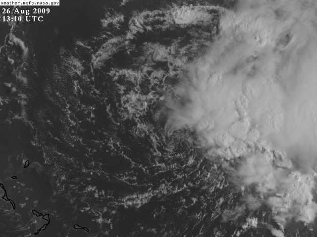
HURAKAN wrote:Do a loop and you will clearly see what appears to be a LLC

http://wwwghcc.msfc.nasa.gov/GOES/goeseastconus.html


Thanks very much for this type of link, Hurakan. My amateur eyes needed it to begin to see those LLC's which you all clearly saw. Satellite views make a world of difference. WLD.
0 likes   

User avatar
KWT
Category 5
Category 5
Posts: 31415
Joined: Tue Aug 17, 2004 11:02 am
Location: UK!!!

#962 Postby KWT » Wed Aug 26, 2009 8:18 am

curtadams,there is a lot of shear about, look at the WV and you can see a new ULL pretty much divebomb 92L.
Not likely to strengthen at all over the next 12-18hrs because of this, in fact may even weaken a little bit over that time period IMO.

Also don't model hug too much people, whilst I don't think this is a landfalling risk to Florida the longer it keeps this presentation up the more the chances are it could reach Florida before it curves up to the NNE.
0 likes   

User avatar
HURAKAN
Professional-Met
Professional-Met
Posts: 46086
Age: 38
Joined: Thu May 20, 2004 4:34 pm
Location: Key West, FL
Contact:

#963 Postby HURAKAN » Wed Aug 26, 2009 8:19 am

Image

Latest. Reminds me of Arlene, Arlberto, Henri and many others
0 likes   

User avatar
HURAKAN
Professional-Met
Professional-Met
Posts: 46086
Age: 38
Joined: Thu May 20, 2004 4:34 pm
Location: Key West, FL
Contact:

#964 Postby HURAKAN » Wed Aug 26, 2009 8:24 am

Image
0 likes   

Derek Ortt

#965 Postby Derek Ortt » Wed Aug 26, 2009 8:26 am

given the very shallow convection within about 200 miles of the cneter, this may not meet the convective requirement to be a TC
0 likes   

User avatar
HURAKAN
Professional-Met
Professional-Met
Posts: 46086
Age: 38
Joined: Thu May 20, 2004 4:34 pm
Location: Key West, FL
Contact:

#966 Postby HURAKAN » Wed Aug 26, 2009 8:27 am

Image

WTNT01 KNGU 261201
SUBJ/TROPICAL CYCLONE FORMATION ALERT 261201Z AUG 09//
RMKS/
1. FORMATION OF A SIGNIFICANT TROPICAL CYCLONE IS POSSIBLE WITHIN
100 NM EITHER SIDE OF A LINE FROM 23.5N 68.5W TO 30.0N 75.0W
WITHIN THE NEXT 24 HOURS. AVAILABLE DATA DOES NOT JUSTIFY
ISSUANCE OF NUMBERED TROPICAL CYCLONE WARNINGS AT THIS TIME.
WINDS IN THE AREA ARE ESTIMATED TO BE 30 TO 35 KNOTS. METSAT IM-
AGERY AT 261200Z INDICATES THAT A CIRCULATION CENTER IS LOCATED
NEAR 24.5N 69.5W. THE SYSTEM IS MOVING WEST-NORTHWESTWARD AT 15
KNOTS.
2.REMARKS: AT 26/12Z LATEST INFRARED SATELLITE IMAGERY INDICATES AN ELON-
GATED AREA OF DISTURBED WEATHER WITH A CLOSED LOW LEVEL CIRCULATION
PRESENT, LOCATED APPROXIMATELY 470NM EAST OF NASSAU IN THE BAHAMAS.
NUMEROUS CLUSTERS OF CONVECTIVE ACTIVITY ARE LOCATED ON THE NORTHERN
THROUGH EASTERN PERIPHERY OF THIS AREA. SEA SURFACE TEMPERATURES ARE
RANGING FROM 27 TO 29 DEGREES CELSIUS ACROSS THE TROPICAL ATLANTIC.
UPPER LEVEL WINDS OVER THE SYSTEM ARE SOUTHERLY 20 TO 25 KTS. HOWEVER,
UPPER-LEVEL WINDSHEAR IS DECREASING NORTHWESTWARD OF THIS AREA OF
DISTURBED WEATHER AS IT CONTINUES TO TRACK TOWARDS AN ENVIRONMENT
WHERE CONDITIONS BECOME MORE CONDUCIVE FOR TROPICAL CYCLONE DEVELOPMENT.
3. THIS ALERT IS VALID UNTIL BY 271200Z AUG 09.
//
0 likes   

CrazyC83
Professional-Met
Professional-Met
Posts: 34002
Joined: Tue Mar 07, 2006 11:57 pm
Location: Deep South, for the first time!

#967 Postby CrazyC83 » Wed Aug 26, 2009 8:28 am

URNT15 KWBC 261317
NOAA3 WXWXA AL92 HDOB 31 20090826
130730 2517N 06754W 6445 03844 0095 +056 +048 185019 023 999 999 03
130800 2519N 06755W 6419 03876 0094 +053 +053 170019 025 999 999 03
130830 2521N 06757W 6426 03866 0107 +047 +047 158027 029 999 999 03
130900 2523N 06758W 6438 03856 0112 +046 +046 151018 023 047 010 03
130930 2525N 06759W 6439 03850 0113 +045 +045 161014 015 999 999 03
131000 2526N 06801W 6439 03852 0104 +052 +051 174014 014 999 999 03
131030 2527N 06804W 6441 03849 0109 +048 +048 178017 019 999 999 03
131100 2528N 06806W 6438 03851 0106 +049 +048 167015 017 999 999 03
131130 2528N 06808W 6438 03852 0094 +057 +043 153014 015 999 999 03
131200 2529N 06811W 6439 03850 0099 +052 +050 178010 012 036 023 03
131230 2529N 06813W 6442 03847 0110 +047 +043 158009 011 999 999 03
131300 2529N 06815W 6440 03849 0101 +054 +030 145011 012 999 999 03
131330 2530N 06818W 6441 03847 0102 +053 +032 135014 014 999 999 03
131400 2530N 06820W 6439 03848 0103 +050 +042 135016 017 999 999 03
131430 2530N 06823W 6438 03849 0100 +053 +028 130017 017 999 999 03
131500 2531N 06825W 6440 03848 0102 +052 +039 140017 018 999 999 03
131530 2531N 06828W 6439 03850 0104 +049 +049 135017 017 999 999 03
131600 2531N 06830W 6441 03846 0107 +048 +046 129019 021 999 999 03
131630 2532N 06833W 6441 03848 0109 +046 +045 126017 021 999 999 03
131700 2532N 06835W 6442 03844 0103 +050 +048 126015 015 999 999 03
0 likes   

User avatar
wxman57
Moderator-Pro Met
Moderator-Pro Met
Posts: 22979
Age: 67
Joined: Sat Jun 21, 2003 8:06 pm
Location: Houston, TX (southwest)

Re: ATL: Invest 92L

#968 Postby wxman57 » Wed Aug 26, 2009 8:28 am

That's what I'm thinking, Derek. Although it is forming an LLC, there's no convection near the center yet. May have to wait until this afternoon/evening. I think there are some 40kt easterly winds in the band of convection. But around the center, the winds are only in the 10-15 kt range, particularly west and south of the center.

I'm forecasting a sheared hurricane with 80-85 mph wind passing near or across the Outer Banks of NC Saturday morning. Hurricane-force winds will probably remain east of the center, offshore, due to increasing SW wind shear by that time.

Image
0 likes   

User avatar
SEASON_CANCELED
Category 3
Category 3
Posts: 887
Joined: Mon Jul 06, 2009 5:17 am
Location: 8 Bit Charlie Sheen

Re: ATL: Invest 92L - Computer Models

#969 Postby SEASON_CANCELED » Wed Aug 26, 2009 8:30 am

Yuck the CMC right over manhatten :eek:
0 likes   

Derek Ortt

#970 Postby Derek Ortt » Wed Aug 26, 2009 8:31 am

may have to wait until Friday then as WV shows the UL cutting off to the NW of the cyclone. It also continues to dive over the system.

I am now thinking just a strong TS... possibly along the lines of Gabrielle where the models also butchered the UL patter
0 likes   

User avatar
HURAKAN
Professional-Met
Professional-Met
Posts: 46086
Age: 38
Joined: Thu May 20, 2004 4:34 pm
Location: Key West, FL
Contact:

#971 Postby HURAKAN » Wed Aug 26, 2009 8:31 am

I always like to dig Arlene out of here grave for these situations (Sorry Arlene):

Image

This was the first image of Arlene as a tropical storm. The center located at 19.2N and 84.0W and look where the convection is, miles away.

So, is 92L Danny. I think so!
0 likes   

User avatar
SEASON_CANCELED
Category 3
Category 3
Posts: 887
Joined: Mon Jul 06, 2009 5:17 am
Location: 8 Bit Charlie Sheen

Re: ATL: Invest 92L

#972 Postby SEASON_CANCELED » Wed Aug 26, 2009 8:32 am

Give it 24 hours the Comma shape will begin and wrap the LLC. Nice Hurakan
0 likes   

User avatar
KWT
Category 5
Category 5
Posts: 31415
Joined: Tue Aug 17, 2004 11:02 am
Location: UK!!!

#973 Postby KWT » Wed Aug 26, 2009 8:32 am

Convection seems to be having a real hard time getting close to the LLC, wcman57, do you think the convection will be able to get closer in the that time frame then?

Also that sort of strength plus the profile it would take on remind me somewhat of a Gordon type system, doesn't look as strong as it probably is in the future I guess.
0 likes   

Derek Ortt

#974 Postby Derek Ortt » Wed Aug 26, 2009 8:33 am

I'm not as worried about SW shear near the coast. Conditions are forecast to be the most favorable then, plus we'll have the QG enhancement

It is the next 36-48 hours that are downright hostile (regardless as to what the models say)
0 likes   

CrazyC83
Professional-Met
Professional-Met
Posts: 34002
Joined: Tue Mar 07, 2006 11:57 pm
Location: Deep South, for the first time!

#975 Postby CrazyC83 » Wed Aug 26, 2009 8:34 am

URNT15 KWBC 261327
NOAA3 WXWXA AL92 HDOB 32 20090826
131730 2532N 06838W 6441 03845 0104 +049 +046 117016 017 042 008 03
131800 2533N 06840W 6440 03845 0107 +046 +046 122022 023 045 007 03
131830 2533N 06843W 6438 03848 0109 +045 +045 119024 025 999 999 03
131900 2533N 06845W 6440 03846 0104 +049 +048 118024 025 999 999 03
131930 2534N 06848W 6440 03847 0101 +050 +050 121021 022 999 999 03
132000 2534N 06851W 6439 03848 0101 +050 +046 113015 017 999 999 03
132030 2534N 06853W 6442 03838 0097 +050 +042 110016 017 999 999 03
132100 2535N 06856W 6441 03840 0100 +049 +041 110017 017 999 999 03
132130 2535N 06858W 6441 03843 0100 +050 +040 104019 020 999 999 03
132200 2536N 06901W 6441 03843 0102 +050 +039 099021 023 999 999 03
132230 2536N 06903W 6439 03848 0104 +049 +039 095023 025 999 999 03
132300 2538N 06905W 6439 03848 0101 +052 +040 091027 029 999 999 03
132330 2539N 06907W 6442 03848 0107 +050 +038 080028 030 035 001 03
132400 2540N 06909W 6441 03849 0100 +054 +041 072025 026 999 999 03
132430 2541N 06912W 6443 03845 0093 +057 +046 078027 028 999 999 03
132500 2543N 06914W 6440 03849 0105 +050 +048 082024 027 999 999 03
132530 2544N 06916W 6443 03845 0088 +062 +044 084022 023 999 999 03
132600 2545N 06918W 6440 03849 0091 +059 +046 079021 022 999 999 03
132630 2547N 06920W 6440 03849 0086 +063 +044 074021 021 999 999 03
132700 2548N 06922W 6442 03847 0082 +065 +043 076023 024 034 002 03
0 likes   

Derek Ortt

#976 Postby Derek Ortt » Wed Aug 26, 2009 8:34 am

I have to say, Arlene looks a lot better than this current thing

maybe Alberto 2006 would be better
0 likes   

User avatar
HURAKAN
Professional-Met
Professional-Met
Posts: 46086
Age: 38
Joined: Thu May 20, 2004 4:34 pm
Location: Key West, FL
Contact:

#977 Postby HURAKAN » Wed Aug 26, 2009 8:36 am

Here he's:

Image

92L:

Image
0 likes   

User avatar
x-y-no
Category 5
Category 5
Posts: 8359
Age: 65
Joined: Wed Aug 11, 2004 12:14 pm
Location: Fort Lauderdale, FL

Re: ATL: Invest 92L - Computer Models

#978 Postby x-y-no » Wed Aug 26, 2009 8:38 am

SEASON_CANCELED wrote:Yuck the CMC right over manhatten :eek:


Yep .... CMC has the trillion dollar storm scenario - major storm sweeping right up the eastern seaboard from the Grand Banks to Boston.

Let's all sincerely hope that doesn't verify.
0 likes   

User avatar
Bocadude85
Category 5
Category 5
Posts: 2991
Age: 38
Joined: Mon Apr 18, 2005 2:20 pm
Location: Honolulu,Hi

Re: ATL: Invest 92L

#979 Postby Bocadude85 » Wed Aug 26, 2009 8:39 am

http://www.ssd.noaa.gov/goes/flt/t1/loop-vis.html

Great loop here showing the LLC very well... also seems its heading just North of due West
0 likes   

Derek Ortt

Re:

#980 Postby Derek Ortt » Wed Aug 26, 2009 8:40 am

gatorcane wrote::uarrow: that is precisely the problem here.

You look at the models and they just are not correct this time (and have not been correct all week). The NHC keeps mentioning the Bahamas needs to closely monitor this system. Looking at those models above, why would the NHC even think to say that?

Throw the models out for the time being. Yes a curve to the north will happen but probably farther west closer or through the Bahamas.

As for the Carolinas, well with a system sitting to your south like this with weak ridgingin and a trough hanging out to the west, you bet you want to closely watch this one also.


NHC is mentioning for the Bahamas to monitor because of proximity, not because they expect landfall! Did they expect Bill to move through the Leewards?
0 likes   


Return to “2009”

Who is online

Users browsing this forum: No registered users and 6 guests