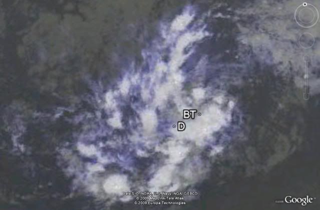
ATL : TROPICAL DEPRESSION ERIKA (06L)

Moderator: S2k Moderators

Message
Author
User avatar
HURAKAN
Professional-Met
Professional-Met
Posts: 46086
Age: 38
Joined: Thu May 20, 2004 4:34 pm
Location: Key West, FL
Contact:

#701 Postby HURAKAN » Sat Aug 29, 2009 7:34 pm

Image

BT vs D
0 likes   

User avatar
cycloneye
Admin
Admin
Posts: 145356
Age: 68
Joined: Thu Oct 10, 2002 10:54 am
Location: San Juan, Puerto Rico

Re: ATL : INVEST 94L

#702 Postby cycloneye » Sat Aug 29, 2009 7:35 pm

There was some commentary earlier that it was starting to move WNW but according to the 00 UTC BAMS,it is still moving west at 270 degrees at 14 kts.

LATCUR = 10.7N LONCUR = 43.4W DIRCUR = 270DEG SPDCUR = 14KT
0 likes   

User avatar
HURAKAN
Professional-Met
Professional-Met
Posts: 46086
Age: 38
Joined: Thu May 20, 2004 4:34 pm
Location: Key West, FL
Contact:

#703 Postby HURAKAN » Sat Aug 29, 2009 7:36 pm

Image

Latest
0 likes   

Aric Dunn
Category 5
Category 5
Posts: 21238
Age: 42
Joined: Sun Sep 19, 2004 9:58 pm
Location: Ready for the Chase.
Contact:

Re:

#704 Postby Aric Dunn » Sat Aug 29, 2009 7:36 pm

Derek Ortt wrote:not quite sure I understand that outlook. To me, this appears somewhat better organized structurally today

yeah for sure..

but I imagine its because the convection has not maintained long enough.. by 2am if the trend continues and convection is still present then orange will likely be there.. and red in the morning there after if it continues after that.
0 likes   

otowntiger
Category 5
Category 5
Posts: 1921
Joined: Tue Aug 31, 2004 7:06 pm

Re: ATL : INVEST 94L

#705 Postby otowntiger » Sat Aug 29, 2009 7:36 pm

ehhh. Not too impressed still. It is hanging in there and like everyone says the twisting may be little more pronounced, but there is just about no convection with this thing and what little is there is scattered like pimples on the face of a teenaged boy. :)
0 likes   

jinftl
Category 5
Category 5
Posts: 4312
Joined: Tue Aug 31, 2004 4:47 pm
Location: fort lauderdale, fl

Re: ATL : INVEST 94L - Computer Models

#706 Postby jinftl » Sat Aug 29, 2009 7:37 pm

Current position:
00 GMT 08/30/09 10.7N 43.4W

Compare current position to where the model below says the latitude would be at approx the same longitude
12Z 13.1N 43.3W 317./11.5

Current position estimate is west of any of the latest model runs.....it is off course each one of these models already

Image


cycloneye wrote:18z GFDL is in the fish camp.

WHXX04 KWBC 292316
CHGQLM
ATTENTION...NATIONAL HURRICANE CENTER
NCEP COUPLED GFDL HURRICANE MODEL FORECAST MADE FOR

TROPICAL DEPRESSION INVEST 94L

INITIAL TIME 18Z AUG 29
FORECAST STORM POSITION
HOUR LATITUDE LONGITUDE HEADING/SPEED(KT)

0 11.0 42.0 270./14.0
6 12.2 42.5 339./13.6
12 13.1 43.3 317./11.5
18 13.9 44.3 307./13.2
24 14.7 45.7 302./15.2
30 15.4 47.1 295./15.1
36 16.0 48.0 305./10.6
42 16.7 48.8 311./10.4
48 17.1 49.6 295./ 8.4
54 17.5 50.1 303./ 6.6
60 18.1 50.8 316./ 8.8
66 18.5 51.5 301./ 8.1
72 18.9 52.3 296./ 8.7
78 19.6 52.9 320./ 8.8
84 20.2 53.7 306./ 9.5
90 20.6 54.6 292./ 9.2
96 21.2 55.4 304./10.0
102 21.6 56.3 295./ 9.3
108 21.9 57.1 293./ 8.0
114 22.5 57.7 317./ 7.6
120 23.0 58.4 306./ 8.8
126 23.6 58.7 332./ 6.7
0 likes   

User avatar
KWT
Category 5
Category 5
Posts: 31415
Joined: Tue Aug 17, 2004 11:02 am
Location: UK!!!

#707 Postby KWT » Sat Aug 29, 2009 7:38 pm

I think BT looks far more likely to be correct, Qscat would have shown something if the SSD position was correct.
0 likes   

User avatar
expat2carib
S2K Supporter
S2K Supporter
Posts: 458
Joined: Tue Jul 22, 2008 1:44 pm
Location: Sint Maarten

Re: ATL : INVEST 94L

#708 Postby expat2carib » Sat Aug 29, 2009 7:40 pm

Mhhhhhhhh. Getting my attention again
Image
0 likes   

User avatar
gatorcane
S2K Supporter
S2K Supporter
Posts: 23691
Age: 47
Joined: Sun Mar 13, 2005 3:54 pm
Location: Boca Raton, FL

#709 Postby gatorcane » Sat Aug 29, 2009 7:40 pm

Looks more organized and also I see a more WNW movement now taking shape. I think its probably worthy of code orange again (maybe red by this time tomorrow). My guess is the NHC doesn't want to go from orange to yellow to orange in one day. I say if it keeps this up it will be code orange next advisory. They likely want to let it marinate some this evening.

One thing is for sure, if it gets going more quickly its likely to go more NW and east of the islands in responsive to a ULL in the Central Atlantic. On the other hand if it stays weaker its likely going more west. Split the difference and you get a path just NE of the Leewards or so...(maybe 100 miles???). Interesting days ahead maybe. I still think right of the islands by 200 miles or so....that ULL is huge.

The ULL is seen here:

Image
0 likes   

User avatar
abajan
S2K Supporter
S2K Supporter
Posts: 4233
Joined: Sun Sep 07, 2003 5:10 am
Location: Barbados

Re: ATL : INVEST 94L

#710 Postby abajan » Sat Aug 29, 2009 7:52 pm

This loop looks mighty impressive to me. Convection may not be that great now (it will probably flare overnight, though) but the circulation is beginning to get its act together. Thankfully, that loop also seems to show that the long predicted west north-westerly turn has started.
0 likes   

User avatar
Blown Away
S2K Supporter
S2K Supporter
Posts: 10147
Joined: Wed May 26, 2004 6:17 am

Re: ATL : INVEST 94L - Computer Models

#711 Postby Blown Away » Sat Aug 29, 2009 7:55 pm

These models have been crazy with 94L. Amazing they almost have 94L as a major hurricane.
0 likes   

User avatar
gatorcane
S2K Supporter
S2K Supporter
Posts: 23691
Age: 47
Joined: Sun Mar 13, 2005 3:54 pm
Location: Boca Raton, FL

#712 Postby gatorcane » Sat Aug 29, 2009 7:55 pm

This is about the area Bill started heading more WNW ...but 94L is alot more shallow. It should get further west than Bill you would think.
0 likes   

User avatar
Evil Jeremy
S2K Supporter
S2K Supporter
Posts: 5463
Age: 32
Joined: Mon Apr 10, 2006 2:10 pm
Location: Los Angeles, CA

Re:

#713 Postby Evil Jeremy » Sat Aug 29, 2009 7:57 pm

gatorcane wrote:This is about the area Bill started heading more WNW ...but 94L is alot more shallow. It should get further west than Bill you would think.


Not to mention that 94L is a couple degrees south of where Bill was at this point I think.
0 likes   

caribsue
Tropical Depression
Tropical Depression
Posts: 96
Joined: Mon Jul 14, 2008 3:54 pm
Location: Barbados

Re: ATL : INVEST 94L

#714 Postby caribsue » Sat Aug 29, 2009 7:57 pm

Hope you and the others are right my fellow countryman.... Lets hope that that old Bajan adage is true once again and we are spared.
0 likes   

jinftl
Category 5
Category 5
Posts: 4312
Joined: Tue Aug 31, 2004 4:47 pm
Location: fort lauderdale, fl

Re:

#715 Postby jinftl » Sat Aug 29, 2009 7:58 pm

Bill was about 3 deg latitude further north than 94L at a comparable longitude....plus he was already a hurricane and moving wnw

AT 500 AM AST...0900 UTC...THE CENTER OF HURRICANE BILL WAS LOCATED
NEAR LATITUDE 13.8 NORTH...LONGITUDE 44.0 WEST OR ABOUT 1160 MILES
...1870 KM...EAST OF THE LESSER ANTILLES.

BILL IS MOVING QUICKLY TOWARD THE WEST-NORTHWEST NEAR 22 MPH...35
KM/HR...AND THIS GENERAL MOTION IS EXPECTED TO CONTINUE FOR THE
NEXT 24 TO 48 HOURS.


gatorcane wrote:This is about the area Bill started heading more WNW ...but 94L is alot more shallow. It should get further west than Bill you would think.
0 likes   

User avatar
gatorcane
S2K Supporter
S2K Supporter
Posts: 23691
Age: 47
Joined: Sun Mar 13, 2005 3:54 pm
Location: Boca Raton, FL

#716 Postby gatorcane » Sat Aug 29, 2009 7:59 pm

Surprised nobody posted the UKMET -- just NE of the islands:

Image
0 likes   

User avatar
gatorcane
S2K Supporter
S2K Supporter
Posts: 23691
Age: 47
Joined: Sun Mar 13, 2005 3:54 pm
Location: Boca Raton, FL

#717 Postby gatorcane » Sat Aug 29, 2009 8:05 pm

The ECMWF and UKMET are both just NE of the islands, but the UKMET looks a bit quicker. That latest ECMWF bends it more back west once north of Puerto Rico and steers it towards the SE Bahamas. Curious what the 00Z ECMWF shows.
0 likes   

User avatar
funster
Category 3
Category 3
Posts: 816
Joined: Sat Dec 29, 2007 4:27 pm
Location: North Dallas

Re: ATL : INVEST 94L

#718 Postby funster » Sat Aug 29, 2009 8:26 pm

We certainly don't need a big storm now with the recession and a terrible flu season on the way. I hope 94L fizzles. The northeast can not deal with wind because of how soggy the soil is. Thousands and thousands of trees would fail.
0 likes   

User avatar
D3m3NT3DVoRT3X
Tropical Low
Tropical Low
Posts: 31
Age: 47
Joined: Thu Aug 16, 2007 6:37 pm
Location: The Burg < FL

Re: ATL : INVEST 94L

#719 Postby D3m3NT3DVoRT3X » Sat Aug 29, 2009 8:34 pm

Image
0 likes   

User avatar
abajan
S2K Supporter
S2K Supporter
Posts: 4233
Joined: Sun Sep 07, 2003 5:10 am
Location: Barbados

Re: ATL : INVEST 94L

#720 Postby abajan » Sat Aug 29, 2009 8:41 pm

caribsue wrote:Hope you and the others are right my fellow countryman.... Lets hope that that old Bajan adage is true once again and we are spared.
If you're referring to "God is a Bajan", I think it's one of the most ridiculous sayings. He's no more a Bajan than he is a Brazilian, Canadian, Somalian or American. We on this rock have become way too complacent about storms and other natural disasters.

One would've thought that Hurricane Ivan which passed fairly far to our south would have been the wake up call that they don't all go north. I can distinctly remember Selma, the weather presenter, a couple nights before stating with an almost godlike degree of certainty, that it would pass to our north! Of course, she was taking her cue from the Met Office which didn't seem to be taking the situation too seriously.
0 likes   


Return to “2009”

Who is online

Users browsing this forum: No registered users and 3 guests