If I understand the GFS correctly, it seems to take the energy and split it, spread it out and then consolidate it later in an area farther north and west than what we seem to be seeing now. I was looking at the 850 charts from the last few runs. Since there is no "Bill-esque" slam dunk low pressure out there now, perhaps the GFS and other global models are not seeing what we can plainly see with our eyes. As long as our eyes do not deceive us, it would appear that the surface low would get going south of 12N and west of 45W or so. Not up near 18 and 42-43 like the 12Z GFS showed:
http://www.nco.ncep.noaa.gov/pmb/nwprod ... v_048l.gif
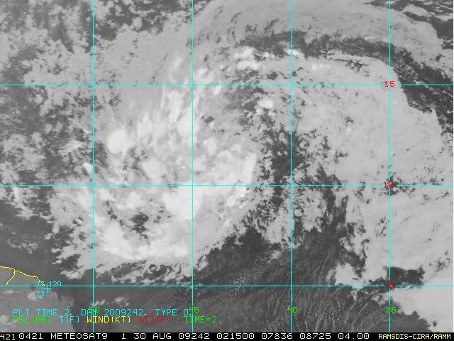
Look at that mess. And what's up with the clockwise flow to the east of that yellow "energy"? Anyhow, if the models are not really seeing it, then what good are they for tracking this single system? This is PERHAPS where the more simple numeric models have a better handle. Any thoughts?
ATL : TROPICAL DEPRESSION ERIKA (06L)
Moderator: S2k Moderators
-
hurricanetrack

- HurricaneTrack.com

- Posts: 1781
- Joined: Tue Dec 02, 2003 10:46 pm
- Location: Wilmington, NC
- Contact:
-
Derek Ortt
Re: ATL : INVEST 94L
abajan wrote:If you're referring to "God is a Bajan", I think it's one of the most ridiculous sayings. He's no more a Bajan than he is a Brazilian, Canadian, Somalian or American. We on this rock have become way too complacent about storms and other natural disasters.caribsue wrote:Hope you and the others are right my fellow countryman.... Lets hope that that old Bajan adage is true once again and we are spared.
One would've thought that Hurricane Ivan which passed fairly far to our south would have been the wake up call that they don't all go north. I can distinctly remember Selma, the weather presenter, a couple nights before stating with an almost godlike degree of certainty, that it would pass to our north! Of course, she was taking her cue from the Met Office which didn't seem to be taking the situation too seriously.
I think they were following NHC, which was following a dynamically flawed GFS (it turned Ivan through a 500mb ridge).
I remember when I took a big chance, went against all guidance, and had Ivan near Aruba for a forecast around that time
(can check at http://www.nwhhc.com/Archives/2004/Atla ... 4ivan.html)
0 likes
-
AtlanticWind

- S2K Supporter

- Posts: 1898
- Age: 67
- Joined: Sun Aug 08, 2004 9:57 pm
- Location: Plantation,Fla
Re: ATL : INVEST 94L
Still spotty convection and an ill defined center, thought it would be doing more by now.
we will see what happens on sunday.
we will see what happens on sunday.
0 likes
-
Fego

- S2K Supporter
- Posts: 767
- Age: 66
- Joined: Sun Apr 18, 2004 7:58 pm
- Location: San Juan, Puerto Rico
- Contact:
Re: ATL : INVEST 94L
Quiet long time without a new post. May be is the middle of the seven inning.
0 likes
-
otowntiger
- Category 5
- Posts: 1932
- Joined: Tue Aug 31, 2004 7:06 pm
Re: ATL : INVEST 94L
Yep, this 'thing' what ever you want to call it will not develop very much or very fast if at all. As I've said before it won't matter where this thing goes if it's nothing when it gets there. 
0 likes


-
AtlanticWind
- S2K Supporter
- Posts: 1898
- Age: 67
- Joined: Sun Aug 08, 2004 9:57 pm
- Location: Plantation,Fla
Re: ATL : INVEST 94L
otowntiger wrote:Yep, this 'thing' what ever you want to call it will not develop very much or very fast if at all. As I've said before it won't matter where this thing goes if it's nothing when it gets there.
Im glad you can see the future, any stock market tips for monday?
0 likes
-
cycloneye

- Admin

- Posts: 149219
- Age: 69
- Joined: Thu Oct 10, 2002 10:54 am
- Location: San Juan, Puerto Rico
Re:
jasons wrote::uarrow: I never go by infrared
BUT...it's getting that "look" if you ask me.
I agree that it is organizing slowly.And organizing slowly doesnt bold well for the NE Caribbean islands because 94L being very south in latitud it causees the shallow system to not recurve so easy.
0 likes
-
Blown Away

- S2K Supporter
- Posts: 10253
- Joined: Wed May 26, 2004 6:17 am

-
Derek Ortt
-
fasterdisaster
- Category 5
- Posts: 1868
- Joined: Mon Sep 19, 2005 4:41 pm
- Location: Miami, Florida
-
AtlanticWind
- S2K Supporter
- Posts: 1898
- Age: 67
- Joined: Sun Aug 08, 2004 9:57 pm
- Location: Plantation,Fla
Re:
Derek Ortt wrote:and turning WNW. Still don't see much of an islands threat, unless this forms near 55W. If that is the case, then we'd likely be looking at nothing more than a low end TS for the islands
What chance do see of this forming to a storm or a Hurricane?
0 likes
-
cycloneye
- Admin
- Posts: 149219
- Age: 69
- Joined: Thu Oct 10, 2002 10:54 am
- Location: San Juan, Puerto Rico
Re: ATL : INVEST 94L
Derek,I know is early for this but do you expect some watches for some of the islands as this may clip or be close to the northern Leewards?
0 likes
-
Derek Ortt
Re: ATL : INVEST 94L
cycloneye wrote:Derek,I know is early for this but do you expect some watches for some of the islands as this may clip or be close to the northern Leewards?
at this time, probably not. Most I think you'd see is TS winds and that is if this takes its sweet time organizing. Then you'd be looking at a low end TS
0 likes
-
Evil Jeremy

- S2K Supporter
- Posts: 5463
- Age: 32
- Joined: Mon Apr 10, 2006 2:10 pm
- Location: Los Angeles, CA
Re:
Derek Ortt wrote:decent chance of becoming at least a storm given its current structure
Derek, the dunce hat is waiting lol. Do you think this will take a more westward path through or above the Caribbean or recurve, or something else?
0 likes
-
Derek Ortt
Re: ATL : INVEST 94L
The season could suddenly see a monster hurricane form in the Caribbean and head towards the US or we could see another weak struggler fighting for convection.
0 likes

Who is online
Users browsing this forum: No registered users and 3 guests