ATL: TROPICAL LOW ex-FRED (ex-07L)

Moderator: S2k Moderators

Message
Author
ozonepete
Professional-Met
Professional-Met
Posts: 4743
Joined: Mon Sep 07, 2009 3:23 pm
Location: From Ozone Park, NYC / Now in Brooklyn, NY

Re:

#741 Postby ozonepete » Sun Sep 13, 2009 4:54 pm

brunota2003 wrote:If you look at the water vapor loop, the moisture envelope is gradually getting larger. Where all that moisture is coming from I dunno though, look at all the dry air it is pushing against to the west! There is also more moisture working it's way towards Fred, thanks to our friend the tropical wave off to the east.


Very good point. The only big negative right now is all of that dry air ahead of it. Here's the CIMSS mid-level water vapor, much more important than the upper level. This does not look good. However, we've seen this case at times where the dry air moved forward at the same or greater speed as the cyclone did. In that case it might never get ingested.
0 likes   

User avatar
brunota2003
S2K Supporter
S2K Supporter
Posts: 9476
Age: 34
Joined: Sat Jul 30, 2005 9:56 pm
Location: Stanton, KY...formerly Havelock, NC
Contact:

#742 Postby brunota2003 » Sun Sep 13, 2009 4:55 pm

The posts in this forum are NOT official forecast and should not be used as such. They are just the opinion of the poster and may or may not be backed by sound meteorological data. They are NOT endorsed by any professional institution or storm2k.org. For official information, please refer to the NHC and NWS products.


Since the storms have been concentrated and deep, along with persisting for most of the day and moving closer towards the center...I, as an amateur, would put the chance of it regenerating at about 40%.

The only thing I do not really like is the very obvious wind shear still trying to blow the storms away (but the fact that they fired and are trying to stay close to the center/work towards the center is showing that perhaps the shear is weakening) and all of the dry air surrounding the system.

Another thing to note is the moisture envelope has gradually been getting larger as the day passes.
0 likes   

User avatar
HURAKAN
Professional-Met
Professional-Met
Posts: 46086
Age: 38
Joined: Thu May 20, 2004 4:34 pm
Location: Key West, FL
Contact:

#743 Postby HURAKAN » Sun Sep 13, 2009 4:58 pm

Image

Fred the Fighter
0 likes   

ozonepete
Professional-Met
Professional-Met
Posts: 4743
Joined: Mon Sep 07, 2009 3:23 pm
Location: From Ozone Park, NYC / Now in Brooklyn, NY

Re: ATL: TROPICAL DEPRESSION FRED (07L) (Code Orange)

#744 Postby ozonepete » Sun Sep 13, 2009 5:04 pm

The large size of the circulation has probably helped it maintain that moisture envelope and keep dry air out of the center. But remember as it regenerates, the circulation deepens and extends back up into the mid-levels and that might pull some of the dry air in. Kind of like a good news/bad news situation.

Image
0 likes   

User avatar
Gustywind
Category 5
Category 5
Posts: 12334
Joined: Mon Sep 03, 2007 7:29 am
Location: Baie-Mahault, GUADELOUPE

Re: Re:

#745 Postby Gustywind » Sun Sep 13, 2009 5:10 pm

jlauderdal wrote:
brunota2003 wrote:OT: That bear really needs to go see a dentist...like, NOW


probably needs a bottle of mouthwash too


Image

Maybe this one has the perfect teeth :) :eek: :double: 
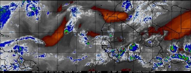
Looks like a red code :lol: given the NTC: National Teeth Center
The following post is NOT an official forecast and should not be used as such. It is just the funny opinion of the poster and may or may not be backed by sound meteorological data. It is NOT endorsed by any professional institution including storm2k.org, NTC, For Official Information please refer to the NHC and NWS products.
With a strong sense of humor (i hope) :oops: ...
Nice Regards
Gustywind :cheesy: :ggreen: :)
0 likes   

User avatar
cycloneye
Admin
Admin
Posts: 145333
Age: 68
Joined: Thu Oct 10, 2002 10:54 am
Location: San Juan, Puerto Rico

Re: ATL: TROPICAL DEPRESSION FRED (07L) (Code Orange)

#746 Postby cycloneye » Sun Sep 13, 2009 5:19 pm

Image
0 likes   

User avatar
Gustywind
Category 5
Category 5
Posts: 12334
Joined: Mon Sep 03, 2007 7:29 am
Location: Baie-Mahault, GUADELOUPE

#747 Postby Gustywind » Sun Sep 13, 2009 5:20 pm

Image
0 likes   

jinftl
Category 5
Category 5
Posts: 4312
Joined: Tue Aug 31, 2004 4:47 pm
Location: fort lauderdale, fl

Re: ATL: TROPICAL DEPRESSION FRED (07L)

#748 Postby jinftl » Sun Sep 13, 2009 5:49 pm

Remnant low or not, what will be steering the system this week?

NWS Miami continues to mention a building ridge over the atlantic late in the week into the weekend...

.THURSDAY THROUGH SUNDAY...A RETURN TO A MOSTLY EASTERLY FLOW IS
EXPECTED AS A LOW/MID LVL ATLANTIC RIDGE BUILDS WESTWARD. THIS
WILL ALLOW DEEPER TROPICAL MOISTURE TO BE ADVECTED BACK OVER SOUTH
FLORIDA WITH A RESULTANT INCREASE IN POPS. AT THIS POINT AND TIME
WILL INCREASE POPS ONLY TO CLIMATOLOGICAL VALUES, I.E. 30-40
PERCENT RANGE.
0 likes   

User avatar
AdamFirst
S2K Supporter
S2K Supporter
Posts: 2491
Age: 36
Joined: Thu Aug 14, 2008 10:54 am
Location: Port Saint Lucie, FL

#749 Postby AdamFirst » Sun Sep 13, 2009 5:51 pm

I think it's funny that this thread is alive again :P
0 likes   

jlauderdal
S2K Supporter
S2K Supporter
Posts: 7183
Joined: Wed May 19, 2004 5:46 am
Location: NE Fort Lauderdale
Contact:

Re:

#750 Postby jlauderdal » Sun Sep 13, 2009 6:24 pm

AdamFirst wrote:I think it's funny that this thread is alive again :P


i think its funny its orange and not just yellow, it wont be funny though if it actually develops and then the big ridge gets setup
0 likes   

User avatar
gatorcane
S2K Supporter
S2K Supporter
Posts: 23691
Age: 47
Joined: Sun Mar 13, 2005 3:54 pm
Location: Boca Raton, FL

#751 Postby gatorcane » Sun Sep 13, 2009 6:31 pm

18Z GFS really does not like Fred's chances.

http://www.nco.ncep.noaa.gov/pmb/nwprod ... el_l.shtml
0 likes   

User avatar
cycloneye
Admin
Admin
Posts: 145333
Age: 68
Joined: Thu Oct 10, 2002 10:54 am
Location: San Juan, Puerto Rico

Re: ATL: TROPICAL DEPRESSION FRED (07L)

#752 Postby cycloneye » Sun Sep 13, 2009 6:32 pm


ABNT20 KNHC 132332
TWOAT
TROPICAL WEATHER OUTLOOK
NWS TPC/NATIONAL HURRICANE CENTER MIAMI FL
800 PM EDT SUN SEP 13 2009

FOR THE NORTH ATLANTIC...CARIBBEAN SEA AND THE GULF OF MEXICO...

SHOWER AND THUNDERSTORM ACTIVITY CONTINUES IN ASSOCIATION WITH THE
REMNANTS OF FRED...WHICH ARE LOCATED ABOUT 725 MILES WEST-NORTHWEST
OF THE NORTHERNMOST CAPE VERDE ISLANDS AND MOVING SLOWLY WESTWARD.
WHILE UPPER-LEVEL WINDS ARE EXPECTED TO REMAIN UNFAVORABLE FOR
RE-DEVELOPMENT...REGENERATION OF THIS SYSTEM INTO A TROPICAL
CYCLONE IS POSSIBLE IF THE ORGANIZATION OF THE SHOWER AND
THUNDERSTORM ACTIVITY INCREASES. THERE IS A MEDIUM CHANCE...30 TO
50 PERCENT...OF THIS SYSTEM BECOMING A TROPICAL CYCLONE DURING THE
NEXT 48 HOURS. ADDITIONAL INFORMATION ON THIS SYSTEM CAN BE FOUND
IN HIGH SEAS FORECASTS ISSUED BY THE NATIONAL WEATHER SERVICE...
UNDER AWIPS HEADER NFDHSFAT1 AND WMO HEADER FZNT01 KWBC.

ELSEWHERE...TROPICAL CYCLONE FORMATION IS NOT EXPECTED DURING THE
NEXT 48 HOURS.

$$
FORECASTER BRENNAN

Image
0 likes   

IvanSurvivor
Tropical Storm
Tropical Storm
Posts: 152
Joined: Wed Aug 20, 2008 12:12 am
Location: Pensacola Florida (Warrington)

Re: ATL: TROPICAL DEPRESSION FRED (07L)

#753 Postby IvanSurvivor » Sun Sep 13, 2009 7:13 pm

How much lower in latitude (further south) was a storm like Ivan at this point in the Atlantic? No comparison, just wondering...
0 likes   

User avatar
perk
Category 3
Category 3
Posts: 825
Joined: Mon Aug 09, 2004 9:35 am
Location: Richmond Texas

Re: ATL: TROPICAL DEPRESSION FRED (07L)

#754 Postby perk » Sun Sep 13, 2009 7:15 pm

Ok if upper level winds are not favorable for regeneration why go to code orange. :double:
0 likes   

User avatar
Gustywind
Category 5
Category 5
Posts: 12334
Joined: Mon Sep 03, 2007 7:29 am
Location: Baie-Mahault, GUADELOUPE

#755 Postby Gustywind » Sun Sep 13, 2009 7:15 pm

000
AXNT20 KNHC 132340
TWDAT

TROPICAL WEATHER DISCUSSION
NWS TPC/NATIONAL HURRICANE CENTER MIAMI FL
805 PM EDT SUN SEP 13 2009

TROPICAL WEATHER DISCUSSION FOR NORTH AMERICA...CENTRAL
AMERICA...GULF OF MEXICO...CARIBBEAN SEA...NORTHERN SECTIONS
OF SOUTH AMERICA...AND ATLANTIC OCEAN TO THE AFRICAN COAST
FROM THE EQUATOR TO 32N. THE FOLLOWING INFORMATION IS BASED
ON SATELLITE IMAGERY...METEOROLOGICAL ANALYSIS...WEATHER
OBSERVATIONS...AND RADAR.

BASED ON 1800 UTC SURFACE ANALYSIS AND SATELLITE IMAGERY THROUGH
2245 UTC.

...SPECIAL FEATURES...
AN AREA OF SHOWERS/THUNDERSTORMS TO THE N OF A 1009 MB SURFACE
LOW NEAR 18N35W...THE REMNANT CIRCULATION OF FRED...HAS
INCREASED OVER THE PAST FEW HOURS. NUMEROUS STRONG CONVECTION IS
FROM 19N-23N BETWEEN 34W-36W. UPPER LEVEL WINDS REMAIN
UNFAVORABLE FOR REDEVELOPMENT INTO A TROPICAL CYCLONE.
HOWEVER...IF CONVECTION CONTINUES TO PERSIST AND BECOMES BETTER
ORGANIZED REGENERATION IS POSSIBLE. THERE IS NOW A MEDIUM
CHANCE...30 TO 50 PERCENT...OF THIS SYSTEM BECOMING A TROPICAL
CYCLONE DURING THE NEXT 48 HRS
.


Image


$$
WALTON
0 likes   

User avatar
AdamFirst
S2K Supporter
S2K Supporter
Posts: 2491
Age: 36
Joined: Thu Aug 14, 2008 10:54 am
Location: Port Saint Lucie, FL

Re: ATL: TROPICAL DEPRESSION FRED (07L)

#756 Postby AdamFirst » Sun Sep 13, 2009 7:17 pm

IvanSurvivor wrote:How much lower in latitude (further south) was a storm like Ivan at this point in the Atlantic? No comparison, just wondering...


Image

I'd say Ivan was at least 5 degrees south of ex-Fred.
0 likes   

IvanSurvivor
Tropical Storm
Tropical Storm
Posts: 152
Joined: Wed Aug 20, 2008 12:12 am
Location: Pensacola Florida (Warrington)

Re: ATL: TROPICAL DEPRESSION FRED (07L)

#757 Postby IvanSurvivor » Sun Sep 13, 2009 7:17 pm

I worry about storms with 4 letters in their name...Erin, Opal, Ivan...
0 likes   

User avatar
Gustywind
Category 5
Category 5
Posts: 12334
Joined: Mon Sep 03, 2007 7:29 am
Location: Baie-Mahault, GUADELOUPE

Re: ATL: TROPICAL DEPRESSION FRED (07L)

#758 Postby Gustywind » Sun Sep 13, 2009 7:22 pm

IvanSurvivor wrote:I worry about storms with 4 letters in their name...Erin, Opal, Ivan...

Humm...:roll: HUGO... :eek: but no good boy or LUIS or CLEO, INEZ?
0 likes   

User avatar
Gustywind
Category 5
Category 5
Posts: 12334
Joined: Mon Sep 03, 2007 7:29 am
Location: Baie-Mahault, GUADELOUPE

Re: ATL: TROPICAL DEPRESSION FRED (07L)

#759 Postby Gustywind » Sun Sep 13, 2009 7:24 pm

AdamFirst wrote:
IvanSurvivor wrote:How much lower in latitude (further south) was a storm like Ivan at this point in the Atlantic? No comparison, just wondering...


Image

I'd say Ivan was at least 5 degrees south of ex-Fred.


Hurricane Ivan (09/02 - 09/24)
2004 Storm Archive — Current Tropical Activity :rarrow: http://www.wunderground.com/hurricane/at20049.asp

Storm Coordinates


Date: Time: Lat: Lon: Wind(mph): Pressure: Storm Type:
09/02 18 GMT 9.7 27.6 30 1009 Tropical Depression
09/03 00 GMT 9.7 28.7 35 1007 Tropical Depression
09/03 06 GMT 9.7 30.3 40 1005 Tropical Storm
09/03 12 GMT 9.5 32.1 45 1003 Tropical Storm
09/03 18 GMT 9.3 33.6 50 1000 Tropical Storm
09/04 00 GMT 9.1 35.0 50 999 Tropical Storm
09/04 06 GMT 8.9 36.5 60 997 Tropical Storm

09/04 12 GMT 8.9 38.2 60 997 Tropical Storm
09/04 18 GMT 9.0 39.9 65 994 Tropical Storm
09/05 00 GMT 9.3 41.4 70 991 Tropical Storm
09/05 06 GMT 9.5 43.4 75 987 Category 1 Hurricane
09/05 12 GMT 9.8 45.1 100 977 Category 2 Hurricane
09/05 18 GMT 10.2 46.8 125 955 Category 3 Hurricane
09/06 00 GMT 10.6 48.5 135 948 Category 4 Hurricane
09/06 06 GMT 10.8 50.5 125 950 Category 3 Hurricane
09/06 12 GMT 11.0 52.5 125 955 Category 3 Hurricane
09/06 18 GMT 11.3 54.4 105 969 Category 2 Hurricane
09/07 00 GMT 11.2 56.1 105 964 Category 2 Hurricane
09/07 06 GMT 11.3 57.8 110 965 Category 2 Hurricane
09/07 12 GMT 11.6 59.4 115 963 Category 3 Hurricane
09/07 18 GMT 11.8 61.1 120 956 Category 3 Hurricane
09/08 00 GMT 12.0 62.6 135 950 Category 4 Hurricane
09/08 06 GMT 12.3 64.1 140 946 Category 4 Hurricane
09/08 12 GMT 12.6 65.5 140 955 Category 4 Hurricane
09/08 18 GMT 13.0 67.0 140 950 Category 4 Hurricane
09/09 00 GMT 13.3 68.3 150 938 Category 4 Hurricane
09/09 06 GMT 13.7 69.5 160 925 Category 5 Hurricane
09/09 12 GMT 14.2 70.8 160 919 Category 5 Hurricane
09/09 18 GMT 14.7 71.9 150 921 Category 4 Hurricane
09/10 00 GMT 15.2 72.8 150 923 Category 4 Hurricane
09/10 06 GMT 15.7 73.8 145 930 Category 4 Hurricane
09/10 12 GMT 16.2 74.7 145 934 Category 4 Hurricane
09/10 18 GMT 16.8 75.8 140 940 Category 4 Hurricane
09/11 00 GMT 17.3 76.5 155 926 Category 4 Hurricane
09/11 06 GMT 17.4 77.6 150 923 Category 4 Hurricane
09/11 12 GMT 17.7 78.4 145 925 Category 4 Hurricane
09/11 18 GMT 18.0 79.0 165 920 Category 5 Hurricane
09/12 00 GMT 18.2 79.6 165 910 Category 5 Hurricane
09/12 06 GMT 18.4 80.4 155 915 Category 4 Hurricane
09/12 12 GMT 18.8 81.2 155 919 Category 4 Hurricane
09/12 18 GMT 19.1 82.1 150 920 Category 4 Hurricane
09/13 00 GMT 19.5 82.8 160 916 Category 5 Hurricane
09/13 06 GMT 19.9 83.5 160 920 Category 5 Hurricane
09/13 12 GMT 20.4 84.1 160 915 Category 5 Hurricane
09/13 18 GMT 20.9 84.7 160 912 Category 5 Hurricane
09/14 00 GMT 21.6 85.1 160 914 Category 5 Hurricane
09/14 06 GMT 22.4 85.6 160 924 Category 5 Hurricane
09/14 12 GMT 23.0 86.0 145 930 Category 4 Hurricane
09/14 18 GMT 23.7 86.5 140 931 Category 4 Hurricane
09/15 00 GMT 24.7 87.0 140 928 Category 4 Hurricane
09/15 06 GMT 25.6 87.4 140 935 Category 4 Hurricane
09/15 12 GMT 26.7 87.9 135 939 Category 4 Hurricane
09/15 18 GMT 27.9 88.2 135 937 Category 4 Hurricane
09/16 00 GMT 28.9 88.2 125 931 Category 3 Hurricane
09/16 06 GMT 30.0 87.9 120 943 Category 3 Hurricane
09/16 12 GMT 31.4 87.7 80 965 Category 1 Hurricane
09/16 18 GMT 32.5 87.4 60 975 Tropical Storm
09/17 00 GMT 33.8 86.5 35 986 Tropical Depression
09/17 06 GMT 34.7 85.7 30 991 Tropical Depression
09/17 12 GMT 35.4 84.0 25 994 Tropical Depression
09/17 18 GMT 36.2 82.3 25 996 Tropical Depression
09/18 00 GMT 37.0 80.5 25 999 Tropical Depression
09/18 06 GMT 37.7 78.5 15 998 Tropical Depression
09/18 12 GMT 38.4 76.7 15 1000 Tropical Depression
09/18 18 GMT 38.0 75.5 30 1002 Extratropical Storm
09/19 00 GMT 37.5 74.0 40 1003 Extratropical Storm
09/19 06 GMT 36.0 74.0 40 1005 Extratropical Storm
09/19 12 GMT 34.5 74.5 40 1008 Extratropical Storm
09/19 18 GMT 32.8 75.8 40 1008 Extratropical Storm
09/20 00 GMT 31.0 77.5 40 1008 Extratropical Storm
09/20 06 GMT 29.0 78.5 40 1008 Extratropical Storm
09/20 12 GMT 27.5 78.7 35 1009 Extratropical Storm
09/20 18 GMT 26.4 79.1 30 1009 Extratropical Storm
09/21 00 GMT 26.1 79.7 30 1009 Extratropical Storm
09/21 06 GMT 25.9 80.6 30 1009 Extratropical Storm
09/21 12 GMT 25.8 81.7 30 1009 Extratropical Storm
09/21 18 GMT 25.2 82.8 30 1010 Extratropical Storm
09/22 00 GMT 24.8 84.1 30 1010 Extratropical Storm
09/22 06 GMT 25.1 86.1 30 1010 Extratropical Storm
09/22 12 GMT 26.0 87.3 30 1010 Extratropical Storm
09/22 18 GMT 26.5 88.6 35 1008 Tropical Depression
09/23 00 GMT 27.1 89.5 40 1007 Tropical Storm
09/23 06 GMT 27.9 91.0 40 1007 Tropical Storm
09/23 12 GMT 28.9 92.2 60 998 Tropical Storm
09/23 18 GMT 29.2 92.7 45 1003 Tropical Storm
09/24 00 GMT 29.6 93.2 35 1003 Tropical Depression
09/24 06 GMT 30.1 94.2 30 1009 Tropical Depression
0 likes   

User avatar
perk
Category 3
Category 3
Posts: 825
Joined: Mon Aug 09, 2004 9:35 am
Location: Richmond Texas

Re: ATL: TROPICAL DEPRESSION FRED (07L)

#760 Postby perk » Sun Sep 13, 2009 7:26 pm

IvanSurvivor wrote:I worry about storms with 4 letters in their name...Erin, Opal, Ivan...

I'm not very fund of 3 letter storms neither.(Ike). :D
0 likes   


Return to “2009”

Who is online

Users browsing this forum: No registered users and 7 guests