drdavisjr wrote:oaba09 wrote:drdavisjr wrote:
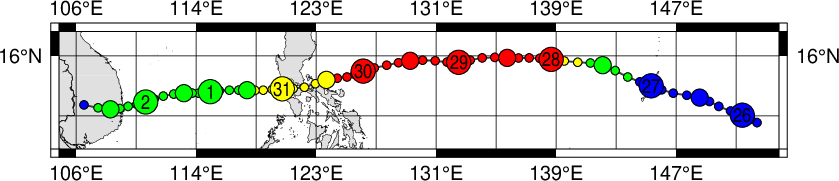
This is ecmwf +72 hr forecast
If I'm seeing it correctly, that's a southern luzon landfall.......interesting........It will be interesting as to how the forecasts will look tomorrow...
True, but notice that it is category 1 typhoon, if not tropical storm. This would indicate that the ridge was strong enough to drive it southwest (obviously) and weaken it substantially.

Still, a cat 1 hit on metro manila will be devastating......