WPAC : TROPICAL DEPRESSION MIRINAE (23W)
Moderator: S2k Moderators
-
StormingB81

- S2K Supporter

- Posts: 5676
- Age: 44
- Joined: Thu Aug 27, 2009 1:45 am
- Location: Rockledge, Florida
http://www.weather.com/maps/news/atlsto ... mated.html
Look at this radar loop from weather.com. That blow up to the NE of the typhoon. is that a partof the storm or can that blow up into another storm?
Look at this radar loop from weather.com. That blow up to the NE of the typhoon. is that a partof the storm or can that blow up into another storm?
0 likes
-
dexterlabio
- Category 5

- Posts: 3519
- Joined: Sat Oct 24, 2009 11:50 pm
Re: WPAC : TYPHOON MIRINAE (23W) PAGASA=TYPHOON SANTI
A. TYPHOON 23W (MIRINAE)
B. 29/0530Z
C. 15.9N
D. 130.7E
E. THREE/MTSAT
F. T4.0/5.0/W0.5/24HRS STT: W1.0/06HRS
G. IR/EIR/VIS/MSI
H. REMARKS: 15A/PBO TIGHTLY CURVED BANDING/ANMTN. CNVCTN WRAP
OF .70 ON LOG10 SPIRAL YIELDS A DT OF 3.0. PT AND MET YIELD A
4.0. DBO PT AND MET.
I. ADDITIONAL POSITIONS:
29/0027Z 16.1N 132.2E AMSU
29/0030Z 15.9N 132.1E MMHS
29/0207Z 15.9N 131.6E TRMM
UEHARA
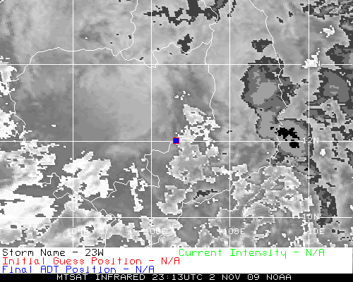
by the way, i have this feeling that mirinae is weakening. i dunno. i am just observing the sat animation.
B. 29/0530Z
C. 15.9N
D. 130.7E
E. THREE/MTSAT
F. T4.0/5.0/W0.5/24HRS STT: W1.0/06HRS
G. IR/EIR/VIS/MSI
H. REMARKS: 15A/PBO TIGHTLY CURVED BANDING/ANMTN. CNVCTN WRAP
OF .70 ON LOG10 SPIRAL YIELDS A DT OF 3.0. PT AND MET YIELD A
4.0. DBO PT AND MET.
I. ADDITIONAL POSITIONS:
29/0027Z 16.1N 132.2E AMSU
29/0030Z 15.9N 132.1E MMHS
29/0207Z 15.9N 131.6E TRMM
UEHARA
by the way, i have this feeling that mirinae is weakening. i dunno. i am just observing the sat animation.
0 likes
Personal Forecast Disclaimer:
The posts in this forum are NOT official forecast and should not be used as such. They are just the opinion of the poster and may or may not be backed by sound meteorological data. They are NOT endorsed by any professional institution or storm2k.org. For official information, please refer to the NHC and NWS products.
The posts in this forum are NOT official forecast and should not be used as such. They are just the opinion of the poster and may or may not be backed by sound meteorological data. They are NOT endorsed by any professional institution or storm2k.org. For official information, please refer to the NHC and NWS products.
-
metenthusiast

- Category 1

- Posts: 271
- Age: 48
- Joined: Sun Oct 18, 2009 1:09 am
- Location: Manila, Phllippines
- Contact:
Re: WPAC : TYPHOON MIRINAE (23W) PAGASA=TYPHOON SANTI
I know this is a bit off topic but it's still cause for concern for our Filipino friends here at storm2k
MAYON VOLCANO ADVISORY
28 October 2009, 8:00 A.M.
This is to notify the public and concerned authorities on the current activity of Mayon Volcano.
At 5:32 AM today, one minor ash explosion occurred at the summit crater of Mayon Volcano (13.2576 N, 123.6856 E). This event lasted for about one minute. The explosion produced a brownish ash column that rose to a maximum height of about 600 meters above the crater and drifted to the northeast. For the past 24 hours, the seismic network recorded thirteen (13) volcanic earthquakes. Steam emission was at moderate level creeping downslope towards southwest. Sulfur Dioxide (SO2) emission rate was measured yesterday at 250 tonnes/day. Crater glow was not observed last night due to poor visibility.
The status of Mayon Volcano remains at Alert Level 2. This means a state of unrest which could lead to more ash explosion or eventually to hazardous magmatic eruption. Thus PHIVOLCS strongly recommends that the 6-km radius Permanent Danger Zone (PDZ) around the volcano and the 7-km Extended Danger Zone (EDZ) on the southeast flank of the volcano are off-limits due to the threat from sudden explosions and rockfalls from the upper slope. Active river channels and those areas perennially identified as lahar prone in the southeast sector should also be avoided especially during bad weather condition or when there is heavy and prolonged rainfall.
0 likes
-
metenthusiast
- Category 1
- Posts: 271
- Age: 48
- Joined: Sun Oct 18, 2009 1:09 am
- Location: Manila, Phllippines
- Contact:
Re: WPAC : TYPHOON MIRINAE (23W) PAGASA=TYPHOON SANTI
dexterlabio wrote:by the way, i have this feeling that mirinae is weakening. i dunno. i am just observing the sat animation.
Yeah. That's seems to be what I'm seeing also. Hope our Pro Met friends could elaborate on this more...
0 likes
-
oaba09
- S2K Supporter
- Posts: 1496
- Age: 39
- Joined: Thu Oct 01, 2009 10:02 am
- Location: Valenzuela, Philippines
- Contact:
Re: WPAC : TYPHOON MIRINAE (23W) PAGASA=TYPHOON SANTI
dexterlabio wrote:A. TYPHOON 23W (MIRINAE)
B. 29/0530Z
C. 15.9N
D. 130.7E
E. THREE/MTSAT
F. T4.0/5.0/W0.5/24HRS STT: W1.0/06HRS
G. IR/EIR/VIS/MSI
H. REMARKS: 15A/PBO TIGHTLY CURVED BANDING/ANMTN. CNVCTN WRAP
OF .70 ON LOG10 SPIRAL YIELDS A DT OF 3.0. PT AND MET YIELD A
4.0. DBO PT AND MET.
I. ADDITIONAL POSITIONS:
29/0027Z 16.1N 132.2E AMSU
29/0030Z 15.9N 132.1E MMHS
29/0207Z 15.9N 131.6E TRMM
UEHARA
by the way, i have this feeling that mirinae is weakening. i dunno. i am just observing the sat animation.
So it is WSW.........
0 likes
-
oaba09
- S2K Supporter
- Posts: 1496
- Age: 39
- Joined: Thu Oct 01, 2009 10:02 am
- Location: Valenzuela, Philippines
- Contact:
Re: WPAC : TYPHOON MIRINAE (23W) PAGASA=TYPHOON SANTI
metenthusiast wrote:dexterlabio wrote:by the way, i have this feeling that mirinae is weakening. i dunno. i am just observing the sat animation.
Yeah. That's seems to be what I'm seeing also. Hope our Pro Met friends could elaborate on this more...
I think they're all asleep right now
0 likes
-
dexterlabio
- Category 5
- Posts: 3519
- Joined: Sat Oct 24, 2009 11:50 pm
<Analyses at 29/06 UTC>
Scale -
Intensity Strong
Center position N15°50'(15.8°)
E130°35'(130.6°)
Direction and speed of movement W 30km/h(15kt)
Central pressure 960hPa
Maximum wind speed near the center 40m/s(75kt)
Maximum wind gust speed 55m/s(105kt)
Area of 50kt winds or more Wide 110km(60NM)
Area of 30kt winds or more N370km(200NM)
S220km(120NM)
<Forecast for 30/06 UTC>
Intensity Strong
Center position of probability circle N15°30'(15.5°)
E125°20'(125.3°)
Direction and speed of movement W 25km/h(13kt)
Central pressure 960hPa
Maximum wind speed near the center 40m/s(75kt)
Maximum wind gust speed 55m/s(105kt)
Radius of probability circle 140km(75NM)
Storm warning area Wide 240km(130NM)
<Forecast for 31/06 UTC>
Intensity -
Center position of probability circle N15°30'(15.5°)
E120°50'(120.8°)
Direction and speed of movement W 20km/h(11kt)
Central pressure 980hPa
Maximum wind speed near the center 30m/s(55kt)
Maximum wind gust speed 40m/s(80kt)
Radius of probability circle 260km(140NM)
Storm warning area Wide 310km(170NM)
<Forecast for 01/06 UTC>
Intensity -
Center position of probability circle N15°25'(15.4°)
E115°00'(115.0°)
Direction and speed of movement W 25km/h(14kt)
Central pressure 980hPa
Maximum wind speed near the center 30m/s(55kt)
Maximum wind gust speed 40m/s(80kt)
Radius of probability circle 390km(210NM)
Storm warning area Wide 440km(240NM)
mirinae has weakened.
0 likes
Personal Forecast Disclaimer:
The posts in this forum are NOT official forecast and should not be used as such. They are just the opinion of the poster and may or may not be backed by sound meteorological data. They are NOT endorsed by any professional institution or storm2k.org. For official information, please refer to the NHC and NWS products.
The posts in this forum are NOT official forecast and should not be used as such. They are just the opinion of the poster and may or may not be backed by sound meteorological data. They are NOT endorsed by any professional institution or storm2k.org. For official information, please refer to the NHC and NWS products.

-
StormingB81
- S2K Supporter
- Posts: 5676
- Age: 44
- Joined: Thu Aug 27, 2009 1:45 am
- Location: Rockledge, Florida
Im just wondering what the cluster is ot the NE of this storm headed what looks to be NW. Is that part of the typhoon or another one blowing up.
http://www.weather.com/maps/news/atlsto ... mated.html
http://www.weather.com/maps/news/atlsto ... mated.html
0 likes
-
drdavisjr

- Category 1
- Posts: 428
- Age: 58
- Joined: Mon Oct 12, 2009 7:07 am
- Location: Marilao, Bulacan, Philippines
- Contact:
Re:
StormingB81 wrote:Im just wondering what the cluster is ot the NE of this storm headed what looks to be NW. Is that part of the typhoon or another one blowing up.
http://www.weather.com/maps/news/atlsto ... mated.html
Yeah, good question. I think it is definitely part of the storm.
0 likes
-
dexterlabio
- Category 5
- Posts: 3519
- Joined: Sat Oct 24, 2009 11:50 pm
Re: WPAC : TYPHOON MIRINAE (23W) PAGASA=TYPHOON SANTI
i have this feeling that this will make landfall somewhere in quezon-aurora area with winds of a category 2 or 1, that is if mirinae's circulation will continue to succumb to the effects of the shear.
0 likes
Personal Forecast Disclaimer:
The posts in this forum are NOT official forecast and should not be used as such. They are just the opinion of the poster and may or may not be backed by sound meteorological data. They are NOT endorsed by any professional institution or storm2k.org. For official information, please refer to the NHC and NWS products.
The posts in this forum are NOT official forecast and should not be used as such. They are just the opinion of the poster and may or may not be backed by sound meteorological data. They are NOT endorsed by any professional institution or storm2k.org. For official information, please refer to the NHC and NWS products.
-
dexterlabio
- Category 5
- Posts: 3519
- Joined: Sat Oct 24, 2009 11:50 pm
am i seeing things, or mirinae's circulation is really deteriorating? i didn't quite expect this to happen.
0 likes
Personal Forecast Disclaimer:
The posts in this forum are NOT official forecast and should not be used as such. They are just the opinion of the poster and may or may not be backed by sound meteorological data. They are NOT endorsed by any professional institution or storm2k.org. For official information, please refer to the NHC and NWS products.
The posts in this forum are NOT official forecast and should not be used as such. They are just the opinion of the poster and may or may not be backed by sound meteorological data. They are NOT endorsed by any professional institution or storm2k.org. For official information, please refer to the NHC and NWS products.
-
drdavisjr
- Category 1
- Posts: 428
- Age: 58
- Joined: Mon Oct 12, 2009 7:07 am
- Location: Marilao, Bulacan, Philippines
- Contact:
Re: Re:
oaba09 wrote:dexterlabio wrote:am i seeing things, or mirinae's circulation is really deteriorating? i didn't quite expect this to happen.
It's definitely weakening right now......
I think it might be recovering already...
0 likes
-
oaba09
- S2K Supporter
- Posts: 1496
- Age: 39
- Joined: Thu Oct 01, 2009 10:02 am
- Location: Valenzuela, Philippines
- Contact:
200910290600 15.8 130.6 90
200910290000 16.1 132.2 90
200910281800 16.3 133.7 85
200910281200 16.3 135.4 85
200910280600 16.2 136.9 85
200910280000 16.2 138.5 75
200910271800 15.9 140.2 65
200910271200 15.6 142.2 45
200910270600 14.8 143.7 40
200910270000 14.1 145.4 35
200910261800 13.6 146.9 35
200910261200 13.2 148.4 35
200910260600 12.7 149.9 30
200910260000 12.2 151.3 25
0 likes
Who is online
Users browsing this forum: No registered users and 36 guests