Winter Weather Discussion
Moderator: S2k Moderators
Forum rules
 The posts in this forum are NOT official forecast and should not be used as such.
 They are just the opinion of the poster and may or may not be backed by sound meteorological data. They are NOT endorsed by any professional institution or
STORM2K.
-
richtrav
- Tropical Storm

- Posts: 184
- Joined: Mon Sep 19, 2005 9:48 pm
- Location: South Texas
#3161 Postby richtrav » Sun Jan 03, 2010 2:41 am
southerngale wrote:txagwxman wrote:18z 2m temps are insane for this Friday/Saturday/Sunday in SE TX. All those palm trees are done for.
Do you (or does anyone else) know if a well matured palm tree has a better shot of survival? I have a huge one in my backyard. I just moved to this house in November '08 so this year is the first
really cold weather I've experienced with it.
it also depends on what kind of palm you have. Florida palmettos took 2F in College Station in 1989 with partial leaf burn. Texas palmettos are slightly more tender but it still
takes temperatures below 10F to do them much harm. You may have the ubiquitous Mexican fan palm in your yard, they're fast growing and widely available. An '83 type event can take them out totally but you'll probably just get some leaf scorching if it drops to the 20 range. Most tender among the commonly used large palms is the handsome queen palm. Extended temps in the low 20s are capable of taking them out if unprotected. Latest run I looked at didn't look quite as ominous as the previous and it'll probably be fine, and if it isn't then the plant could not be considered a reliable palm for your area, this is looking more like a run-of-the-mill hard freeze we used to get every few years
0 likes
-
txagwxman
- Professional-Met

- Posts: 960
- Joined: Thu Dec 24, 2009 3:26 pm
- Location: Tomball, TX
#3162 Postby txagwxman » Sun Jan 03, 2010 9:05 am
richtrav wrote:southerngale wrote:txagwxman wrote:18z 2m temps are insane for this Friday/Saturday/Sunday in SE TX. All those palm trees are done for.
Do you (or does anyone else) know if a well matured palm tree has a better shot of survival? I have a huge one in my backyard. I just moved to this house in November '08 so this year is the first
really cold weather I've experienced with it.
it also depends on what kind of palm you have. Florida palmettos took 2F in College Station in 1989 with partial leaf burn. Texas palmettos are slightly more tender but it still
takes temperatures below 10F to do them much harm. You may have the ubiquitous Mexican fan palm in your yard, they're fast growing and widely available. An '83 type event can take them out totally but you'll probably just get some leaf scorching if it drops to the 20 range. Most tender among the commonly used large palms is the handsome queen palm. Extended temps in the low 20s are capable of taking them out if unprotected. Latest run I looked at didn't look quite as ominous as the previous and it'll probably be fine, and if it isn't then the plant could not be considered a reliable palm for your area, this is looking more like a run-of-the-mill hard freeze we used to get every few years
When I was a kid growing up in Houston it got down to 12F in January 1982, and I noticed almost all the stout palm trees turned brown...probably only kid that noticed this, but hey I am meteorologist. But by summer they came back.
GEM interesting, it has some frozen stuff for SE TX on Fri.
Last edited by
txagwxman on Sun Jan 03, 2010 9:10 am, edited 1 time in total.
0 likes
“If you thought that science was certain - well, that is just an error on your part.”
-
Snowman67
- Category 2

- Posts: 640
- Joined: Thu Dec 31, 2009 12:44 pm
- Location: Tomball, TX
#3163 Postby Snowman67 » Sun Jan 03, 2010 9:05 am
NATIONAL WEATHER SERVICE HOUSTON/GALVESTON TX
353 AM CST SUN JAN 3 2010
.DISCUSSION...
CLOUDS CURRENTLY MOVING IN FROM THE WEST AND ANTICIPATE A MCLDY &
COOL DAY AREAWIDE. WILL MAINTAIN LOWISH POPS IN THE MATAGORDA BAY
AREA AND OFFSHORE WHERE BETTER SFC CONVERGENCE/MOISTURE EXISTS.
ANOTHER FRONT SHOULD PUSH THRU THE AREA TONIGHT REINFORCING THE
COOL TEMPS THRU MIDWEEK. GULF OPENS BACK UP EARLY WED AS HIGH PRES
SLIDES EWD. WILL PROBABLY SEE SCT SHRA UNDER STRONG LLJ INCREASE
IN COVERAGE THRU THE DAY WED AND WED NIGHT.
COOL WX WILL BE REPLACED BY A VERY COLD ARCTIC AIRMASS THAT WILL
BE MOVING INTO SE TX LATE WED NIGHT AND EARLY THURS MORNING.
MODELS (FWIW THIS FAR OUT) ARE ALL IN GOOD AGREEMENT SHOWING THE
FRONTAL BOUNDARY ALONG THE COAST AROUND SUNRISE WITH THE COLDEST
TEMPS LAGGING BEHIND THE INITIAL WIND SHIFT A FEW HOURS. AS
PREVIOUS FCSTER STATED...WILL LIKELY NEED TO WAIT A FEW MORE DAYS
TO NAIL DOWN THE DETAILS...BUT TOUGHEST FCST ISSUE AT THIS POINT
WILL BE NARROWING DOWN WHEN THE ASSOCIATED PRECIP ENDS. PAST
SEVERAL RUNS HAVE SHOWN SOME PRECIP LINGERING BEHIND THE FRONT FOR
3-6 HOURS AND THIS WOULD POSE A CHALLENGE AS TO WHAT TYPE. DECIDED
TO MENTION THE THREAT OF SLEET AS FAR SOUTH AS THE I-10/HWY 59
CORRIDOR THURS MORNING BASED ON LATEST DATA. BUT AGAIN...WOULDN`T
READ TOO MUCH INTO IT JUST YET AS IT`S BOUND TO CHANGE IN SOME
FASHION BETWEEN NOW AND THEN. TEMP FCSTS REMAIN BASED OFF RAW DATA
WHICH SHOWS EXTENDED PERIODS OF FREEZING TEMPS BETWEEN THURS AND
SAT. LATEST 00Z ECMWF IS ACTUALLY SHOWING A STRONG REINFORCING
HIGH MOVING FURTHER SOUTH INTO TEXAS LATER NEXT WEEKEND... 47
0 likes
Any forecast I make is based on my opinion only. Please refer to the NWS or NHC for official forecasts.
-
srainhoutx
- S2K Supporter

- Posts: 6919
- Age: 68
- Joined: Sun Jan 14, 2007 11:34 am
- Location: Haywood County, NC
-
Contact:
#3164 Postby srainhoutx » Sun Jan 03, 2010 9:45 am
As txagwxman mentioned, the GGEM shows some wintry precip in SE TX on Friday. The ECMWF has the Baja low back on the table with a reinforcing shot of Cold Air on Saturday. The EC also suggests a split flow setup which would add to the mix. Just something to think about.
0 likes
Carla/Alicia/Jerry(In The Eye)/Michelle/Charley/Ivan/Dennis/Katrina/Rita/Wilma/Ike/Harvey
Member: National Weather Association
Wx Infinity Forums
http://wxinfinity.com/index.phpFacebook.com/WeatherInfinity
Twitter @WeatherInfinity
-
iorange55
- Category 5

- Posts: 2392
- Joined: Thu Nov 13, 2008 9:47 pm
- Location: Big D
#3165 Postby iorange55 » Sun Jan 03, 2010 9:54 am
12z nam has the hp at 1052, and looks like it has a low further south, I'm not sure if it's the low.
84hr

0 likes
-
Ntxw
- Storm2k Moderator

- Posts: 23275
- Joined: Wed Oct 21, 2009 6:34 pm
- Location: DFW, Texas
#3166 Postby Ntxw » Sun Jan 03, 2010 10:02 am

Should there be a big storm, the winds will be howling between the two gradients (aside from the fact arctic air is driving it's way down) there would surely be blizzard conditions at
least Kansas northward.
Edit: Accuweather seems to want to shift from their previous storm track further south which is favorable for us in Texas


0 likes
The above post and any post by Ntxw is NOT an official forecast and should not be used as such. It is just the opinion of the poster and may or may not be backed by sound meteorological data. It is NOT endorsed by any professional institution including Storm2k. For official information, please refer to NWS products.
Help support Storm2K!

-
attallaman
#3167 Postby attallaman » Sun Jan 03, 2010 10:16 am
southerngale wrote:txagwxman wrote:18z 2m temps are insane for this Friday/Saturday/Sunday in SE TX. All those palm trees are done for.
Do you (or does anyone else) know if a well matured palm tree has a better shot of survival? I have a huge one in my backyard. I just moved to this house in November '08 so this year is the first
really cold weather I've experienced with it.
I've had sagos survive to temperatures as low as 15 degrees F. They did get burned but I cut them back in the spring and they managed to come back.
0 likes
-
srainhoutx
- S2K Supporter
- Posts: 6919
- Age: 68
- Joined: Sun Jan 14, 2007 11:34 am
- Location: Haywood County, NC
-
Contact:
#3168 Postby srainhoutx » Sun Jan 03, 2010 10:18 am
Ntxw wrote::uarrow: Should there be a big storm, the winds will be howling between the two gradients (aside from the fact arctic air is driving it's way down) there would surely be blizzard conditions at
least Kansas northward.
Edit: Accuweather seems to want to shift from their previous storm track further south which is favorable for us in Texas
NAM suggests a big change from previous guidance. Surface Low in W TX as well as a closed off Upper Low and a lot of energy behind that feature in the 200/300mb levels. May see more digging in the GFS abit later.

0 likes
Carla/Alicia/Jerry(In The Eye)/Michelle/Charley/Ivan/Dennis/Katrina/Rita/Wilma/Ike/Harvey
Member: National Weather Association
Wx Infinity Forums
http://wxinfinity.com/index.phpFacebook.com/WeatherInfinity
Twitter @WeatherInfinity
-
iorange55
- Category 5
- Posts: 2392
- Joined: Thu Nov 13, 2008 9:47 pm
- Location: Big D
#3169 Postby iorange55 » Sun Jan 03, 2010 10:19 am
Ntxw wrote::uarrow: Should there be a big storm, the winds will be howling between the two gradients (aside from the fact arctic air is driving it's way down) there would surely be blizzard conditions at
least Kansas northward.
Edit: Accuweather seems to want to shift from their previous storm track further south which is favorable for us in Texas
Now all it needs is to blow up with moisture, and we're pretty much set. The models need to bring back that storm they had 3-4 days ago that was rather amazing. But seeing as how a big storm like that is unlikely I'd take a snowfall of 1-3 inches.
0 likes
-
Ntxw
- Storm2k Moderator
- Posts: 23275
- Joined: Wed Oct 21, 2009 6:34 pm
- Location: DFW, Texas
#3170 Postby Ntxw » Sun Jan 03, 2010 10:21 am
iorange55 wrote:Ntxw wrote::uarrow: Should there be a big storm, the winds will be howling between the two gradients (aside from the fact arctic air is driving it's way down) there would surely be blizzard conditions at
least Kansas northward.
Edit: Accuweather seems to want to shift from their previous storm track further south which is favorable for us in Texas
Now all it needs is to blow up with moisture, and we're pretty much set. The models need to bring back that storm they had 3-4 days ago that was rather amazing. But seeing as how a big storm like that is unlikely I'd take a snowfall of 1-3 inches.
There would be big shifts in temperature. I think the low will be very dynamic with isentropic lifting. Again from past experience usually when it gets very cold a big storm is there to pull it south. Question is I think will we be on the warm or cold side of the storm.
0 likes
The above post and any post by Ntxw is NOT an official forecast and should not be used as such. It is just the opinion of the poster and may or may not be backed by sound meteorological data. It is NOT endorsed by any professional institution including Storm2k. For official information, please refer to NWS products.
Help support Storm2K!
-
weatherguy425
- Tropical Storm
- Posts: 180
- Joined: Sun Aug 16, 2009 1:06 pm
- Location: Houston, TX > Lubbock, TX > Savannah, GA
-
Contact:
#3171 Postby weatherguy425 » Sun Jan 03, 2010 10:24 am
ntxw- either way we'll end up getting both sides... the warm as it approaches and the cold as it departs, and thats if the cold air doesn't out run it which is certainly possible...
0 likes
-
Portastorm
- Storm2k Moderator
- Posts: 9926
- Age: 63
- Joined: Fri Jul 11, 2003 9:16 am
- Location: Round Rock, TX
-
Contact:
#3172 Postby Portastorm » Sun Jan 03, 2010 10:26 am
The 12z GFS run in starting ... this ought to be fun!

0 likes
-
Ntxw
- Storm2k Moderator
- Posts: 23275
- Joined: Wed Oct 21, 2009 6:34 pm
- Location: DFW, Texas
#3173 Postby Ntxw » Sun Jan 03, 2010 10:27 am
weatherguy425 wrote:ntxw- either way we'll end up getting both sides... the warm as it approaches and the cold as it departs, and thats if the cold air doesn't out run it which is certainly possible...
Well it hasn't been exactly warm around here or expected to really get that warm. As Srainhoutx said stepping down
It's not really going from warm to cold, but rather cold to much colder by our standards.
0 likes
The above post and any post by Ntxw is NOT an official forecast and should not be used as such. It is just the opinion of the poster and may or may not be backed by sound meteorological data. It is NOT endorsed by any professional institution including Storm2k. For official information, please refer to NWS products.
Help support Storm2K!
-
iorange55
- Category 5
- Posts: 2392
- Joined: Thu Nov 13, 2008 9:47 pm
- Location: Big D
#3174 Postby iorange55 » Sun Jan 03, 2010 10:29 am
Portastorm wrote:The 12z GFS run in starting ... this ought to be fun!
Lol when it's supposed to get fun is when it gets disappointing, so if this run is good then I'm completely sold on this event.
0 likes
-
weatherguy425
- Tropical Storm
- Posts: 180
- Joined: Sun Aug 16, 2009 1:06 pm
- Location: Houston, TX > Lubbock, TX > Savannah, GA
-
Contact:
#3175 Postby weatherguy425 » Sun Jan 03, 2010 10:30 am
yeah, but the pre-frontal airmass is certainly "warmer" than what behind the front

, its certainly the difference between rain and wintry precip.
0 likes
-
Ntxw
- Storm2k Moderator
- Posts: 23275
- Joined: Wed Oct 21, 2009 6:34 pm
- Location: DFW, Texas
#3176 Postby Ntxw » Sun Jan 03, 2010 10:33 am
weatherguy425 wrote:yeah, but the pre-frontal airmass is certainly "warmer" than what behind the front
, its certainly the difference between rain and wintry precip.
I understand, but if the track of the low is positioned just right to the south, our touch with the warmer side will be brief
. Latest snippet from FW this morning.
NORTHWEST FLOW ALOFT WILL REMAIN THROUGH TUESDAY UNTIL A STRONG
LOW PRESSURE SYSTEM DEEPENS OVER THE NORTHERN HIGH PLAINS
WEDNESDAY. THIS SYSTEM IS PROGGED TO MOVE SOUTH/SOUTHEAST THROUGH
THE END OF THE WEEK. LOW LEVEL MOISTURE WILL BRIEFLY RETURN TO
NORTH TEXAS WEDNESDAY AHEAD OF THIS SYSTEM. THE COMBINATION OF
INCREASING LARGE SCALE LIFT AND MOISTURE WILL BRING RAIN CHANCES
TO MOST OF THE REGION WEDNESDAY. RAIN CHANCES WILL INCREASE
WEDNESDAY NIGHT WHEN AN ARCTIC COLD FRONT ARRIVES. THE BEST CHANCE
OF RAIN WILL BE EAST OF INTERSTATE 35 WHERE MOISTURE WILL BE MOST
ABUNDANT. MODELS ARE INDICATING THE POSSIBILITY OF SOME POST
FRONTAL PRECIP IN THE EAST EARLY THURSDAY MORNING. IT DOES APPEAR
THAT SOME BRIEF SNOW OR RAIN MIXED WITH SNOW WILL BE POSSIBLE
BASED ON FORECAST SOUNDINGS. NO ACCUMULATIONS ARE EXPECTED
ANYWHERE IN NORTH TEXAS.
0 likes
The above post and any post by Ntxw is NOT an official forecast and should not be used as such. It is just the opinion of the poster and may or may not be backed by sound meteorological data. It is NOT endorsed by any professional institution including Storm2k. For official information, please refer to NWS products.
Help support Storm2K!
-
iorange55
- Category 5
- Posts: 2392
- Joined: Thu Nov 13, 2008 9:47 pm
- Location: Big D
#3177 Postby iorange55 » Sun Jan 03, 2010 10:39 am
Also while we wait here is a little write up on accuweather
This storm will first move into the Northwest tonight into Monday. It may then dive southward through the Rockies, then ride along the Gulf Coast before paralleling the East Coast.
During the Wednesday to Friday timeframe, snow could fall from Dallas, Texas, to Jackson, Miss., to Montgomery, Ala., to Charlotte, N.C., to Richmond, Va.
There may be enough snow to disrupt travel and lead to school cancellations.
0 likes
-
Portastorm
- Storm2k Moderator
- Posts: 9926
- Age: 63
- Joined: Fri Jul 11, 2003 9:16 am
- Location: Round Rock, TX
-
Contact:
#3178 Postby Portastorm » Sun Jan 03, 2010 10:43 am
Through 36 hours I don't see much difference at all from the 0z run. Then again, I'm only looking at the surface, 850mb, and 500 mb levels.
0 likes
-
Ntxw
- Storm2k Moderator
- Posts: 23275
- Joined: Wed Oct 21, 2009 6:34 pm
- Location: DFW, Texas
#3179 Postby Ntxw » Sun Jan 03, 2010 10:45 am
Portastorm is really onto this =P disecting frame by frame as it comes out

0 likes
The above post and any post by Ntxw is NOT an official forecast and should not be used as such. It is just the opinion of the poster and may or may not be backed by sound meteorological data. It is NOT endorsed by any professional institution including Storm2k. For official information, please refer to NWS products.
Help support Storm2K!
-
wxman22
- Category 5
- Posts: 1766
- Joined: Mon Jan 30, 2006 12:39 am
- Location: Wichita Falls, TX
-
Contact:
#3180 Postby wxman22 » Sun Jan 03, 2010 10:47 am
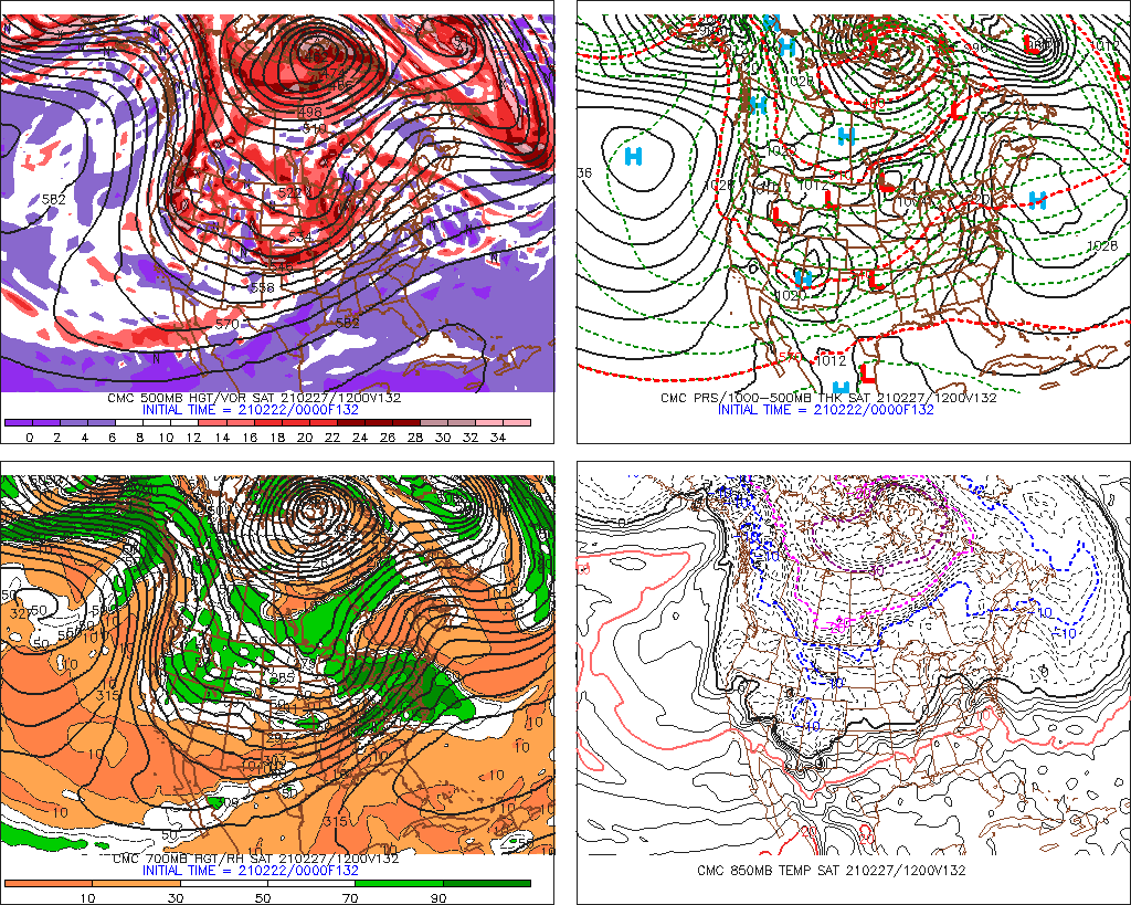
The cmc pulls the energy into Texas which i think is what causes it to show more post frontal precip?
0 likes
Return to “Winter Weather”
Who is online
Users browsing this forum: bevolon, BigB0882, BradKingK, Brazoria979cnty, cajungal, CaptinCrunch, Captmorg70, Cdenton12, cheezyWXguy, chickypez, CSpringer, DonWrk, foulbeast, gboudx, Google Adsense [Bot], gpsnowman, Harp.1, HockeyTx82, Iceresistance, JayDT, Kingarabian, Lagreeneyes03, Majestic-12 [Bot], MHTX5, Ntxw, orangeblood, Ralph's Weather, rwfromkansas, South Texas Storms, Stratton23, Tammie, Texas Snow, Tireman4, TomballEd, txtwister78, WaveBreaking, Winter_Wisher, Wthrfan, wxman22, wxman57, Yukon Cornelius and 289 guests


