


Deep South Winterwx Discussion 2015-2016
Moderator: S2k Moderators
Forum rules
 The posts in this forum are NOT official forecast and should not be used as such. They are just the opinion of the poster and may or may not be backed by sound meteorological data. They are NOT endorsed by any professional institution or STORM2K.

The posts in this forum are NOT official forecast and should not be used as such. They are just the opinion of the poster and may or may not be backed by sound meteorological data. They are NOT endorsed by any professional institution or STORM2K.
Re: Deep South Snow/Winterwx thread (2009-2010)
you guys really should watch the thickness values more than 850 temps.. 12z NAM = very little if any snow for the gulf coast.
0 likes
"It is better to live one day as a lion than a hundred years as a sheep"
-
SunnyThoughts
- Category 5

- Posts: 2263
- Joined: Wed Jul 09, 2003 12:42 pm
- Location: Pensacola, Florida
Snippet concerning the thicknesses...from Mobile/Pensacola area
IF THIS TREND CONTINUES...A WINTER STORM WATCH WILL LIKELY BE ISSUED
LATER TODAY...FOLLOWED BY EITHER A WINTER WEATHER ADVISORY OR A
POSSIBLE WINTER STORM WARNING BY SUNRISE THURSDAY.
NOTE...IF THE TRACK OF THE SURFACE LOW VERIFIES A LITTLE MORE SOUTH
THAN CURRENTLY FORECAST...COLDER AIR AND CRITICAL COLD SEASON
THICKNESSES WILL LIKELY BE PULLED MORE SOUTHWARD...WHICH WILL LIKELY
RESULT IN A SOUTHEASTWARD ADJUSTMENT TO ACCUMULATING SLEET AND SNOW.
0 likes
-
Sabanic

- Category 2

- Posts: 683
- Age: 66
- Joined: Wed Aug 01, 2007 7:01 am
- Location: Mobile, AL
- Contact:
Re: Deep South Snow/Winterwx thread (2009-2010)
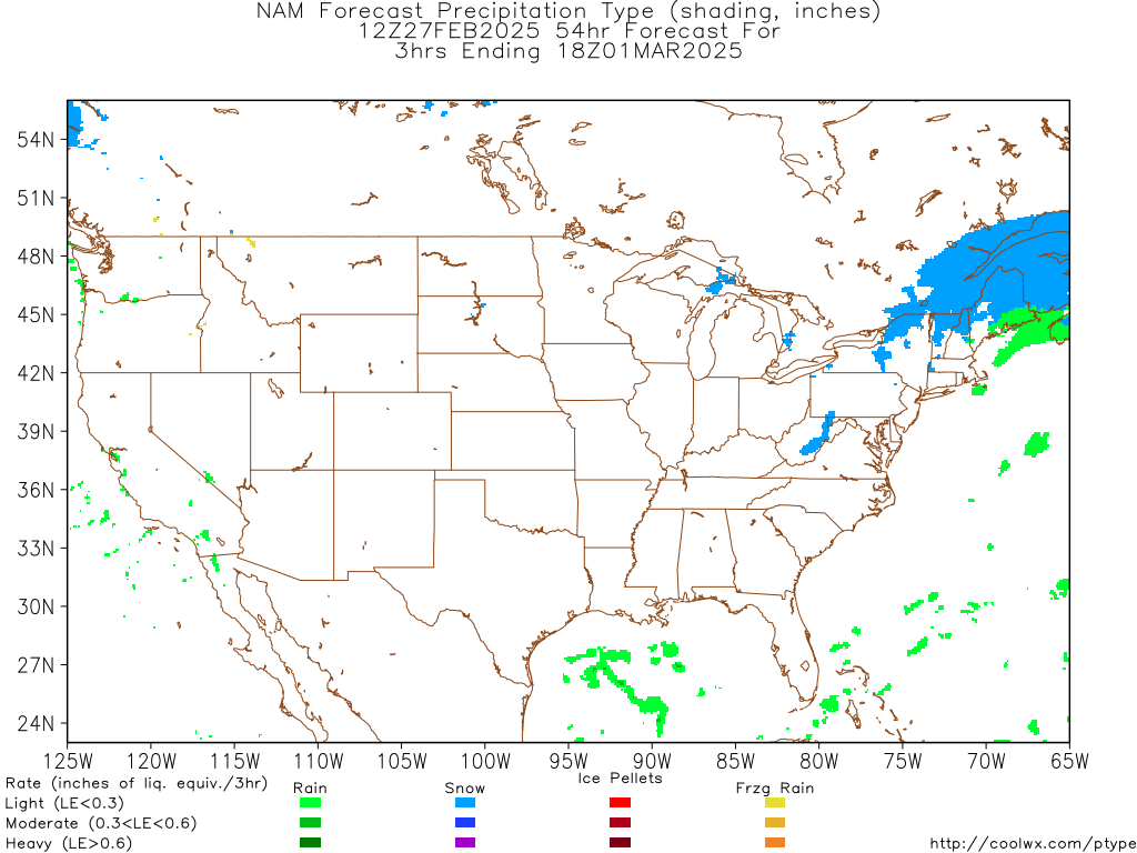
Ivanhater wrote:12z Nam Precip type
Now that would be awesome!
0 likes
"I can do all things through Christ which strengtheneth me" - Philippians 4:13
Re:
SunnyThoughts wrote:Snippet concerning the thicknesses...from Mobile/Pensacola area
IF THIS TREND CONTINUES...A WINTER STORM WATCH WILL LIKELY BE ISSUED
LATER TODAY...FOLLOWED BY EITHER A WINTER WEATHER ADVISORY OR A
POSSIBLE WINTER STORM WARNING BY SUNRISE THURSDAY.
NOTE...IF THE TRACK OF THE SURFACE LOW VERIFIES A LITTLE MORE SOUTH
THAN CURRENTLY FORECAST...COLDER AIR AND CRITICAL COLD SEASON
THICKNESSES WILL LIKELY BE PULLED MORE SOUTHWARD...WHICH WILL LIKELY
RESULT IN A SOUTHEASTWARD ADJUSTMENT TO ACCUMULATING SLEET AND SNOW.
thats true but we have discussed how southerly tracks like the one the GFS has been showing are most likely not going to happen. NAM looks about the farthest south the low would track imo
0 likes
"It is better to live one day as a lion than a hundred years as a sheep"
-
SunnyThoughts
- Category 5
- Posts: 2263
- Joined: Wed Jul 09, 2003 12:42 pm
- Location: Pensacola, Florida

Re: Deep South Snow/Winterwx thread (2009-2010)
RNGR wrote:you guys really should watch the thickness values more than 850 temps.. 12z NAM = very little if any snow for the gulf coast.
Many of the discussions talk about a great setup for evaporational cooling, with heavy precip falling through a relatively dry layer. I was skeptical about the last snow forecast in December and thought sleet at best, but this setup looks better. Nevertheless, it'll still be a close call for the immediate coast, IMO.
0 likes
-
IvanSurvivor
- Tropical Storm

- Posts: 152
- Joined: Wed Aug 20, 2008 12:12 am
- Location: Pensacola Florida (Warrington)
-
Ivanhater

- Storm2k Moderator

- Posts: 11221
- Age: 39
- Joined: Fri Jul 01, 2005 8:25 am
- Location: Pensacola
Re: Deep South Snow/Winterwx thread (2009-2010)
Even the 12z GFS brings the Freeze line all the way to the coast...the trend is going in the right direction for the Gulfcoast 

0 likes
Michael
-
Brent
- S2K Supporter

- Posts: 38762
- Age: 37
- Joined: Sun May 16, 2004 10:30 pm
- Location: Tulsa Oklahoma
- Contact:
Re: Deep South Snow/Winterwx thread (2009-2010)
SPECIAL WEATHER STATEMENT
NATIONAL WEATHER SERVICE BIRMINGHAM AL
540 AM CST WED FEB 10 2010
ALZ011>015-017>050-110600-
AUTAUGA-BARBOUR-BIBB-BLOUNT-BULLOCK-CALHOUN-CHAMBERS-CHEROKEE-
CHILTON-CLAY-CLEBURNE-COOSA-DALLAS-ELMORE-ETOWAH-FAYETTE-GREENE-HALE-
JEFFERSON-LAMAR-LEE-LOWNDES-MACON-MARENGO-MARION-MONTGOMERY-PERRY-
PICKENS-PIKE-RANDOLPH-RUSSELL-SHELBY-ST CLAIR-SUMTER-TALLADEGA-
TALLAPOOSA-TUSCALOOSA-WALKER-WINSTON-
540 AM CST WED FEB 10 2010
...WINTER WEATHER POTENTIAL FOR FRIDAY...
OVER THE LAST COUPLE OF DAYS MUCH HAS BEEN DISCUSSED IN REGARDS TO
THE POTENTIAL FOR WINTER WEATHER ON FRIDAY. AT THIS TIME...THE
FORECAST IS BEGINNING TO BE MORE CONSISTENT THAT THERE WILL BE A
CHANCE FOR AN ACCUMULATING SNOW ACROSS PORTIONS OF CENTRAL ALABAMA.
THE TIMING FOR THIS EVENT REMAINS VERY CONSISTENT IN ALL OF THE
FORECAST MODELS...AS FRIDAY LOOKS TO BE THE TARGET DAY.
HOWEVER...SOME UNCERTAINTY REMAINS ON THE TRACK OF THE SURFACE
LOW...WHICH WILL DETERMINE NOT ONLY THE AMOUNT OF MOISTURE THAT IS
OFFERED UP WITH THIS SYSTEM...BUT ALSO...HOW FAR THE FREEZING LINE
WILL DIG INTO THE SOUTH.
AS OF WEDNESDAY MORNING...THE BEST FORECAST FOR SNOW AMOUNTS OF
AROUND 2 INCHES WILL BE BETWEEN THE INTERSTATE 20 AND HIGHWAY 80
CORRIDORS...WITH 1 TO 2 INCHES NORTH AND SOUTH OF THIS AREA. A
TRACE TO ONE-HALF INCH IS EXPECTED FROM TROY TO EUFAULA.
PLEASE BEGIN TO PLAN AHEAD ON HOW SEVERAL INCHES OF SNOW COULD
AFFECT YOU AND YOUR FAMILY...BEFORE IT ACTUALLY FALLS.
CHECK BACK WITH US FREQUENTLY ON THIS POTENTIAL FOR WINTER WEATHER
FRIDAY. ON THE WEB...CHECK OUT OUR HAZARDOUS WEATHER OUTLOOK AND
OUR MULTIMEDIA IMPACT BRIEFING FOR THE LATEST INFORMATION.
$$
0 likes
#neversummer
-
PTrackerLA

- Category 5
- Posts: 5281
- Age: 42
- Joined: Thu Oct 10, 2002 8:40 pm
- Location: Lafayette, LA
Re: Deep South Snow/Winterwx thread (2009-2010)
Look at the dump of cold air for the south on Mardi Gras day! If you thought the hard freezes were over for the gulf coast, think again.

0 likes
-
Brent
- S2K Supporter
- Posts: 38762
- Age: 37
- Joined: Sun May 16, 2004 10:30 pm
- Location: Tulsa Oklahoma
- Contact:
Re: Deep South Snow/Winterwx thread (2009-2010)

Friday...Colder. Chance of snow in the morning...then snow likely in the afternoon. Light snow accumulations. Highs in the upper 30s. North winds around 5 mph. Chance of snow 70 percent.
0 likes
#neversummer
-
Ivanhater
- Storm2k Moderator
- Posts: 11221
- Age: 39
- Joined: Fri Jul 01, 2005 8:25 am
- Location: Pensacola
Re: Deep South Snow/Winterwx thread (2009-2010)
80 percent chance of Snow for Pensacola..wow 
Thursday Night: A chance of rain before midnight, then snow and sleet likely. Cloudy, with a low around 32. North wind around 5 mph. Chance of precipitation is 70%.
Friday: Snow and sleet. High near 42. North wind between 5 and 10 mph. Chance of precipitation is 80%.
Thursday Night: A chance of rain before midnight, then snow and sleet likely. Cloudy, with a low around 32. North wind around 5 mph. Chance of precipitation is 70%.
Friday: Snow and sleet. High near 42. North wind between 5 and 10 mph. Chance of precipitation is 80%.
0 likes
Michael
-
Ivanhater
- Storm2k Moderator
- Posts: 11221
- Age: 39
- Joined: Fri Jul 01, 2005 8:25 am
- Location: Pensacola
Re: Deep South Snow/Winterwx thread (2009-2010)
12z Canadian continues the Snowstorm for the Gulfcoast

0 likes
Michael
-
Extremeweatherguy

- Category 5
- Posts: 11095
- Joined: Mon Oct 10, 2005 8:13 pm
- Location: Florida
It actually looks like Pensacola could have a legitimate chance at winter weather this go around. It is still very borderline, as it usually always is in Florida, but I think that a period of mixing or a changeover is definitely possible during the colder hours of the day.
Here is a look at the 12z model skew-t's for Friday morning in the western FL panhandle:
NAM:
http://www.twisterdata.com/data/tmp/scr ... .5000W.png
http://www.twisterdata.com/data/tmp/scr ... .5000W.png
GFS:
http://www.twisterdata.com/data/tmp/scr ... .5000W.png
http://www.twisterdata.com/data/tmp/scr ... .5000W.png
Both of the models show a period where a wintery mix is very possible, if not likely. They are not very good soundings for widespread accumulating winter precipitation, but even just a few snow flakes or sleet pellets reaching the surface would be pretty exciting for the sunshine state.
I am definitely rooting for you guys in Pensacola Ivanhater! I know you've been waiting for quite some time to see winter weather, and hopefully this will finally be your chance to see some.
Last edited by Extremeweatherguy on Wed Feb 10, 2010 11:58 am, edited 1 time in total.
0 likes
Re: Deep South Snow/Winterwx thread (2009-2010)
CMC also wants to make a nice snow storm out of monday's clipper system:

0 likes
"It is better to live one day as a lion than a hundred years as a sheep"
-
Ivanhater
- Storm2k Moderator
- Posts: 11221
- Age: 39
- Joined: Fri Jul 01, 2005 8:25 am
- Location: Pensacola
Rehttp://www.storm2: Deep South Snow/Winterwx thread (2009-2
Thanks Extreme. If it is going to be cold, it might as well snow. It is certainly becoming the talk of the town today!
0 likes
Michael
-
Sabanic
- Category 2
- Posts: 683
- Age: 66
- Joined: Wed Aug 01, 2007 7:01 am
- Location: Mobile, AL
- Contact:
Re: Deep South Snow/Winterwx thread (2009-2010)
Hey IH what do you think our chances here to your west are looking like? TV & Radio folks are saying nothing for the most part.
Thanks
Thanks
0 likes
"I can do all things through Christ which strengtheneth me" - Philippians 4:13
Who is online
Users browsing this forum: No registered users and 46 guests