Caribbean - Central America Weather

U.S. & Caribbean Weather Discussions and Severe Weather Events

Moderator: S2k Moderators

Forum rules

The posts in this forum are NOT official forecast and should not be used as such. They are just the opinion of the poster and may or may not be backed by sound meteorological data. They are NOT endorsed by any professional institution or STORM2K.

Help Support Storm2K
Message
Author
User avatar
cycloneye
Admin
Admin
Posts: 145330
Age: 68
Joined: Thu Oct 10, 2002 10:54 am
Location: San Juan, Puerto Rico

Re: Caribbean - Central America Weather Thread

#5601 Postby cycloneye » Sun Jul 18, 2010 6:37 am

TWOAT
TROPICAL WEATHER OUTLOOK
NWS TPC/NATIONAL HURRICANE CENTER MIAMI FL
800 AM EDT SUN JUL 18 2010

FOR THE NORTH ATLANTIC...CARIBBEAN SEA AND THE GULF OF MEXICO...

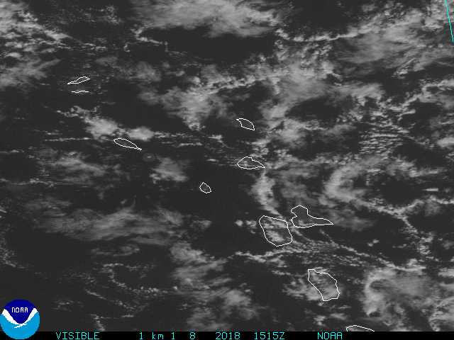
A TROPICAL WAVE LOCATED A COUPLE HUNDRED MILES EAST OF THE LEEWARD
ISLANDS IS PRODUCING DISORGANIZED SHOWERS AND THUNDERSTORMS.
ENVIRONMENTAL CONDITIONS ARE EXPECTED TO REMAIN UNFAVORABLE FOR
SIGNIFICANT DEVELOPMENT DURING THE NEXT COUPLE OF DAYS AS THIS
SYSTEM MOVES WEST-NORTHWESTWARD AT ABOUT 15 MPH. THERE IS A LOW
CHANCE...10 PERCENT...OF THIS SYSTEM BECOMING A TROPICAL CYCLONE
DURING THE NEXT 48 HOURS...ALTHOUGH CONDITIONS COULD BECOME MORE
FAVORABLE FOR DEVELOPMENT AFTER THAT TIME. REGARDLESS OF
DEVELOPMENT...GUSTY WINDS AND RAINFALL ASSOCIATED WITH THIS SYSTEM
COULD AFFECT THE LEEWARD ISLANDS...THE VIRGIN ISLANDS...AND PUERTO
RICO DURING THE NEXT COUPLE OF DAYS.

ELSEWHERE...TROPICAL CYCLONE FORMATION IS NOT EXPECTED DURING THE
NEXT 48 HOURS

$$
FORECASTER CANGIALOSI/BRENNAN

Image
0 likes   
Visit the Caribbean-Central America Weather Thread where you can find at first post web cams,radars
and observations from Caribbean basin members Click Here

User avatar
cycloneye
Admin
Admin
Posts: 145330
Age: 68
Joined: Thu Oct 10, 2002 10:54 am
Location: San Juan, Puerto Rico

Re: Caribbean - Central America Weather Thread

#5602 Postby cycloneye » Sun Jul 18, 2010 9:19 am

Image
0 likes   
Visit the Caribbean-Central America Weather Thread where you can find at first post web cams,radars
and observations from Caribbean basin members Click Here

User avatar
Gustywind
Category 5
Category 5
Posts: 12334
Joined: Mon Sep 03, 2007 7:29 am
Location: Baie-Mahault, GUADELOUPE

#5603 Postby Gustywind » Sun Jul 18, 2010 9:27 am

Yellow alert has been required for the Northern Leewards. :darrow: http://www.meteo.gp/donnees/bulletin/vi ... ilance.php
For those you want to improve their french :) :darrow:
http://www.meteo.fr/temps/domtom/antill ... ivi_in.pdf
It's the moment to begin, why not my carib friends :cheesy:

Increasing convection and better sat pic appearence a few miles from the EC islands especially the Leewards.
Image

Here is the translation from this weather alert (yellow code) at 930 AM:

Synopsis and observations:
An area of showers and tstorms (twave) is concerning the Lesser Antilles. The most active part is located on the East Atlantic, at 100 kilometers east of the Nothern Leewards (St Marteen and St Barth).

Forecasts:
Tstorms, accompanied with strong showers and sometimes gustywinds, will spread on the area of St Marteen and St Barth and could concerned these two islands, and for a pretty long period, at least tommorow night.

Summary:
The risk is moderate;
The impact expected is moderate.

Validity-Duration:
From Sunday 18th- Monday 19th at least
Next weather forecast: tonight at approximetaly 6 PM.

Stay tuned.
0 likes   

User avatar
Gustywind
Category 5
Category 5
Posts: 12334
Joined: Mon Sep 03, 2007 7:29 am
Location: Baie-Mahault, GUADELOUPE

#5604 Postby Gustywind » Sun Jul 18, 2010 9:29 am

Hope that Msbee will stay safe and dry... Any news from her Cycloneye?
0 likes   

User avatar
cycloneye
Admin
Admin
Posts: 145330
Age: 68
Joined: Thu Oct 10, 2002 10:54 am
Location: San Juan, Puerto Rico

Re: Caribbean - Central America Weather Thread

#5605 Postby cycloneye » Sun Jul 18, 2010 9:30 am

Here is Dr Jeff Masters discussion of wave.

Posted by: JeffMasters, 1:57 PM GMT on July18, 2010

A tropical wave near 18N, 60W is entering the northernmost Lesser Antilles Islands and is generating some disorganized heavy thunderstorm activity. This wave is under about 20 knots of wind shear, due to strong upper-level westerly winds. The strong upper-level winds are associated with the counter-clockwise flow of air around an upper-level cold-cored low pressure system a few hundred miles north of Puerto Rico. As the wave progresses west to west-northwest through Tuesday, thunderstorm activity will increase, due to interaction with the upper low. The rains from these thunderstorms will bring the threat of flooding to Puerto Rico on Monday, the Dominican Republic on Tuesday, and Haiti on Wednesday. The upper low will also bring high wind shear of 20 - 30 knots over the the wave on Monday and Tuesday. No development of the wave is likely until at least Thursday, when it will be over the eastern Bahamas and eastern Cuba. At that time, shear is expected to drop below 20 knots, and the wave has the potential to develop. However, none of the reliable computer models is calling for tropical cyclone development over the next seven days. I expect that this wave will eventually enter the Gulf of Mexico early next week. NHC is giving the wave a 10% chance of developing into a tropical depression by Tuesday.
0 likes   
Visit the Caribbean-Central America Weather Thread where you can find at first post web cams,radars
and observations from Caribbean basin members Click Here

User avatar
cycloneye
Admin
Admin
Posts: 145330
Age: 68
Joined: Thu Oct 10, 2002 10:54 am
Location: San Juan, Puerto Rico

Re: Caribbean - Central America Weather Thread

#5606 Postby cycloneye » Sun Jul 18, 2010 10:00 am

Image
0 likes   
Visit the Caribbean-Central America Weather Thread where you can find at first post web cams,radars
and observations from Caribbean basin members Click Here

User avatar
Gustywind
Category 5
Category 5
Posts: 12334
Joined: Mon Sep 03, 2007 7:29 am
Location: Baie-Mahault, GUADELOUPE

#5607 Postby Gustywind » Sun Jul 18, 2010 10:06 am

Image
0 likes   

User avatar
abajan
S2K Supporter
S2K Supporter
Posts: 4231
Joined: Sun Sep 07, 2003 5:10 am
Location: Barbados

#5608 Postby abajan » Sun Jul 18, 2010 10:21 am

The amount of rain Puerto Ricans have had so far this year is amazing. And now it looks like they may have this system to contend with too!
0 likes   

User avatar
Gustywind
Category 5
Category 5
Posts: 12334
Joined: Mon Sep 03, 2007 7:29 am
Location: Baie-Mahault, GUADELOUPE

#5609 Postby Gustywind » Sun Jul 18, 2010 11:10 am

Heavy downpours for the Northern Leewards.
0 likes   

User avatar
cycloneye
Admin
Admin
Posts: 145330
Age: 68
Joined: Thu Oct 10, 2002 10:54 am
Location: San Juan, Puerto Rico

Re: Caribbean - Central America Weather Thread

#5610 Postby cycloneye » Sun Jul 18, 2010 12:36 pm

TROPICAL WEATHER OUTLOOK
NWS TPC/NATIONAL HURRICANE CENTER MIAMI FL
200 PM EDT SUN JUL 18 2010

FOR THE NORTH ATLANTIC...CARIBBEAN SEA AND THE GULF OF MEXICO...

A TROPICAL WAVE APPROACHING THE LEEWARD ISLANDS CONTINUES TO PRODUCE
DISORGANIZED SHOWERS AND THUNDERSTORMS. HOWEVER...SURFACE
PRESSURES REMAIN HIGH...AND ANY DEVELOPMENT OF THIS SYSTEM WILL BE
SLOW TO OCCUR AS IT MOVES WEST-NORTHWESTWARD AT ABOUT 15 MPH.
THERE IS A LOW CHANCE...10 PERCENT...OF THIS SYSTEM BECOMING A
TROPICAL CYCLONE DURING THE NEXT 48 HOURS. REGARDLESS OF
DEVELOPMENT...GUSTY WINDS AND LOCALLY HEAVY RAINFALL ASSOCIATED
WITH THIS SYSTEM COULD AFFECT THE LEEWARD ISLANDS...THE VIRGIN
ISLANDS...PUERTO RICO...THE DOMINICAN REPUBLIC...HAITI...AND THE
TURKS AND CAICOS ISLANDS DURING THE NEXT COUPLE OF DAYS.

ELSEWHERE...TROPICAL CYCLONE FORMATION IS NOT EXPECTED DURING THE
NEXT 48 HOURS

$$
FORECASTER BRENNAN

Image
0 likes   
Visit the Caribbean-Central America Weather Thread where you can find at first post web cams,radars
and observations from Caribbean basin members Click Here

User avatar
Gustywind
Category 5
Category 5
Posts: 12334
Joined: Mon Sep 03, 2007 7:29 am
Location: Baie-Mahault, GUADELOUPE

#5611 Postby Gustywind » Sun Jul 18, 2010 12:55 pm

000
AXNT20 KNHC 181751
TWDAT

TROPICAL WEATHER DISCUSSION
NWS TPC/NATIONAL HURRICANE CENTER MIAMI FL
205 PM EDT SUN JUL 18 2010

TROPICAL WEATHER DISCUSSION FOR NORTH AMERICA...CENTRAL
AMERICA...GULF OF MEXICO...CARIBBEAN SEA...NORTHERN SECTIONS OF
SOUTH AMERICA...AND ATLANTIC OCEAN TO THE AFRICAN COAST FROM THE
EQUATOR TO 32N. THE FOLLOWING INFORMATION IS BASED ON SATELLITE
IMAGERY...METEOROLOGICAL ANALYSIS...WEATHER OBSERVATIONS...AND
RADAR.

BASED ON 1200 UTC SURFACE ANALYSIS AND SATELLITE IMAGERY THROUGH
1715 UTC...

...TROPICAL WAVES...


TROPICAL WAVE IS APPROACHING THE LESSER ANTILLES ALONG 59W S OF
19N MOVING W 15-20 KT. BROAD CYCLONIC FLOW IS ABOUT THE WAVE
AXIS EVIDENT IN SATELLITE IMAGERY. A LARGE AREA OF DEEP LAYER
MOISTURE ALSO ACCOMPANIES THE WAVE SEEN IN TOTAL PRECIPITABLE
WATER IMAGERY. SCATTERED STRONG CONVECTION IS NEAR THE NRN
EXTENT OF THE WAVE FROM 16N-20N BETWEEN 56W-64W ALREADY
IMPACTING PORTIONS OF THE LEEWARD ISLANDS. THIS WAVE WILL LIKELY
BRING HEAVY RAINFALL AND GUSTY WINDS TO THE LEEWARD
ISLANDS...VIRGIN ISLANDS...AND PUERTO RICO OVER THE NEXT COUPLE
OF DAYS.


$$

WALTON
0 likes   

User avatar
Gustywind
Category 5
Category 5
Posts: 12334
Joined: Mon Sep 03, 2007 7:29 am
Location: Baie-Mahault, GUADELOUPE

#5612 Postby Gustywind » Sun Jul 18, 2010 12:55 pm

Image
0 likes   

User avatar
KWT
Category 5
Category 5
Posts: 31415
Joined: Tue Aug 17, 2004 11:02 am
Location: UK!!!

#5613 Postby KWT » Sun Jul 18, 2010 1:01 pm

Lots of rain heading for you Luis looking at the radar, your gonna have a rather wet night I think tonight looking at the way things are developing.
0 likes   
Personal Forecast Disclaimer:
The posts in this forum are NOT official forecast and should not be used as such. They are just the opinion of the poster and may or may not be backed by sound meteorological data. They are NOT endorsed by any professional institution or storm2k.org. For official information, please refer to the NHC and NWS products

User avatar
Gustywind
Category 5
Category 5
Posts: 12334
Joined: Mon Sep 03, 2007 7:29 am
Location: Baie-Mahault, GUADELOUPE

#5614 Postby Gustywind » Sun Jul 18, 2010 1:11 pm

Looks like this system is not moving very fast, wet weather conditions on much of the Leewards but especially the Nothern including PR and the BVI. Be safe and dry Luis, keep us informed...
Image
0 likes   

User avatar
cycloneye
Admin
Admin
Posts: 145330
Age: 68
Joined: Thu Oct 10, 2002 10:54 am
Location: San Juan, Puerto Rico

Re: Caribbean - Central America Weather Thread

#5615 Postby cycloneye » Sun Jul 18, 2010 1:58 pm

MARINE WEATHER STATEMENT
NATIONAL WEATHER SERVICE SAN JUAN PR
204 PM AST SUN JUL 18 2010

AMZ710-715-725-732-182100-
204 PM AST SUN JUL 18 2010

...STRONG THUNDERSTORMS OVER THE LOCAL WATERS...

AT 156 PM AST...NATIONAL WEATHER SERVICE DOPPLER RADAR INDICATED A
LINE OF THUNDERSTORMS...PRODUCING GUSTY WINDS...46 NM EAST OF
CULEBRA...MOVING WEST AT AROUND 25 KNOTS.

MARINERS CAN EXPECT GUSTY WINDS...LOCALLY HIGHER WAVES...LIGHTNING
STRIKES...AND HEAVY DOWNPOURS. BOATERS SHOULD SEEK SAFE HARBOR
IMMEDIATELY UNTIL THIS STORM PASSES.

LIGHTNING IS OCCURRING WITH THIS STORM. IF CAUGHT ON THE OPEN WATER
STAY BELOW DECK IF POSSIBLE...KEEP AWAY FROM UNGROUNDED METAL
OBJECTS.

LAT...LON 1786 6577 1792 6569 1795 6574 1950 6520
1950 6407 1700 6479 1701 6607

$$

MARTINEZ
0 likes   
Visit the Caribbean-Central America Weather Thread where you can find at first post web cams,radars
and observations from Caribbean basin members Click Here

User avatar
cycloneye
Admin
Admin
Posts: 145330
Age: 68
Joined: Thu Oct 10, 2002 10:54 am
Location: San Juan, Puerto Rico

Re: Caribbean - CA=Strong Wave affecting Leewards,VI Puerto Rico

#5616 Postby cycloneye » Sun Jul 18, 2010 2:00 pm

000
FXCA62 TJSJ 181844
AFDSJU

AREA FORECAST DISCUSSION
NATIONAL WEATHER SERVICE SAN JUAN PR
244 PM AST SUN JUL 18 2010

.SYNOPSIS...AT UPPER LEVELS...TUTT LOW WITHDRAWS TO NORTHEAST AND
RETURNS OVER THE COURSE OF THE WORK WEEK. OVER THE WEEKEND IT SETS
OUT FOR THE FLORIDA STRAITS WHILE HIGH PRESSURE FILLS IN FROM THE
WEST ALONG 30 NORTH. AN INVERTED TROUGH NEAR 39 WEST WILL MOVE
SOUTH OF THE AREA SATURDAY FOLLOWED BY ANOTHER SUNDAY NIGHT.

AT MID LEVELS...HIGH PRESSURE SHIFTS EAST AT 30 NORTH WHILE A LOW
NEAR 35 WEST MOVES SOUTHWEST AND THEN WEST...CROSSING THE WINDWARD
ISLANDS ON THURSDAY AND THE LOCAL AREA ON FRIDAY NIGHT...BUT A
WEAK AND DISORGANIZED INVERTED TROUGH REMAINS OVER THE EASTERN AND
CENTRAL CARIBBEAN AREA UNTIL NEXT WEEKEND.

AT LOWER LEVELS... A BROAD AND VIGOROUS TROPICAL WAVE CROSSING THE
LEEWARD ISLANDS HAS BEGUN AFFECTING SAINT CROIX AND SAINT THOMAS
AND WILL SOON BE FELT IN PUERTO RICO. EFFECTS FROM THIS WAVE MAY
BE FELT AS LATE AS WEDNESDAY. A WEAK WIND SURGE MAY BE IN THE
WORKS FOR NEXT SUNDAY.

&&

.DISCUSSION...SHOWERS HAVE BEEN SLOW TO DEVELOP DESPITE UNSTABLE
CONDITIONS...AND SUSPECT THAT UPPER LEVELS HAVE MODERATED AS
MENTIONED IN THE PREVIOUS DISCUSSION. HEAVY SHOWERS CONTINUE IN
SOUTHWEST PUERTO RICO AND A FEW SHOWERS WERE MOVING ACROSS EAST
CENTRAL PUERTO RICO. AND ACTIVITY MAY CONTINUE TO DEVELOP OVER
PUERTO RICO APART FROM THE WAVE THROUGH 6 PM. BUT BY FAR THE MOST
ACTIVITY IS NOW ENTERING THE FORECAST AREA FROM THE EAST AND IS
CROSSING THE U.S. VIRGIN ISLANDS. IST AND ISX HAVE REPORTED GUSTS
OF 20 TO 27 KNOTS SO FAR AND EXPECT GUSTS ONLY A LITTLE HIGHER
NEAR THE STRONGER THUNDERSTORMS FOR NOW. THE ASCAT PASS AT 18/1338Z
SHOWED WINDS OF 15 TO 19 KNOTS IN MOST OF THE AREA UNDER THE WAVE
WHERE IT WAS VISIBLE. THE ECMWF APPEARS TO BE ON A WINNING STREAK.
THE CONTINUED MOISTURE IT FORECAST FOR EASTERN PUERTO RICO LAST NIGHT
VERIFIED WELL. LIGHT AMOUNTS WERE HAD IN ABOUT 80 PERCENT OF THE
EASTERN THIRD OF THE ISLAND. SHOWERS ARE NOW PASSING THROUGH THE
VIRGIN ISLANDS AND MAY ARRIVE BEFORE 6 PM AST IN EASTERN PUERTO
RICO...AND WILL ALMOST CERTAINLY WET MUCH OF THE EASTERN HALF OF
PUERTO RICO AS WELL AND CONTINUE WITH THE INCLEMENT WEATHER IN THE
VIRGIN ISLAND TONIGHT AND TOMORROW. THEREFORE HAVE CONTINUED WITH
THE ECMWF FORECAST THROUGH MUCH OF THE WEEK. AS POINTED OUT BY THE
PREVIOUS SHIFT...THE WIDE TROPICAL WAVE MAY BE COMPRISED OF TWO
SEPARATE VORTICES WHICH ROTATED AROUND EACH OTHER IN THEIR JOURNEY
ACROSS THE ATLANTIC. THE ECMWF APPEARS TO DEPICT THIS IN THE
PASSAGE OF TWO WAVES...ONE ON MONDAY MORNING WITH GOOD MOISTURE
AND ONE ON TUESDAY MORNING WITH VERY GOOD MOISTURE. THEN LOW LEVEL
CONVERGENCE CONTINUES ON WEDNESDAY MORNING ALSO WITH VERY GOOD
MOISTURE. THEREFORE CONSIDER THAT RAINY WET WEATHER WILL CONTINUE
THROUGH AT LEAST WEDNESDAY WITH THE BEST AMOUNTS IN EASTERN PUERTO
RICO. THERE IS SOME DRYING ON THURSDAY AND THEN THESE LESSER LEVELS
OF MOISTURE CONTINUE FRIDAY...STILL GOOD FOR SCATTERED SHOWERS.
FEATURES ARE MUCH LESS DISTINCT FOR THE LATTER PART OF THE WEEK
AND NEXT WEEKEND AND WILL TAKE THIS AS A SIGN OF AN AT LEAST
TEMPORARY RETURN TO SOME SEMBLANCE OF NORMALCY FOR THE MONTH OF
JULY.

WITH ALL THIS RAIN THE POSSIBILITY OF SOME FLOODING IS BEGINNING
TO LOOM. WHETHER IT OCCURS WITH THE FIRST WAVE OR THE SECOND IS
UNCERTAIN AND MAY HAVE MORE TO DO WITH THE TIMING OF THE PASSAGE
OF THE FIRST WAVE DURING THE NORMALLY MORE INACTIVE NIGHTTIME
PERIOD. THEREFORE WILL DEFER TO THE EVENING SHIFT WHETHER TO PUT
UP A FLASH FLOOD WATCH FOR MONDAY MORNING OR NOT.


&&

.AVIATION...TEMPO MVFR CONDS AND MOUNTAIN OBSCURATIONS EXPECTED IN AND
AROUND TJMZ IN SHRA OR TSRA THROUGH 18/21Z. THEN...AN APPROACHING
TROPICAL WAVE WILL INCREASE SHOWER AND THUNDERSTORM ACTIVITY ACROSS
THE LOCAL AREA. THEREFORE...MVFR OR EVEN IFR CONDS NOW PRESENT IN
TNCM/TKPK...THEN SPREADING IN AND AROUND TIST/TISX AFT 18/20Z AND
TJSJ 19/00Z. ALL HIGHER TERRAIN IS EXPECTED TO BE OBSCURED AFT
19/08Z.

&&

.MARINE...SEAS AT BUOY 41043 HAVE REMAINED ABOVE 7 FEET SINCE
18/12Z AND ARE EXPECTED TO INCREASE SOMEWHAT AS TROPICAL WAVE
APPROACHES. SMALL CRAFT ADVISORIES SHOULD REMAIN CONFINED TO
ATLANTIC WATERS AND THE ANEGADA PASSAGE. HOWEVER STRONG GUSTS
SHOULD BE EXPECTED NEAR THUNDERSTORMS...AND SOME MAY EXCEED 35 KNOTS.

0 likes   
Visit the Caribbean-Central America Weather Thread where you can find at first post web cams,radars
and observations from Caribbean basin members Click Here

User avatar
knotimpaired
Category 1
Category 1
Posts: 495
Joined: Fri May 20, 2005 4:14 am
Location: Vieques, PR
Contact:

Re: Caribbean - CA=Strong Wave affecting Leewards,VI Puerto Rico

#5617 Postby knotimpaired » Sun Jul 18, 2010 2:22 pm

Well this weekend is our Patronales and the parade was supposed to start at 1pm. But in Vieques time that means 3 pm. We watched the dark clouds moving in and made it home by 2:58.

Now it is raining cats and dogs. Since 3 pm we have had .45" and it does not look as if it is going to let up anytime soon.

If they had started the parade at 1 it would have been over by now :roll:
0 likes   

User avatar
cycloneye
Admin
Admin
Posts: 145330
Age: 68
Joined: Thu Oct 10, 2002 10:54 am
Location: San Juan, Puerto Rico

Re: Caribbean - CA=Strong Wave affecting Leewards,VI Puerto Rico

#5618 Postby cycloneye » Sun Jul 18, 2010 2:25 pm

knotimpaired wrote:Well this weekend is our Patronales and the parade was supposed to start at 1pm. But in Vieques time that means 3 pm. We watched the dark clouds moving in and made it home by 2:58.

Now it is raining cats and dogs. Since 3 pm we have had .45" and it does not look as if it is going to let up anytime soon.

If they had started the parade at 1 it would have been over by now :roll:


Yes, Puerto Rican time as usual. I think the rest of the patronales will be wet.
0 likes   
Visit the Caribbean-Central America Weather Thread where you can find at first post web cams,radars
and observations from Caribbean basin members Click Here

User avatar
knotimpaired
Category 1
Category 1
Posts: 495
Joined: Fri May 20, 2005 4:14 am
Location: Vieques, PR
Contact:

Re: Caribbean - CA=Strong Wave affecting Leewards,VI Puerto Rico

#5619 Postby knotimpaired » Sun Jul 18, 2010 2:32 pm

Yes, I have a feeling this is going to last quite a while. The good news is that our headliner Tito "El Bambino" played last night and it was dry for him.

We are now up to .82" in 31 minutes.
0 likes   

User avatar
cycloneye
Admin
Admin
Posts: 145330
Age: 68
Joined: Thu Oct 10, 2002 10:54 am
Location: San Juan, Puerto Rico

Re: Caribbean - CA=Strong Wave affecting Leewards,VI Puerto Rico

#5620 Postby cycloneye » Sun Jul 18, 2010 2:35 pm

knotimpaired, here is your Vieques station.

http://www.playacofi.com/weather/
0 likes   
Visit the Caribbean-Central America Weather Thread where you can find at first post web cams,radars
and observations from Caribbean basin members Click Here


Return to “USA & Caribbean Weather”

Who is online

Users browsing this forum: No registered users and 33 guests