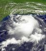
Just thought I'd mention that GOES-15 (launched March 4, 2010) is now in Super Rapid Scan Operations aka it updates every minute.
The general link: http://rammb.cira.colostate.edu/ramsdis ... oes-15.asp
Igor Floater: http://rammb.cira.colostate.edu/ramsdis ... height=600
ATL: IGOR - Ex Hurricane - Discussion
Moderator: S2k Moderators
-
JonathanBelles
- Professional-Met

- Posts: 11430
- Age: 35
- Joined: Sat Dec 24, 2005 9:00 pm
- Location: School: Florida State University (Tallahassee, FL) Home: St. Petersburg, Florida
- Contact:

Re: ATL: Hurricane IGOR - Discussion
sure doesnt look like it wants to turn.....I think it will though that south of west jog gave it a little breathing room before it hits the weakness....It would make me nervous also.... 
0 likes
-
Aric Dunn
- Category 5

- Posts: 21238
- Age: 43
- Joined: Sun Sep 19, 2004 9:58 pm
- Location: Ready for the Chase.
- Contact:
Re: ATL: Hurricane IGOR - Discussion
Clearly still moving just south of due west and is south of all guidance which have it moving WNW now..

0 likes
Note: If I make a post that is brief. Please refer back to previous posts for the analysis or reasoning. I do not re-write/qoute what my initial post said each time.
If there is nothing before... then just ask
Space & Atmospheric Physicist, Embry-Riddle Aeronautical University,
I believe the sky is falling...
If there is nothing before... then just ask
Space & Atmospheric Physicist, Embry-Riddle Aeronautical University,
I believe the sky is falling...

Re:
fact789 wrote:Just thought I'd mention that GOES-15 (launched March 4, 2010) is now in Super Rapid Scan Operations aka it updates every minute.
The general link: http://rammb.cira.colostate.edu/ramsdis ... oes-15.asp
Igor Floater: http://rammb.cira.colostate.edu/ramsdis ... height=600
Glimpse of the future there.
0 likes
-
CrazyC83
- Professional-Met
- Posts: 34315
- Joined: Tue Mar 07, 2006 11:57 pm
- Location: Deep South, for the first time!
Re: Re:
cpdaman wrote:CrazyC83 wrote:brunota2003 wrote:3. ADDITIONAL DAY OUTLOOK: POSSIBLE FIX OF HURRICANE
IGOR AT 16/1800Z NEAR 23.5N 58.5W.
That might need to be pushed up, since Igor is likely to be at that longitude within 48 hours, not 72, at this rate, and a much greater island threat. IMO, if current trends continue, I would send out a Gulfstream plane tonight and Recon tomorrow afternoon if Igor has not gained latitude yet.
in your mind what are you thinking for the islands as far as possible winds (UNOFFICIALLY)
Personal Forecast Disclaimer:
The posts in this forum are NOT official forecast and should not be used as such. They are just the opinion of the poster and may or may not be backed by sound meteorological data. They are NOT endorsed by any professional institution or storm2k.org. For official information, please refer to the NHC and NWS products.
VERY difficult to say right now, but if it doesn't turn at all (worst-case scenario), hurricane conditions easily with possible winds over 110 mph. Still time to turn but not that much room before at least tropical storm conditions become possible in the northern Leewards. After that, every move farther south increases the chance of hurricane conditions and increases threats farther south and west.
I would at this point guess for the northernmost Leewards a 50% chance of TS conditions and a 20% chance of hurricane conditions given the size of the storm.
Last edited by CrazyC83 on Mon Sep 13, 2010 1:11 pm, edited 1 time in total.
0 likes
-
tolakram
- Admin

- Posts: 20185
- Age: 62
- Joined: Sun Aug 27, 2006 8:23 pm
- Location: Florence, KY (name is Mark)
Re: ATL: Hurricane IGOR - Discussion
expat2carib wrote:OK they have been great. But don't ignore the "Earl factor" for not so long ago. NHC projection of Earl didn't suppose to shave the northern Leewards until very late where the cone changed.
http://www.nhc.noaa.gov/archive/2010/gr ... p_5W.shtml
True, but then again the initial tracks were much closer to the islands, and no big NW turn like they are forecasting with Igor. It was always shown to be a shallow turn to the NW. I am agreeing, though, that this needs to be watched very closely.
0 likes
M a r k
- - - - -
Join us in chat: Storm2K Chatroom Invite. Android and IOS apps also available.
The posts in this forum are NOT official forecasts and should not be used as such. Posts are NOT endorsed by any professional institution or STORM2K.org. For official information and forecasts, please refer to NHC and NWS products.
Re: ATL: Hurricane IGOR - Discussion
granted ARIC...that is about two hours old
this one goes thru 145pm
http://rammb.cira.colostate.edu/ramsdis ... _floater_1
this one goes thru 145pm
http://rammb.cira.colostate.edu/ramsdis ... _floater_1
Last edited by cpdaman on Mon Sep 13, 2010 1:18 pm, edited 1 time in total.
0 likes
-
theregulator
- Tropical Wave

- Posts: 6
- Age: 53
- Joined: Thu Aug 26, 2010 2:10 pm
- Location: Everett, WA
- Contact:
Re: ATL: Hurricane IGOR - Discussion
That's pretty telling movement outside of the forecast pockets, which after looking at your last post, Aric, it does seem to emulate how Ike presented in the models initially - still a LONG way to go before he hits the GOM - but this west and south of west movement is absolutely NOT as predicted.
Could he be subverting the weakness in the ridge to the north, as implied in another post, and if so, just how much further south and west could this shift the track? Along the likes of Ike would be a very scary situation.
Could he be subverting the weakness in the ridge to the north, as implied in another post, and if so, just how much further south and west could this shift the track? Along the likes of Ike would be a very scary situation.
Aric Dunn wrote:Clearly still moving just south of due west and is south of all guidance which have it moving WNW now..
0 likes

Re: ATL: Hurricane IGOR - Discussion
Just my 2 cents ... and this is NOT a forecast of any kind .... disclaimer , disclaimer , disclaimer .... this is merely a set of observations ....
1. the visible cloud pattern at this point does not have a "look" that there is any real troughing influence on the steering ... the clouds at the higher levels do not seem to be streaming north or northeast
2. I see no indication that the system infrastructure is becoming stretched in any northerly fashion .... again no indication of a real troughing influence
3. in looking at the 200 mb vorticity I see the upper trough due north of the system ... maybe even a bit northeast ... indication that they have "passed as ships in the night"
4. The upstream trough appears at least over the last several hours to be flattening not digging ... future re-curve maybe later ??
5. the system has not appeared to have "slowed significantly " ... which would usually indicate a change in the process ... ie a change in direction of motion
again ... all of the above are just my take and have no intention of being any forecast whatsoever
0 likes
-
x-y-no

- Category 5
- Posts: 8359
- Age: 65
- Joined: Wed Aug 11, 2004 12:14 pm
- Location: Fort Lauderdale, FL
Re: ATL: Hurricane IGOR - Discussion
expat2carib wrote:OK they have been great. But don't ignore the "Earl factor" for not so long ago. NHC projection of Earl didn't suppose to shave the northern Leewards until very late where the cone changed.
The NE Leewards were in the 5-day cone in the Wed. Aug. 25 5pm and 11pm advisories. They were then out of the cone for 2 advisories - Thu. Aug. 26 5am and 11am. By Thu. Aug. 26 5pm they were back in the cone and remained in the cone all the way up to impact.
0 likes
-
Aric Dunn
- Category 5
- Posts: 21238
- Age: 43
- Joined: Sun Sep 19, 2004 9:58 pm
- Location: Ready for the Chase.
- Contact:
what was the previous best track position?
well no gain in lat in the last 6 hours and that is a about 68 miles west in the last 6 hours.. or about 11 mph
13/1145 UTC 17.6N 49.2W
13/1745 UTC 17.6N 50.1W T6.5/6.5
well no gain in lat in the last 6 hours and that is a about 68 miles west in the last 6 hours.. or about 11 mph
13/1145 UTC 17.6N 49.2W
13/1745 UTC 17.6N 50.1W T6.5/6.5
Last edited by Aric Dunn on Mon Sep 13, 2010 1:28 pm, edited 1 time in total.
0 likes
Note: If I make a post that is brief. Please refer back to previous posts for the analysis or reasoning. I do not re-write/qoute what my initial post said each time.
If there is nothing before... then just ask
Space & Atmospheric Physicist, Embry-Riddle Aeronautical University,
I believe the sky is falling...
If there is nothing before... then just ask
Space & Atmospheric Physicist, Embry-Riddle Aeronautical University,
I believe the sky is falling...
-
cycloneye

- Admin
- Posts: 149484
- Age: 69
- Joined: Thu Oct 10, 2002 10:54 am
- Location: San Juan, Puerto Rico
Re:
Aric Dunn wrote:what was the previous best track position?
Here are the last two 06z and 12z.Still waiting for 18z.
AL, 11, 2010091306, , BEST, 0, 177N, 484W, 130, 935, HU,
AL, 11, 2010091312, , BEST, 0, 176N, 492W, 130, 933, HU
0 likes
Visit the Caribbean-Central America Weather Thread where you can find at first post web cams,radars
and observations from Caribbean basin members Click Here
and observations from Caribbean basin members Click Here
-
DisasterMagnet
- Tropical Low

- Posts: 17
- Joined: Tue Aug 10, 2010 9:55 pm
Re: ATL: Hurricane IGOR - Discussion
I'm a total novice, and joined here to learn the more technical side of storm watching. I hope to go back to school to be a pro-met.
That said, if I still lived on STT (UVI grad), I would be starting preparations ASAP. It's very worrisome that the expected turn isn't happening as quickly as expected. I went from enjoying this awesome storm to having that pit-of-the-stomach feeling.
Also, re: the steering maps from earlier...How long do they prevail if current? Again, this is from a newbie, but I interpret those as to pushing Igor south and/or west for the time being.
Again, anything I post is purely speculative and is strictly opinion.
0 likes


-
x-y-no
- Category 5
- Posts: 8359
- Age: 65
- Joined: Wed Aug 11, 2004 12:14 pm
- Location: Fort Lauderdale, FL
Re: ATL: Hurricane IGOR - Discussion
hcane27 wrote:3. in looking at the 200 mb vorticity I see the upper trough due north of the system ... maybe even a bit northeast ... indication that they have "passed as ships in the night"
That shortwave isn't what's supposed to pick him up. Rather, it's the broad trough plunging down between 80w and 65w ... what you referred to as the upstream trough.
Other than that, I largely agree with your points - there's no sign in the current appearance of the storm that the turn is starting. I think we may well see mostly west movement for another 6 to 12 hours.
0 likes


-
cycloneye
- Admin
- Posts: 149484
- Age: 69
- Joined: Thu Oct 10, 2002 10:54 am
- Location: San Juan, Puerto Rico
Re: ATL: Hurricane IGOR - Discussion
18z Best Track
AL, 11, 2010091318, , BEST, 0, 176N, 501W, 130, 933, HU
ftp://ftp.tpc.ncep.noaa.gov/atcf/tcweb/ ... 010.invest
AL, 11, 2010091318, , BEST, 0, 176N, 501W, 130, 933, HU
ftp://ftp.tpc.ncep.noaa.gov/atcf/tcweb/ ... 010.invest
0 likes
Visit the Caribbean-Central America Weather Thread where you can find at first post web cams,radars
and observations from Caribbean basin members Click Here
and observations from Caribbean basin members Click Here
-
MortisFL

- Category 1

- Posts: 391
- Age: 42
- Joined: Mon Jul 21, 2003 9:01 am
- Location: Sarasota, FL
- Contact:
Re: ATL: Hurricane IGOR - Discussion
Looks like its back on a west course after it made a WSW dip.
0 likes
Who is online
Users browsing this forum: No registered users and 59 guests