Global model runs discussion

Moderator: S2k Moderators

Message
Author
User avatar
GCANE
S2K Supporter
S2K Supporter
Posts: 11496
Joined: Mon Oct 22, 2007 8:03 am

Re: Global Model Runs Discussion

#2221 Postby GCANE » Mon Jul 11, 2011 5:52 am

00Z GFS is maintaining the CV wave.

Image

Image

Image
0 likes   

floridasun78
Category 5
Category 5
Posts: 3755
Joined: Sun May 17, 2009 10:16 pm
Location: miami fl

#2222 Postby floridasun78 » Mon Jul 11, 2011 7:44 am

i hope we dont have any storm next week i going on vacation to miami beach do any model run show any system for next week?
0 likes   

User avatar
StormTracker
S2K Supporter
S2K Supporter
Posts: 2903
Age: 59
Joined: Thu Jun 29, 2006 6:06 am
Location: Quail Heights(Redlands), FL.

Re:

#2223 Postby StormTracker » Mon Jul 11, 2011 10:22 am

floridasun78 wrote:i hope we dont have any storm next week i going on vacation to miami beach do any model run show any system for next week?

Only the GFS is hinting at something possibly, but look at the bright side, at least you'll be close to home if anything!
0 likes   
Something's wrong when you regret, things that haven't happened yet!

flwxwatcher
Category 4
Category 4
Posts: 926
Joined: Wed May 16, 2007 3:35 pm
Location: Central Florida

Re: Global Model Runs Discussion

#2224 Postby flwxwatcher » Mon Jul 11, 2011 10:22 am

GCANE wrote:00Z GFS is maintaining the CV wave.


Yes by day 16 it brings a system into the Bahamas but in the shorter term it's also hinting at it seems, at some home brew off the SE Coast this week-end.
0 likes   

User avatar
srainhoutx
S2K Supporter
S2K Supporter
Posts: 6919
Age: 67
Joined: Sun Jan 14, 2007 11:34 am
Location: Haywood County, NC
Contact:

Re: Global Model Runs Discussion

#2225 Postby srainhoutx » Mon Jul 11, 2011 11:01 am

Another development worth noting is the empirical MJO wave propagation has made a major shift to suggesting rising air (more tropical thunderstorm chances) for the next several weeks...

Image
0 likes   
Carla/Alicia/Jerry(In The Eye)/Michelle/Charley/Ivan/Dennis/Katrina/Rita/Wilma/Ike/Harvey

Member: National Weather Association
Wx Infinity Forums
http://wxinfinity.com/index.php

Facebook.com/WeatherInfinity
Twitter @WeatherInfinity

User avatar
ROCK
Category 5
Category 5
Posts: 9484
Age: 54
Joined: Tue Aug 17, 2004 7:30 am
Location: Kemah, Texas

Re: Global Model Runs Discussion

#2226 Postby ROCK » Mon Jul 11, 2011 12:14 pm

https://www.fnmoc.navy.mil/wxmap_cgi/cg ... t=Tropical

NOGAPS is on drugs... :lol: it doesnt know what to develope...
0 likes   

User avatar
ROCK
Category 5
Category 5
Posts: 9484
Age: 54
Joined: Tue Aug 17, 2004 7:30 am
Location: Kemah, Texas

Re: Global Model Runs Discussion

#2227 Postby ROCK » Mon Jul 11, 2011 12:29 pm

http://moe.met.fsu.edu/cgi-bin/cmctc2.c ... =Animation

CMC not impressed...developes at 144hr in the EPAC....
0 likes   

User avatar
cycloneye
Admin
Admin
Posts: 145309
Age: 68
Joined: Thu Oct 10, 2002 10:54 am
Location: San Juan, Puerto Rico

Re: Global Model Runs Discussion

#2228 Postby cycloneye » Mon Jul 11, 2011 12:34 pm

While NOGAPS and CMC do their weird things, :) GFS continues with another run showing the early parade of strong tropical waves from Africa.

12z GFS animation
0 likes   
Visit the Caribbean-Central America Weather Thread where you can find at first post web cams,radars
and observations from Caribbean basin members Click Here

User avatar
cycloneye
Admin
Admin
Posts: 145309
Age: 68
Joined: Thu Oct 10, 2002 10:54 am
Location: San Juan, Puerto Rico

Re: Global Model Runs Discussion

#2229 Postby cycloneye » Mon Jul 11, 2011 1:22 pm

Apart from the parade of strong waves,GFS also shows a small area just off the SC/NC coast.

Image
0 likes   
Visit the Caribbean-Central America Weather Thread where you can find at first post web cams,radars
and observations from Caribbean basin members Click Here

User avatar
GCANE
S2K Supporter
S2K Supporter
Posts: 11496
Joined: Mon Oct 22, 2007 8:03 am

Re: Global Model Runs Discussion

#2230 Postby GCANE » Mon Jul 11, 2011 1:26 pm

12Z spins it up Thursday developing into a borderline warm core.


Image
0 likes   

User avatar
Ivanhater
Storm2k Moderator
Storm2k Moderator
Posts: 11161
Age: 38
Joined: Fri Jul 01, 2005 8:25 am
Location: Pensacola

Re: Global Model Runs Discussion

#2231 Postby Ivanhater » Mon Jul 11, 2011 1:44 pm

cycloneye wrote:Apart from the parade of strong waves,GFS also shows a small area just off the SC/NC coast.

Image


So does the 12z Euro

[img]Image

Uploaded with ImageShack.us[/img]
0 likes   
Michael

User avatar
Ivanhater
Storm2k Moderator
Storm2k Moderator
Posts: 11161
Age: 38
Joined: Fri Jul 01, 2005 8:25 am
Location: Pensacola

Re: Global Model Runs Discussion

#2232 Postby Ivanhater » Mon Jul 11, 2011 2:09 pm

Taking a look at the 12z Euro...we are starting to see signs of the Gom death ridge getting some weakness in it...interesting

[img]Image

Uploaded with ImageShack.us[/img]

[img]Image

Uploaded with ImageShack.us[/img]

GFS supports the idea


Image

Image
0 likes   
Michael

User avatar
cycloneye
Admin
Admin
Posts: 145309
Age: 68
Joined: Thu Oct 10, 2002 10:54 am
Location: San Juan, Puerto Rico

Re: Global Model Runs Discussion

#2233 Postby cycloneye » Mon Jul 11, 2011 2:10 pm

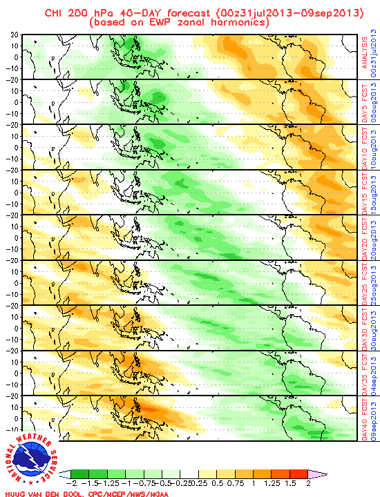
srainhoutx wrote:Another development worth noting is the empirical MJO wave propagation has made a major shift to suggesting rising air (more tropical thunderstorm chances) for the next several weeks...

Image


Steve,and to reinforce what you posted, the GFS ensembles and UKMET ensembles have the wet phase of MJO hanging around octanges 1-8 to almost the end of this month. All this means that things may pick up soon in the Atlantic basin.

GFS ensembles

Image

UKMET Ensembles

Image
0 likes   
Visit the Caribbean-Central America Weather Thread where you can find at first post web cams,radars
and observations from Caribbean basin members Click Here

User avatar
Rgv20
S2K Supporter
S2K Supporter
Posts: 2466
Age: 38
Joined: Wed Jan 05, 2011 5:42 pm
Location: Edinburg/McAllen Tx

#2234 Postby Rgv20 » Mon Jul 11, 2011 6:51 pm

Seems that the long range 12zGFS does not have the support of its ensembles members and the European Ensembles with regards to breaking the GOM ridge.

12zGFS by day 10
Image

12zGFS Ensembles day 10
Image

And finally the 12zECMWF Ensembles want the ridge to stick around by day 10
Image
0 likes   
The following post is NOT an official forecast and should not be used as such. It is just the opinion of the poster and may or may not be backed by sound meteorological data. It is NOT endorsed by any professional institution including storm2k.org For Official Information please refer to the NHC and NWS products.

User avatar
ROCK
Category 5
Category 5
Posts: 9484
Age: 54
Joined: Tue Aug 17, 2004 7:30 am
Location: Kemah, Texas

Re: Global Model Runs Discussion

#2235 Postby ROCK » Mon Jul 11, 2011 11:03 pm

it will break as we get closer to the end of the month. The odds are against it as it has been hanging on for months now.
0 likes   

User avatar
South Texas Storms
Professional-Met
Professional-Met
Posts: 4226
Joined: Thu Jun 24, 2010 12:28 am
Location: Houston, TX

Re: Global Model Runs Discussion

#2236 Postby South Texas Storms » Mon Jul 11, 2011 11:04 pm

ROCK wrote:it will break as we get closer to the end of the month. The odds are against it as it has been hanging on for months now.


Will that mean rain for all of us?
0 likes   

dwsqos2

Re: Global Model Runs Discussion

#2237 Postby dwsqos2 » Mon Jul 11, 2011 11:45 pm

Looking at the 0Z gfs, I am feeling ever more confident in 0/0/0 for July.
0 likes   

User avatar
KWT
Category 5
Category 5
Posts: 31415
Joined: Tue Aug 17, 2004 11:02 am
Location: UK!!!

#2238 Postby KWT » Tue Jul 12, 2011 4:38 am

The 0z ECM does try and develop something very close to the coast off Carlolina...a further 50-100 mile eastward shunt and it'd probably develop into a TD/TS as it tries to cut-off from the front...
but doesn't quite make it this run.
0 likes   
Personal Forecast Disclaimer:
The posts in this forum are NOT official forecast and should not be used as such. They are just the opinion of the poster and may or may not be backed by sound meteorological data. They are NOT endorsed by any professional institution or storm2k.org. For official information, please refer to the NHC and NWS products

plasticup

Re: Global Model Runs Discussion

#2239 Postby plasticup » Tue Jul 12, 2011 7:51 am

South Texas Storms wrote:
ROCK wrote:it will break as we get closer to the end of the month. The odds are against it as it has been hanging on for months now.


Will that mean rain for all of us?

Eventually, if the ridge really does break down. But the longrange models have been showing that for a while, without much success.
0 likes   

flwxwatcher
Category 4
Category 4
Posts: 926
Joined: Wed May 16, 2007 3:35 pm
Location: Central Florida

Re:

#2240 Postby flwxwatcher » Tue Jul 12, 2011 10:13 am

KWT wrote:The 0z ECM does try and develop something very close to the coast off Carlolina...a further 50-100 mile eastward shunt and it'd probably develop into a TD/TS as it tries to cut-off from the front...
but doesn't quite make it this run.


It does look pretty good on the EURO and the GFS is doing the same thing in that general area also. Something to watch this week-end .


http://mag.ncep.noaa.gov/NCOMAGWEB/appc ... t=Loop+All


Image

Uploaded with ImageShack.us
0 likes   


Return to “2015”

Who is online

Users browsing this forum: No registered users and 1 guest