ATL: IRENE - Remnants - Discussion
Moderator: S2k Moderators
-
Aric Dunn
- Category 5

- Posts: 21238
- Age: 43
- Joined: Sun Sep 19, 2004 9:58 pm
- Location: Ready for the Chase.
- Contact:
Re: ATL: IRENE - Hurricane - Discussion
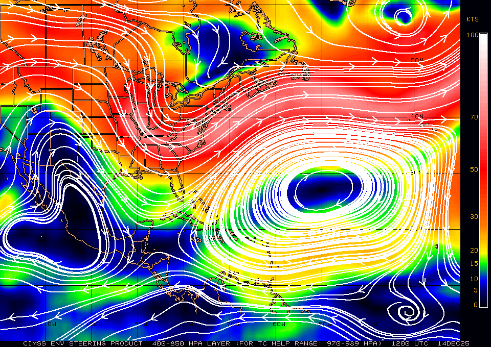
ridging seems to be filling even more.. and trough is flattening out
Last edited by Aric Dunn on Wed Aug 24, 2011 4:53 pm, edited 1 time in total.
0 likes
Note: If I make a post that is brief. Please refer back to previous posts for the analysis or reasoning. I do not re-write/qoute what my initial post said each time.
If there is nothing before... then just ask
Space & Atmospheric Physicist, Embry-Riddle Aeronautical University,
I believe the sky is falling...
If there is nothing before... then just ask
Space & Atmospheric Physicist, Embry-Riddle Aeronautical University,
I believe the sky is falling...
-
cycloneye

- Admin

- Posts: 149467
- Age: 69
- Joined: Thu Oct 10, 2002 10:54 am
- Location: San Juan, Puerto Rico
Re: ATL: IRENE - Hurricane - Discussion
News=The NOAA plane turned around as it was approaching Irene. We will have to wait for the Air Force plane.That one departed.
0 likes
Visit the Caribbean-Central America Weather Thread where you can find at first post web cams,radars
and observations from Caribbean basin members Click Here
and observations from Caribbean basin members Click Here

Re: ATL: IRENE - Recon
Too bad hope they're OK  Fortunately we still have this plane.
AIR FORCE
000
URNT15 KNHC 242147
AF302 1709A IRENE HDOB 05 20110824
213800 1832N 06637W 4479 06718 0339 -113 -174 021004 004 019 000 03
213830 1832N 06639W 4416 06825 0350 -121 -182 032004 005 017 000 03
213900 1833N 06641W 4357 06927 0354 -126 -195 329002 003 016 000 03
213930 1833N 06644W 4291 07046 0365 -132 -205 253003 003 018 000 03
214000 1834N 06646W 4236 07151 0373 -140 -211 244003 003 021 000 03
214030 1834N 06648W 4183 07245 0379 -146 -232 249003 003 017 000 00
214100 1835N 06651W 4137 07334 0387 -154 -214 254004 004 019 000 00
214130 1835N 06653W 4088 07420 0392 -158 -216 222004 005 019 000 00
214200 1836N 06655W 4043 07500 0398 -163 -220 192003 004 019 000 00
214230 1836N 06655W 4043 07500 0403 -165 -216 166002 002 018 000 03
214300 1837N 06700W 3958 07672 0412 -165 -202 097001 001 014 000 00
214330 1837N 06702W 3931 07719 0415 -165 -213 086002 002 012 000 00
214400 1838N 06705W 3923 07736 0414 -167 -227 054003 003 012 001 00
214430 1838N 06707W 3923 07734 0412 -170 -219 037001 002 013 000 00
214500 1839N 06710W 3924 07730 0410 -173 -217 316002 003 016 001 00
214530 1839N 06712W 3930 07720 0408 -174 -212 246003 004 017 000 00
214600 1840N 06715W 3926 07728 0408 -173 -212 228005 006 013 001 00
214630 1841N 06717W 3927 07725 0408 -172 -212 203006 007 015 000 00
214700 1841N 06720W 3927 07725 0409 -175 -208 183007 008 015 000 00
214730 1842N 06722W 3925 07727 0410 -175 -211 165006 007 015 000 03
$$
;
0 likes
-
Bocadude85

- Category 5
- Posts: 2991
- Age: 39
- Joined: Mon Apr 18, 2005 2:20 pm
- Location: Honolulu,Hi
Re: ATL: IRENE - Hurricane - Discussion
First rain band coming of Grand Bahama heading for the Fla coast.
http://radar.weather.gov/radar.php?rid=AMX&product=N0Z&overlay=11101111&loop=yes
http://radar.weather.gov/radar.php?rid=AMX&product=N0Z&overlay=11101111&loop=yes
0 likes
Re: ATL: IRENE - Recon Discussion
The planes are having problems more often than in previous years, maybe some newer planes are needed.
0 likes
-
HenkL
- S2K Supporter

- Posts: 2401
- Joined: Fri Sep 10, 2004 5:33 pm
- Location: Groningen, The Netherlands
- Contact:
Re data from the Gulfstream:
The map from the NOAA flight gives data on the 500 hPa level (hPa = mb), around 5 km high.
The wind barbs give the direction and wind speed (see here). The winds north of Irene are from E-SE, indicating there is an area of higher pressure north/northeast of those positions (a ridge). More to the NW some winds are coming from SSW and some from NE. This indicates a (small) area of lower pressure (trough) between them.
The winds around the 500 hPa level 'steer' a hurricane. Not exactly at that level only, but in this case winds somewhat lower and somewhat higher in the atmosphere (at 700 and 400 hPa levels) were about the same.
Further: the barbs indicate there isn't much wind at the 500 hPa level, so the steering force isn't very powerful. This is the reason Irene isn't moving fast.
The numbers are temperature (upper) and dewpoint (lower) in °C. The difference between them is an indication for how much moisture is in the air. A small difference means lots of moisture, a big difference means dry air. A hurricane needs moisture to survive.
Last edited by HenkL on Wed Aug 24, 2011 5:09 pm, edited 1 time in total.
0 likes
-
CrazyC83
- Professional-Met

- Posts: 34315
- Joined: Tue Mar 07, 2006 11:57 pm
- Location: Deep South, for the first time!
Re: ATL: IRENE - Recon Discussion
Macrocane wrote:The planes are having problems more often than in previous years, maybe some newer planes are needed.
Not likely with the budget cuts. NOAA planes also seem less reliable.
0 likes
-
TropicalWXMA

- Tropical Storm

- Posts: 114
- Joined: Wed May 18, 2005 9:22 pm
- Location: Boston, MA
- Contact:
Re: ATL: IRENE - Recon
Dave wrote:TropicalWXMA wrote:Just got word that one of the hurricane hunter planes are having engine problems and are RTB.
Unsure if it is the NOAA Lockheed WP-3D Orion, reg N42RF or the USAF Lockheed Martin WC-130J Hercules, reg 96-5302.
Could be NOAA2 - from last hdobs, they're increasing in lat again..got to the edge of Irene but on ge have turned around.
Confirmed. It was indeed N42RF (NOAA02), that is having engine problems and had to RTB.
0 likes
-
Dave

- Retired Staff

- Posts: 13442
- Age: 75
- Joined: Tue Aug 01, 2006 3:57 pm
- Location: Milan Indiana
- Contact:
Here you go Macrocane....

0 likes
This post is NOT AN OFFICIAL FORECAST and should not be used as such. It is just the opinion of the poster and may or may not be backed by sound meteorological data. It is NOT endorsed by any professional institution including storm2k.org. For Official Information please refer to the NHC and NWS products.
-
cycloneye
- Admin
- Posts: 149467
- Age: 69
- Joined: Thu Oct 10, 2002 10:54 am
- Location: San Juan, Puerto Rico
Re: ATL: IRENE - Recon Discussion
CrazyC83 wrote:Macrocane wrote:The planes are having problems more often than in previous years, maybe some newer planes are needed.
Not likely with the budget cuts. NOAA planes also seem less reliable.
Yes,they will have to modernizise those planes.
0 likes
Visit the Caribbean-Central America Weather Thread where you can find at first post web cams,radars
and observations from Caribbean basin members Click Here
and observations from Caribbean basin members Click Here
-
gatorcane

- S2K Supporter
- Posts: 23708
- Age: 48
- Joined: Sun Mar 13, 2005 3:54 pm
- Location: Boca Raton, FL
Looks like a noticeable turn to the north here, look how high that convection is just on the north side of the eye: 
http://wwwghcc.msfc.nasa.gov/cgi-bin/ge ... map=latlon
http://wwwghcc.msfc.nasa.gov/cgi-bin/ge ... map=latlon
0 likes
Re: ATL: IRENE - Recon
000
URNT15 KNHC 242157
AF302 1709A IRENE HDOB 06 20110824
214800 1843N 06725W 3926 07724 0411 -175 -207 166010 012 019 000 03
214830 1844N 06727W 3929 07722 0409 -173 -207 158011 011 021 000 00
214900 1846N 06729W 3926 07728 0410 -174 -206 156010 011 021 000 00
214930 1848N 06731W 3926 07722 0410 -175 -205 148012 012 022 000 00
215000 1850N 06733W 3926 07720 0409 -170 -208 144012 013 022 000 00
215030 1852N 06734W 3926 07721 0410 -170 -210 144012 013 022 000 00
215100 1854N 06736W 3926 07723 0408 -170 -212 137012 013 023 000 00
215130 1855N 06738W 3926 07721 0409 -170 -210 132011 012 022 001 00
215200 1857N 06740W 3926 07726 0408 -170 -215 123011 012 025 001 00
215230 1859N 06742W 3927 07728 0409 -169 -211 144007 008 023 000 00
215300 1901N 06744W 3926 07725 0409 -170 -201 196009 010 019 000 00
215330 1902N 06746W 3925 07726 0411 -170 -199 185009 010 020 000 00
215400 1904N 06748W 3927 07726 0411 -170 -201 189010 012 022 000 00
215430 1906N 06750W 3926 07726 0411 -170 -200 199006 008 022 000 00
215500 1908N 06752W 3926 07724 0410 -170 -203 205008 009 022 000 00
215530 1909N 06754W 3926 07724 0410 -170 -204 186006 008 023 000 00
215600 1911N 06756W 3926 07727 0410 -170 -202 102002 004 023 000 00
215630 1913N 06757W 3926 07728 0410 -170 -201 073003 004 024 000 00
215700 1915N 06759W 3926 07716 0410 -170 -202 217005 008 025 000 00
215730 1916N 06801W 3927 07720 0409 -170 -204 200007 008 025 001 00
$$
;
0 likes

-
Dave
- Retired Staff
- Posts: 13442
- Age: 75
- Joined: Tue Aug 01, 2006 3:57 pm
- Location: Milan Indiana
- Contact:

0 likes
This post is NOT AN OFFICIAL FORECAST and should not be used as such. It is just the opinion of the poster and may or may not be backed by sound meteorological data. It is NOT endorsed by any professional institution including storm2k.org. For Official Information please refer to the NHC and NWS products.

-
jlauderdal
- S2K Supporter
- Posts: 7240
- Joined: Wed May 19, 2004 5:46 am
- Location: NE Fort Lauderdale
- Contact:
Re: ATL: IRENE - Hurricane - Discussion
Bocadude85 wrote:First rain band coming of Grand Bahama heading for the Fla coast.
http://radar.weather.gov/radar.php?rid=AMX&product=N0Z&overlay=11101111&loop=yes
im going to make claim right now to the first raindrop felt in the lower 48 from Irene, there is incoming from Irene and its heading right at my location
0 likes
-
Hurricaneman
- Category 5
- Posts: 7404
- Age: 45
- Joined: Tue Aug 31, 2004 3:24 pm
- Location: central florida
Re: ATL: IRENE - Hurricane - Discussion
Maybe a more northerly direction, but in no way due north
0 likes

Who is online
Users browsing this forum: No registered users and 26 guests