ATL: IRENE - Remnants - Discussion

Moderator: S2k Moderators

Message
Author
User avatar
KWT
Category 5
Category 5
Posts: 31415
Joined: Tue Aug 17, 2004 11:02 am
Location: UK!!!

Re:

#7081 Postby KWT » Thu Aug 25, 2011 5:29 pm

maxintensity wrote:No doubt a continued strengthening phase. NOAA plane penetrating again and I think we could see 945mb this pass.


Should see a lower pressure, I suspect the winds at flight level should be a little stronger as well, but we'll see soon enough!
0 likes   
Personal Forecast Disclaimer:
The posts in this forum are NOT official forecast and should not be used as such. They are just the opinion of the poster and may or may not be backed by sound meteorological data. They are NOT endorsed by any professional institution or storm2k.org. For official information, please refer to the NHC and NWS products

User avatar
Dave
Retired Staff
Retired Staff
Posts: 13442
Age: 74
Joined: Tue Aug 01, 2006 3:57 pm
Location: Milan Indiana
Contact:

#7082 Postby Dave » Thu Aug 25, 2011 5:30 pm

NOAA2

Image
0 likes   
This post is NOT AN OFFICIAL FORECAST and should not be used as such. It is just the opinion of the poster and may or may not be backed by sound meteorological data. It is NOT endorsed by any professional institution including storm2k.org. For Official Information please refer to the NHC and NWS products.

User avatar
littlevince
S2K Supporter
S2K Supporter
Posts: 768
Joined: Fri Oct 21, 2005 10:45 am
Location: Portugal

Re: ATL: IRENE - Recon

#7083 Postby littlevince » Thu Aug 25, 2011 5:32 pm

000
URNT15 KNHC 252225
AF306 2109A IRENE HDOB 42 20110825
221530 2601N 07606W 6969 03068 9969 +087 +035 210068 069 047 003 00
221600 2601N 07604W 6967 03073 9972 +090 +034 210071 073 047 002 00
221630 2601N 07601W 6966 03079 9968 +094 +034 210073 074 046 002 03
221700 2601N 07559W 6968 03077 9966 +098 +034 209075 075 045 000 03
221730 2601N 07557W 6968 03080 9970 +098 +035 208075 075 045 000 03
221800 2600N 07556W 6969 03085 9969 +100 +035 209075 075 044 000 03
221830 2600N 07554W 6967 03088 9971 +100 +036 208075 076 045 000 03
221900 2600N 07552W 6966 03092 9975 +100 +036 206073 074 042 002 03
221930 2559N 07550W 6967 03092 9977 +100 +037 205073 073 042 000 03
222000 2559N 07548W 6968 03094 9982 +099 +037 205070 072 044 000 03
222030 2558N 07547W 6969 03095 9987 +095 +037 206071 072 043 000 03
222100 2557N 07545W 6967 03096 9991 +094 +037 206070 070 043 000 03
222130 2557N 07544W 6966 03100 9992 +093 +037 203068 069 044 000 03
222200 2556N 07542W 6966 03098 9989 +095 +037 203068 068 044 000 03
222230 2555N 07541W 6967 03100 9992 +095 +037 203068 068 043 000 03
222300 2554N 07540W 6967 03101 9990 +097 +037 203068 069 041 001 00
222330 2553N 07538W 6968 03103 9992 +098 +037 204068 070 042 001 03
222400 2554N 07536W 6969 03102 9989 +099 +037 201068 069 /// /// 03
222430 2556N 07536W 6967 03103 9990 +100 +038 200068 068 043 000 03
222500 2558N 07536W 6967 03101 9987 +100 +038 200068 068 043 000 00
$$
;

Image
0 likes   

tolakram
Admin
Admin
Posts: 20020
Age: 62
Joined: Sun Aug 27, 2006 8:23 pm
Location: Florence, KY (name is Mark)

Re: ATL: IRENE - Hurricane - Discussion

#7084 Postby tolakram » Thu Aug 25, 2011 5:33 pm

Latest IR

Image
0 likes   
M a r k
- - - - -
Join us in chat: Storm2K Chatroom Invite. Android and IOS apps also available.

The posts in this forum are NOT official forecasts and should not be used as such. Posts are NOT endorsed by any professional institution or STORM2K.org. For official information and forecasts, please refer to NHC and NWS products.

Trishasmom
Tropical Low
Tropical Low
Posts: 23
Joined: Sun Aug 17, 2008 4:31 pm
Location: Charles City, VA

Re: ATL: IRENE - Hurricane - Discussion

#7085 Postby Trishasmom » Thu Aug 25, 2011 5:35 pm

Also, your water heater is a source of water after the storm.


Thanks, hadn't thought about that. Our county (which is inland) is under a severe thunderstorm watch now until later tonight and a Tropical Storm watch as well. We were hit pretty hard with Isabel so I don't trust these hurricanes with names starting with I's they seem to like to try and see how far inland they can affect.

Carol
0 likes   

User avatar
Dave
Retired Staff
Retired Staff
Posts: 13442
Age: 74
Joined: Tue Aug 01, 2006 3:57 pm
Location: Milan Indiana
Contact:

#7086 Postby Dave » Thu Aug 25, 2011 5:35 pm

000
URNT15 KWBC 252218
NOAA2 2309A IRENE HDOB 15 20110825
220900 2816N 07714W 7524 02357 9849 +160 +130 108084 085 062 003 00
220930 2814N 07715W 7530 02345 9846 +155 +146 105089 090 059 007 00
221000 2812N 07715W 7519 02347 9844 +144 //// 108092 094 061 005 01
221030 2811N 07716W 7521 02336 9834 +144 //// 109098 099 061 006 01
221100 2809N 07716W 7528 02320 9826 +146 //// 110092 094 060 006 01
221130 2807N 07716W 7524 02321 9817 +148 //// 109093 094 062 010 01
221200 2806N 07716W 7528 02310 9809 +148 //// 108096 097 063 011 01
221230 2804N 07716W 7526 02304 9802 +148 //// 106095 097 064 011 01
221300 2802N 07716W 7525 02299 9789 +155 +156 103091 092 069 018 00
221330 2801N 07716W 7523 02292 9781 +151 //// 104095 098 071 019 01
221400 2759N 07716W 7494 02315 9769 +151 //// 107098 099 070 015 01
221430 2757N 07716W 7518 02278 9757 +154 //// 109095 100 071 011 01
221500 2756N 07716W 7536 02250 9746 +156 //// 107091 092 076 010 01
221530 2754N 07716W 7518 02259 9732 +156 //// 103091 092 073 011 01
221600 2752N 07717W 7518 02244 9718 +157 +162 102090 093 068 022 00
221630 2750N 07717W 7498 02253 9697 +160 //// 102092 093 072 033 01
221700 2748N 07717W 7513 02221 9674 +171 +168 100091 093 077 024 00
221730 2746N 07718W 7523 02196 9659 +171 +173 097089 095 081 009 00
221800 2745N 07718W 7536 02170 9640 +180 +172 094081 086 081 006 00
221830 2743N 07718W 7509 02181 9623 +173 +176 094084 086 080 013 00
0 likes   
This post is NOT AN OFFICIAL FORECAST and should not be used as such. It is just the opinion of the poster and may or may not be backed by sound meteorological data. It is NOT endorsed by any professional institution including storm2k.org. For Official Information please refer to the NHC and NWS products.

User avatar
GCANE
S2K Supporter
S2K Supporter
Posts: 11510
Joined: Mon Oct 22, 2007 8:03 am

Re:

#7087 Postby GCANE » Thu Aug 25, 2011 5:36 pm

KWT wrote:Latest hour loops is amazing, take a look at it and notice the higher cloud tops wrapping around the eyewall in the last hour. Think abit of a strengthening phase is kicking off now.


She's bombing.
0 likes   

User avatar
Dave
Retired Staff
Retired Staff
Posts: 13442
Age: 74
Joined: Tue Aug 01, 2006 3:57 pm
Location: Milan Indiana
Contact:

#7088 Postby Dave » Thu Aug 25, 2011 5:36 pm

000
UZNT13 KWBC 252219
XXAA 75228 99288 70772 08087 99997 25613 06552 00526 ///// /////
92658 21208 09070 85390 18222 10575 88999 77999
31313 09608 82159
51515 10167 07775
61616 NOAA2 2309A IRENE OB 11
62626 REL 2881N07722W 215929 SPG 2882N07730W 220255 WL150 07553 0
85 DLM WND 10069 996753 MBL WND 08061=
XXBB 75228 99288 70772 08087 00997 25613 11983 24411 22941 22008
33868 19429 44753 12200
21212 00997 06552 11995 07055 22986 07549 33981 07057 44977 07557
55972 07566 66958 08062 77952 08070 88911 09069 99897 09583 11888
10076 22753 11070
31313 09608 82159
51515 10167 07775
61616 NOAA2 2309A IRENE OB 11
62626 REL 2881N07722W 215929 SPG 2882N07730W 220255 WL150 07553 0
85 DLM WND 10069 996753 MBL WND 08061=
0 likes   
This post is NOT AN OFFICIAL FORECAST and should not be used as such. It is just the opinion of the poster and may or may not be backed by sound meteorological data. It is NOT endorsed by any professional institution including storm2k.org. For Official Information please refer to the NHC and NWS products.

maryellen40
Tropical Low
Tropical Low
Posts: 20
Joined: Sun Aug 21, 2011 2:21 pm
Location: Michigan

#7089 Postby maryellen40 » Thu Aug 25, 2011 5:37 pm

NYC is waiting until Saturday on whether to issue mandatory evacs-that is way too late.
0 likes   

maxintensity
Tropical Storm
Tropical Storm
Posts: 165
Joined: Tue Aug 02, 2011 9:54 pm

Re: ATL: IRENE - Hurricane - Discussion

#7090 Postby maxintensity » Thu Aug 25, 2011 5:37 pm

WOW! This is a big eye with A LOT of room for contraction and significant intensification after seeing the last HDOB from NOAA.
0 likes   

User avatar
KWT
Category 5
Category 5
Posts: 31415
Joined: Tue Aug 17, 2004 11:02 am
Location: UK!!!

#7091 Postby KWT » Thu Aug 25, 2011 5:37 pm

Cool IR,eyewall doesn't look quite perfect, very good true but not quite perfect, probably not bombing but seems to be going through a strengthening phase.
0 likes   
Personal Forecast Disclaimer:
The posts in this forum are NOT official forecast and should not be used as such. They are just the opinion of the poster and may or may not be backed by sound meteorological data. They are NOT endorsed by any professional institution or storm2k.org. For official information, please refer to the NHC and NWS products

User avatar
melhow
S2K Supporter
S2K Supporter
Posts: 362
Joined: Sat Sep 04, 2004 4:00 pm
Location: Safety Harbor, FL

Re: ATL: IRENE - Hurricane - Discussion

#7092 Postby melhow » Thu Aug 25, 2011 5:39 pm

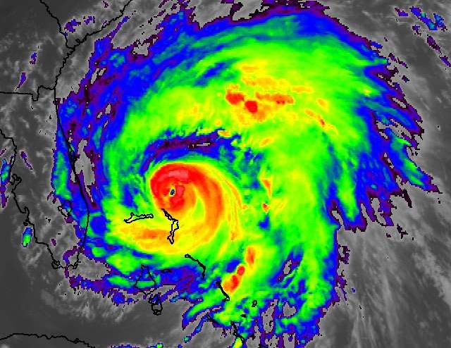
A high tide on Long Island's Jones Inlet is estimated to occur Sunday 8/28 7:26 AM

http://www.mobilegeographics.com:81/locations/2924.html

Jones Inlet (Point Lookout), Long Island, New York
40.5867° N, 73.5783° W

2011-08-25 7:37 PM EDT Sunset
2011-08-25 11:48 PM EDT 0.31 feet Low Tide
2011-08-26 5:47 AM EDT 3.49 feet High Tide
2011-08-26 6:15 AM EDT Sunrise
2011-08-26 11:47 AM EDT 0.26 feet Low Tide
2011-08-26 6:01 PM EDT 4.24 feet High Tide
2011-08-26 7:36 PM EDT Sunset
2011-08-27 12:35 AM EDT 0.03 feet Low Tide
2011-08-27 6:16 AM EDT Sunrise
2011-08-27 6:38 AM EDT 3.83 feet High Tide
2011-08-27 12:40 PM EDT 0.02 feet Low Tide
2011-08-27 6:51 PM EDT 4.47 feet High Tide
2011-08-27 7:34 PM EDT Sunset
2011-08-28 1:22 AM EDT -0.22 feet Low Tide
2011-08-28 6:17 AM EDT Sunrise
2011-08-28 7:26 AM EDT 4.16 feet High Tide
2011-08-28 1:32 PM EDT -0.20 feet Low Tide
2011-08-28 7:33 PM EDT Sunset
2011-08-28 7:38 PM EDT 4.62 feet High Tide
2011-08-28 11:04 PM EDT New Moon
2011-08-29 2:08 AM EDT -0.42 feet Low Tide
2011-08-29 6:18 AM EDT Sunrise
2011-08-29 8:11 AM EDT 4.44 feet High Tide
2011-08-29 2:24 PM EDT -0.36 feet Low Tide
2011-08-29 7:31 PM EDT Sunset
0 likes   

bob rulz
Category 5
Category 5
Posts: 1704
Age: 35
Joined: Sat Jan 28, 2006 7:30 pm
Location: Salt Lake City, Utah

Re: ATL: IRENE - Hurricane - Discussion

#7093 Postby bob rulz » Thu Aug 25, 2011 5:40 pm

Significant improvement just over the last hour or so. It seems to finally be getting everything together at least for a short period of time...
0 likes   

User avatar
Dave
Retired Staff
Retired Staff
Posts: 13442
Age: 74
Joined: Tue Aug 01, 2006 3:57 pm
Location: Milan Indiana
Contact:

#7094 Postby Dave » Thu Aug 25, 2011 5:41 pm

NOAA2

Image
0 likes   
This post is NOT AN OFFICIAL FORECAST and should not be used as such. It is just the opinion of the poster and may or may not be backed by sound meteorological data. It is NOT endorsed by any professional institution including storm2k.org. For Official Information please refer to the NHC and NWS products.

otowntiger
Category 5
Category 5
Posts: 1922
Joined: Tue Aug 31, 2004 7:06 pm

Re: Re:

#7095 Postby otowntiger » Thu Aug 25, 2011 5:42 pm

GCANE wrote:
KWT wrote:Latest hour loops is amazing, take a look at it and notice the higher cloud tops wrapping around the eyewall in the last hour. Think abit of a strengthening phase is kicking off now.


She's bombing.
I don't know if I'd say she is bombing just yet, but definitlely better looking with each frame. Also has the wind radii expanded? Because for the last couple hours we've been getting gale force winds in Orlando, gusting in the 30's and we have got to be over 300 miles from the center. We've not gotten much rain and inconsistant clouds but the wind sure has picked up this afternoon. Its a good thing that all west movement has ceased because it wouldn't take much of a western jog to bring much more nasty weather on shore.
Last edited by otowntiger on Thu Aug 25, 2011 5:44 pm, edited 1 time in total.
0 likes   

User avatar
littlevince
S2K Supporter
S2K Supporter
Posts: 768
Joined: Fri Oct 21, 2005 10:45 am
Location: Portugal

Re: ATL: IRENE - Recon

#7096 Postby littlevince » Thu Aug 25, 2011 5:42 pm

000
URNT15 KNHC 252235
AF306 2109A IRENE HDOB 43 20110825
222530 2600N 07537W 6964 03103 9994 +094 +037 200067 069 045 000 03
222600 2602N 07537W 6969 03096 9992 +094 +037 196067 068 045 000 03
222630 2605N 07537W 6965 03100 9989 +095 +037 199070 071 /// /// 03
222700 2606N 07536W 6965 03101 9987 +096 +037 200072 072 /// /// 03
222730 2606N 07534W 6968 03098 9989 +097 +037 201071 072 /// /// 03
222800 2605N 07533W 6967 03100 9990 +097 +037 201069 069 044 000 03
222830 2603N 07533W 6966 03106 9994 +098 +037 202069 070 045 001 03
222900 2602N 07533W 6967 03106 9996 +096 +037 202068 069 046 001 00
222930 2601N 07533W 6966 03107 9996 +098 +037 202068 069 045 000 03
223000 2600N 07532W 6970 03103 9988 +104 +037 202069 070 045 001 03
223030 2559N 07533W 6961 03112 9995 +097 +037 200065 068 /// /// 03
223100 2600N 07535W 6968 03103 9996 +096 +036 200067 068 042 001 03
223130 2602N 07536W 6967 03101 9996 +095 +036 199067 068 042 000 03
223200 2603N 07537W 6971 03095 9987 +098 +036 199068 068 043 001 03
223230 2605N 07539W 6969 03096 9989 +095 +036 201068 068 043 000 00
223300 2606N 07540W 6966 03101 9989 +095 +037 202069 070 043 000 03
223330 2607N 07542W 6966 03095 9981 +098 +037 199069 069 044 000 03
223400 2609N 07543W 6967 03089 9975 +099 +037 200070 072 044 000 03
223430 2610N 07545W 6966 03088 9978 +095 +036 201072 072 046 001 00
223500 2611N 07546W 6967 03080 9976 +093 +036 201072 072 046 001 00
$$
;

Image
0 likes   

User avatar
kamqercam
Tropical Depression
Tropical Depression
Posts: 54
Age: 43
Joined: Sun Mar 27, 2005 2:53 am
Location: Wilmington, NC

#7097 Postby kamqercam » Thu Aug 25, 2011 5:43 pm

I just thought about this. It's a bad time for a hurricane to come thru testing structures that haven't been caught yet with any structural damage from the recent Earthquake.
0 likes   

User avatar
wxman57
Moderator-Pro Met
Moderator-Pro Met
Posts: 22991
Age: 67
Joined: Sat Jun 21, 2003 8:06 pm
Location: Houston, TX (southwest)

Re: ATL: IRENE - Hurricane - Discussion

#7098 Postby wxman57 » Thu Aug 25, 2011 5:44 pm

summersquall wrote:
Trishasmom wrote:
I'm really scared for all of them. I am trying to spread the message all over that they need to take this seriously and learn from hurricane veterans in the south.


I know Virginia had already started setting up for Irene when we had the earthquake but they did not just ignore Irene and we have shelters being set up already. Where I am we may get some wind and rain since we are about 25 miles west of Williamsburg but my sister is in Newport News and I know they are taking this seriously.

Even those inland might have problems if for no other reason that the power goes out and when that happens we lose water as well. So am filling up my jugs and cleaning the tub so I can store water there if it becomes necessary.


Also, your water heater is a source of water after the storm.


You really should not drink water that comes out of the water heater, as it may contain sediment and possibly bacteria. That's one reason you never use water from the hot water tap for cooking. The best solution is something like "mywatersafe". They make plastic containers from 5gal to 65gal. The 65 gallon plastic bag fits in your bathtub and has a pump attached.

http://www.mywatersafe.com
0 likes   

User avatar
Dave
Retired Staff
Retired Staff
Posts: 13442
Age: 74
Joined: Tue Aug 01, 2006 3:57 pm
Location: Milan Indiana
Contact:

Re: ATL: IRENE - Recon Discussion

#7099 Postby Dave » Thu Aug 25, 2011 5:44 pm

tolakram wrote:I can do some posting, obs or images, if needed.


When you get back you can have NOAA2 for awhile if you want...both! lol
0 likes   

jabman98
Category 1
Category 1
Posts: 379
Joined: Fri Apr 25, 2003 12:15 pm
Location: Houston, TX

Re:

#7100 Postby jabman98 » Thu Aug 25, 2011 5:45 pm

kamqercam wrote:I just thought about this. It's a bad time for a hurricane to come thru testing structures that haven't been caught yet with any structural damage.

You mean those that were damaged from the earthquake this week? Yeah, bad timing.

Question: How warm is the water Irene will be going through now that she's turned? Still pretty hot?
0 likes   


Return to “2011”

Who is online

Users browsing this forum: No registered users and 5 guests