psyclone wrote:
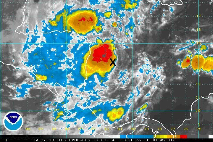
meaning that it developed its spin at and even lower latitude farther east. stating that the reason for a lack of development is a lack of coriolis is inaccurate.
True, but the overall land-inhibition combined with weak coriolis is probably more accurate. Plus there's all sorts of dry air and deep-plunging troughs nearby.
It's weak but it's there. Sheared from the east. I think it will re-fire.


 Another run (18z) by GFS that has nothing.