
the 0Z GFS at 189Hr....has our guy in the carib under PR
http://mag.ncep.noaa.gov/NCOMAGWEB/appc ... mageSize=M
204HR it is gone.....opened back up to a wave.
Global model runs discussion
Moderator: S2k Moderators
Re: Global Model Runs Discussion
0 likes
-
Hurricane Alexis

- Category 2

- Posts: 683
- Age: 29
- Joined: Thu Jun 14, 2012 7:59 pm
- Location: Miami,Florida
Re: Global Model Runs Discussion
The last few GFS runs have been showing another wave coming off Africa, north of the CV islands, and forming immediately.
0 likes
Personal Forecast Disclaimer:
The posts in this forum are NOT official forecast and should not be used as such. They are just the opinion of the poster and may or may not be backed by sound meteorological data. They are NOT endorsed by any professional institution or storm2k.org. For official information, please refer to the NHC and NWS products.
The posts in this forum are NOT official forecast and should not be used as such. They are just the opinion of the poster and may or may not be backed by sound meteorological data. They are NOT endorsed by any professional institution or storm2k.org. For official information, please refer to the NHC and NWS products.
-
cycloneye

- Admin

- Posts: 149480
- Age: 69
- Joined: Thu Oct 10, 2002 10:54 am
- Location: San Juan, Puerto Rico
Re: Global Model Runs Discussion
And another run by GFS (00z) that shows Florence,but is very long range.

0 likes
Visit the Caribbean-Central America Weather Thread where you can find at first post web cams,radars
and observations from Caribbean basin members Click Here
and observations from Caribbean basin members Click Here
-
Kingarabian

- S2K Supporter

- Posts: 16365
- Joined: Sat Aug 08, 2009 3:06 am
- Location: Honolulu, Hawaii
Re: Global Model Runs Discussion
cycloneye wrote:And another run by GFS (00z) that shows Florence,but is very long range.
Yeah looks like a fish... or another Isabella? Who knows.
Code: Select all
The posts in this forum are NOT official forecast and should not be used as such. They are just the opinion of the poster and may or may not be backed by sound meteorological data. They are NOT endorsed by any professional institution or storm2k.org. For official information, please refer to the NHC and NWS products.
0 likes
RIP Kobe Bryant
-
Hurricane Alexis
- Category 2
- Posts: 683
- Age: 29
- Joined: Thu Jun 14, 2012 7:59 pm
- Location: Miami,Florida
Re: Global Model Runs Discussion
cycloneye wrote:And another run by GFS (00z) that shows Florence,but is very long range.
It's been persistent quite a few runs already, it is long range, but still...
0 likes
Personal Forecast Disclaimer:
The posts in this forum are NOT official forecast and should not be used as such. They are just the opinion of the poster and may or may not be backed by sound meteorological data. They are NOT endorsed by any professional institution or storm2k.org. For official information, please refer to the NHC and NWS products.
The posts in this forum are NOT official forecast and should not be used as such. They are just the opinion of the poster and may or may not be backed by sound meteorological data. They are NOT endorsed by any professional institution or storm2k.org. For official information, please refer to the NHC and NWS products.

-
Kingarabian
- S2K Supporter
- Posts: 16365
- Joined: Sat Aug 08, 2009 3:06 am
- Location: Honolulu, Hawaii
Re:
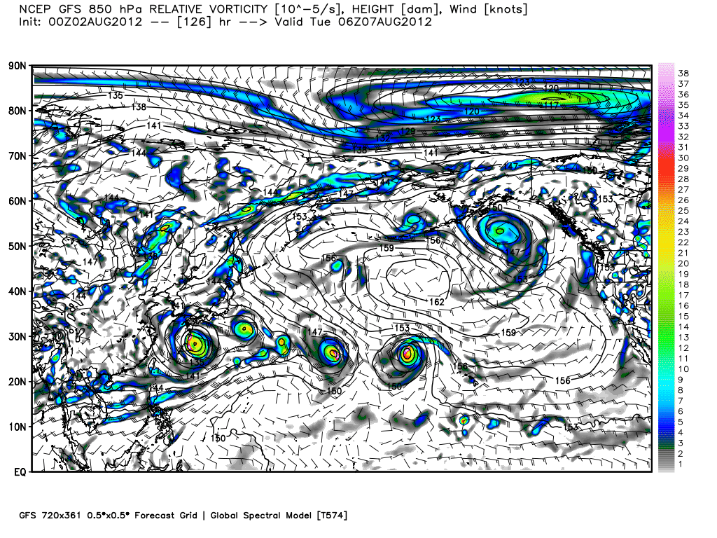
RL3AO wrote:West Pac going nuts.
That massive storm looks really close to Hawaii. Do you know where it originates?
0 likes
RIP Kobe Bryant
Re: Re:
Kingarabian wrote:That massive storm looks really close to Hawaii. Do you know where it originates?
Forms well west of Hawaii and starts drifting east. Not tropical in orgin but the model shows a double fujiwhara effect with two other lows next week.
0 likes
-
Hurricane Alexis
- Category 2
- Posts: 683
- Age: 29
- Joined: Thu Jun 14, 2012 7:59 pm
- Location: Miami,Florida
Is that a storm making landfall in FL in the 00z ECMWF run at 48hr 
0 likes
Personal Forecast Disclaimer:
The posts in this forum are NOT official forecast and should not be used as such. They are just the opinion of the poster and may or may not be backed by sound meteorological data. They are NOT endorsed by any professional institution or storm2k.org. For official information, please refer to the NHC and NWS products.
The posts in this forum are NOT official forecast and should not be used as such. They are just the opinion of the poster and may or may not be backed by sound meteorological data. They are NOT endorsed by any professional institution or storm2k.org. For official information, please refer to the NHC and NWS products.
-
Kingarabian
- S2K Supporter
- Posts: 16365
- Joined: Sat Aug 08, 2009 3:06 am
- Location: Honolulu, Hawaii
Re: Re:
RL3AO wrote:Kingarabian wrote:That massive storm looks really close to Hawaii. Do you know where it originates?
Forms well west of Hawaii and starts drifting east. Not tropical in orgin but the model shows a double fujiwhara effect with two other lows next week.
Thank you sir.
0 likes
RIP Kobe Bryant

Re: Global Model Runs Discussion
Looks like the lid is about to be blown off... Are we in an El Nino on this run?.... 

Uploaded with ImageShack.us

Uploaded with ImageShack.us
0 likes
The following post is NOT an official forecast and should not be used as such. It is just the opinion of the poster and may or may not be backed by sound meteorological data. It is NOT endorsed by any professional institution including storm2k.org For Official Information please refer to the NHC and NWS products.

-
HurricaneFan
- Tropical Storm

- Posts: 192
- Age: 42
- Joined: Tue Jan 18, 2011 6:16 pm
- Location: Anguilla,Leeward Islands 18.3N 63.0W
Re: Global Model Runs Discussion
What are the models showing in terms of the Bermuda/Azores High setup in the Atlantic in the medium to long range?(Aug 14th-Aug 31st).
It looks like before then,the setup is ripe for ocean storms.
Are the models hinting at a pattern change or keeping the same pattern?
It looks like before then,the setup is ripe for ocean storms.
Are the models hinting at a pattern change or keeping the same pattern?
0 likes
-
gatorcane

- S2K Supporter
- Posts: 23708
- Age: 48
- Joined: Sun Mar 13, 2005 3:54 pm
- Location: Boca Raton, FL
Re: Global Model Runs Discussion
HurricaneFan wrote:What are the models showing in terms of the Bermuda/Azores High setup in the Atlantic in the medium to long range?(Aug 14th-Aug 31st).
It looks like before then,the setup is ripe for ocean storms.
Are the models hinting at a pattern change or keeping the same pattern?
Looping the long-range GFS, looks like it's forecasting a few Cape Verde storms, but they are recurving well east of the islands and the United States, so the long-wave pattern is hinting at a near normal Azores high and a weak Bermuda High feature for the next couple of weeks. Of course things can change so keep checking this thread for updates
http://raleighwx.americanwx.com/models/ ... SLoop.html
0 likes
-
Ivanhater

- Storm2k Moderator

- Posts: 11221
- Age: 39
- Joined: Fri Jul 01, 2005 8:25 am
- Location: Pensacola
Re: Global Model Runs Discussion
12z GFS has a wave that will emerge off Africa in a couple of days threatening the SE Coast in the long range

Uploaded with ImageShack.us

Uploaded with ImageShack.us

Uploaded with ImageShack.us

Uploaded with ImageShack.us
0 likes
Michael
-
cycloneye
- Admin
- Posts: 149480
- Age: 69
- Joined: Thu Oct 10, 2002 10:54 am
- Location: San Juan, Puerto Rico
Re: Global Model Runs Discussion
Folks,GFS made a coup with Ernesto having the scenario that we are witnessing. So far in this season,this model has performed very well so even these long range scenarios have to be taken a bit more seriously than what normally they would. Wow,the CV season is in full swing.
0 likes
Visit the Caribbean-Central America Weather Thread where you can find at first post web cams,radars
and observations from Caribbean basin members Click Here
and observations from Caribbean basin members Click Here

Re: Global Model Runs Discussion
0 likes
-
PTrackerLA

- Category 5

- Posts: 5281
- Age: 42
- Joined: Thu Oct 10, 2002 8:40 pm
- Location: Lafayette, LA
Re: Global Model Runs Discussion
Looks like the meat and potatoes of the season is coming up soon. Interesting to see so much activity out there.
0 likes
-
HurricaneFan
- Tropical Storm
- Posts: 192
- Age: 42
- Joined: Tue Jan 18, 2011 6:16 pm
- Location: Anguilla,Leeward Islands 18.3N 63.0W
Re: Global Model Runs Discussion
gatorcane wrote:HurricaneFan wrote:What are the models showing in terms of the Bermuda/Azores High setup in the Atlantic in the medium to long range?(Aug 14th-Aug 31st).
It looks like before then,the setup is ripe for ocean storms.
Are the models hinting at a pattern change or keeping the same pattern?
Looping the long-range GFS, looks like it's forecasting a few Cape Verde storms, but they are recurving well east of the islands and the United States, so the long-wave pattern is hinting at a near normal Azores high and a weak Bermuda High feature for the next couple of weeks. Of course things can change so keep checking this thread for updates
http://raleighwx.americanwx.com/models/ ... SLoop.html
But what about after the two week time frame?(Aug 20th-Aug 31st)
0 likes
-
somethingfunny

- ChatStaff

- Posts: 3926
- Age: 37
- Joined: Thu May 31, 2007 10:30 pm
- Location: McKinney, Texas
I wish everybody on page 202 had used static images to show the global model runs last week. Ernesto kind of surprised everybody by popping up and I'd like to see which models detected it and when they first did so. As for Florence, I know none of the globals saw that one coming.
0 likes
I am not a meteorologist, and any posts made by me are not official forecasts or to be interpreted as being intelligent. These posts are just my opinions and are probably silly opinions.
Who is online
Users browsing this forum: No registered users and 53 guests