ATL: GABRIELLE - Remnants - Discussion
Moderator: S2k Moderators

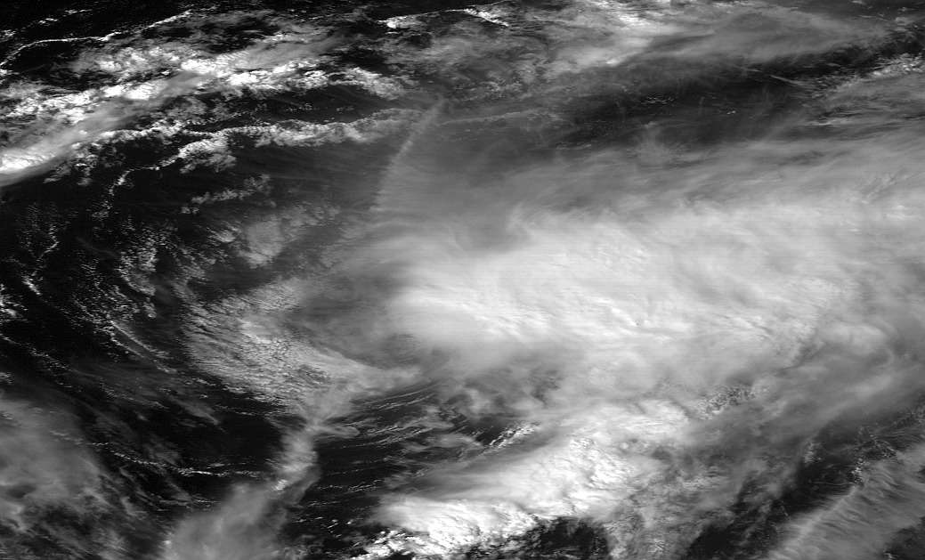
http://www.ssd.noaa.gov/PS/TROP/floaters/07L/flash-vis-long.html
can't tell if my eyes are playing tricks on me due to NE movement of the shear, but the center looks like it will pass directly over Bermuda. And the Bermuda radar doesn't seem to have updated in over two hours.
can't tell if my eyes are playing tricks on me due to NE movement of the shear, but the center looks like it will pass directly over Bermuda. And the Bermuda radar doesn't seem to have updated in over two hours.
0 likes
The above post is not official and should not be used as such. It is the opinion of the poster and may or may not be backed by sound meteorological data. It is not endorsed by any professional institution or storm2k.org. For official information, please refer to the NHC and NWS products.
-
tolakram
- Admin

- Posts: 20186
- Age: 62
- Joined: Sun Aug 27, 2006 8:23 pm
- Location: Florence, KY (name is Mark)
Re: ATL: GABRIELLE - Tropical Storm - Discussion
18:31Z
0 likes
M a r k
- - - - -
Join us in chat: Storm2K Chatroom Invite. Android and IOS apps also available.
The posts in this forum are NOT official forecasts and should not be used as such. Posts are NOT endorsed by any professional institution or STORM2K.org. For official information and forecasts, please refer to NHC and NWS products.
-
tolakram
- Admin
- Posts: 20186
- Age: 62
- Joined: Sun Aug 27, 2006 8:23 pm
- Location: Florence, KY (name is Mark)
Re: ATL: GABRIELLE - Tropical Storm - Discussion
The loops I like to use are having all kinds of issues, probably because the images are all delayed by a minute.
4 good frames in this one, if you can tolerate turning off the missing images.
http://wwwghcc.msfc.nasa.gov/cgi-bin/get-goes?satellite=GOES-E%20CONUS&lat=32&lon=-62&info=vis&zoom=1&width=1000&height=800&quality=95&type=Animation&palette=ir1.pal&numframes=7
4 good frames in this one, if you can tolerate turning off the missing images.
http://wwwghcc.msfc.nasa.gov/cgi-bin/get-goes?satellite=GOES-E%20CONUS&lat=32&lon=-62&info=vis&zoom=1&width=1000&height=800&quality=95&type=Animation&palette=ir1.pal&numframes=7
0 likes
M a r k
- - - - -
Join us in chat: Storm2K Chatroom Invite. Android and IOS apps also available.
The posts in this forum are NOT official forecasts and should not be used as such. Posts are NOT endorsed by any professional institution or STORM2K.org. For official information and forecasts, please refer to NHC and NWS products.
- - - - -
Join us in chat: Storm2K Chatroom Invite. Android and IOS apps also available.
The posts in this forum are NOT official forecasts and should not be used as such. Posts are NOT endorsed by any professional institution or STORM2K.org. For official information and forecasts, please refer to NHC and NWS products.
Re: ATL: GABRIELLE - Tropical Storm - Discussion
Bermuda radar has updated to about 1pm.
http://www.weather.bm/radarLarge.asp
http://www.weather.bm/radarLarge.asp
0 likes
The above post is not official and should not be used as such. It is the opinion of the poster and may or may not be backed by sound meteorological data. It is not endorsed by any professional institution or storm2k.org. For official information, please refer to the NHC and NWS products.
-
HurricaneDREW92
- Category 1

- Posts: 320
- Age: 27
- Joined: Sun Jul 28, 2013 11:56 am
- Location: Boston, MA
Re: ATL: GABRIELLE - Tropical Storm - Discussion
Could anyone explain? Thx.
201200 3139N 06505W 8427 01575 //// +179 //// 032027 030 046 001 01
201230 3138N 06503W 8426 01568 //// +192 //// 021027 029 049 000 01
201300 3137N 06502W 8432 01560 //// +199 //// 031023 025 047 000 05
201330 3136N 06501W 8415 01574 //// +208 //// 019021 023 047 000 01
201400 3135N 06459W 8434 01549 //// +203 //// 035022 023 045 000 05
0 likes
This post is NOT AN OFFICIAL FORECAST and should not be used as such. It is just the opinion of the poster and may or may not be backed by sound meteorological data. It is NOT endorsed by any professional institution including storm2k.org. For Official Information please refer to the NHC and NWS products.
-THE ABOVE IS THE OPINION OF DREW ONLY
-THE ABOVE IS THE OPINION OF DREW ONLY
-
wxman57

- Moderator-Pro Met

- Posts: 23175
- Age: 68
- Joined: Sat Jun 21, 2003 8:06 pm
- Location: Houston, TX (southwest)
Re: ATL: GABRIELLE - Tropical Storm - Discussion
All those high SFMR winds are flagged. The surface winds aren't likely stronger than FL winds. With a lack of convection, the conversion to the surface may be greater than normal, too.
0 likes
-
cycloneye

- Admin
- Posts: 149493
- Age: 69
- Joined: Thu Oct 10, 2002 10:54 am
- Location: San Juan, Puerto Rico
Re: ATL: GABRIELLE - Tropical Storm - Discussion
More flagged.
202330 3117N 06431W 8429 01583 //// +169 //// 209047 048 041 000 01
202400 3116N 06430W 8429 01588 //// +171 //// 207046 047 040 000 01
202330 3117N 06431W 8429 01583 //// +169 //// 209047 048 041 000 01
202400 3116N 06430W 8429 01588 //// +171 //// 207046 047 040 000 01
0 likes
Visit the Caribbean-Central America Weather Thread where you can find at first post web cams,radars
and observations from Caribbean basin members Click Here
and observations from Caribbean basin members Click Here
-
wxman57
- Moderator-Pro Met
- Posts: 23175
- Age: 68
- Joined: Sat Jun 21, 2003 8:06 pm
- Location: Houston, TX (southwest)
Re: ATL: GABRIELLE - Tropical Storm - Discussion
Bermuda radar is back up:
http://www.weather.bm/radarLarge.asp
http://www.weather.bm/radarLarge.asp
0 likes
-
brunota2003

- S2K Supporter

- Posts: 9476
- Age: 35
- Joined: Sat Jul 30, 2005 9:56 pm
- Location: Stanton, KY...formerly Havelock, NC
- Contact:
-
brunota2003
- S2K Supporter
- Posts: 9476
- Age: 35
- Joined: Sat Jul 30, 2005 9:56 pm
- Location: Stanton, KY...formerly Havelock, NC
- Contact:
Re: ATL: GABRIELLE - Tropical Storm - Discussion
wxman57 wrote:All those high SFMR winds are flagged. The surface winds aren't likely stronger than FL winds. With a lack of convection, the conversion to the surface may be greater than normal, too.
None of them are flagged. SFMR flag codes are 03 and 05. The 01 is either temp or dew point, I believe.
Correction:
03, 05, 06, 09 all deal with SFMR. 03 is just SFMR, with the other 3 being SFMR and other errors as well.
For anyone interested (Note: It is a .PDF):
http://www.ofcm.gov/nhop/13/pdf/18-app-g.pdf
Page 9 (or G-9) has the error codes.
Last edited by brunota2003 on Tue Sep 10, 2013 3:38 pm, edited 1 time in total.
0 likes
Just a small town southern boy helping other humans.
-
Extratropical94

- Professional-Met

- Posts: 3545
- Age: 31
- Joined: Wed Oct 20, 2010 6:36 am
- Location: Hamburg, Germany
- Contact:
Re: ATL: GABRIELLE - Tropical Storm - Discussion
cycloneye wrote:More flagged.
202330 3117N 06431W 8429 01583 //// +169 //// 209047 048 041 000 01
202400 3116N 06430W 8429 01588 //// +171 //// 207046 047 040 000 01
Those are more likely as the SFMR winds are slightly lower than the flight level winds.
0 likes
54° 11' 59'' N, 9° 9' 20'' E
Boomer Sooner!
Go Broncos! Go Cards!
Clinching counties, one at a time: https://mob-rule.com/user-gifs/USA/xtrp94.gif
- Daniel
Boomer Sooner!
Go Broncos! Go Cards!
Clinching counties, one at a time: https://mob-rule.com/user-gifs/USA/xtrp94.gif
- Daniel
-
wxman57
- Moderator-Pro Met
- Posts: 23175
- Age: 68
- Joined: Sat Jun 21, 2003 8:06 pm
- Location: Houston, TX (southwest)
Re: ATL: GABRIELLE - Tropical Storm - Discussion
brunota2003 wrote:wxman57 wrote:All those high SFMR winds are flagged. The surface winds aren't likely stronger than FL winds. With a lack of convection, the conversion to the surface may be greater than normal, too.
None of them are flagged. SFMR flag codes are 03 and 05. The 01 is either temp or dew point, I believe.
It is completely unrealistic that a storm which lacks significant convection has higher winds (or just below FL speeds) at the surface than aloft. Could be 40 kts at the surface.
0 likes
-
brunota2003
- S2K Supporter
- Posts: 9476
- Age: 35
- Joined: Sat Jul 30, 2005 9:56 pm
- Location: Stanton, KY...formerly Havelock, NC
- Contact:
Re: ATL: GABRIELLE - Tropical Storm - Discussion
wxman57 wrote:brunota2003 wrote:wxman57 wrote:All those high SFMR winds are flagged. The surface winds aren't likely stronger than FL winds. With a lack of convection, the conversion to the surface may be greater than normal, too.
None of them are flagged. SFMR flag codes are 03 and 05. The 01 is either temp or dew point, I believe.
It is completely unrealistic that a storm which lacks significant convection has higher winds (or just below FL speeds) at the surface than aloft. Could be 40 kts at the surface.
Not arguing that point, just that the 01 is T/TD error and the SFMR is not flagged (by the computer).
0 likes
Just a small town southern boy helping other humans.
-
cycloneye
- Admin
- Posts: 149493
- Age: 69
- Joined: Thu Oct 10, 2002 10:54 am
- Location: San Juan, Puerto Rico
Re: ATL: GABRIELLE - Tropical Storm - Discussion
BULLETIN
TROPICAL STORM GABRIELLE ADVISORY NUMBER 10
NWS NATIONAL HURRICANE CENTER MIAMI FL AL072013
500 PM AST TUE SEP 10 2013
...WIND INCREASING ON BERMUDA AS STRENGTHENING GABRIELLE
APPROACHES...
SUMMARY OF 500 PM AST...2100 UTC...INFORMATION
----------------------------------------------
LOCATION...31.5N 64.9W
ABOUT 55 MI...90 KM S OF BERMUDA
MAXIMUM SUSTAINED WINDS...60 MPH...95 KM/H
PRESENT MOVEMENT...N OR 360 DEGREES AT 10 MPH...17 KM/H
MINIMUM CENTRAL PRESSURE...1004 MB...29.65 INCHES
TROPICAL STORM GABRIELLE DISCUSSION NUMBER 10
NWS NATIONAL HURRICANE CENTER MIAMI FL AL072013
500 PM AST TUE SEP 10 2013
AN AIR FORCE RESERVE HURRICANE HUNTER AIRCRAFT INVESTIGATING
GABRIELLE FOUND PEAK SFMR WINDS OF 45-50 KT NORTHWEST AND SOUTHEAST
OF THE CENTER ON THEIR FIRST PASS THROUGH THE STORM...AND THE
INITIAL INTENSITY IS INCREASED TO 50 KT FOR THIS ADVISORY. THE
CENTRAL PRESSURE OF 1004 MB IS BASED ON A DROPSONDE FROM THE
AIRCRAFT. GABRIELLE HAS BEEN ABLE TO STRENGTHEN TODAY DESPITE THE
PRESENCE OF MODERATE SOUTHWESTERLY SHEAR WHICH HAS EXPOSED THE
LOW-LEVEL CENTER TO THE SOUTHWEST OF THE DEEP CONVECTION. WHILE
MODERATE SHEAR IS EXPECTED TO CONTINUE OR EVEN INCREASE OVER THE
NEXT COUPLE OF DAYS...THE STATISTICAL/DYNAMICAL AND GLOBAL MODELS
SHOW SOME STRENGTHENING DURING THAT TIME. THIS SEEMS TO BE SUPPORTED
BY MARGINAL SSTS AND AN INCREASE IN UPPER-LEVEL DIVERGENCE AHEAD OF
A MID/UPPER-LEVEL TROUGH. THE NHC FORECAST SHOWS THE POTENTIAL FOR
SOME STRENGTHENING AND THEN LITTLE CHANGE THROUGH EXTRATROPICAL
TRANSITION IN ABOUT 96 HOURS.
THE INITIAL MOTION ESTIMATE IS 360/09. THE MODEL GUIDANCE SHOWS A
TURN TOWARD THE NORTH-NORTHWEST WITH A DECREASE IN FORWARD SPEED
OVER THE NEXT 12 TO 24 HOURS...AS GABRIELLE IS TUGGED WESTWARD BY A
WEAKENING MID/UPPER-LEVEL LOW CURRENTLY SITUATED EAST OF FLORIDA.
AT 48 HOURS AND BEYOND...AN ACCELERATION TOWARD THE NORTHEAST IS
EXPECTED AHEAD OF A DEEP-LAYER TROUGH MOVING THROUGH EASTERN NORTH
AMERICA. THE TRACK MODELS REMAIN IN REASONABLE AGREEMENT ON THE
OVERALL SCENARIO...HOWEVER MUCH OF THE GUIDANCE HAS SHIFTED A
LITTLE TO THE LEFT THIS CYCLE. OVERALL...THE NHC TRACK FORECAST IS
SIMILAR TO THE PREVIOUS ONE THROUGH 48 HOURS AND AFTERWARD HAS BEEN
ADJUSTED A BIT TO THE LEFT...BUT STILL LIES EAST OF THE MULTI-MODEL
CONSENSUS.
FORECAST POSITIONS AND MAX WINDS
INIT 10/2100Z 31.5N 64.9W 50 KT 60 MPH
12H 11/0600Z 32.6N 65.0W 55 KT 65 MPH
24H 11/1800Z 33.5N 65.5W 55 KT 65 MPH
36H 12/0600Z 34.3N 66.0W 55 KT 65 MPH
48H 12/1800Z 35.7N 66.5W 55 KT 65 MPH
72H 13/1800Z 42.0N 63.5W 55 KT 65 MPH
96H 14/1800Z 52.0N 52.4W 50 KT 60 MPH...POST-TROP/EXTRATROP
120H 15/1800Z...DISSIPATED
$$
FORECASTER BRENNAN
0 likes
Visit the Caribbean-Central America Weather Thread where you can find at first post web cams,radars
and observations from Caribbean basin members Click Here
and observations from Caribbean basin members Click Here
-
Riptide

- Category 2

- Posts: 753
- Age: 34
- Joined: Fri Jul 23, 2010 3:33 pm
- Location: Cape May, New Jersey
- Contact:
Re: ATL: GABRIELLE - Tropical Storm - Discussion
Webcam from Bermuda
http://www.weather.bm/tools/animateimag ... =webcamera
http://www.weather.bm/tools/animateimag ... =webcamera
0 likes
-
HurricaneDREW92
- Category 1
- Posts: 320
- Age: 27
- Joined: Sun Jul 28, 2013 11:56 am
- Location: Boston, MA
Re: ATL: GABRIELLE - Tropical Storm - Discussion
cycloneye wrote:BULLETIN
TROPICAL STORM GABRIELLE ADVISORY NUMBER 10
NWS NATIONAL HURRICANE CENTER MIAMI FL AL072013
500 PM AST TUE SEP 10 2013
...WIND INCREASING ON BERMUDA AS STRENGTHENING GABRIELLE
APPROACHES...
SUMMARY OF 500 PM AST...2100 UTC...INFORMATION
----------------------------------------------
LOCATION...31.5N 64.9W
ABOUT 55 MI...90 KM S OF BERMUDA
MAXIMUM SUSTAINED WINDS...60 MPH...95 KM/H
PRESENT MOVEMENT...N OR 360 DEGREES AT 10 MPH...17 KM/H
MINIMUM CENTRAL PRESSURE...1004 MB...29.65 INCHES
TROPICAL STORM GABRIELLE DISCUSSION NUMBER 10
NWS NATIONAL HURRICANE CENTER MIAMI FL AL072013
500 PM AST TUE SEP 10 2013
AN AIR FORCE RESERVE HURRICANE HUNTER AIRCRAFT INVESTIGATING
GABRIELLE FOUND PEAK SFMR WINDS OF 45-50 KT NORTHWEST AND SOUTHEAST
OF THE CENTER ON THEIR FIRST PASS THROUGH THE STORM...AND THE
INITIAL INTENSITY IS INCREASED TO 50 KT FOR THIS ADVISORY. THE
CENTRAL PRESSURE OF 1004 MB IS BASED ON A DROPSONDE FROM THE
AIRCRAFT. GABRIELLE HAS BEEN ABLE TO STRENGTHEN TODAY DESPITE THE
PRESENCE OF MODERATE SOUTHWESTERLY SHEAR WHICH HAS EXPOSED THE
LOW-LEVEL CENTER TO THE SOUTHWEST OF THE DEEP CONVECTION. WHILE
MODERATE SHEAR IS EXPECTED TO CONTINUE OR EVEN INCREASE OVER THE
NEXT COUPLE OF DAYS...THE STATISTICAL/DYNAMICAL AND GLOBAL MODELS
SHOW SOME STRENGTHENING DURING THAT TIME. THIS SEEMS TO BE SUPPORTED
BY MARGINAL SSTS AND AN INCREASE IN UPPER-LEVEL DIVERGENCE AHEAD OF
A MID/UPPER-LEVEL TROUGH. THE NHC FORECAST SHOWS THE POTENTIAL FOR
SOME STRENGTHENING AND THEN LITTLE CHANGE THROUGH EXTRATROPICAL
TRANSITION IN ABOUT 96 HOURS.
THE INITIAL MOTION ESTIMATE IS 360/09. THE MODEL GUIDANCE SHOWS A
TURN TOWARD THE NORTH-NORTHWEST WITH A DECREASE IN FORWARD SPEED
OVER THE NEXT 12 TO 24 HOURS...AS GABRIELLE IS TUGGED WESTWARD BY A
WEAKENING MID/UPPER-LEVEL LOW CURRENTLY SITUATED EAST OF FLORIDA.
AT 48 HOURS AND BEYOND...AN ACCELERATION TOWARD THE NORTHEAST IS
EXPECTED AHEAD OF A DEEP-LAYER TROUGH MOVING THROUGH EASTERN NORTH
AMERICA. THE TRACK MODELS REMAIN IN REASONABLE AGREEMENT ON THE
OVERALL SCENARIO...HOWEVER MUCH OF THE GUIDANCE HAS SHIFTED A
LITTLE TO THE LEFT THIS CYCLE. OVERALL...THE NHC TRACK FORECAST IS
SIMILAR TO THE PREVIOUS ONE THROUGH 48 HOURS AND AFTERWARD HAS BEEN
ADJUSTED A BIT TO THE LEFT...BUT STILL LIES EAST OF THE MULTI-MODEL
CONSENSUS.
FORECAST POSITIONS AND MAX WINDS
INIT 10/2100Z 31.5N 64.9W 50 KT 60 MPH
12H 11/0600Z 32.6N 65.0W 55 KT 65 MPH
24H 11/1800Z 33.5N 65.5W 55 KT 65 MPH
36H 12/0600Z 34.3N 66.0W 55 KT 65 MPH
48H 12/1800Z 35.7N 66.5W 55 KT 65 MPH
72H 13/1800Z 42.0N 63.5W 55 KT 65 MPH
96H 14/1800Z 52.0N 52.4W 50 KT 60 MPH...POST-TROP/EXTRATROP
120H 15/1800Z...DISSIPATED
$$
FORECASTER BRENNAN
Wow
0 likes
This post is NOT AN OFFICIAL FORECAST and should not be used as such. It is just the opinion of the poster and may or may not be backed by sound meteorological data. It is NOT endorsed by any professional institution including storm2k.org. For Official Information please refer to the NHC and NWS products.
-THE ABOVE IS THE OPINION OF DREW ONLY
-THE ABOVE IS THE OPINION OF DREW ONLY
-
brunota2003
- S2K Supporter
- Posts: 9476
- Age: 35
- Joined: Sat Jul 30, 2005 9:56 pm
- Location: Stanton, KY...formerly Havelock, NC
- Contact:
-
Aric Dunn
- Category 5

- Posts: 21238
- Age: 43
- Joined: Sun Sep 19, 2004 9:58 pm
- Location: Ready for the Chase.
- Contact:
Re:
brunota2003 wrote:Well, looks like the NHC didn't think the 49 knot winds the SFMR found were in error, despite being way higher than flight level!
thats likely because sfmr measure ocean spray/water droplets and thus if there is little convection to saturate it then it becomes more
reliable. also the anticipated bend back to the nnw and nw appears have begun..
0 likes
Note: If I make a post that is brief. Please refer back to previous posts for the analysis or reasoning. I do not re-write/qoute what my initial post said each time.
If there is nothing before... then just ask
Space & Atmospheric Physicist, Embry-Riddle Aeronautical University,
I believe the sky is falling...
If there is nothing before... then just ask
Space & Atmospheric Physicist, Embry-Riddle Aeronautical University,
I believe the sky is falling...
Who is online
Users browsing this forum: No registered users and 51 guests