AL, 92, 2014072012, , BEST, 0, 103N, 346W, 25, 1013, DB, 0, , 0, 0, 0, 0,
AL, 92, 2014072018, , BEST, 0, 109N, 362W, 25, 1013, DB, 0, , 0, 0, 0, 0,
AL, 92, 2014072100, , BEST, 0, 112N, 380W, 30, 1013, DB, 0, , 0, 0, 0, 0,
AL, 92, 2014072106, , BEST, 0, 114N, 398W, 25, 1013, DB, 0, , 0, 0, 0, 0,
AL, 92, 2014072112, , BEST, 0, 114N, 416W, 25, 1013, DB
ATL: TWO - Remnants - Discussion
Moderator: S2k Moderators
-
cycloneye

- Admin

- Posts: 149467
- Age: 69
- Joined: Thu Oct 10, 2002 10:54 am
- Location: San Juan, Puerto Rico
ATL: TWO - Remnants - Discussion
0 likes
Visit the Caribbean-Central America Weather Thread where you can find at first post web cams,radars
and observations from Caribbean basin members Click Here
and observations from Caribbean basin members Click Here


Re: ATL: INVEST 92L - Discussion
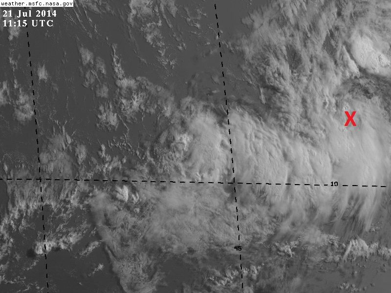
Wow! This is looking good this morning. Hello....
http://www.ssd.noaa.gov/PS/TROP/floaters/92L/imagery/vis-animated.gif
http://www.ssd.noaa.gov/PS/TROP/floaters/92L/imagery/vis-animated.gif
0 likes
The following post is NOT an official forecast and should not be used as such. It is just the opinion of the poster and may or may not be backed by sound meteorological data. It is NOT endorsed by any professional institution including storm2k.org For Official Information please refer to the NHC and NWS products.
Re: ATL: INVEST 92L - Discussion
0 likes
The following post is NOT an official forecast and should not be used as such. It is just the opinion of the poster and may or may not be backed by sound meteorological data. It is NOT endorsed by any professional institution including storm2k.org For Official Information please refer to the NHC and NWS products.
-
cycloneye
- Admin
- Posts: 149467
- Age: 69
- Joined: Thu Oct 10, 2002 10:54 am
- Location: San Juan, Puerto Rico
Re: ATL: INVEST 92L - Discussion
JB's take:
Joe Bastardi @BigJoeBastardi · 13m
CLose up of Atlantic Wave with nice looking circulation, also hint of open spot near center. #interesting
Joe Bastardi @BigJoeBastardi · 13m
CLose up of Atlantic Wave with nice looking circulation, also hint of open spot near center. #interesting
0 likes
Visit the Caribbean-Central America Weather Thread where you can find at first post web cams,radars
and observations from Caribbean basin members Click Here
and observations from Caribbean basin members Click Here
-
wxman57

- Moderator-Pro Met

- Posts: 23174
- Age: 68
- Joined: Sat Jun 21, 2003 8:06 pm
- Location: Houston, TX (southwest)
Re: ATL: INVEST 92L - Discussion
Looks impressive this morning, possibly even qualifies as a TD if we could confirm that the well-defined circulation extends down to the surface. Models indicate semi-favorable conditions for development for the next 2 days. Increasing wind shear is predicted by the time it reaches the eastern Caribbean on Thursday. That wind shear will likely rip it apart. The disturbance would have to track over South America to avoid the shear.
0 likes
-
cycloneye
- Admin
- Posts: 149467
- Age: 69
- Joined: Thu Oct 10, 2002 10:54 am
- Location: San Juan, Puerto Rico
Re: ATL: INVEST 92L - Discussion
Interesting as JB says.

0 likes
Visit the Caribbean-Central America Weather Thread where you can find at first post web cams,radars
and observations from Caribbean basin members Click Here
and observations from Caribbean basin members Click Here


Re: ATL: INVEST 92L - Discussion
wxman57 wrote:Looks impressive this morning, possibly even qualifies as a TD if we could confirm that the well-defined circulation extends down to the surface. Models indicate semi-favorable conditions for development for the next 2 days. Increasing wind shear is predicted by the time it reaches the eastern Caribbean on Thursday. That wind shear will likely rip it apart. The disturbance would have to track over South America to avoid the shear.
I am quite surprised, I thought the dry air west of 40 was going to destroy it. It seems that it has been insulated from the dry air somewhat by the moisture of the ITCZ. Also, the system is quite small so I wonder if the models are having a hard time with it.
0 likes
The following post is NOT an official forecast and should not be used as such. It is just the opinion of the poster and may or may not be backed by sound meteorological data. It is NOT endorsed by any professional institution including storm2k.org For Official Information please refer to the NHC and NWS products.
-
tropicwatch

- Category 5

- Posts: 3426
- Age: 62
- Joined: Sat Jun 02, 2007 10:01 am
- Location: The Villages, Florida
- Contact:
Very impressive looking for this time of year and that far out in the Atlantic.
0 likes
Tropicwatch
Agnes 72', Eloise 75, Elena 85', Kate 85', Charley 86', Florence 88', Beryl 94', Dean 95', Erin 95', Opal 95', Earl 98', Georges 98', Ivan 2004', Arlene 2005', Dennis 2005', Ida 2009' Debby 2012' Irma 2017' Michael 2018'
Agnes 72', Eloise 75, Elena 85', Kate 85', Charley 86', Florence 88', Beryl 94', Dean 95', Erin 95', Opal 95', Earl 98', Georges 98', Ivan 2004', Arlene 2005', Dennis 2005', Ida 2009' Debby 2012' Irma 2017' Michael 2018'


Re: ATL: INVEST 92L - Discussion
Oh my! 
I new of the existence of this system but didn't think it would have developed quite so quickly. Bears watching, I guess.
I new of the existence of this system but didn't think it would have developed quite so quickly. Bears watching, I guess.
0 likes
-
jaguarjace

- Category 4

- Posts: 975
- Age: 31
- Joined: Sat Jun 11, 2011 7:38 am
- Location: Khon Kaen, Thailand
Re: ATL: INVEST 92L - Discussion
SPECIAL TROPICAL WEATHER OUTLOOK
NWS NATIONAL HURRICANE CENTER MIAMI FL
1110 AM EDT MON JUL 21 2014
For the North Atlantic...Caribbean Sea and the Gulf of Mexico:
Special outlook issued to update discussion of system in the
central tropical Atlantic.
1. Updated: Shower activity associated with a small area of low
pressure located about midway between the Cape Verde Islands and the
Lesser Antilles has increased a little during the past few hours.
Although this activity remains limited, it continues to show signs
of organization. Satellite data also indicate that a closed
circulation could be forming and that the system is producing a
small area of winds near tropical storm force. A tropical depression
could develop during the next couple of days while the system moves
westward to west-northwestward at 15 to 20 mph. After that time
however, environmental conditions are expected to become less
conducive for development. Interests in the Lesser Antilles should
monitor the progress of this system.
* Formation chance through 48 hours...medium...50 percent.
* Formation chance through 5 days...medium...50 percent.
Forecaster Brennan/Roberts
0 likes
Owner of the Tropical Archive YouTube channel
Web Developer at Force Thirteen
Twitter/X : @force13_support
Web Developer at Force Thirteen
Twitter/X : @force13_support
Re: ATL: INVEST 92L - Discussion
Looks like a TD at this time. Any thoughts from the pro mets
0 likes
-
TheStormExpert

-
HurricaneBrain

- S2K Supporter

- Posts: 520
- Joined: Thu Jun 30, 2011 2:07 pm
Who is online
Users browsing this forum: No registered users and 38 guests