ATL: BERTHA - Post-Tropical - Discussion
Moderator: S2k Moderators
-
cycloneye

- Admin

- Posts: 149565
- Age: 69
- Joined: Thu Oct 10, 2002 10:54 am
- Location: San Juan, Puerto Rico
Re: ATL: BERTHA - Tropical Storm - Discussion
They passed center with the wind shift.
0 likes
Visit the Caribbean-Central America Weather Thread where you can find at first post web cams,radars
and observations from Caribbean basin members Click Here
and observations from Caribbean basin members Click Here
-
Gustywind

- Category 5

- Posts: 12334
- Joined: Mon Sep 03, 2007 7:29 am
- Location: Baie-Mahault, GUADELOUPE
Guadeloupe and Martinica and the Northern Leewards are under an yellow alert for a risk of strong showers and thunderstorms, strong sea but no warnings for all these islands concerning a risk of TS for the moment. I will keep your informed if anything happens here.
 http://www.meteofrance.gp/vigilance-antilles-guyane
0 likes
-
cycloneye
- Admin
- Posts: 149565
- Age: 69
- Joined: Thu Oct 10, 2002 10:54 am
- Location: San Juan, Puerto Rico
Re: ATL: BERTHA - Tropical Storm - Discussion
SUMMARY OF 800 AM AST...1200 UTC...INFORMATION
----------------------------------------------
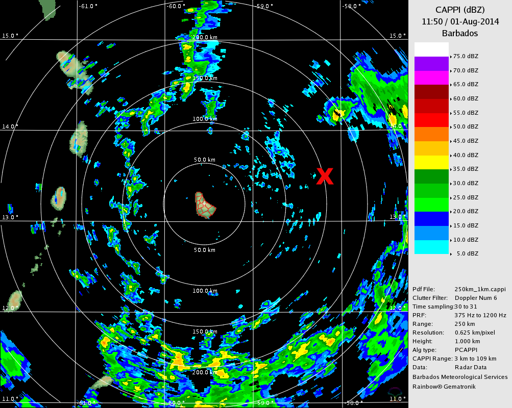
LOCATION...13.6N 57.9W
ABOUT 110 MI...175 KM ENE OF BARBADOS
ABOUT 220 MI...355 KM ESE OF MARTINIQUE
MAXIMUM SUSTAINED WINDS...45 MPH...75 KM/H
PRESENT MOVEMENT...WNW OR 290 DEGREES AT 20 MPH...31 KM/H
MINIMUM CENTRAL PRESSURE...1008 MB...29.77 INCHES
----------------------------------------------
LOCATION...13.6N 57.9W
ABOUT 110 MI...175 KM ENE OF BARBADOS
ABOUT 220 MI...355 KM ESE OF MARTINIQUE
MAXIMUM SUSTAINED WINDS...45 MPH...75 KM/H
PRESENT MOVEMENT...WNW OR 290 DEGREES AT 20 MPH...31 KM/H
MINIMUM CENTRAL PRESSURE...1008 MB...29.77 INCHES
0 likes
Visit the Caribbean-Central America Weather Thread where you can find at first post web cams,radars
and observations from Caribbean basin members Click Here
and observations from Caribbean basin members Click Here

-
tropicwatch

- Category 5
- Posts: 3426
- Age: 62
- Joined: Sat Jun 02, 2007 10:01 am
- Location: The Villages, Florida
- Contact:
Anybody want to take over obs on the recon thread? Need a break 
0 likes
Tropicwatch
Agnes 72', Eloise 75, Elena 85', Kate 85', Charley 86', Florence 88', Beryl 94', Dean 95', Erin 95', Opal 95', Earl 98', Georges 98', Ivan 2004', Arlene 2005', Dennis 2005', Ida 2009' Debby 2012' Irma 2017' Michael 2018'
Agnes 72', Eloise 75, Elena 85', Kate 85', Charley 86', Florence 88', Beryl 94', Dean 95', Erin 95', Opal 95', Earl 98', Georges 98', Ivan 2004', Arlene 2005', Dennis 2005', Ida 2009' Debby 2012' Irma 2017' Michael 2018'
-
tropicwatch
- Category 5
- Posts: 3426
- Age: 62
- Joined: Sat Jun 02, 2007 10:01 am
- Location: The Villages, Florida
- Contact:
Re: Re:
NDG wrote:panamatropicwatch wrote:Anybody want to take over obs on the recon thread? Need a break
I'll try, but I have to take care of some personal stuff in between. Maybe I'll put a timer.
Thanks!
0 likes
Tropicwatch
Agnes 72', Eloise 75, Elena 85', Kate 85', Charley 86', Florence 88', Beryl 94', Dean 95', Erin 95', Opal 95', Earl 98', Georges 98', Ivan 2004', Arlene 2005', Dennis 2005', Ida 2009' Debby 2012' Irma 2017' Michael 2018'
Agnes 72', Eloise 75, Elena 85', Kate 85', Charley 86', Florence 88', Beryl 94', Dean 95', Erin 95', Opal 95', Earl 98', Georges 98', Ivan 2004', Arlene 2005', Dennis 2005', Ida 2009' Debby 2012' Irma 2017' Michael 2018'
-
cycloneye
- Admin
- Posts: 149565
- Age: 69
- Joined: Thu Oct 10, 2002 10:54 am
- Location: San Juan, Puerto Rico
Re: ATL: BERTHA - Tropical Storm - Discussion
NDG,I have to go too so can you post the graphics?
0 likes
Visit the Caribbean-Central America Weather Thread where you can find at first post web cams,radars
and observations from Caribbean basin members Click Here
and observations from Caribbean basin members Click Here
-
Equilibrium
Re:
Alyono wrote:those high winds were during a descent... may not be valid
Morning visible is inconclusive as to whether or not there is a center. Recon is doing a low level invest to confirm that the center still exists
Confident there is a centre by just viewing infrared red loop find it hard to believe you still question it.
The posts in this forum are NOT official forecast and should not be used as such. They are just the opinion of the poster and may or may not be backed by sound meteorological data. They are NOT endorsed by any professional institution or storm2k.org. For official information, please refer to the NHC and NWS product
0 likes

Re: Re:
Equilibrium wrote:Alyono wrote:those high winds were during a descent... may not be valid
Morning visible is inconclusive as to whether or not there is a center. Recon is doing a low level invest to confirm that the center still exists
Confident there is a centre by just viewing infrared red loop find it hard to believe you still question it.
The posts in this forum are NOT official forecast and should not be used as such. They are just the opinion of the poster and may or may not be backed by sound meteorological data. They are NOT endorsed by any professional institution or storm2k.org. For official information, please refer to the NHC and NWS product
You cannot use an IR loop to easily see low clouds. Need visible or shortwave IR. The visible and the aircraft dtaa is not that impressive. Still a center, but very very weak
0 likes
-
Dean4Storms
- S2K Supporter

- Posts: 6358
- Age: 63
- Joined: Sun Aug 31, 2003 1:01 pm
- Location: Miramar Bch. FL
-
Equilibrium
Re: Re:
Alyono wrote:Equilibrium wrote:Alyono wrote:those high winds were during a descent... may not be valid
Morning visible is inconclusive as to whether or not there is a center. Recon is doing a low level invest to confirm that the center still exists
Confident there is a centre by just viewing infrared red loop find it hard to believe you still question it.
The posts in this forum are NOT official forecast and should not be used as such. They are just the opinion of the poster and may or may not be backed by sound meteorological data. They are NOT endorsed by any professional institution or storm2k.org. For official information, please refer to the NHC and NWS product
You cannot use an IR loop to easily see low clouds. Need visible or shortwave IR. The visible and the aircraft dtaa is not that impressive. Still a center, but very very weak
it was a shortwave Infrared Imagery loop i have been viewing.
0 likes

From the data from the recon, the west component in the wind looks a bit weak in southeast field of the center
0 likes
Personal Forecast Disclaimer:
The posts in this forum are NOT official forecast and should not be used as such. They are just the opinion of the poster and may or may not be backed by sound meteorological data. They are NOT endorsed by any professional institution or storm2k.org. For official information, please refer to the NHC and NWS products.
The posts in this forum are NOT official forecast and should not be used as such. They are just the opinion of the poster and may or may not be backed by sound meteorological data. They are NOT endorsed by any professional institution or storm2k.org. For official information, please refer to the NHC and NWS products.

Re: ATL: BERTHA - Tropical Storm - Discussion
The better SST's and location must have helped.
0 likes
Re: ATL: BERTHA - Tropical Storm - Discussion
Sanibel wrote:The better SST's and location must have helped.
UL diverging winds are also helping, though the shear is not helping her get better organized too fast.
BTW, 55 knot flight level winds just reported by the recon NE of the LLC around some of that heavy squalls.
0 likes
Who is online
Users browsing this forum: No registered users and 17 guests