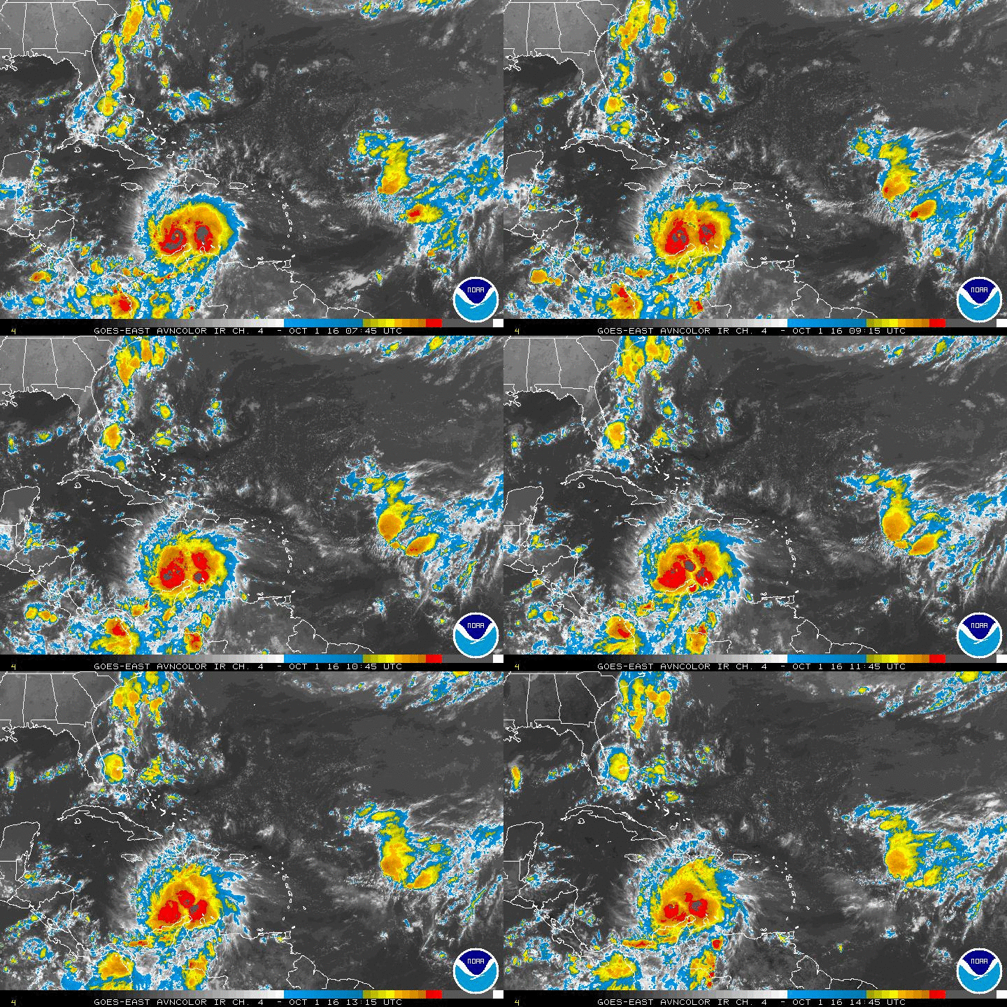
ATL: CRISTOBAL - Post-Tropical - Discussion

Moderator: S2k Moderators

Message
Author
User avatar
fci
S2K Supporter
S2K Supporter
Posts: 3324
Joined: Tue Sep 14, 2004 10:29 am
Location: Lake Worth, FL

Re:

#1121 Postby fci » Sat Aug 23, 2014 3:40 pm

TheStormExpert wrote:Kind of off topic, but there's over 50 pages for this thread, and nearly 80 pages for the models thread. This has to be some sort of record of pages set for only an Invest. :eek:


Just catching up so my comment might be late or repetitive of something earlier; but I recall upwards of 100 pages on invests in the past. There was a 90L that went all the way from near Africa to the Western Carib. And never developed!
0 likes   
Personal Forecast Disclaimer:
My posts are just my opinion and are most likely not backed by sound meteorological data. They are NOT endorsed by any professional institution or storm2k.org. For official information, please refer to the NHC and NWS products.
Bottom line is that I am just expressing my opinion!!!

User avatar
weathernerdguy
Tropical Storm
Tropical Storm
Posts: 188
Age: 23
Joined: Wed Jul 10, 2013 8:44 pm

#1122 Postby weathernerdguy » Sat Aug 23, 2014 3:41 pm

Forecasted to be a hurricane.. Maybe the 3rd hurricane for the Atlantic
0 likes   
The posts in this forum are NOT official forecast and should not be used as such. They are just the opinion of the poster and may or may not be backed by sound meteorological data. They are NOT endorsed by any professional institution or storm2k.org. For official information, please refer to the NHC and NWS products

User avatar
HurricaneBelle
S2K Supporter
S2K Supporter
Posts: 1179
Joined: Sun Aug 27, 2006 6:12 pm
Location: Clearwater, FL

Re: ATL: FOUR - Tropical Depression - Discussion

#1123 Postby HurricaneBelle » Sat Aug 23, 2014 3:43 pm

The official NHC forecast only takes it as far west as 77.5
0 likes   

srva80
Tropical Low
Tropical Low
Posts: 38
Joined: Thu Aug 23, 2012 6:58 am
Location: Houma, LA

#1124 Postby srva80 » Sat Aug 23, 2014 3:44 pm

Td4
0 likes   

User avatar
SouthDadeFish
Professional-Met
Professional-Met
Posts: 2835
Joined: Thu Sep 23, 2010 2:54 pm
Location: Miami, FL
Contact:

#1125 Postby SouthDadeFish » Sat Aug 23, 2014 3:45 pm

NHC track is essentially same as TVCN, but I think a little slower.
0 likes   

User avatar
cycloneye
Admin
Admin
Posts: 145327
Age: 68
Joined: Thu Oct 10, 2002 10:54 am
Location: San Juan, Puerto Rico

Re: ATL: FOUR - Tropical Depression - Discussion

#1126 Postby cycloneye » Sat Aug 23, 2014 3:45 pm

Image
0 likes   
Visit the Caribbean-Central America Weather Thread where you can find at first post web cams,radars
and observations from Caribbean basin members Click Here

User avatar
toad strangler
S2K Supporter
S2K Supporter
Posts: 4543
Joined: Sun Jul 28, 2013 3:09 pm
Location: Earth
Contact:

#1127 Postby toad strangler » Sat Aug 23, 2014 3:48 pm

NHC favoring the OTS camp and that should not be a surprise to weigh the more trusted models more heavily.
0 likes   

User avatar
cycloneye
Admin
Admin
Posts: 145327
Age: 68
Joined: Thu Oct 10, 2002 10:54 am
Location: San Juan, Puerto Rico

Re: ATL: FOUR - Tropical Depression - Discussion

#1128 Postby cycloneye » Sat Aug 23, 2014 3:50 pm

Read the first discussion of TD FOUR here
0 likes   
Visit the Caribbean-Central America Weather Thread where you can find at first post web cams,radars
and observations from Caribbean basin members Click Here

User avatar
HurricaneBelle
S2K Supporter
S2K Supporter
Posts: 1179
Joined: Sun Aug 27, 2006 6:12 pm
Location: Clearwater, FL

#1129 Postby HurricaneBelle » Sat Aug 23, 2014 3:50 pm

Key phrase from the NHC discussion:

"Given the spread in the guidance and the recent formation of the system, confidence in the details of the track forecast is lower than normal"
0 likes   

User avatar
bahamaswx
Category 5
Category 5
Posts: 1542
Joined: Sat Sep 13, 2003 1:11 am
Location: Georgetown, Bahamas

Re: ATL: INVEST 96L - Discussion

#1130 Postby bahamaswx » Sat Aug 23, 2014 3:50 pm

Hammy wrote:convection to SW is probably resulting from the air moving over Inagua as it's pretty scattered and weak elsewhere around it.


Inagua is essentially a giant salt pan. It's flatter than flat.
0 likes   

User avatar
meriland23
Category 5
Category 5
Posts: 1239
Age: 37
Joined: Mon Aug 29, 2011 9:29 pm

Re: ATL: FOUR - Tropical Depression - Discussion

#1131 Postby meriland23 » Sat Aug 23, 2014 3:51 pm

cycloneye wrote:Image


Given the model trends I expect nhc to shift the track west a bit. Just a opinion though.
0 likes   
The posts in this forum are NOT official forecast and should not be used as such. They are just the opinion of the poster and may or may not be backed by sound meteorological data. They are NOT endorsed by any professional institution or storm2k.org. For official information, please refer to the NHC and NWS products.

User avatar
cycloneye
Admin
Admin
Posts: 145327
Age: 68
Joined: Thu Oct 10, 2002 10:54 am
Location: San Juan, Puerto Rico

Re: ATL: FOUR - Tropical Depression - Discussion

#1132 Postby cycloneye » Sat Aug 23, 2014 3:52 pm

Important last sentence.

Given the spread in the guidance and the recent
formation of the system, confidence in the details of the track
forecast is lower than normal.
0 likes   
Visit the Caribbean-Central America Weather Thread where you can find at first post web cams,radars
and observations from Caribbean basin members Click Here

OuterBanker
S2K Supporter
S2K Supporter
Posts: 1731
Joined: Wed Feb 26, 2003 10:53 am
Location: Nags Head, NC
Contact:

#1133 Postby OuterBanker » Sat Aug 23, 2014 3:55 pm

Here we go. In the 5 day cone again. I know little confidence in the cone this far out, but enough to start the hype.
0 likes   

WeatherGuesser
Category 5
Category 5
Posts: 2672
Joined: Tue Jun 29, 2010 6:46 am

#1134 Postby WeatherGuesser » Sat Aug 23, 2014 3:57 pm

Finally made it, eh?

After what, nearly a week?
0 likes   

User avatar
weathernerdguy
Tropical Storm
Tropical Storm
Posts: 188
Age: 23
Joined: Wed Jul 10, 2013 8:44 pm

Re:

#1135 Postby weathernerdguy » Sat Aug 23, 2014 3:58 pm

WeatherGuesser wrote:Finally made it, eh?

After what, nearly a week?

Since Tuesday.
0 likes   
The posts in this forum are NOT official forecast and should not be used as such. They are just the opinion of the poster and may or may not be backed by sound meteorological data. They are NOT endorsed by any professional institution or storm2k.org. For official information, please refer to the NHC and NWS products

User avatar
tropicwatch
Category 5
Category 5
Posts: 3384
Age: 61
Joined: Sat Jun 02, 2007 10:01 am
Location: Panama City Florida
Contact:

#1136 Postby tropicwatch » Sat Aug 23, 2014 4:00 pm

Better late then never 8-)
0 likes   
Tropicwatch


Agnes 72', Eloise 75, Elena 85', Kate 85', Charley 86', Florence 88', Beryl 94', Dean 95', Erin 95', Opal 95', Earl 98', Georges 98', Ivan 2004', Arlene 2005', Dennis 2005', Ida 2009' Debby 2012' Irma 2017' Michael 2018'

User avatar
AdamFirst
S2K Supporter
S2K Supporter
Posts: 2491
Age: 36
Joined: Thu Aug 14, 2008 10:54 am
Location: Port Saint Lucie, FL

#1137 Postby AdamFirst » Sat Aug 23, 2014 4:01 pm

Promet on WPLG TV emphasized that South Florida needs to keep watch on this system.
0 likes   
Dolphins Marlins Canes Golden Panthers HEAT
Andrew 1992 - Irene 1999 - Frances 2004 - Jeanne 2004 - Wilma 2005 - Fay 2008 - Isaac 2012 - Matthew 2016 - Irma 2017 - Dorian 2019 - Ian 2022 - Nicole 2022 - Milton 2024

User avatar
meriland23
Category 5
Category 5
Posts: 1239
Age: 37
Joined: Mon Aug 29, 2011 9:29 pm

Re: Re:

#1138 Postby meriland23 » Sat Aug 23, 2014 4:02 pm

weathernerdguy wrote:
WeatherGuesser wrote:Finally made it, eh?

After what, nearly a week?

Since Tuesday.


At this rate it will be in the Flemish Cap when it becomes a hurricane lol..
0 likes   
The posts in this forum are NOT official forecast and should not be used as such. They are just the opinion of the poster and may or may not be backed by sound meteorological data. They are NOT endorsed by any professional institution or storm2k.org. For official information, please refer to the NHC and NWS products.

stauglocal
Tropical Low
Tropical Low
Posts: 29
Joined: Fri Jun 03, 2011 8:31 am

#1139 Postby stauglocal » Sat Aug 23, 2014 4:08 pm

Yes! Made it to TD, I'm very proud of you 96L. :D
0 likes   

User avatar
tropicwatch
Category 5
Category 5
Posts: 3384
Age: 61
Joined: Sat Jun 02, 2007 10:01 am
Location: Panama City Florida
Contact:

Re: ATL: FOUR - Tropical Depression - Discussion

#1140 Postby tropicwatch » Sat Aug 23, 2014 4:09 pm

Convection building closer to the COC.

Image
0 likes   
Tropicwatch


Agnes 72', Eloise 75, Elena 85', Kate 85', Charley 86', Florence 88', Beryl 94', Dean 95', Erin 95', Opal 95', Earl 98', Georges 98', Ivan 2004', Arlene 2005', Dennis 2005', Ida 2009' Debby 2012' Irma 2017' Michael 2018'


Return to “2014”

Who is online

Users browsing this forum: No registered users and 6 guests