Area of Disturbed Weather Near the NE Florida/Georgia coast

This is the general tropical discussion area. Anyone can take their shot at predicting a storms path.

Moderator: S2k Moderators

Forum rules

The posts in this forum are NOT official forecasts and should not be used as such. They are just the opinion of the poster and may or may not be backed by sound meteorological data. They are NOT endorsed by any professional institution or STORM2K. For official information, please refer to products from the National Hurricane Center and National Weather Service.

Help Support Storm2K
Message
Author
User avatar
AJC3
Admin
Admin
Posts: 3999
Age: 61
Joined: Tue Aug 31, 2004 7:04 pm
Location: Ballston Spa, New York
Contact:

Re:

#21 Postby AJC3 » Wed Sep 03, 2014 12:59 pm

northjaxpro wrote::uarrow:
Well, AJC3, it is a matter of judgment in interpretation with regards to the vorticity. The vorticity is stretched out now. We can I think at least agree that the vorticity has maintained itself over this time, but no question it is an elongated axis right now. There is no debating that aspect for sure.


No qualms with that...I think the main thing to take away from this is that it's very unlikely that we'll see any downward "burrowing" given the deformation that's going on aloft, and that if anything was to form at the surface, the mechanism would be forced ascent/divergence to its east.
0 likes   

User avatar
HurricaneBelle
S2K Supporter
S2K Supporter
Posts: 1179
Joined: Sun Aug 27, 2006 6:12 pm
Location: Clearwater, FL

Re: Re:

#22 Postby HurricaneBelle » Wed Sep 03, 2014 1:16 pm

AJC3 wrote:Of particular note, Invest 93L in October of 2011 was a classic case of some models (notably the ECM) forecasting "drilling down" type development of a "BI" surface low in the GOMEX, directly beneath the upper level feature, while others (e.g. the GFS) showed the more classic low development in the divergent ascending area east of Florida. The GFS solution turned out to be much closer to reality, with a locally notorious hybrid cyclone forming over the NW Bahamas and moving onshore the Florida east coast just north of Cape Canaveral.


This 2011 system never was classified in post-season analysis, was it?
0 likes   

User avatar
AJC3
Admin
Admin
Posts: 3999
Age: 61
Joined: Tue Aug 31, 2004 7:04 pm
Location: Ballston Spa, New York
Contact:

Re: Re:

#23 Postby AJC3 » Wed Sep 03, 2014 1:57 pm

HurricaneBelle wrote: This 2011 system never was classified in post-season analysis, was it?


Nope.

Here is what they wrote about that system....

Here are NHC's working definitions that were applied:

Tropical Cyclone - A warm-core non-frontal synoptic-scale cyclone, originating over tropical or subtropical waters, with organized deep convection and a closed surface wind circulation about a well-defined center. Once formed, a tropical cyclone is maintained by the extraction of heat energy from the ocean at high temperature and heat export at the low temperatures of the upper troposphere. In this they differ from extratropical cyclones, which derive their energy from horizontal temperature contrasts in the atmosphere (baroclinic effects).

Subtropical Cyclone - A non-frontal low-pressure system that has characteristics of both tropical and extratropical cyclones. Like tropical cyclones, they are non-frontal, synoptic-scale cyclones that originate over tropical or subtropical waters, and have a closed surface wind circulation about a well-defined center. In addition, they have organized moderate to deep convection, but lack a central dense overcast. Unlike tropical cyclones, subtropical cyclones derive a significant proportion of their energy from baroclinic sources, and are generally cold-core in the upper troposphere, often being associated with an upper-level low or trough. In comparison to tropical cyclones, these systems generally have a radius of maximum winds occurring relatively far from the center (usually greater than 60 n mi), and generally have a less symmetric wind field and distribution of convection

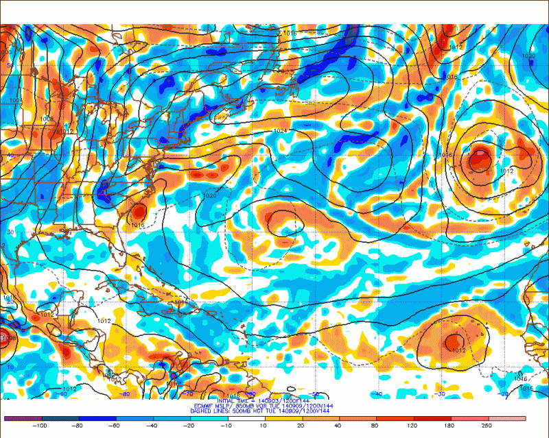
The October cyclone was difficult to classify, consisting of a small area of very strong (~50 kt sustained) winds embedded within a much broader environment of low pressure that was itself producing gale/tropical-storm-force winds, at least early on. The inner system possessed some of the essential characteristics of a tropical storm: it had sustained winds in excess of 34 kt, it had a well-defined center of circulation, it had a warm core, at least in the lower troposphere, and the low center itself did not lie along any frontal boundaries, at least at the time the center moved onshore. In particular, the strength, distribution, and impacts of the winds near the center of this system were indistinguishable from many other small tropical storms.

Other attributes of the system, however, argued against its classification as a tropical storm. The system's convection near the core was intermittent and of short duration, and was considered too transient to satisfy the definition's organized deep convection requirement. The transient nature of the strong inner core circulation itself also cast doubt as to whether it could be considered of synoptic scale. The vertical extent of the cyclonic circulation was limited to below about 12,000 ft, very uncharacteristic of a tropical cyclone of this strength.

We also considered whether the system should be classified as a subtropical cyclone. There were clearly mixed characteristics of extratropical and tropical cyclones present, including the presence nearby of an upper-level cold low, and the large-scale distribution of winds and convection. However, there was enough air mass contrast associated with the system to raise doubts as to whether it was truly non-frontal. The very small radius of maximum winds and occasional convection very near the center also made the system difficult to classify as a subtropical cyclone.

Nature does not always cooperate with the classification systems designed by man. There is a continuum of cyclone types in the real atmosphere, and it is often difficult to place these systems into the small number of bins that meteorologists have created for them. The 9-10 October Florida system is certainly one of these difficult cyclones. NHC’s historical record, however, requires its members to belong to either the “tropical” or “subtropical” bins, and our view in this case is that neither applies. It is simply “something else”.
0 likes   

User avatar
NDG
S2K Supporter
S2K Supporter
Posts: 15446
Joined: Sun Jul 09, 2006 10:14 pm
Location: Orlando, FL

Re: Mid-Upper Low in Florida Straits

#24 Postby NDG » Wed Sep 03, 2014 4:29 pm

12z Euro shows this vorticity slowly moving northward over the next few days hanging around the Carolinas coast through early next week with possible weak development with it.

Image
0 likes   

User avatar
tropicwatch
Category 5
Category 5
Posts: 3386
Age: 61
Joined: Sat Jun 02, 2007 10:01 am
Location: Panama City Florida
Contact:

Re: Mid-Upper Low in Florida Straits

#25 Postby tropicwatch » Wed Sep 03, 2014 4:48 pm

A little off topic but check out the mesoscale vortex that was over northwest Florida earlier today.

Image
0 likes   
Tropicwatch


Agnes 72', Eloise 75, Elena 85', Kate 85', Charley 86', Florence 88', Beryl 94', Dean 95', Erin 95', Opal 95', Earl 98', Georges 98', Ivan 2004', Arlene 2005', Dennis 2005', Ida 2009' Debby 2012' Irma 2017' Michael 2018'

User avatar
northjaxpro
S2K Supporter
S2K Supporter
Posts: 8900
Joined: Mon Sep 27, 2010 11:21 am
Location: Jacksonville, FL

#26 Postby northjaxpro » Wed Sep 03, 2014 5:49 pm

Interesting, it appears that the elongated axis, which had been drifting west these past several days, is now drifting northward throughout the day.

It will be interesting to see if any thing comes of this vorticity. NDG, the EURO run showing that this potential feature possibly being off the Carolinas early next is interesting indeed.
0 likes   
NEVER, EVER SAY NEVER in the tropics and weather in general, and most importantly, with life itself!!

________________________________________________________________________________________

Fay 2008 Beryl 2012 Debby 2012 Colin 2016 Hermine 2016 Julia 2016 Matthew 2016 Irma 2017 Dorian 2019

User avatar
gatorcane
S2K Supporter
S2K Supporter
Posts: 23691
Age: 47
Joined: Sun Mar 13, 2005 3:54 pm
Location: Boca Raton, FL

#27 Postby gatorcane » Wed Sep 03, 2014 6:06 pm

The UKMET also shows some development along the eastern seaboard of the U.S.:

Image
0 likes   

OuterBanker
S2K Supporter
S2K Supporter
Posts: 1731
Joined: Wed Feb 26, 2003 10:53 am
Location: Nags Head, NC
Contact:

Re:

#28 Postby OuterBanker » Wed Sep 03, 2014 8:12 pm

gatorcane wrote:The UKMET also shows some development along the eastern seaboard of the U.S.:

Image


Is that eastern NC under that storm? Good think the UKMET is never right.
0 likes   

User avatar
beoumont
Category 1
Category 1
Posts: 473
Joined: Sun Jul 10, 2011 4:13 pm
Location: East Central Florida
Contact:

Re: Re:

#29 Postby beoumont » Wed Sep 03, 2014 8:35 pm

HurricaneBelle wrote:
AJC3 wrote:Of particular note, Invest 93L in October of 2011 was a classic case of some models (notably the ECM) forecasting "drilling down" type development of a "BI" surface low in the GOMEX, directly beneath the upper level feature, while others (e.g. the GFS) showed the more classic low development in the divergent ascending area east of Florida. The GFS solution turned out to be much closer to reality, with a locally notorious hybrid cyclone forming over the NW Bahamas and moving onshore the Florida east coast just north of Cape Canaveral.


This 2011 system never was classified in post-season analysis, was it?


I recall one interesting observation from that system. The evening the center made a close approach to Vero Beach, where I live, I drove to beachside. When I left my house, near US 1 on the mainland side, the wind was in the 10-15 mph range. The distance from US 1, across Indian River (salt water lagoon) to the boardwalk on the beach east of there is 1.7 miles.

On the boardwalk, the wind was a steady 40-50 mph for the 1/2 hour I stood there enjoying the strong NNW wind. It was not raining.

I drove back across the lagoon to US 1, and the wind was again in the 10-15 mph range. The fronds at the top of the palm trees were barely moving.

It is not unusual for a drop-off of wind, especially when a tropical system is around, from beachside to just inland; but usually that drop-off is in the 20% range. It was strange.
0 likes   
List of 79 tropical cyclones intercepted by Richard Horodner:
http://www.canebeard.com/page/page/572246.htm

User avatar
NDG
S2K Supporter
S2K Supporter
Posts: 15446
Joined: Sun Jul 09, 2006 10:14 pm
Location: Orlando, FL

Re: Mid-Upper Low in Florida Straits

#30 Postby NDG » Thu Sep 04, 2014 9:01 am

Interesting little vorticity east of Daytona Beach this morning, heading north towards the Carolinas coast.
Last night the Euro did not do much with this compared to its 12z run, it shows it getting absorbed by a cold front similar to what the GFS has been showing.

http://wwwghcc.msfc.nasa.gov/cgi-bin/ge ... mframes=10
0 likes   

User avatar
tropicwatch
Category 5
Category 5
Posts: 3386
Age: 61
Joined: Sat Jun 02, 2007 10:01 am
Location: Panama City Florida
Contact:

Re: Mid-Upper Low in Florida Straits

#31 Postby tropicwatch » Thu Sep 04, 2014 9:07 am

:uarrow: 850mb vorticity does seem to be increasing in that area.

Image
0 likes   
Tropicwatch


Agnes 72', Eloise 75, Elena 85', Kate 85', Charley 86', Florence 88', Beryl 94', Dean 95', Erin 95', Opal 95', Earl 98', Georges 98', Ivan 2004', Arlene 2005', Dennis 2005', Ida 2009' Debby 2012' Irma 2017' Michael 2018'

User avatar
AJC3
Admin
Admin
Posts: 3999
Age: 61
Joined: Tue Aug 31, 2004 7:04 pm
Location: Ballston Spa, New York
Contact:

Re: Mid-Upper Low in Florida Straits

#32 Postby AJC3 » Thu Sep 04, 2014 9:10 am

NDG wrote:Interesting little vorticity east of Daytona Beach this morning, heading north towards the Carolinas coast.
Last night the Euro did not do much with this compared to its 12z run, it shows it getting absorbed by a cold front similar to what the GFS has been showing.

http://wwwghcc.msfc.nasa.gov/cgi-bin/ge ... mframes=10


I was just about to post on this. A small low level vortex is near 29.7N 79.5W, or about 100 ENE of DAB, and appears to be moving NNW. This could become the focus of the development of a surface cyclone if it was to slow down and stay offshore, but I have doubts - winds aloft seem to be pretty hostile. Time will tell...
0 likes   

User avatar
NDG
S2K Supporter
S2K Supporter
Posts: 15446
Joined: Sun Jul 09, 2006 10:14 pm
Location: Orlando, FL

Re: Mid-Upper Low in Florida Straits

#33 Postby NDG » Thu Sep 04, 2014 9:22 am

AJC3 wrote:
NDG wrote:Interesting little vorticity east of Daytona Beach this morning, heading north towards the Carolinas coast.
Last night the Euro did not do much with this compared to its 12z run, it shows it getting absorbed by a cold front similar to what the GFS has been showing.

http://wwwghcc.msfc.nasa.gov/cgi-bin/ge ... mframes=10


I was just about to post on this. A small low level vortex is near 29.7N 79.5W, or about 100 ENE of DAB, and appears to be moving NNW. This could become the focus of the development of a surface cyclone if it was to slow down and stay offshore, but I have doubts - winds aloft seem to be pretty hostile. Time will tell...


Yeap, UL winds are currently fairly hostile, 12z JAX sounding showing NE 25 knot UL winds, it might get into a better UL environment as it starts nearing the Carolinas coast this weekend.
0 likes   

ninel conde

#34 Postby ninel conde » Thu Sep 04, 2014 1:14 pm

Joe Bastardi @BigJoeBastardi · 31m

Suspect exciting run of ECMWF on east coast, trying to feedback on system east of Fla now as it comes north, gets some baroclinic bump

JB suspects the EURO will be exciting.
0 likes   

SeGaBob

#35 Postby SeGaBob » Thu Sep 04, 2014 2:21 pm

Would this be the same feature mentioned in the forecast discussion for my area?


.SHORT TERM /FRIDAY THROUGH SUNDAY/...
FRIDAY AND FRIDAY NIGHT...THE FRIDAY FORECAST HAS CHANGED
CONSIDERABLY FROM 24 HOURS AGO. THOUGH THE UPPER ANTICYCLONE WILL
REMAIN POSITIONED JUST NORTH OF THE REGION...A TUTT LOW FEATURE WILL
MOVE CLOSER TO THE SOUTHEAST COAST WHICH SHOWS UP WELL AS A
VORTICITY FEATURE AT 500 MB. AT THE SURFACE...HIGH PRESSURE WILL
STILL BE IN PLACE ACROSS MUCH OF THE SOUTHEAST
...BUT THE MODELS ARE
NOW DEPICTING A SHARPENING COASTAL TROUGH ALONG THE GEORGIA/SOUTH
CAROLINA COAST. THE CONSENSUS IS TO TAKE THIS COASTAL TROUGH INLAND
THROUGH THE MORNING AND INTO THE AFTERNOON.
PWATS SURGE NICELY TO 2
INCHES WITHIN THE CONVERGENCE ZONE OF THE TROUGH. AS SUCH...POPS
HAVE BEEN INCREASED INTO THE 50 PERCENT RANGE FOR THE MORNING HOURS
ESPECIALLY ALONG THE COAST AS THE MOISTURE PENETRATES INLAND.
THROUGH THE DAY...THE TROUGH AXIS WILL CONTINUE TO PUSH INLAND AND
THE AFTERNOON MAY END UP BEING MORE QUIET THAN THE MORNING.
0 likes   

User avatar
Hurricaneman
Category 5
Category 5
Posts: 7351
Age: 45
Joined: Tue Aug 31, 2004 3:24 pm
Location: central florida

#36 Postby Hurricaneman » Thu Sep 04, 2014 3:48 pm

This will have to be watched as it seems that the tropical atlantic north of 20N and west of 60W have been favorable for some development all year while the rest of the atlantic has been riddled with dry air and low instability so don't be surprised if this does become a tropical storm this weekend or the first of next week

The posts in this forum are NOT official forecast and should not be used as such. They are just the opinion of the poster and may or may not be backed by sound meteorological data. They are NOT endorsed by any professional institution or storm2k.org. For official information, please refer to the NHC and NWS products
0 likes   

User avatar
trave2
Tropical Low
Tropical Low
Posts: 36
Joined: Wed Jul 16, 2008 6:15 am
Location: Tampa FL.

Re: Area of Disturbed Weather Near Florida

#37 Postby trave2 » Thu Sep 04, 2014 3:49 pm

there is a closed low on visible satellite off the coast of north Florida
0 likes   

User avatar
NDG
S2K Supporter
S2K Supporter
Posts: 15446
Joined: Sun Jul 09, 2006 10:14 pm
Location: Orlando, FL

#38 Postby NDG » Thu Sep 04, 2014 3:56 pm

The little eddy that has been seen since early this morning has been moving very fast NNW towards the GA coast as if rotating around a larger circulation, and indeed this afternoon it appears there is broader circulation centered over eastern central FL.
0 likes   

User avatar
fwbbreeze
S2K Supporter
S2K Supporter
Posts: 896
Joined: Sun Mar 21, 2004 10:09 pm
Location: Fort Walton Beach, FL

Re: Area of Disturbed Weather Near Florida

#39 Postby fwbbreeze » Thu Sep 04, 2014 4:41 pm

Rather broad...but it does appear to be drifting west across the northern peninsula.
0 likes   

USTropics
Professional-Met
Professional-Met
Posts: 2651
Joined: Sun Aug 12, 2007 3:45 am
Location: Florida State University

Re: Area of Disturbed Weather Near Florida

#40 Postby USTropics » Thu Sep 04, 2014 5:44 pm

Vorticity continues to build over Florida. Very broad as fwb just mentioned: Image
0 likes   


Return to “Talkin' Tropics”

Who is online

Users browsing this forum: Bobbyh83, Google Adsense [Bot], LarryWx, Zeta and 47 guests