Latest CanSIPS model showing a VERY favorable tropical atmospheric state for the 2016 Atlantic Hurricane Season.
https://pbs.twimg.com/media/CdMwBYlUUAAM5eT.jpg:large
Moderator: S2k Moderators


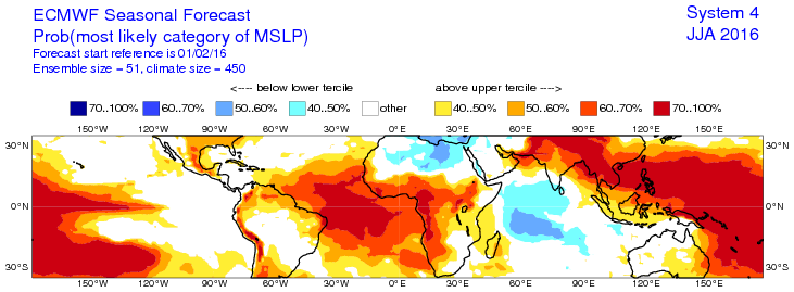
Alyono wrote:That's opposite as to what the EC is showing.
How reliable is CanSIPS?


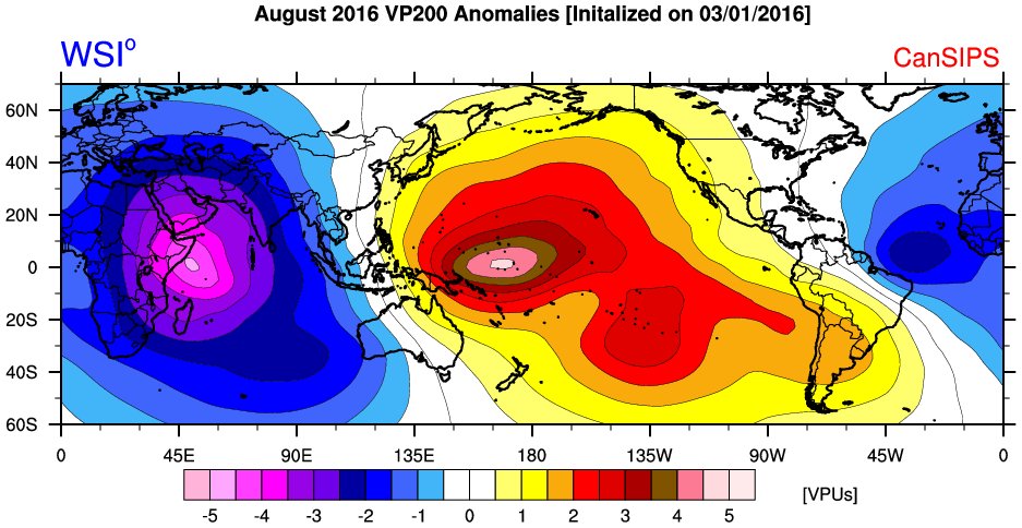
SFLcane wrote:Ok folks now Iam awake...See this post by Dr Michael Ventrice on Twitter.
Latest CanSIPS model showing a VERY favorable tropical atmospheric state for the 2016 Atlantic Hurricane Season.
https://pbs.twimg.com/media/CdMwBYlUUAAM5eT.jpg:large


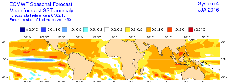


WPBWeather wrote:Re: above post. This is true but it is a lagging indicator--


Users browsing this forum: Google Adsense [Bot] and 242 guests


