ATL: HERMINE - Post-Tropical - Discussion
Moderator: S2k Moderators
Re: ATL: INVEST 99L - Discussion
We've now had 2 atlantic systems declared after 99L that have gone on to develop. Lame
0 likes
-
La Sirena

- Category 1

- Posts: 308
- Joined: Sun Aug 21, 2016 4:02 pm
- Location: Formerly of the Keys, back home in East TN
Re: ATL: INVEST 99L - Discussion
Here in the Lower Keys, skies are darkening up and the wind is picking up quite a bit. Thanks for all the info y'all provide here! This will be interesting to see how it fares into the GOM.
0 likes
The posts in this forum are NOT official forecasts and should not be used as such. They are just the opinion of the poster and may or may not be backed by sound meteorological data. They are NOT endorsed by any professional institution or STORM2K. For official information, please refer to products from the NHC and NWS.
Hurricane Irma,Hurricane Michael, Hurricane Helene
Re: ATL: INVEST 99L - Discussion
psyclone wrote:We've now had 2 atlantic systems declared after 99L that have gone on to develop. Lame
As they say in sports, 'past perfornance isn't a predictor for future success'. Be careful what you wish for
0 likes

Re: ATL: INVEST 99L - Discussion
http://www.wavcis.lsu.edu/forecasts/for ... c=currents
It is also traversing the loop current which only adds fuel.
It is also traversing the loop current which only adds fuel.
0 likes
-
tropicwatch

- Category 5

- Posts: 3426
- Age: 62
- Joined: Sat Jun 02, 2007 10:01 am
- Location: The Villages, Florida
- Contact:
Re: ATL: INVEST 99L - Discussion
Starting to see showers moving around circulation.

0 likes
Tropicwatch
Agnes 72', Eloise 75, Elena 85', Kate 85', Charley 86', Florence 88', Beryl 94', Dean 95', Erin 95', Opal 95', Earl 98', Georges 98', Ivan 2004', Arlene 2005', Dennis 2005', Ida 2009' Debby 2012' Irma 2017' Michael 2018'
Agnes 72', Eloise 75, Elena 85', Kate 85', Charley 86', Florence 88', Beryl 94', Dean 95', Erin 95', Opal 95', Earl 98', Georges 98', Ivan 2004', Arlene 2005', Dennis 2005', Ida 2009' Debby 2012' Irma 2017' Michael 2018'
Re: ATL: INVEST 99L - Discussion
I still would not expect much development today
1 likes
The posts in this forum are NOT official forecast and should not be used as such. They are just the opinion of the poster and may or may not be backed by sound meteorological data. They are NOT endorsed by any professional institution or storm2k.org. For official information, please refer to the NHC and NWS products.
-
wxman57

- Moderator-Pro Met

- Posts: 23175
- Age: 68
- Joined: Sat Jun 21, 2003 8:06 pm
- Location: Houston, TX (southwest)
Re: ATL: INVEST 99L - Discussion
No development today or tomorrow, most likely. Wait for Tuesday afternoon. Recon will confirm a TD then. Watch out northern FL Peninsula on Thursday. Could be a hurricane landfall north of Tampa.
2 likes

Re: ATL: INVEST 99L - Discussion
wxman57 wrote:No development today or tomorrow, most likely. Wait for Tuesday afternoon. Recon will confirm a TD then. Watch out northern FL Peninsula on Thursday. Could be a hurricane landfall north of Tampa.
Thanks wxman57, me and others in Jax will keep an eye on it. It's been awhile since a hurricane has made landfall near the big bend but not impossible.
0 likes
The posts or stuff said are NOT an official forecast. Please look to the NHC and NWS for official forecasts and products.
Floyd-1999, Frances-2004, Jeanne-2004, Fay-2008, Beryl-2012, Debby-2012, Colin-2016, Hermine-2016, Julia-2016, Matthew-2016, Irma-2017, Elsa-2021, Idalia-2023, Debby-2024, Helene-2024.
Go Gators! Go Jags!
Floyd-1999, Frances-2004, Jeanne-2004, Fay-2008, Beryl-2012, Debby-2012, Colin-2016, Hermine-2016, Julia-2016, Matthew-2016, Irma-2017, Elsa-2021, Idalia-2023, Debby-2024, Helene-2024.
Go Gators! Go Jags!

Re: ATL: INVEST 99L - Discussion
It just wants to be the "I" storm, it knows it will be history making as one of the weirdest systems ever.
0 likes
Personal Forecast Disclaimer:
The posts in this forum are NOT official forecast and should not be used as such. They are just the opinion of the poster and may or may not be backed by sound meteorological data. They are NOT endorsed by any professional institution or storm2k.org. For official information, please refer to the NHC and NWS products.
The posts in this forum are NOT official forecast and should not be used as such. They are just the opinion of the poster and may or may not be backed by sound meteorological data. They are NOT endorsed by any professional institution or storm2k.org. For official information, please refer to the NHC and NWS products.
-
Dean4Storms
- S2K Supporter

- Posts: 6358
- Age: 63
- Joined: Sun Aug 31, 2003 1:01 pm
- Location: Miramar Bch. FL
Re: ATL: INVEST 99L - Discussion
wxman57 wrote:No development today or tomorrow, most likely. Wait for Tuesday afternoon. Recon will confirm a TD then. Watch out northern FL Peninsula on Thursday. Could be a hurricane landfall north of Tampa.
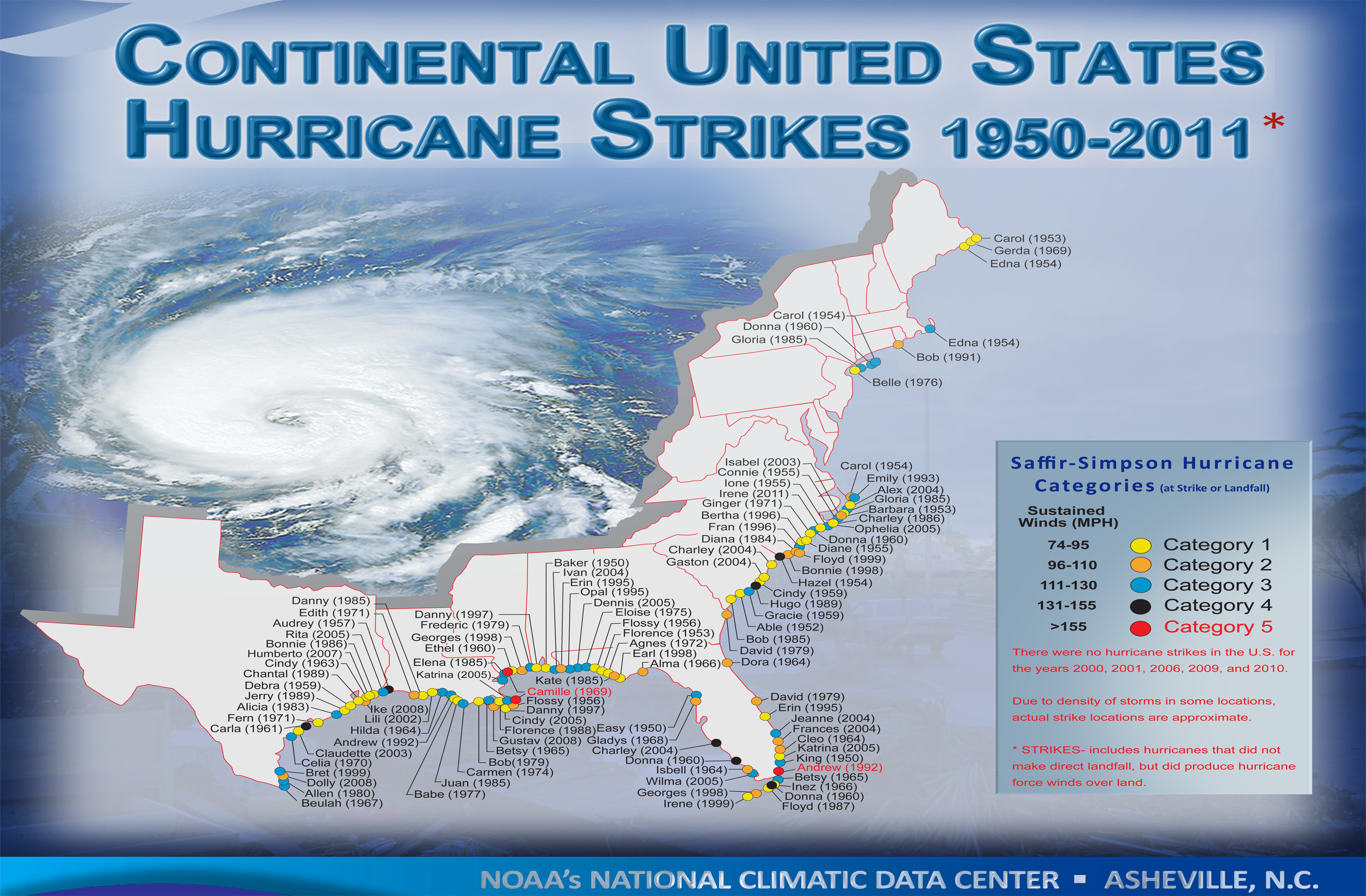
That would be very rare. Hurricanes rarely strike the NE Gulf Coast from Tampa to Apalachicola. My bet is on the FL Panhandle.
http://www.nhc.noaa.gov/climo/images/conus_hurrStrikes_1950-2011.png
1 likes
-
Evil Jeremy

- S2K Supporter
- Posts: 5463
- Age: 32
- Joined: Mon Apr 10, 2006 2:10 pm
- Location: Los Angeles, CA
Re: ATL: INVEST 99L - Discussion
JaxGator wrote:wxman57 wrote:No development today or tomorrow, most likely. Wait for Tuesday afternoon. Recon will confirm a TD then. Watch out northern FL Peninsula on Thursday. Could be a hurricane landfall north of Tampa.
Thanks wxman57, me and others in Jax will keep an eye on it. It's been awhile since a hurricane has made landfall near the big bend but not impossible.
It's funny, I've also been tracking this from Jax all week. Mid-week some models were saying Jax should keep an eye on this from the east, now they're saying from the west. The tropics can be funny like that. Either way, I'll continue to keep my eyes on 99L.
1 likes
Frances 04 / Jeanne 04 / Katrina 05 / Wilma 05 / Fay 08 / Debby 12 / Andrea 13 / Colin 16 / Hermine 16 / Matthew 16 / Irma 17

Re: ATL: INVEST 99L - Discussion
So, I go to the National Hurricane Center site, see that TD 8 has formed and think to myself, "Finally!", only to discover it ain't 99L. Silly me. 
3 likes
-
floridasun78
- Category 5
- Posts: 3755
- Joined: Sun May 17, 2009 10:16 pm
- Location: miami fl
Re: ATL: INVEST 99L - Discussion
no rain in miami we expecting alot rain today not here yet i see keys likely see rain next few hour it look like 99l moving at 5mph
0 likes

Re: ATL: INVEST 99L - Discussion
That convection at 23.8N 802.W is looking pretty good IMHO.
It is definitely pushing the UL winds around and creating an outflow.
Its in the center of the vorticity max.
Going to be running into a very strong ridge of unstable air just to its west.
CAPE = 3000, Theta-e = 363 to 366.
Only thing is for the mid-level dry-air infeed to stop.
That could come soon if popups develop later this afternoon over the glades.
0 likes
-
centuryv58

- Tropical Storm

- Posts: 233
- Age: 67
- Joined: Sat Jul 30, 2016 1:24 pm
- Location: Southeast Florida
Re: ATL: INVEST 99L - Discussion
Latest GFS, Jax gets it from the west. This is been the case for a couple runs of GFS,
1 likes


Re: ATL: INVEST 99L - Discussion
wxman57 wrote:No development today or tomorrow, most likely. Wait for Tuesday afternoon. Recon will confirm a TD then. Watch out northern FL Peninsula on Thursday. Could be a hurricane landfall north of Tampa.
I'm not at all picking on you, but this has been the theme of this system for days now. Wait a few more days...
1 likes
Personal Forecast Disclaimer:
The posts in this forum are NOT official forecast and should not be used as such. They are just the opinion of the poster and may or may not be backed by sound meteorological data. They are NOT endorsed by any professional institution or storm2k.org. For official information, please refer to the NHC and NWS products.
The posts in this forum are NOT official forecast and should not be used as such. They are just the opinion of the poster and may or may not be backed by sound meteorological data. They are NOT endorsed by any professional institution or storm2k.org. For official information, please refer to the NHC and NWS products.

Re: ATL: INVEST 99L - Discussion
Blinhart wrote:It just wants to be the "I" storm, it knows it will be history making as one of the weirdest systems ever.
I had thought that myself!
0 likes
Re: ATL: INVEST 99L - Discussion
centuryv58 wrote:Latest GFS, Jax gets it from the west. This is been the case for a couple runs of GFS,
And the latest Euro too. We'll see if it trends more. We need the rain here in Jax but not a storm on the scale the Euro has.
0 likes
The posts or stuff said are NOT an official forecast. Please look to the NHC and NWS for official forecasts and products.
Floyd-1999, Frances-2004, Jeanne-2004, Fay-2008, Beryl-2012, Debby-2012, Colin-2016, Hermine-2016, Julia-2016, Matthew-2016, Irma-2017, Elsa-2021, Idalia-2023, Debby-2024, Helene-2024.
Go Gators! Go Jags!
Floyd-1999, Frances-2004, Jeanne-2004, Fay-2008, Beryl-2012, Debby-2012, Colin-2016, Hermine-2016, Julia-2016, Matthew-2016, Irma-2017, Elsa-2021, Idalia-2023, Debby-2024, Helene-2024.
Go Gators! Go Jags!
-
sphelps8681
- Category 2

- Posts: 785
- Joined: Thu Aug 16, 2007 5:37 pm
- Location: Somewhere over the rainbow
Re: ATL: INVEST 99L - Discussion
Levi's Tropical Tidbits from Saturday. http://www.tropicaltidbits.com/
Explains a lot on what is happening.
Explains a lot on what is happening.
0 likes
Who is online
Users browsing this forum: No registered users and 80 guests